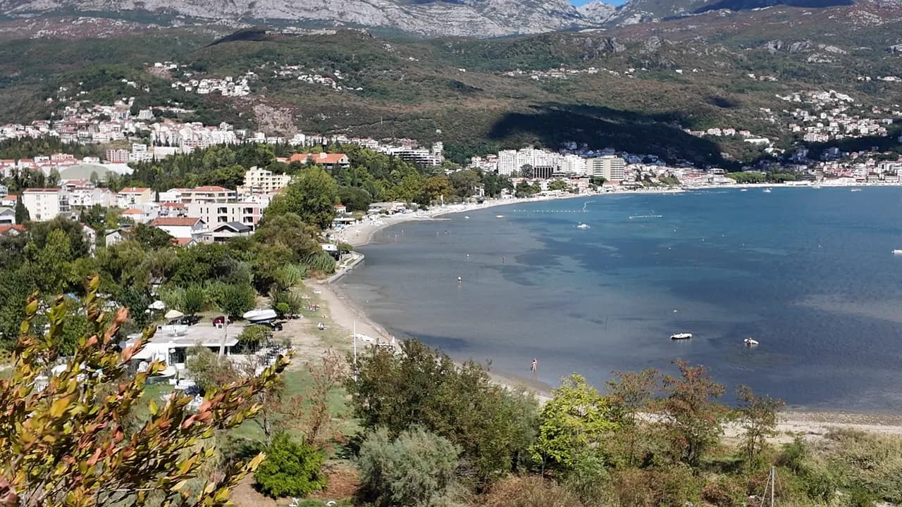
Igalo
The flattest, gentlest shore on the bay: up to a kilometre of sand, pebble and concrete platforms in shallow warm water, with the mud beach of Stara Banja at the Sutorina mouth.
Our verdict
Igalo is a spa town’s beach, and it behaves like one. The main strand — about 600 m by our guide, 1 km by our list — is sand and pebble with concrete platforms, a gentle entry and water that stays shallow and warm, which is why the Institute Dr Simo Milošević was put here in 1949 and why toddlers and physiotherapy patients share it. West of the Institute, at the mouth of the Sutorina, the cove of Stara Banja is where the black mineral mud is dug and applied. Loungers are €8–14, there is no step anywhere between the bus stop and the water, and the Pet Danica promenade starts at the Institute door.
Igalo, in facts
The shore
Facilities
Access
Facts verified September 28, 2026 · Length: Our Igalo guide gives the main beach as about 600 m within 1.5 km of shore; our 25 Best Beaches list says 1 km · 12 more still to check on the ground
Igalo in pictures
Some of these are ours, free to reuse under CC BY 4.0; the rest are licensed and are not. Ours were shot in September 2026.
Igalo in motion
Igalo and the wall of Orjen from the road above Njivice
Stara Banja, the old spa cove at the mouth of the Sutorina, from the hill above it
Photographs and footage by Montenegro.com, free to reuse under CC BY 4.0. Ours were shot in September 2026.
Map
The shaded water is the official bathing zone for station Igalo 02 — the stretch JP Morsko dobro actually samples, not an outline of the beach.
Getting there
2.1 km
Herceg Novi
18 km
Tivat airport
22 km
Kotor
Straight-line distances — Montenegro's roads are mountain roads, so the drive is longer.
- On the Pet Danica Promenade walkStop: igalo-institute
- By busBlue Line: Igalo–Kamenari and the Igalo–Meljine–Igalo circular
- By carIgalo is 2.6 km west of Herceg Novi; a barrier-controlled car park in Norveška Street, seasonal parking near the Institute and formal parking along the Igalo–Meljine corridor
- 5 min on footflat — From the Institute bus stop; Igalo is the one flat town on the bay, with no steps between the road and the water
Today at Igalo
Which way the beach faces is computed from the OpenStreetMap coastline, so onshore and offshore mean this shore and not the region. Forecast by Open-Meteo
Water and awards
Excellent
Latest official sample September 28, 2026: Excellent
Sea 20.6 °C when the sample was taken
5 of 10 samples Excellent across the 2026 season
Official result from JP Morsko dobro, station Igalo 02
Shallow, warm inner-bay water at the mouth of the Sutorina, and the weakest official record on this coast: across three monitoring stations in 2026 the results ran from Excellent down to Sufficient, including a Sufficient reading at Igalo 02 on 3 August, in peak season
No award we can cite for this beach. Absence is information too.
Know before you swim
- The Stara Banja mud shore is slippery and the mud stains — rinse off before you step onto the promenade
- The Sutorina river mouth beside Stara Banja clouds the water for a day after heavy rain — swim from the main strand then
- Boats use the Sutorina channel and moor in the cove — keep to the marked bathing water
- The bottom is stony in places under the sand — swim shoes for children
When the water is warm
Igalo was at its warmest, 27.5 °C, on August 31, 2026, and at its coldest, 19.8 °C, on May 25, 2026. Every point is a real sampling visit with the temperature read on the spot, not a monthly average copied from somewhere else.
Hollow points are the 5 samplings that came back below Excellent.
See all 10 samplings
| Sampled | Sea | Result |
|---|---|---|
| September 28, 2026 | 20.6 °C | Excellent |
| September 16, 2026 | 23.0 °C | Sufficient |
| August 31, 2026 | 27.5 °C | Good |
| August 17, 2026 | 24.7 °C | Excellent |
| August 3, 2026 | 25.4 °C | Sufficient |
| July 20, 2026 | 25.9 °C | Excellent |
| July 6, 2026 | 21.5 °C | Excellent |
| June 22, 2026 | 25.2 °C | Good |
| June 8, 2026 | 21.9 °C | Good |
| May 25, 2026 | 19.8 °C | Excellent |
Season by season
Igalo has been sampled 69 times since 2020: 37 of those readings Excellent, 32 below it.
How warm the water got, season by season. The average is of the July and August samplings only — a fixed window, so a year the inspectors happened to come early does not read as a cold one.
A handful of seasons is a record, not a trend: the spread here is what a few dated readings look like, not evidence of a sea warming or cooling. A hollow point marks a season that recorded a sampling below Excellent.
| Season | Samplings | Excellent | Below | Jul–Aug mean | Warmest |
|---|---|---|---|---|---|
| 2020 | 9 | 7 | 2 | 24.1 °C | 26.1 °C |
| 2021 | 10 | 6 | 4 | 25.4 °C | 27.1 °C |
| 2022 | 11 | 5 | 6 | 24.4 °C | 26.3 °C |
| 2023 | 9 | 3 | 6 | 24.7 °C | 27.1 °C |
| 2024 | 10 | 6 | 4 | 24.2 °C | 26.7 °C |
| 2025 | 10 | 5 | 5 | 23.3 °C | 24.6 °C |
| 2026in progress | 10 | 5 | 5 | 25 °C | 27.5 °C |
Licensed as
The state leases this coast lot by lot. Igalo is tendered as 9 lots covering about 580 m of shore, each with an official category.
Also licensed here: a mooring platform in the water off the beach.
| Category | Lots | Shore |
|---|---|---|
| Family bathing | 8 | 405 m |
| Hotel beach | 1 | 175 m |
About 8,171 m² in total. This is what has been licensed, not what we saw: the number of sunbeds, toilets and showers on a lot is fixed in the signed lease, which is not published. JP Morsko dobro tenders
Nearby beaches



Igalo and its neighbours
The same nine measures for the beaches you could reach the same day. Bold means it differs from this one.
| Measure | 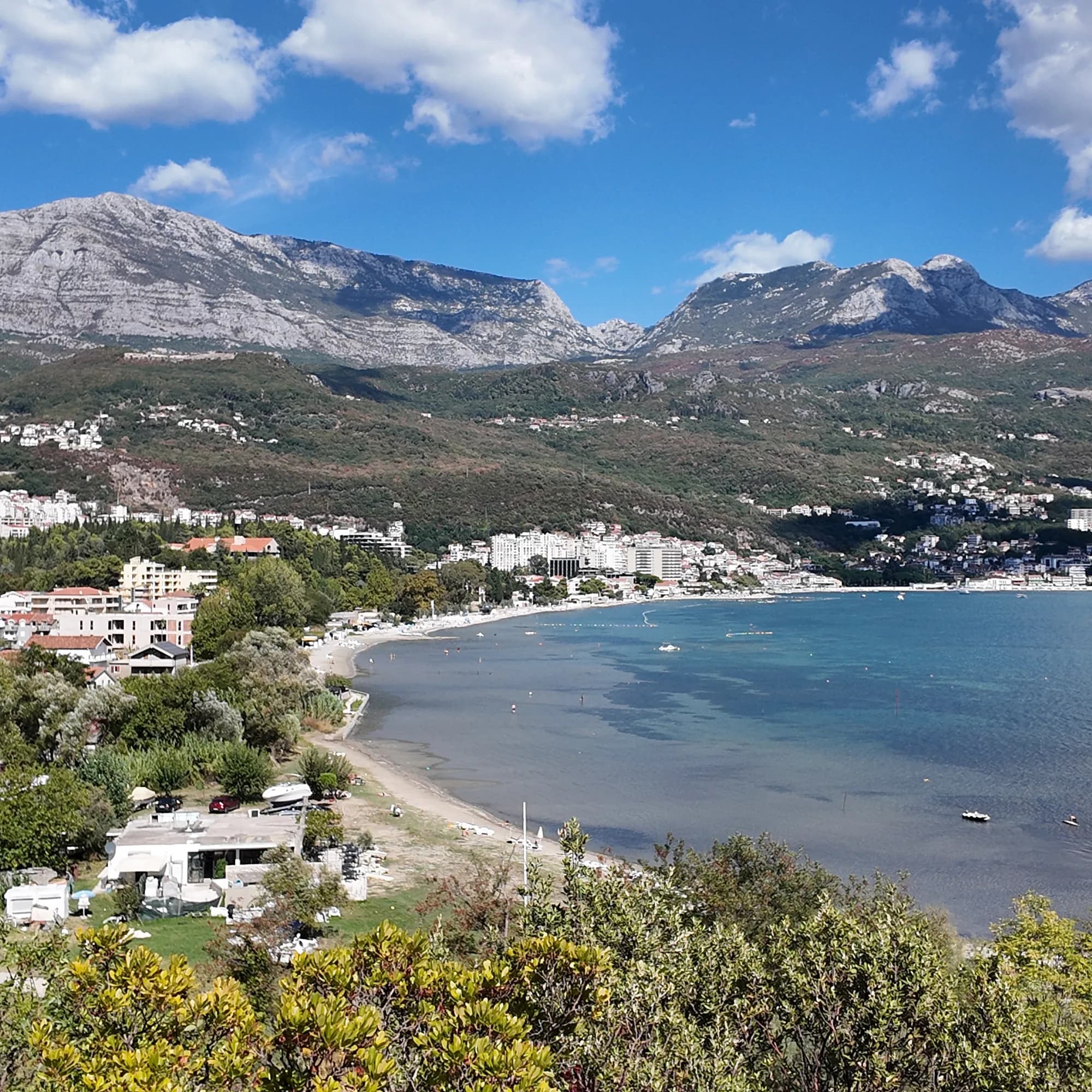 Igalothis beach Igalothis beach |  Njivice1.8 km Njivice1.8 km |  Savina3.1 km Savina3.1 km |  Meljine Beach3.8 km Meljine Beach3.8 km |
|---|---|---|---|---|
| Surface | sand and fine pebble | rock — differs | pebble — differs | pebble — differs |
| Entry | gentle | rocky — differs | moderate — differs | gentle |
| Depth | shallow | deepens quickly — differs | deepens quickly — differs | shallow |
| Shade | umbrellas for hire | umbrellas for hire | umbrellas for hire | umbrellas for hire |
| Character | organised | organised and free sections — differs | organised and free sections — differs | organised |
| Length | 600–1000 m | 200 m — differs | 200 m — differs | 30 m — differs |
| Latest water | Excellent | Excellent | Excellent | —no official sampling point — differs |
| Crowd | busy in season | quiet — differs | busy in season | busy in season |
| Getting there | by road | by road | by road | by road |
Stay near Igalo
All stays in Igalo →

The full guide
Read the Igalo guide
Everything above is the short form. The guide has the sources, the sector codes, the sampling dates and the things that change within a season.
Questions
- What is the Igalo mud?
- Igaljsko blato — a black, mineral-rich sea mud from the bed of Igalo bay with a faint sulphur smell, applied as wraps and baths at the Institute for rheumatic and joint conditions. The Stara Banja cove at the Sutorina mouth is the mud beach; the main strand is ordinary sand and pebble.
- How do I get to Igalo beach from Herceg Novi?
- Walk the Pet Danica promenade west — flat all the way, about 2.6 km — or take a Blue Line bus (Igalo–Kamenari, or the Igalo–Meljine circular). The Institute stop is the western end of the promenade.
- Is the water at Igalo clean?
- Our guide points readers to the official Morsko Dobro bathing-water monitor for the current sample rather than quoting one; the bay is shallow and clouds after rain near the river mouth.
Sources
- montenegro.com — Igalo guide (/cities/igalo/igalo-guide): beach lengths and surfaces, Stara Banja mud, the Institute, Blue Line routes, parking
- montenegro.com — Igalo city hub (shallow warm water, sunbed prices, distances, sea temperatures)
- montenegro.com — Pet Danica walk (/walks/pet-danica): stop 1 Igalo Institute & Mud Baths
- Our 25 Best Beaches in Montenegro list (entry 20)
- OpenStreetMap — beach ways 571737992 and 1359144925 (Blatna plaža)
- Our own frames and clips, September 2026