Parc national · Lac de Skadar · 1 594 m
Lake Skadar
Nacionalni park Skadarsko jezero

Notre avis
Le plus grand lac des Balkans et le seul des cinq parcs constitué surtout d’eau. C’est avant tout un parc ornithologique — des pélicans y nichent — et on le visite en bateau depuis Virpazar plutôt qu’à pied. Les collines alentour portent des vignobles et des monastères devant lesquels la plupart des excursions sur le lac ne s’arrêtent jamais.
La part honnête
Les sorties en bateau depuis Virpazar varient énormément en qualité et dans ce qu’elles comprennent ; le prix affiché sur le ponton n’est pas celui que vous paierez. L’été apporte à la fois la chaleur et les moustiques dans les hauts-fonds. Le niveau du lac varie beaucoup entre le printemps et la fin de l’été, ce qui change ce qui est accessible.
Quand venir
D’avril à juin pour les oiseaux et le niveau de l’eau ; septembre et octobre pour le calme. Juillet et août sont chauds sur l’eau, avec peu d’ombre.
- Oiseaux
- Lacs
- Familles
- Accessible en voiture
- En partie sans marches
Où cela se trouve
Quelle distance, et quel dénivelé
Pas d'itinéraire unique : la coordonnée d'un parc est le centre d'une limite, pas un lieu où l'on marche. Les itinéraires sont sur les pages de ses sommets.
Le froid qu’il y fait
À 4 m, le Lake Skadar affiche en moyenne 10.1 °C de maximale en janv. et 32.8 °C en août. C'est la partie du relevé que nous assumons ici ; voyez plus bas pourquoi il n'y a pas de hauteurs de neige.
Le Lake Skadar culmine à 4 m et le relevé n'y trouve pas de neige notable, ce qui pour une fois est simplement vrai et non une limite du modèle.
| Mois | Maximale diurne |
|---|---|
| janv. | 10.1 °C |
| févr. | 12.6 °C |
| mars | 15.2 °C |
| avr. | 19.2 °C |
| mai | 23.1 °C |
| juin | 29.0 °C |
| juil. | 32.7 °C |
| août | 32.8 °C |
| sept. | 27.0 °C |
| oct. | 21.4 °C |
| nov. | 16.2 °C |
| déc. | 12.1 °C |
Les températures sont corrigées à 4 m, l'altitude du terrain au point interrogé ; le sommet est à 1 594 m. La hauteur de neige n'est pas corrigée — c'est une maille d'environ neuf kilomètres, à lire comme le massif et non comme le sommet.
Réanalyse ERA5-Land (Copernicus), servie par Open-Meteo.
Le Lake Skadar en chiffres
La montagne
| Sommet | 1 594 mRumija, the ridge between the lake and the sea, OSM node (ele 1594). The lake itself is at about 5 m. |
|---|---|
| Massif | Lac de Skadar |
| Type | Parc national |
| Altitude de référence | 4 mAltitude à laquelle le relevé de température est corrigé. Le sommet est à 1 594 m. |
Y monter
| Départ | Virpazar pour les bateaux, Rijeka Crnojevića pour le bras de rivière |
|---|---|
| Difficulté | Une promenade |
| Route | Goudronnée ; Virpazar se trouve sur la route Podgorica–Bar |
| Stationnement | Gratuit |
| Bus | Virpazar est sur la ligne de chemin de fer Belgrade–Bar |
| Itinéraire balisé | Non vérifié |
Là-haut
| Refuge | Aucun recensé dans un rayon de 8 km |
|---|---|
| Eau | Sources cartographiées dans un rayon de 4 km |
| Restauration | Restaurant |
| Toilettes | Oui |
| Abri | Non vérifié |
| Réseau mobile | Oui |
Le parc
| Superficie | 428 km²Mesurée à partir de la relation OpenStreetMap 10147977, qui couvre la partie monténégrine. Couramment citée à 400 km². Le lac se prolonge en Albanie. |
|---|---|
| Entrée | Non vérifié |
Règles à connaître
- Les bateliers opérant dans le parc sont titulaires d’une licence ; la pêche est réglementée selon la saison
Données vérifiées pour la dernière fois auprès de leurs sources le 30 septembre 2026.
D'où viennent ces données
- OpenStreetMap natural=spring and amenity=drinking_water nodes within 4 km for the water field
- OpenStreetMap tourism=alpine_hut and wilderness_hut nodes, searched country-wide for the nearest mountain hut
- OpenStreetMap relation 10147977 for the boundary and area
- Our Lake Skadar and Virpazar guide
- Open-Meteo ERA5-Land archive 2015–2025 for the temperature record
Photographies
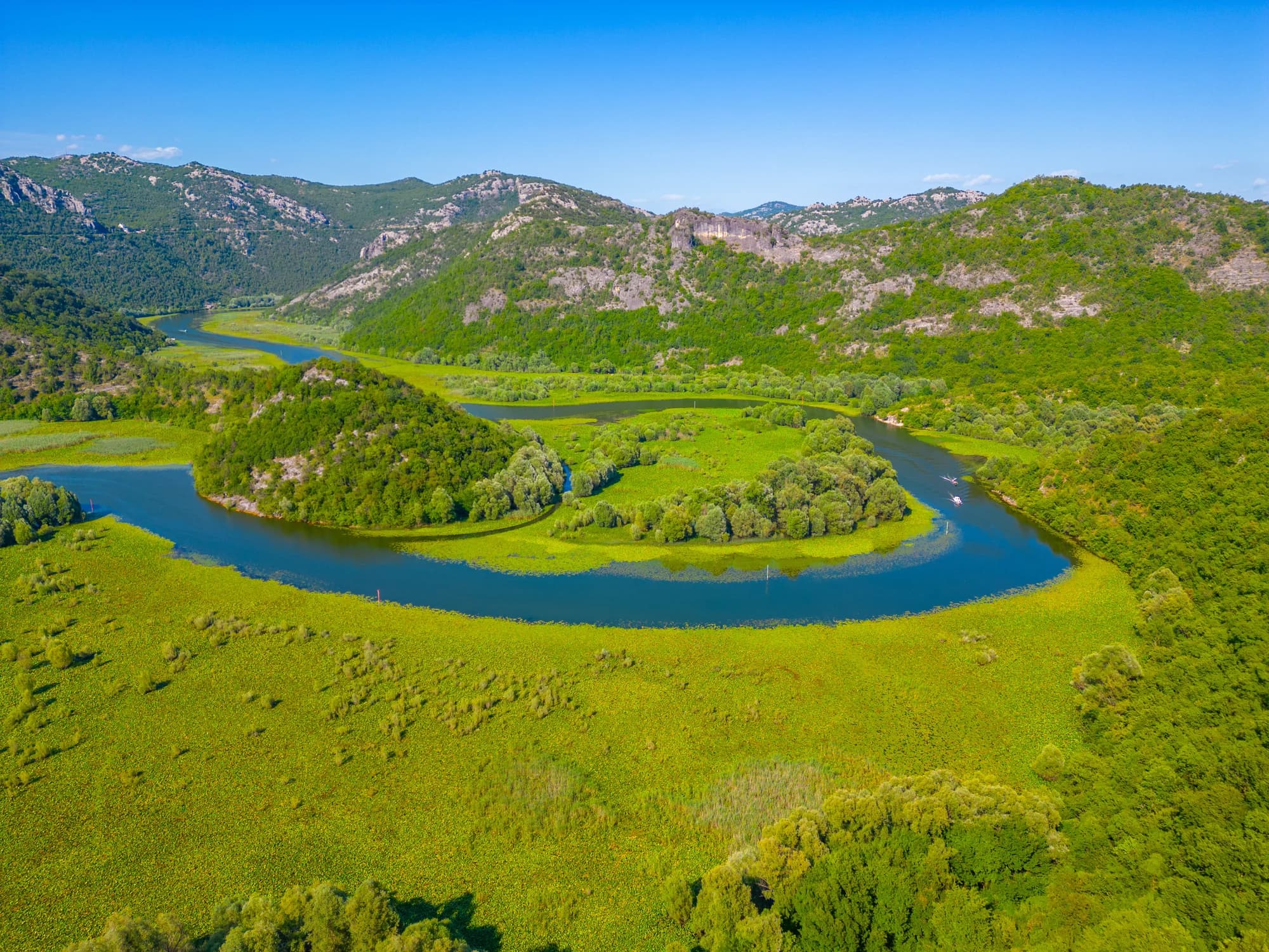
Le bras de rivière à Rijeka Crnojevića