Parco nazionale · Lago di Scutari · 1594 m
Lake Skadar
Nacionalni park Skadarsko jezero

Il nostro giudizio
Il lago più grande dei Balcani e l'unico dei cinque parchi fatto soprattutto d'acqua. È innanzitutto un parco per gli uccelli — qui nidificano i pellicani — e si visita in barca da Virpazar più che a piedi. Le colline intorno ospitano vigneti e monasteri dove la maggior parte delle gite sul lago non si ferma mai.
La parte onesta
Le gite in barca da Virpazar variano enormemente per qualità e per ciò che includono; il prezzo sul pontile non è quello che finirete per pagare. L'estate porta caldo e zanzare nelle acque basse. Il livello del lago varia molto tra la primavera e la tarda estate, e questo cambia ciò che si può raggiungere.
Quando andare
Da aprile a giugno per gli uccelli e il livello dell'acqua; settembre e ottobre per la tranquillità. Luglio e agosto sono caldi sull'acqua, con poca ombra.
- Uccelli
- Laghi
- Famiglie
- Si arriva in auto
- In parte senza gradini
Dove si trovano
Quanto è lontano, e quanto si sale
Nessuna via unica: la coordinata di un parco è il centro di un confine, non un posto dove si cammina. Le vie stanno nelle pagine delle sue cime.
Quanto freddo fa
A 4 m, Lake Skadar ha una massima media di 10.1 °C a gen e di 32.8 °C a ago. È la parte dell’archivio per cui rispondiamo qui; sotto spieghiamo perché non ci sono spessori di neve.
Lake Skadar sta a 4 m e l’archivio non registra neve apprezzabile, cosa che per una volta è semplicemente vera e non un limite del modello.
| Mese | Massima diurna |
|---|---|
| gen | 10.1 °C |
| feb | 12.6 °C |
| mar | 15.2 °C |
| apr | 19.2 °C |
| mag | 23.1 °C |
| giu | 29.0 °C |
| lug | 32.7 °C |
| ago | 32.8 °C |
| set | 27.0 °C |
| ott | 21.4 °C |
| nov | 16.2 °C |
| dic | 12.1 °C |
Le temperature sono corrette a 4 m, la quota del terreno nel punto interrogato; la cima è a 1594 m. Lo spessore della neve non è corretto: è una cella di circa nove chilometri, quindi va letto come il massiccio e non come la cima.
Rianalisi ERA5-Land (Copernicus), servita da Open-Meteo.
Lake Skadar, in numeri
La montagna
| Cima | 1594 mRumija, the ridge between the lake and the sea, OSM node (ele 1594). The lake itself is at about 5 m. |
|---|---|
| Massiccio | Lago di Scutari |
| Tipo | Parco nazionale |
| Quota di riferimento | 4 mLa quota a cui è corretto l’archivio delle temperature. La cima è a 1594 m. |
Come salirci
| Punto di partenza | Virpazar per le barche, Rijeka Crnojevića per il ramo del fiume |
|---|---|
| Difficoltà | Una passeggiata |
| Strada | Asfaltata; Virpazar si trova sulla strada Podgorica–Bar |
| Parcheggio | Gratuito |
| Autobus | Virpazar è sulla ferrovia Belgrado–Bar |
| Percorso segnato | Non verificato |
Là in alto
| Rifugio | Nessuno segnato sulla mappa entro 8 km |
|---|---|
| Acqua | Sorgenti mappate entro 4 km |
| Cibo | Ristorante |
| Servizi | Sì |
| Ricovero | Non verificato |
| Copertura mobile | Sì |
Il parco
| Superficie | 428 km²Misurata dalla relazione OpenStreetMap 10147977, che copre la parte montenegrina. Viene spesso indicata in 400 km². Il lago prosegue in Albania. |
|---|---|
| Ingresso | Non verificato |
Regole da conoscere
- Gli operatori di barche all'interno del parco sono autorizzati; la pesca è regolamentata per stagione
Dati verificati sulle loro fonti per l’ultima volta il 30 settembre 2026.
Da dove vengono questi dati
- OpenStreetMap natural=spring and amenity=drinking_water nodes within 4 km for the water field
- OpenStreetMap tourism=alpine_hut and wilderness_hut nodes, searched country-wide for the nearest mountain hut
- OpenStreetMap relation 10147977 for the boundary and area
- Our Lake Skadar and Virpazar guide
- Open-Meteo ERA5-Land archive 2015–2025 for the temperature record
Fotografie
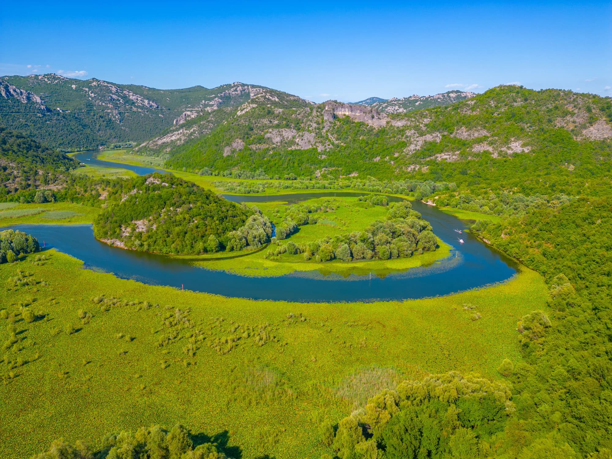
Il ramo del fiume a Rijeka Crnojevića