Parque nacional · Lago Skadar · 1594 m
Lake Skadar
Nacionalni park Skadarsko jezero

Nuestro veredicto
El lago más grande de los Balcanes y el único de los cinco parques que es sobre todo agua. Es ante todo un parque de aves —aquí crían pelícanos— y se visita en barco desde Virpazar más que a pie. Las colinas que lo rodean tienen viñedos y monasterios en los que la mayoría de las excursiones por el lago nunca se detienen.
La parte honesta
Las excursiones en barco desde Virpazar varían enormemente en calidad y en lo que incluyen; el precio en el embarcadero no es el precio que acabará pagando. El verano trae a la vez calor y mosquitos a las aguas poco profundas. El nivel del lago varía mucho entre la primavera y el final del verano, lo que cambia los lugares a los que se puede llegar.
Cuándo ir
De abril a junio por las aves y el nivel del agua; septiembre y octubre por la tranquilidad. Julio y agosto son calurosos en el agua, con poca sombra.
- Aves
- Lagos
- Familias
- Se llega en coche
- En parte sin escalones
Dónde están
Cuánto hay, y cuánto se sube
No hay una ruta única: la coordenada de un parque es el centro de un límite, no un sitio al que se camine. Las rutas están en las páginas de sus cumbres.
Cuánto frío hace
A 4 m, Lake Skadar promedia una máxima diaria de 10.1 °C en ene y de 32.8 °C en ago. Esa es la parte del registro que podemos defender aquí; más abajo explicamos por qué no hay espesores de nieve.
Lake Skadar está a 4 m y el registro no recoge nieve apreciable, lo que por una vez es simplemente cierto y no un límite del modelo.
| Mes | Máxima diurna |
|---|---|
| ene | 10.1 °C |
| feb | 12.6 °C |
| mar | 15.2 °C |
| abr | 19.2 °C |
| may | 23.1 °C |
| jun | 29.0 °C |
| jul | 32.7 °C |
| ago | 32.8 °C |
| sept | 27.0 °C |
| oct | 21.4 °C |
| nov | 16.2 °C |
| dic | 12.1 °C |
Las temperaturas están corregidas a 4 m, la altura del terreno en el punto que consultamos; la cumbre está a 1594 m. El espesor de nieve no está corregido: es una celda de unos nueve kilómetros, así que léalo como el macizo y no como la cumbre.
Reanálisis de ERA5-Land (Copernicus), servido por Open-Meteo.
Lake Skadar, en datos
La montaña
| Cumbre | 1594 mRumija, the ridge between the lake and the sea, OSM node (ele 1594). The lake itself is at about 5 m. |
|---|---|
| Macizo | Lago Skadar |
| Tipo | Parque nacional |
| Altitud de referencia | 4 mLa altitud a la que está corregido el registro de temperatura. La cumbre está a 1594 m. |
Cómo subir
| Inicio de la ruta | Virpazar para los barcos, Rijeka Crnojevića para el brazo del río |
|---|---|
| Dificultad | Un paseo |
| Carretera | Asfaltada; Virpazar está en la carretera Podgorica–Bar |
| Aparcamiento | Gratuito |
| Autobús | Virpazar está en la línea de ferrocarril Belgrado–Bar |
| Ruta señalizada | Sin comprobar |
Allí arriba
| Refugio | Ninguno cartografiado en un radio de 8 km |
|---|---|
| Agua | Manantiales cartografiados en 4 km |
| Comida | Restaurante |
| Aseos | Sí |
| Abrigo | Sin comprobar |
| Cobertura móvil | Sí |
El parque
| Superficie | 428 km²Medida a partir de la relación de OpenStreetMap 10147977, que cubre la parte montenegrina. Se suele citar como 400 km². El lago continúa en Albania. |
|---|---|
| Entrada | Sin comprobar |
Normas que conviene conocer
- Los operadores de barcos dentro del parque tienen licencia; la pesca está regulada por temporadas
Datos comprobados por última vez contra sus fuentes el 30 de septiembre de 2026.
De dónde vienen estos datos
- OpenStreetMap natural=spring and amenity=drinking_water nodes within 4 km for the water field
- OpenStreetMap tourism=alpine_hut and wilderness_hut nodes, searched country-wide for the nearest mountain hut
- OpenStreetMap relation 10147977 for the boundary and area
- Our Lake Skadar and Virpazar guide
- Open-Meteo ERA5-Land archive 2015–2025 for the temperature record
Fotografías
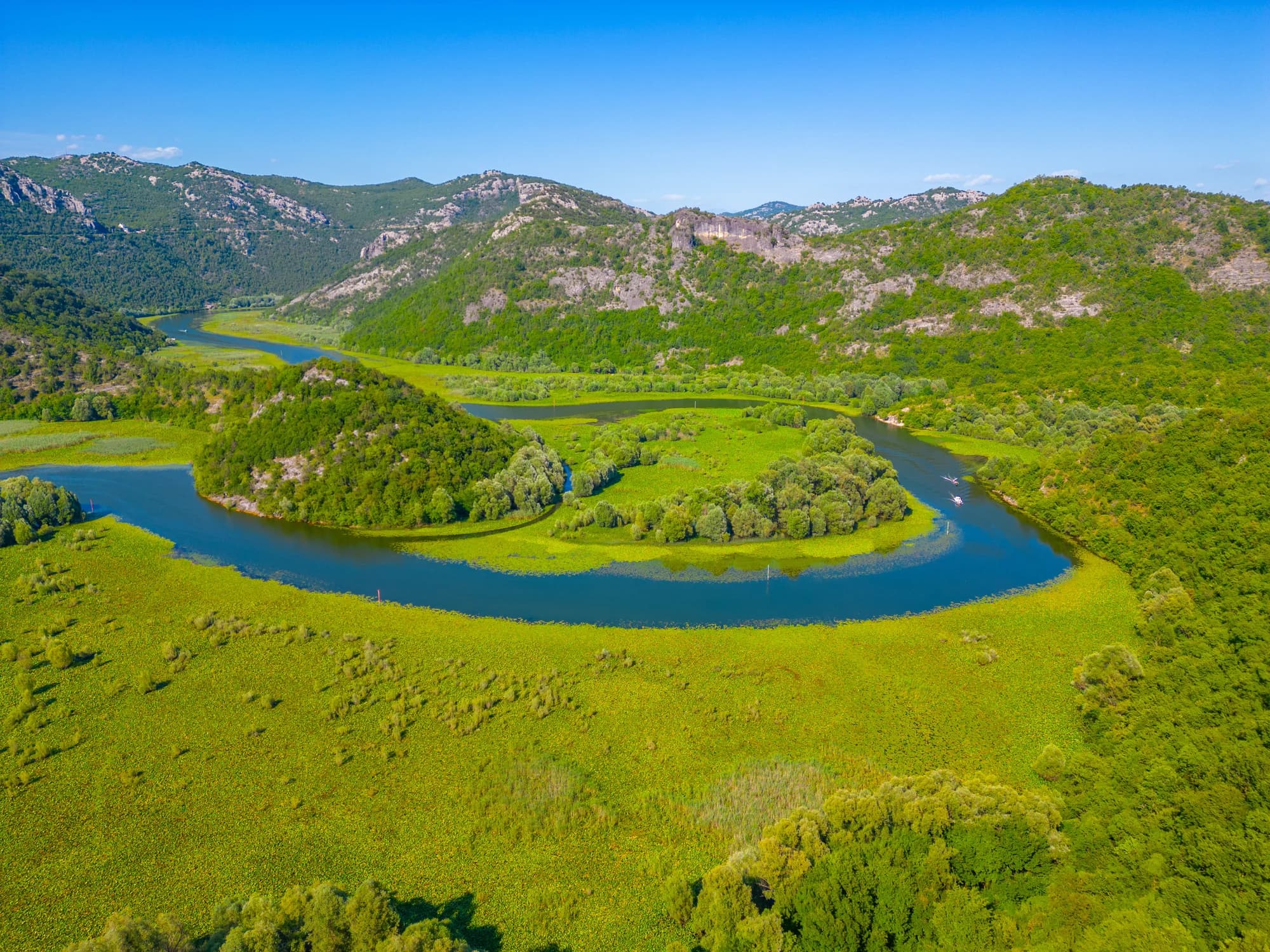
El brazo del río en Rijeka Crnojevića