Eighty-four people live in what was once Montenegro’s largest port: two limestone arches, a ruined capital on the hill above them, and a green river leaving for Lake Skadar.
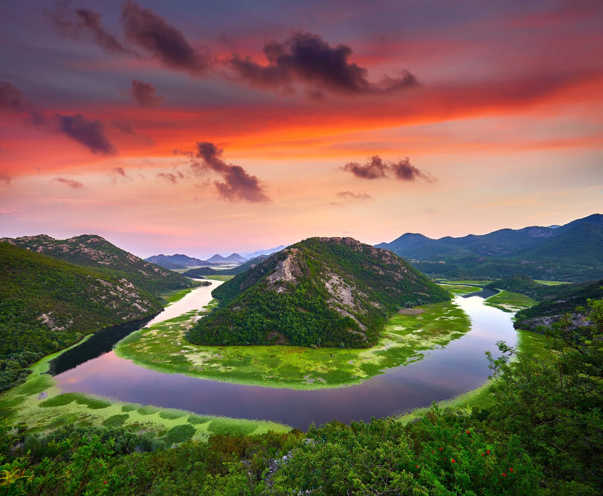
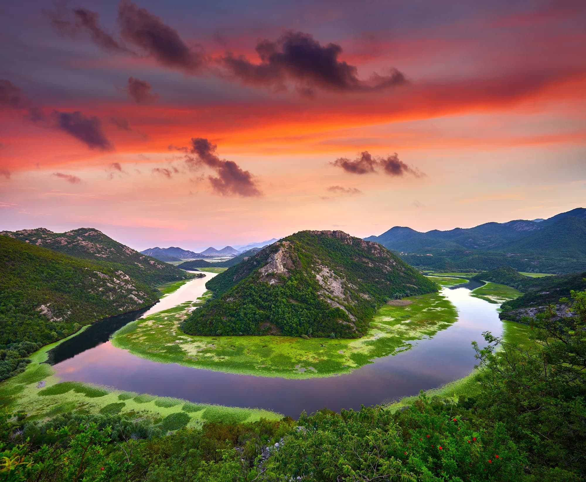
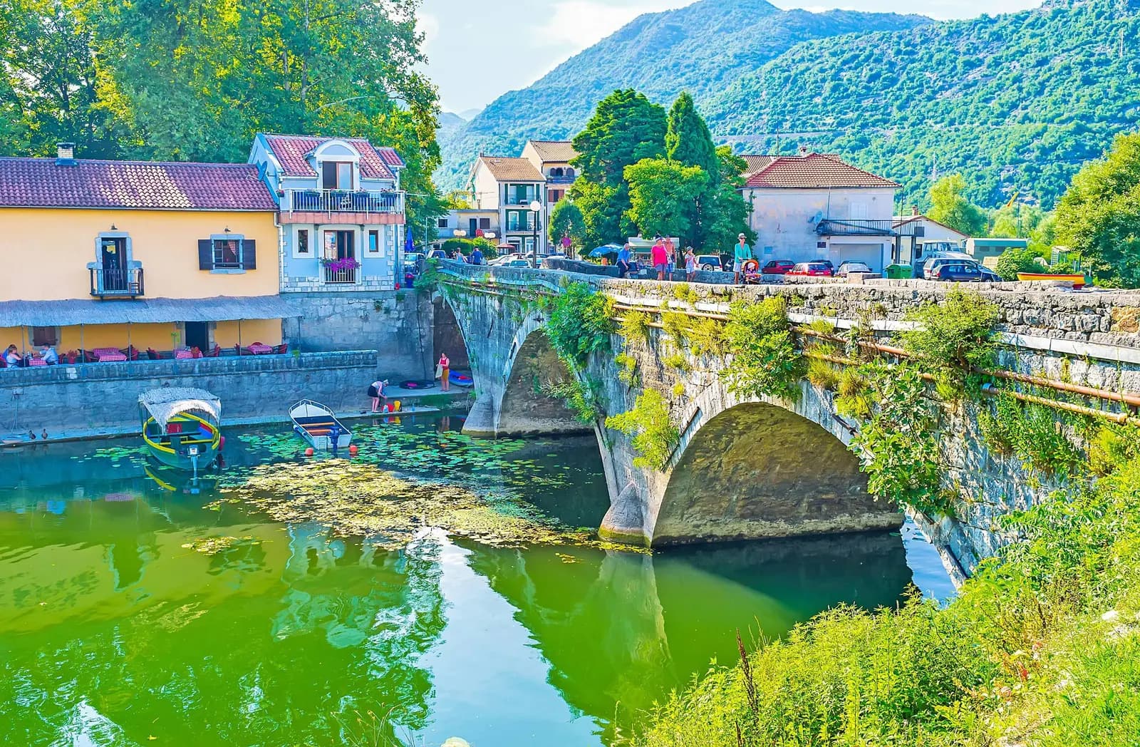
Rijeka Crnojevića sits where a short, deep river of the same name loops through the hills before spreading into the northern arm of Lake Skadar. It amounts to a single street of stone houses along the water, a stone quay, and the arched bridge built in the middle of the 19th century in the reign of Prince Danilo, a span so often photographed that it has become shorthand for the whole lake. The wider view of the river's horseshoe bend is from the road above the town, at Pavlova Strana. The place carries more history than its size suggests. Under the Crnojević dynasty at the end of the 15th century the first printing press in the Balkans was established in this area, traditionally sited at Obod on the heights above the river, producing Cyrillic liturgical books within decades of Gutenberg. Later the town worked as a river port and market where goods moved by boat between the interior and Skadar, and it kept a role in the affairs of the Montenegrin state into the 19th century, when the ruling family maintained a residence here. Today the appeal is slow. Boats leave the quay for trips down the serpentine channel into the open lake, through reed beds and water lily fields where pelicans, cormorants and herons feed; the whole basin is a national park. Restaurants along the river serve what the lake produces, including carp, eel and the small dried bleak that has been a local staple for centuries, and the old market buildings are gradually being restored. It suits travellers who want a couple of unhurried hours rather than a full day, and it pairs naturally with Virpazar, Cetinje or the drive over to Budva. Spring is best for birds and for the green of the surrounding hills; July and August bring the water lilies into flower along with the heat; autumn is quiet and the light on the bend is at its finest.
A few hours
Ninety minutes buys the view, the bridge and the quay that was once Montenegro’s largest port.
One full day
The quay by the old bridge
Best for one small hotel, a few rooms and a campsite on the water — everything in the village is a two-minute walk
Šinđon, 2 km east
Best for a lakeside resort with its own campsite and water access, on the road out towards the viewpoint
The Pavlova strana ridge
Best for a hotel at the viewpoint, 4 km up — you wake above the bend rather than down at the river
Virpazar, 33 km by road
Best for the lake’s other gateway — more rooms, the Bar–Belgrade railway, and its own boats
Census population, Rijeka Crnojevića municipality
The peak was 1961: 804 people. Every count since has been smaller — 484 in 1981, 340 in 1991, 175 in 2011 — and the 2023 census found 84, a tenth of the village’s own record.
Everything here happened by water: a fortified capital on the hill, a press whose address is still argued over, and a century of boats down to Skadar. Widths are to scale.
rijekacrnojevica.me; Wikipedia (Obod, Crnojević printing house, Rijeka Crnojevića); MONSTAT censuses.
A day on the river
Coach hours, then nothing
Meanwhile, in 1494
Obod, 4 January 1494: the Oktoih prvoglasnik comes off the Crnojević press — the first book printed in Cyrillic in the South Slavic lands. Đurađ Crnojević founded the shop; the hieromonk Makarije ran it with seven assistants and finished five books before it closed in 1496.
Where, exactly — the village puts the press at Obod, on the hill whose foundations still carry a plaque; a good deal of modern scholarship puts it in Cetinje. The books are not in doubt, the address is.
Venice: the same year Luca Pacioli’s Summa de arithmetica is printed there — the first published description of double-entry bookkeeping.
Tordesillas — on 7 June Spain and Portugal divide the New World between them; on 3 September Charles VIII crosses the Alps into Italy with some 30,000 men, and before the year is out the Medici have lost Florence and their bank is dissolved.
“A specially prized product of this district was dried ukljeva, for its uniqueness and its exceptional taste, much sought after even on Italian tables.”
Rijeka Crnojevića, Serbian Wikipedia
Translated from the article’s history section, which also credits the village with Montenegro’s first pharmacy and its first arms workshop.
“The nature of Rijeka Crnojevića was milder than that of Cetinje.”
rijekacrnojevica.me, on Petar I’s winter house
The village’s own heritage page for Kuća Svetog Petra Cetinjskog, built 1810–1815 — the oldest preserved house here, at the entrance just above Danilo’s bridge.
Search thousands of hotels and apartments with live prices.
We may earn a commission from partner links. This helps us keep Montenegro.com free for travelers.
Search hotels, apartments and guest houses with live availability.
We may earn a commission from partner links. This helps us keep Montenegro.com free for travelers.
A village on the river of the same name where it meets Skadar lake, about 25 km from Podgorica and half an hour below Cetinje. It sits at the bottom of a steep valley, and the road down to it descends in tight curves.
The meander above the village, where the river doubles back on itself in a near-complete loop between wooded hills. The viewpoint is on the old Cetinje road a couple of kilometres above the village, and it is the most photographed inland scene in Montenegro.
Danilo's bridge, a stone arch built in 1853 under Prince Danilo, still the centrepiece of the village. It carried the main road from Cetinje to the lake, and the old warehouses and quay along the water date from the same period.
It was the port of old Montenegro. Before roads, goods moved from Cetinje down to this quay and on across Skadar lake to Scutari, and in the 19th century Rijeka Crnojevica was a busy trading town with a customs house and a market.
Yes. Small boats run from the village into the lake through the reed channels, which is the best way to see the birdlife — herons, cormorants and, with luck, Dalmatian pelicans. Trips run from spring through autumn.
Yes, and it is short. Come for the viewpoint, walk the quay, eat fish by the water and continue to Cetinje or Virpazar. Early morning and late afternoon give the best light on the meander.
No — the nearest is Podgorica Airport (TGD), 30 km away by road.
17.6 km by road, about 27 min by car.
The UK Foreign, Commonwealth & Development Office (FCDO) has no advisory against travel to Montenegro; it last reviewed its guidance on 13 August 2026. That is their assessment of the country as a whole, not ours and not a judgement about Rijeka Crnojevića, so read it yourself before you travel. The emergency number in Montenegro is 112.
The local plate
The small silver fish that made the village rich: dried ukljeva was the district’s prized export, wanted even on Italian tables, in the century when this was Montenegro’s largest port and leading market. Carp, bleak and eel are still the lake’s mainstays, and the quay’s kitchens still work with them.
Where The fish restaurants along the quay, either side of Danilo’s bridge
The nearest places to Rijeka Crnojevića, at their true positions — Podgorica is about 21 km away in a straight line.
Schematic. Positions and straight-line distances from the coordinates we hold for each place; mountain roads make the drive longer. Coastline and Lake Skadar © OpenStreetMap contributors.
Rijeka Crnojevića in numbers
Ivan Crnojević fortifies Obod on the hill above the river
2023 census — 804 people lived here in 1961
from the spring in the Obodska pećina to the open lake
Lake Skadar’s Montenegrin shore becomes a national park
bird species recorded on the lake the river runs into
Podgorica (TGD); Virpazar, the lake’s other gate, is 33 km
MONSTAT censuses 1948–2023 · Skadar Lake National Park · Wikipedia · rijekacrnojevica.me
Best time: April · May · October
| Place | By road | Driving |
|---|---|---|
| Cetinje | 17.6 km | about 27 min |
| Njeguši | 27.4 km | about 35 min |
| Podgorica | 28.3 km | about 36 min |
| Golubovci | 33.4 km | about 44 min |
| Budva | 42.4 km | about 1 h 1 min |
| Kotor | 54.3 km | about 1 h 13 min |
| Žabljak | 148.2 km | about 3 h 1 min |
Road distances routed over OpenStreetMap data, © OpenStreetMap contributors. Driving times are free-flow and take no account of summer traffic or a queue at the ferry ramp.
One day is the right length: the river is the attraction, and it is 13 km long.