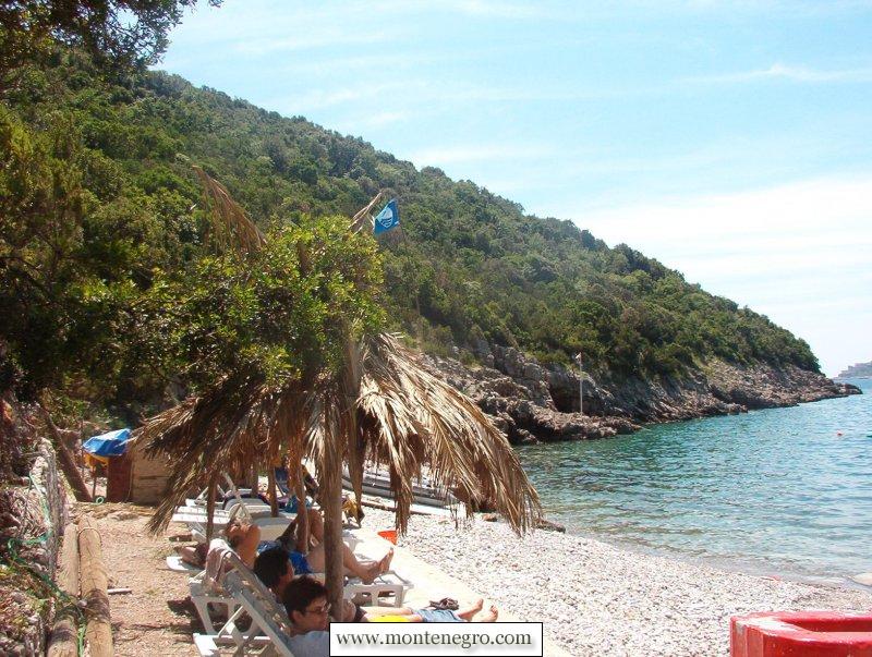
Dobreč is a small Luštica cove with two truths that must be kept apart. It helped launch Montenegro's Blue Flag story in 2004, but that historical award is not a permanent certificate. Today the public coastal profile still describes the beach as reachable only from the sea, while the national programme's published 2026 award list does not include Dobreč.
Plan a conservative boat-out-and-back visit. Come for the sheltered-looking coastal landscape and a piece of tourism history, not on the assumption that a flag, lifeguard, restaurant, shower or scheduled boat will be waiting. Confirm transport, landing conditions, services and the return arrangement on the day.
Dobreč at a glance
| Question | Current information | How to plan |
|---|---|---|
| Where is it? | Morsko dobro publishes 42.412507, 18.558893 | Use the coordinates for orientation, then confirm the actual pickup and landing with the carrier |
| Can I walk in? | The current coastal profile says access is possible only from the sea | Plan a return boat, not an overland approach or improvised scramble |
| What is the shore? | The same profile describes pebble with concrete sections | Bring secure footwear; do not infer step-free landing |
| Is it Blue Flag? | National records list Dobreč–Stevuzo among the six first awards in 2004, but not on the 2026 list | Call it a former or historical award site, not a current Blue Flag beach |
| Is the water clean today? | Montenegro monitors coastal water, but the latest municipality summary does not identify Dobreč | Check the monitoring map and local notices; do not apply a Herceg Novi aggregate to this cove |
| What services operate? | Facilities vary by operator and season | Carry essentials and ask the carrier directly about food, water, toilets, shade and supervision |
The Blue Flag story: pilot, first award, then a changing list
What the sources say
Montenegro's national Blue Flag operator records a pilot phase in 2003. Dobreč, then listed as “Dobreč Stevuzo,” was one of the participating beaches. The following year was the country's first awarded season. Six beaches received flags: Dobreč Stevuzo, Mao/Carine in Risan, Plavi Horizonti, Mogren I, Miami on Velika Plaža and Tropicana.


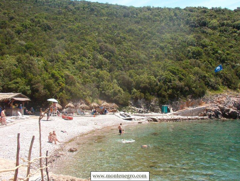
That makes Dobreč historically important. It stood at the beginning of a national environmental-award programme rather than simply joining a mature list later. Photographs from the page created in 2004 show a Blue Flag at the cove and preserve that moment in the programme’s history.
Historical status does not continue automatically. Blue Flag International describes the programme as voluntary and evaluates beaches and marinas against criteria covering water quality, environmental management, education and information, safety, services, biodiversity and related sustainability responsibilities. The criteria are reviewed over time. The organisation also warns that an award is guaranteed only during the stated award season. A flag in a historic photograph therefore cannot be carried forward indefinitely.
| Stage | Status |
|---|---|
| 2003 | pilot participant |
| 2004 | first awarded season |
| 2026 list | Dobreč not listed |
| Visit day | verify every operation |
| What remains current in the public cove profile | Pebble and concrete shore · access from the sea only · published coordinates |
| Still needs a live check | Boat, landing, return, weather, water result and services |
Source: plava-zastavica.org.me, blueflag.global, morskodobro.me
On the national operator's published 2026 award and pilot list, Dobreč does not appear. Within Herceg Novi municipality, the listed 2026 awarded site is the beach at Hotel Iberostar Njivice. Award status can change in a future season. If a current physical flag and the official list ever conflict, ask the national operator rather than choosing the more convenient answer.
For neighbouring context, our Njivice guide explains the peninsula-side settlement associated with that current award. The Mogren guide and Velika Plaža guide cover other coastlines represented in Montenegro's first 2004 list.
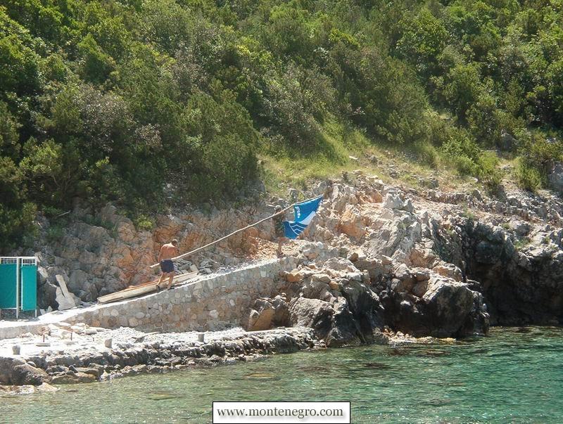
Where the cove is—and what “sea only” means
What the sources say
The Public Enterprise for Coastal Zone Management, Morsko dobro, places Dobreč at 42.412507, 18.558893. Its current cove profile describes a pebble beach, parts with a concrete base, and access possible only from the sea. Build the visit around a confirmed marine transfer and return pickup.
“Only from the sea” is not the same as “every boat can land.” The profile does not certify an anchorage, depth, berth, jetty, passenger transfer, private-vessel access or scheduled water taxi. It also does not say that a path visible on a satellite map is public or safe. Do not attempt to improvise an overland route through Luštica vegetation, private land or coastal rock.
For the peninsula's wider road villages, beaches and military-coast history, build a separate day with the Luštica guide. Dobreč works better as a defined boat objective than as one more marker forced into an overfilled driving loop. If your boat outing also considers the Blue Cave, use the Blue Cave planning guide to compare weather exposure and operator questions; do not assume the two stops always belong in one safe itinerary.

Practical boat planning
Begin with a competent current carrier, not an undated social post. Ask for the legal operator or skipper name, exact departure point, vessel identity, maximum passenger count and what safety equipment is carried. Confirm that the operator actually intends to land or transfer passengers at Dobreč rather than only pass the cove.
Agree the return before boarding. Record the pickup location and a conservative pickup window, exchange working phone numbers and ask what happens if wind or sea state prevents collection. A one-way drop without a robust fallback is inappropriate at a place publicly described as sea-access only. Keep enough battery to communicate and save the cove coordinates offline.
- Before payment: confirm destination, passenger total, departure and return, cancellation rules, lifejackets and any mobility limitation.
- Before boarding: compare the actual vessel and skipper with the booking, listen to the safety briefing and locate a correctly sized lifejacket for every passenger.
- Before landing: let the skipper decide whether conditions allow the planned transfer. Keep hands inside the vessel until instructed and do not jump onto wet rock.
- At the cove: preserve the agreed pickup point, avoid blocking landing space and keep the group together.
- Before the return time: repack early and contact the carrier if anything changes. Do not wait for darkness or a dying phone to reveal a missed arrangement.
Do not rely on a fixed fare without confirming its terms. Price depends on departure point, vessel, group, route, duration and conditions. Likewise, a transfer offered from Herceg Novi, Rose, Žanjice or elsewhere in one season may not run to the same timetable in the next.
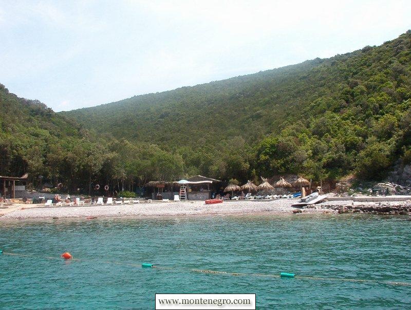
Water quality: use the site result, not the regional percentage
Montenegro has a structured seawater-monitoring programme. Morsko dobro says sampling evaluates the microbiological indicators Escherichia coli and intestinal enterococci, together with supporting physical and chemical observations. Current results are classified into published quality categories.
The 28 August 2026 release reported samples from 114 coastal locations taken between 17 and 21 August. For Herceg Novi municipality it summarized 22 locations: 15 excellent, three good, three satisfactory and one poor, with the named Baošići site later retested as satisfactory. Dobreč was not named in that release. It would be statistically wrong to convert those municipal totals into a Dobreč result.
Before swimming, inspect the official monitoring map for a named, dated nearby sampling point and check any beach notice. Ask the operator about recent rain, runoff, visible pollution and jellyfish or other local hazards. Even an excellent laboratory sample is a time-bounded microbiological observation, not a guarantee against waves, cold, boats, slippery entry or sudden illness.
Do not swim if the landing is unsafe, visibility is poor, craft are manoeuvring close by or local authorities advise against it. Children and weak swimmers need direct supervision at the water's edge. A sheltered appearance in a photograph cannot measure the sea on your day.
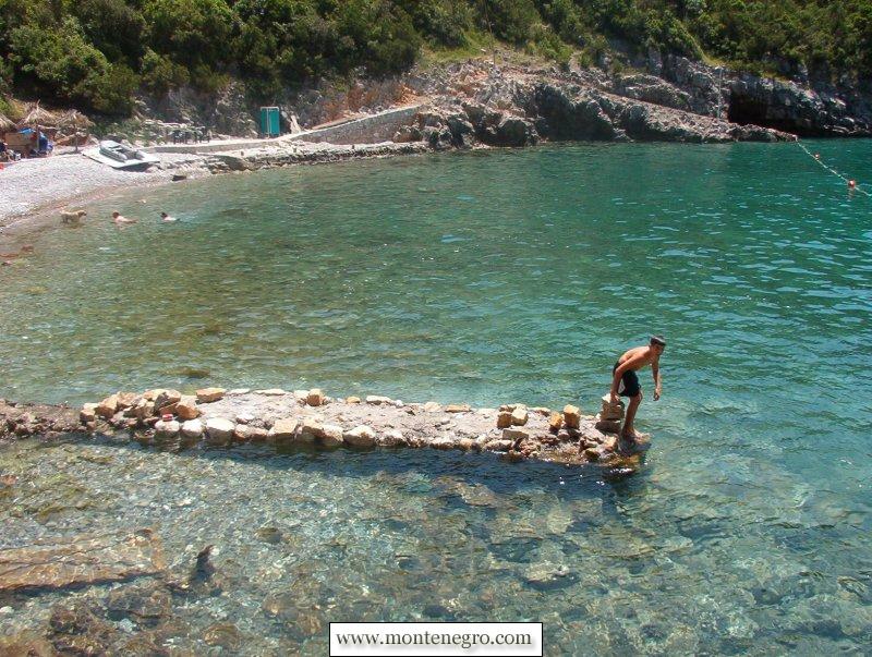
What to bring when services are unconfirmed
Pack as if there are no operating visitor facilities. Bring drinking water, sun protection, essential medication, a charged phone in a waterproof pouch, secure-soled footwear, a modest first-aid kit and a bag that removes all waste. Keep the load compact enough for a controlled boat transfer.
Photographs from 2004 show rustic structures and facilities that may no longer operate. Do not assume that drinking water, food, toilets or showers will be available. Confirm essential facilities directly or make the trip self-contained, and never drink from an unverified outlet.
Shade in an old image is not guaranteed shade today. Avoid peak heat if the carrier cannot confirm shelter. Reef-safe claims vary by product and jurisdiction, so the dependable approach is physical shade, clothing and careful sunscreen use without washing oils or litter into the cove.
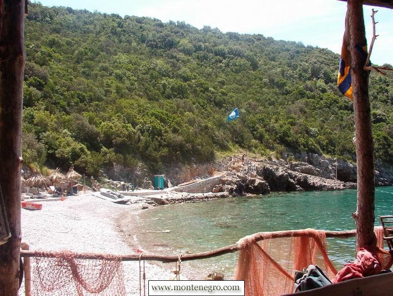
Leave the cove lighter than you found it
Boat-only access concentrates pressure. A dropped bottle, cigarette end or food wrapper is difficult to remove after visitors leave, and wildlife should not be fed. Pack out every item, including fruit peel and tissues. Do not collect stones, shells, sea urchins or plants, and do not move coastal furniture or build rock stacks.
Keep speakers off or low, give other visitors room to land, and avoid drones around people or sensitive wildlife unless every aviation, privacy and protected-area requirement is satisfied. Do not photograph identifiable visitors as if an isolated cove were a private studio.
Historic Blue Flag recognition is best honoured through behaviour rather than nostalgia. The international programme's environmental language matters even when a beach is not on the current award list: correct disposal, respect for habitats, honest information and safe operation remain useful standards for visitors and carriers.
A realistic half-day plan
Reserve the trip only after a forecast and carrier check. Choose a departure that gives ample daylight margin for the return. On arrival, identify the exact pickup point before spreading out. Spend the first minutes observing boat movements, the shore surface and any site notice. Swim only if current evidence and conditions support it.
Keep the final half-hour free for drying, packing and contacting the carrier. If the sea deteriorates, accept an early return. If the operator cancels, use the day for a road-accessible Luštica stop or the Herceg Novi waterfront rather than pressuring another skipper. The first-time Montenegro guide helps with broader coastal transport and heat planning.
Emergency planning
Montenegro's Maritime Operations Centre publishes 129 for maritime emergencies. The national 112 service coordinates general emergency response. Save both numbers, but do not assume perfect mobile coverage or immediate arrival.
When calling, give coordinates, the cove name, vessel description, number of people, injury or illness, sea conditions and immediate hazards. Follow the operator's instructions. Do not launch an untrained rescue swim or move a casualty with a suspected neck or spine injury unless remaining in place creates greater danger.
Frequently asked questions
Is Dobreč a Blue Flag beach in 2026?
Not on the national programme's published 2026 awarded or pilot list checked on 29 August. Dobreč was one of Montenegro's first six awarded beaches in 2004, which is an important historical fact but not current certification.
Can I reach Dobreč by car or on foot?
The current Morsko dobro profile says access is possible only from the sea. Do not convert an unmapped track or apparent satellite route into a public hiking recommendation. Arrange a boat with a confirmed return.
Is there a regular water taxi?
Boat transfers vary by operator, departure point, season and conditions. Ask a competent carrier for the exact date, departure, vessel, landing plan and return terms.
Are there toilets, food and drinking water?
Facilities shown in 2004 may no longer operate, and water from an outlet should not be assumed potable. Bring water and essentials, remove waste and verify any service directly.
Is the water safe for swimming?
Do not infer a Dobreč result from municipality-wide percentages. Check the official monitoring map for a named and dated site, inspect local notices and assess same-day sea, weather and boat traffic.
How long should I stay?
A half-day is a sensible planning frame when the return is explicit and daylight margin is generous. The right duration is whatever the skipper, weather and group can support safely; never let a booked duration override changing conditions.