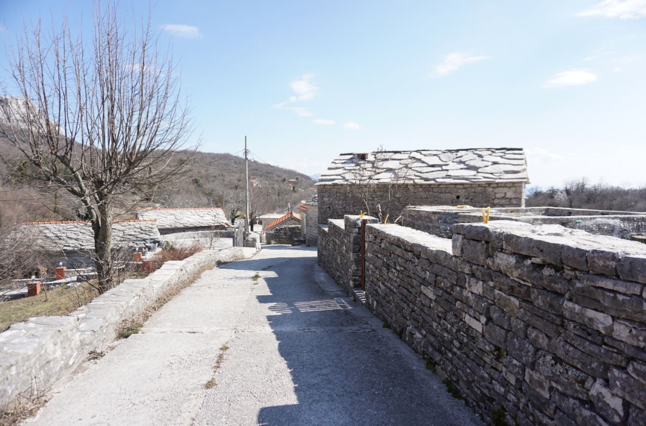
Žlijebi sits at about 700 metres above Herceg Novi, where the coastal slope becomes Orjen limestone. The village is memorable not because everything is generically “old,” but because one local material became an entire building system: flat quarried slabs form walls, roofs, lanes, courtyards and boundaries. This field guide explains what official sources support, how to choose between road and trail access, and how to visit a very small living settlement without turning it into a stage set.
Why Žlijebi deserves careful attention
What the sources say
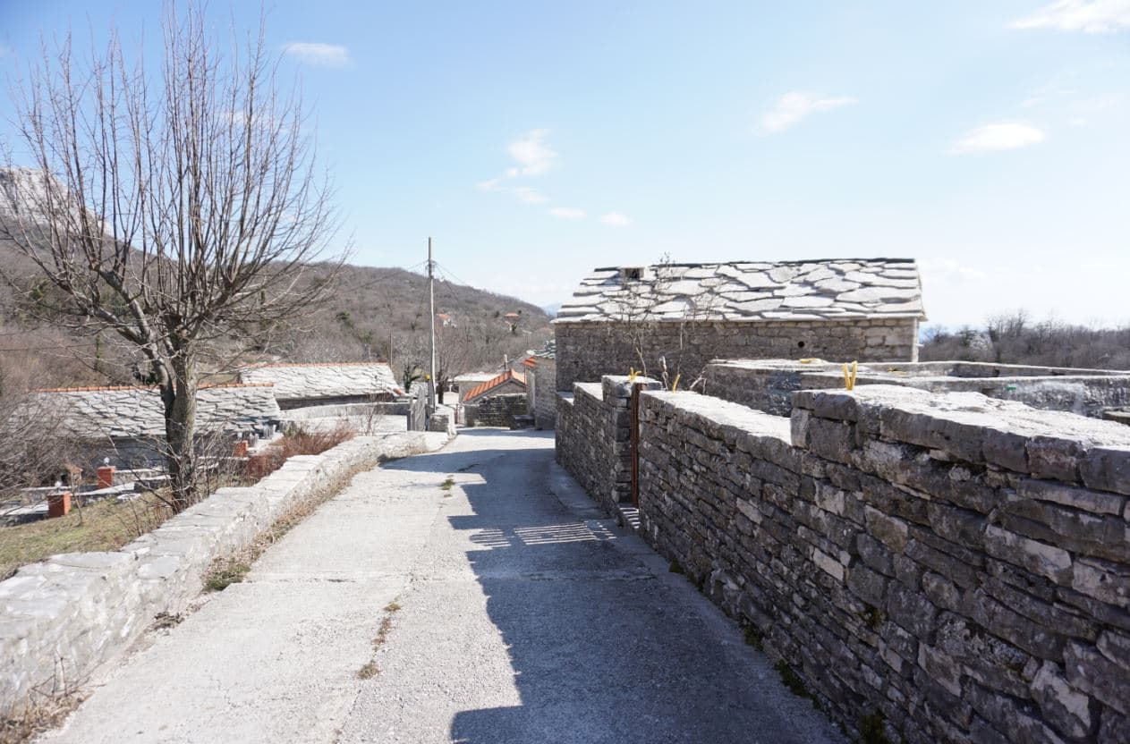
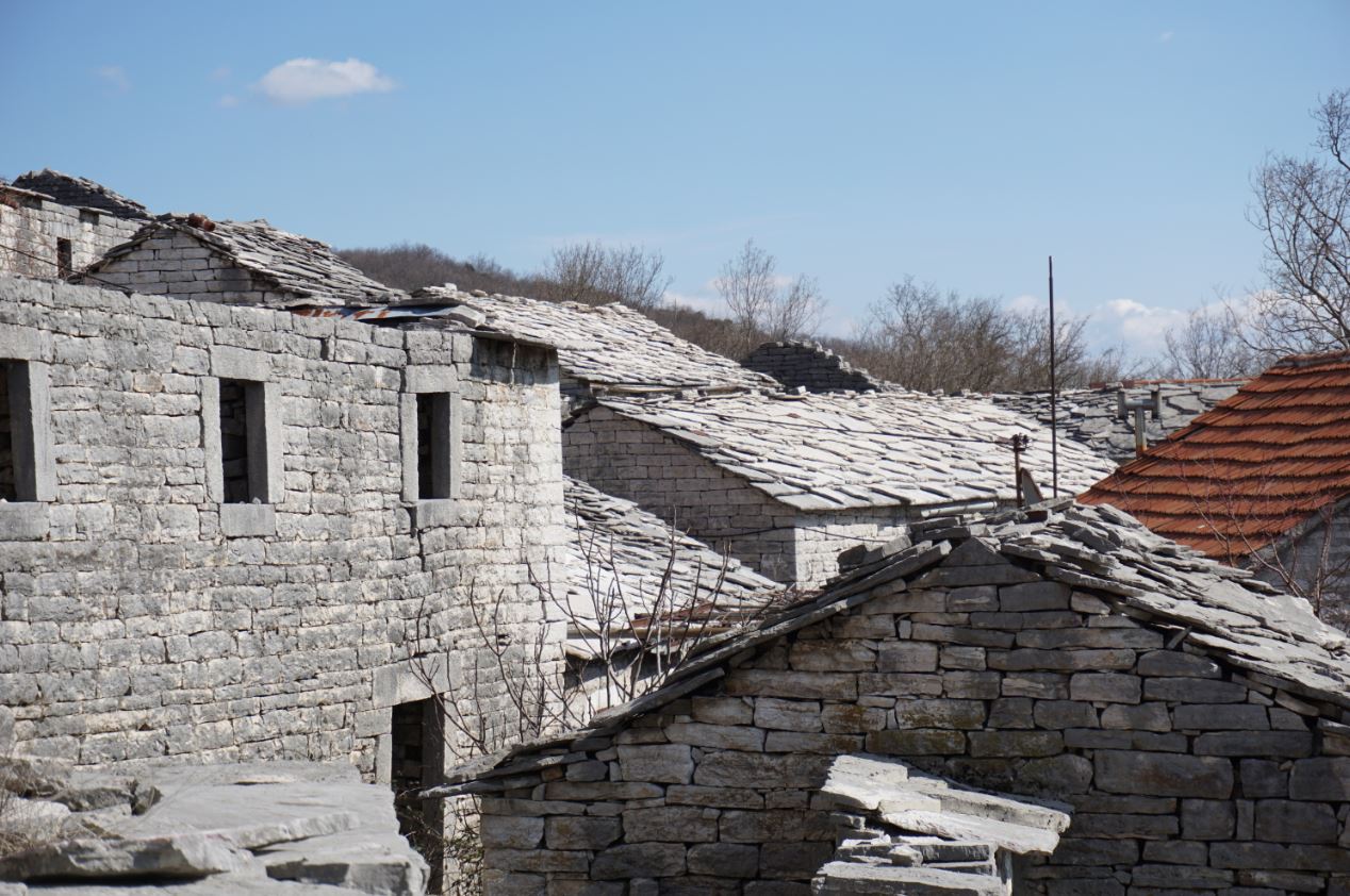
The National Tourism Organisation places Žlijebi around 700 metres above sea level and describes it as one of the smallest villages in the Herceg Novi hinterland. Its distinction is architectural. Stone was extracted from local small quarries, or majdani, in naturally flat layers. Official tourism sources say traditional builders could stack those slabs without binding mortar and used the same material for roofs and field boundaries.
That does not mean every visible building is an untouched artifact. Houses survive because people maintain, adapt and sometimes reconstruct them. Waterproofing, structural reinforcement, utilities and replacement openings can sit behind a traditional exterior. A responsible description distinguishes the inherited construction language from a claim that every component is original.
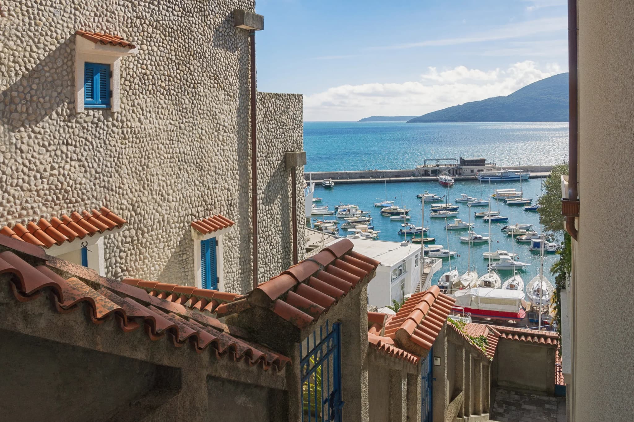
For the coastal context below, begin with our complete Herceg Novi guide. For the wider land-and-sea system visible from the church plateau, the Bay of Kotor guide explains the geography that Žlijebi overlooks.
Reading the stone as a building system
| Element | Visible role | Construction logic | Visitor question |
|---|---|---|---|
| Wall | Load-bearing enclosure and thermal mass | Courses use selected faces and interlocking weight | Is this wall traditional, rebuilt or repaired? |
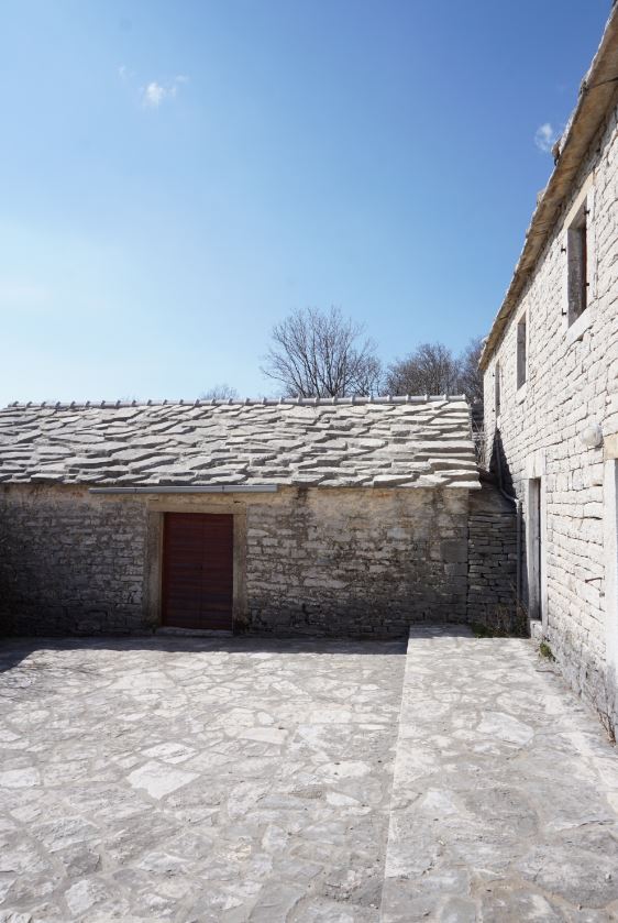
| Roof | Overlapping weather surface | Flat slabs shed water through pitch and overlap | What hidden support now carries the load? |
| Međa | Field or property boundary | Dry-stone stacking uses available fragments | Is the lane public or a household entrance? |
| Gumno | Paved circular working surface | Level stone platform supports threshing and gathering | May visitors enter, or is it private? |
| Lane | Movement and drainage | Stone surfacing resists erosion but becomes slick | Are shoes suitable after rain? |
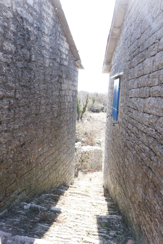
The official story says quarrying still uses wedges, heavy hammers, levers and skill passed between generations, substantially the same method used for more than 300 years. That is a published institutional attribution, not a substitute for a dated quarry study. If a demonstration is available, ask who is teaching, whether photography is welcome and whether the stone is being extracted for a live building project.
Do not remove fragments as souvenirs. A loose slab can be part of a roof repair, boundary or archaeological context. Do not climb a wall for a photograph: dry-stone structures rely on carefully balanced placement, and movement that looks harmless can dislodge a course.
Material intelligence without the “timeless village” myth
Flat stone did not make construction effortless. A roof covering dense enough to resist mountain weather also places substantial weight on walls and timber. Builders needed to select slab thickness, establish pitch, overlap joints and move water beyond the wall face. A courtyard needed drainage; a retaining wall needed enough batter and depth to hold scarce soil. Those are engineering decisions expressed through craft rather than decoration.
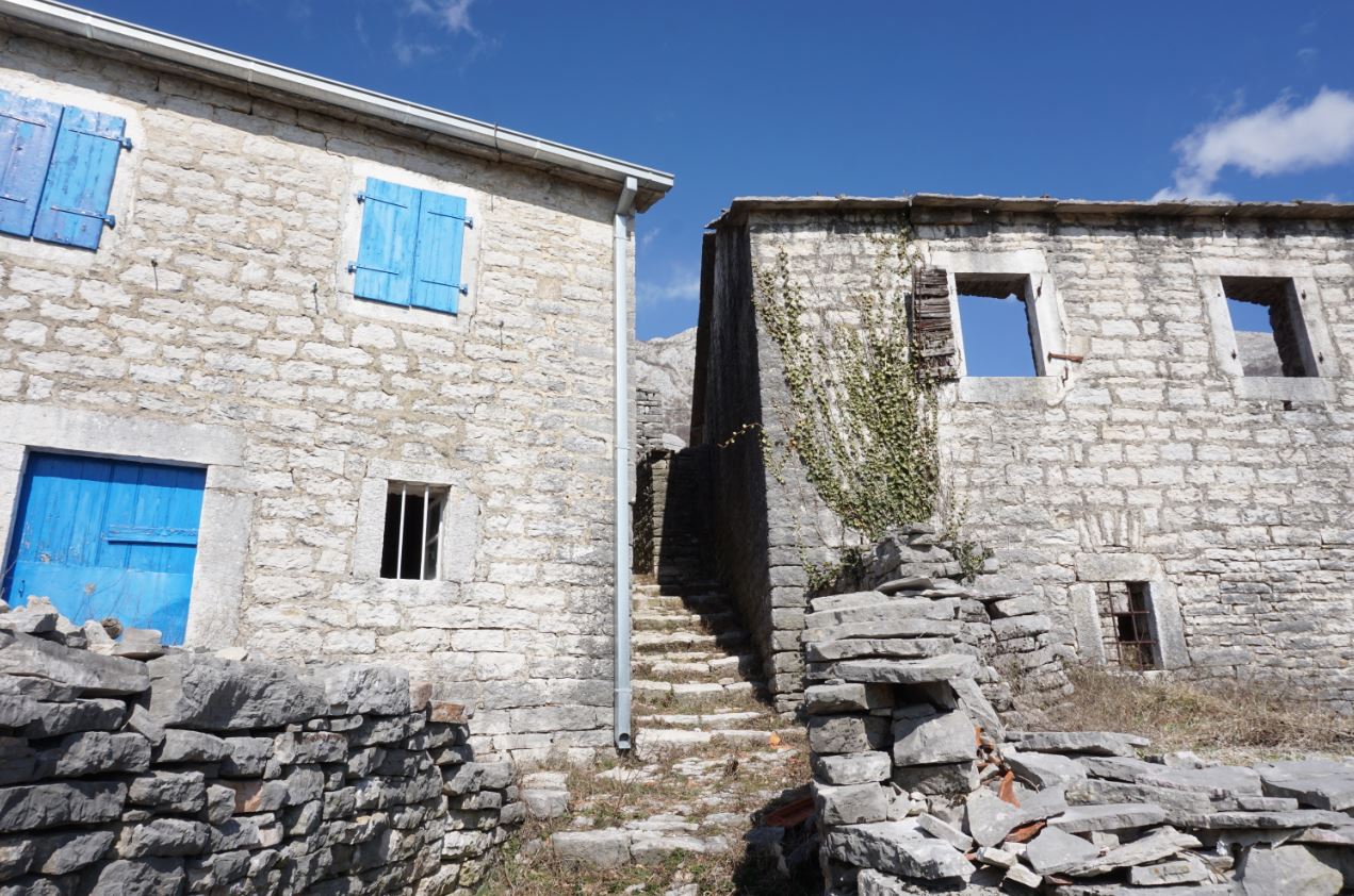
The visual result can appear monochrome, yet the village was never only grey. Timber, metal, lime, plants, soil, textiles and later utility materials complete the lived environment. Blue shutters in the archive are a reminder that heritage is not a prohibition on color. A rigorous survey would identify material layers building by building and distinguish original fabric, repair, adaptation and reconstruction. This article cannot do that from exterior photographs.
“No mortar” also needs a boundary. Official sources apply it to traditional slab construction; they do not prove that every joint in every standing building remains dry-laid. Modern conservation may use compatible binders or concealed measures where safety and water control require them. Visitors should admire the technique without telling residents that a necessary repair makes their home less authentic.
The best way to support continuity is to value skilled labor. If a local craft demonstration is offered, pay the stated price, listen to the vocabulary of tools and stone, and ask how material is selected today. Do not ask for a staged extraction that wastes stone or interrupts work merely to produce a short video.
Two walking approaches, two different commitments
Published route numbers only make sense when the starting point is named. The Tourism Organisation of Herceg Novi's Boka Bay View Trails brochure gives the Kameno–Žlijebi route as 5.5 kilometres with 320 metres of ascent. That is not a walk from the Herceg Novi waterfront.
The official Orjen mountain brochure describes a separate Herceg Novi–Žlijebi route: medium difficulty, about 2 hours 15 minutes one way, beginning opposite the bus station around 90 metres and ending at Saint Nicholas Church at 708 metres. The stated time excludes the return. The brochure recommends cooler parts of the year or early and late summer hours and explicitly warns against descending when the path is wet.
| Option | Published baseline | Best for | Key risk |
|---|---|---|---|
| Drive | Official rural directory places the village 11 km from Herceg Novi | Limited time or reduced walking capacity | Narrow approach, uncertain parking and meeting traffic |
| Walk from Kameno | 5.5 km; 320 m ascent | A shorter marked landscape route | Transport to/from Kameno and route identification |
| Walk from Herceg Novi | 2:15 one way; 90 m to 708 m; medium | A full ascent linking coast and hinterland | Heat, wet stone, long return and navigation |
Never combine the most favorable number from each row. A 5.5-kilometre distance and a 618-metre elevation gain belong to different published approaches. Download current track information, confirm markings with the Orjen park authority and carry enough water for the chosen route.
Weather changes the route, not just the view
A 700-metre village above the Adriatic can feel like a different season from Herceg Novi's waterfront. Elevation, exposure and cloud can replace coastal heat with wind, cold rain or reduced visibility. Conversely, the long climb from town can be dangerously hot even when the church plateau feels comfortable. Check a mountain-relevant forecast, not only the beach temperature.
Wet limestone is the most important simple warning. It reduces grip on polished steps and stone paving, and a slip becomes more consequential on the old serpentine descent. The official route note says not to descend the wet path. Treat that as a decision rule: if rain has arrived or the surface remains slick, use safe arranged transport rather than preserving an itinerary at any cost.
Carry a grippy shoe, sun protection, a warm or waterproof layer, drinking water, charged phone and offline map. A walking pole may help on descent if used competently, but it does not correct unsuitable footwear. Start with enough daylight for a slower return and share the exact route—not just “Žlijebi”—with somebody who will notice if you are overdue.
Fire risk also changes behavior. Do not smoke beside dry vegetation, light a cooking fire or park a hot vehicle over grass. In an emergency call 112, state whether you are on the Herceg Novi route, Kameno route, road or church plateau, and provide coordinates if the phone supplies them.
Practical arrival and village etiquette
Drive in daylight and assume that a narrow lane can carry residents, livestock, work vehicles or oncoming traffic. Do not rely on a satellite image to prove a turning space. Park only where a host or local sign permits, keep gateways clear and avoid leaving a vehicle on vegetation or a stone platform.
The government-backed Montenegro Village Explorer lists Konoba Sikimić at Žlijebi, 11 kilometres from Herceg Novi, with six renovated stone houses and food built around its own vegetables and products purchased from local suppliers. Treat the listing as a lead, not a walk-in guarantee. Call in advance for meals, visits or accommodation; capacity and seasonal operations can change.
Residents are not exhibits. Ask before photographing people, interiors, quarry work, food preparation or private courtyards. Keep voices low near houses and the church. If a gate is closed, that is an answer. Buy directly where possible, but do not pressure a household to provide an unbooked tour.
Saint Nicholas Church and the bay viewpoint
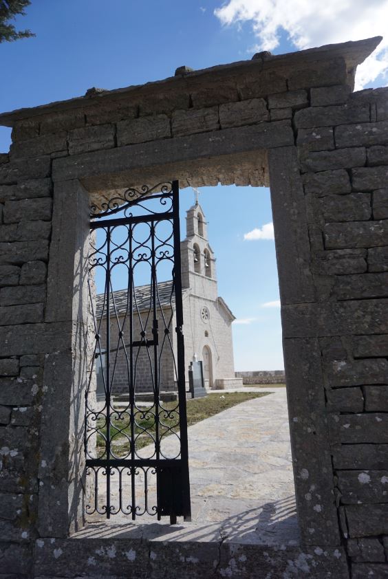
The church plateau is the endpoint named in the official mountain route and sits around 708 metres. It opens a wide view toward Herceg Novi, the bay entrance and the Adriatic. The current source set does not establish a construction date firmly enough for this article, so the church is identified without repeating an unsupported century.
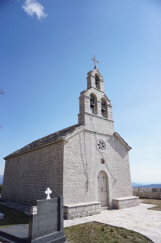
Dress and behave as you would at an active rural church. Do not sit on graves, lean equipment against monuments or fly a drone over worshippers and houses. Wind at the exposed edge can be stronger than inside the village. Keep children and loose objects away from cliff margins.
For a religious heritage comparison closer to town, our Savina Monastery guide covers a very different institution and landscape. For Herceg Novi's civic history, combine another day with Herceg Novi Old Town or the Kanli Kula and Forte Mare fortresses; do not rush those sites after a full mountain descent.
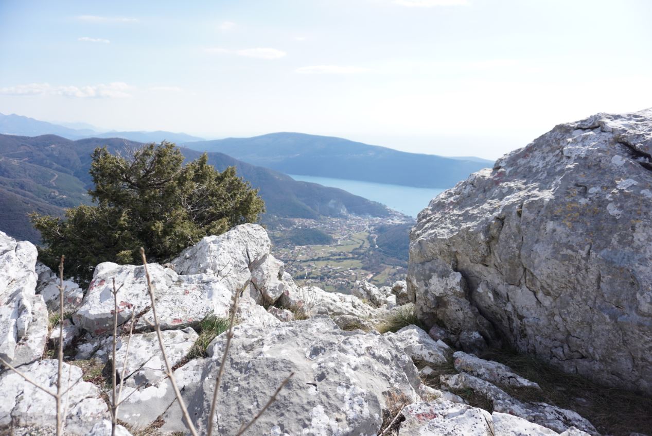
Orjen context: culture inside a protected mountain
Žlijebi belongs to the Orjen massif, and the municipal park agency says Orjen Nature Park began operating in 2018. Its management baseline describes geological, biological, landscape and cultural values, including protected habitats and species. Municipal authorities continued revising boundaries and protection regimes through public consultation, so an old map should not be treated as the final word on permitted activity.
The village demonstrates why culture and ecology cannot be separated. Quarrying, terraces, old paths and settlement form are human interventions in a karst system. Conservation is not achieved by freezing residents out of their home; it requires current rules, sustainable material use and visitor behavior that does not enlarge erosion, waste or wildfire risk.
Carry all waste out. Never light a fire outside an explicitly permitted place. Do not identify or collect plants from photographs. If you extend toward higher Orjen, use current park guidance rather than assuming a village walk prepares you for exposed mountain terrain.
| Route | Timing / distance | Elevation | Grade |
|---|---|---|---|
| Herceg Novi route | 2:15 one way | 90 m to 708 m | medium |
| Kameno route | 5.5 km | 320 m ascent | — |
| Both routes | Do not mix the route numbers | Require current route confirmation | Wet descent and summer heat change the decision |
Herceg Novi Boka Bay View Trails brochure; Orjen official mountain brochure
Paragliding: landscape potential is not launch permission
The legacy draft claims reliable thermals, regular raptor use and an open paragliding strip. No current primary operational source located for this review confirms that a Žlijebi launch is open, managed or appropriate today. Those claims are therefore not repeated.
Montenegro's Point of Single Contact sets out a paraglider pilot-permit process, and government tourism guidance treats tandem paragliding as an adventure service delivered by professionally qualified people. Visitors should book only a lawful provider, confirm pilot credentials, insurance, equipment, launch permission and weather cancellation terms. Never self-launch because a promotional paragraph says birds use the slope.
The landscape may be enjoyed from the ground without disturbing wildlife or flight operations. If a pilot is preparing, keep clear of the wing, lines and take-off run. Do not fly a drone anywhere near paragliders.
A low-impact half-day plan
For drivers, arrange a village or household contact in advance, arrive early, park with permission, walk the lanes, study the roofs from public space and finish at the church viewpoint. For hikers, make the route the main event: start at the correct trailhead, carry the return reserve, and skip a long meal if daylight or weather narrows.
A useful combined trip pairs Žlijebi with one Herceg Novi theme, not five. The Topla literary route works on another half-day; Zelenika provides coastal transport history. Readers interested in the much deeper human timeline of the hinterland can use the Boka prehistory and antiquity guide.
Frequently asked questions
How high is Žlijebi?
Official tourism sources place the village around 700 metres; the Orjen hiking brochure gives 708 metres for Saint Nicholas Church.
Can I drive to the village?
Yes, official municipal material describes asphalt-road access. The approach can still be narrow, and parking is not guaranteed. Drive in daylight and arrange arrival with a host where possible.
How long is the hike?
It depends on the start. Kameno–Žlijebi is published as 5.5 kilometres with 320 metres ascent. Herceg Novi–Žlijebi is about 2 hours 15 minutes one way from roughly 90 to 708 metres.
Are the roofs really made without mortar?
Official sources describe traditional construction from naturally flat, hand-quarried slabs without binding material. A maintained or renovated roof may contain hidden modern reinforcement or waterproofing.
Can I visit a quarry?
Only with permission and a qualified local host. A working quarry has unstable stone, tools and private-property concerns. Do not enter or collect material independently.
Is the paragliding launch open?
This review found no current authoritative operational notice confirming a Žlijebi launch. Contact licensed providers and relevant authorities rather than relying on the legacy article.
What number should I call in an emergency?
Call 112 in Montenegro. Share the trail, nearest junction, direction, coordinates if available and nature of the incident.