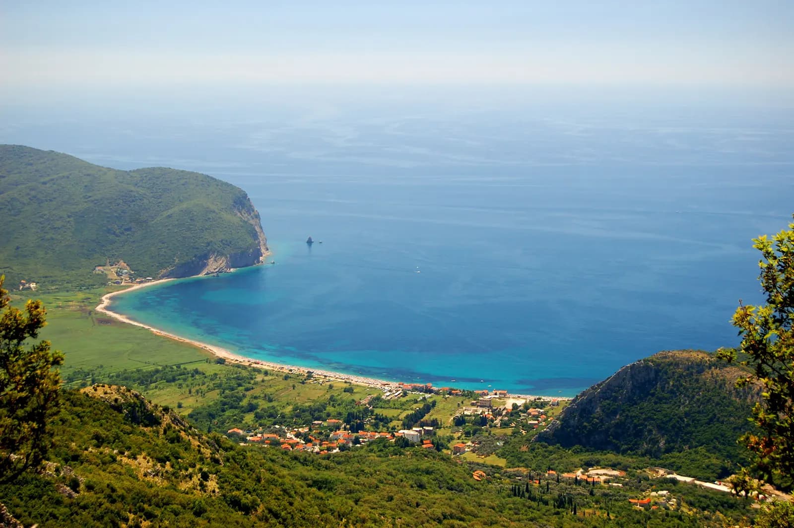
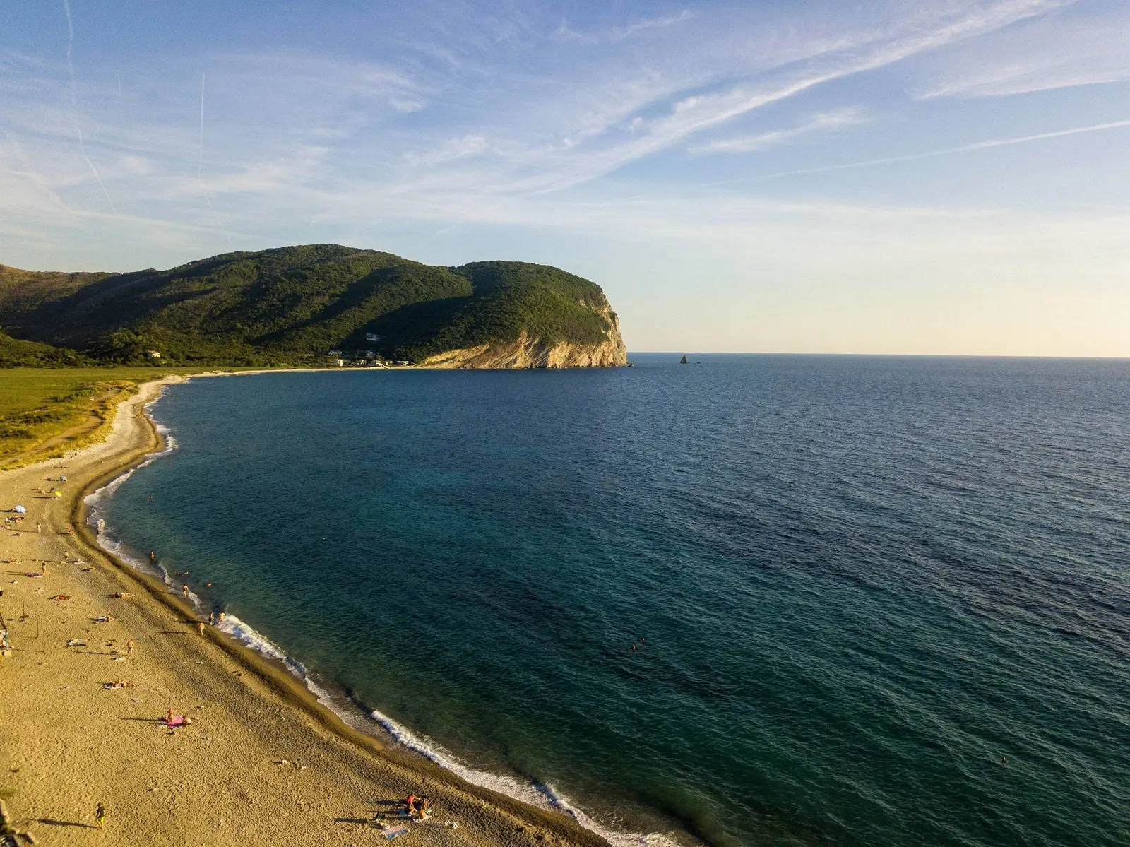
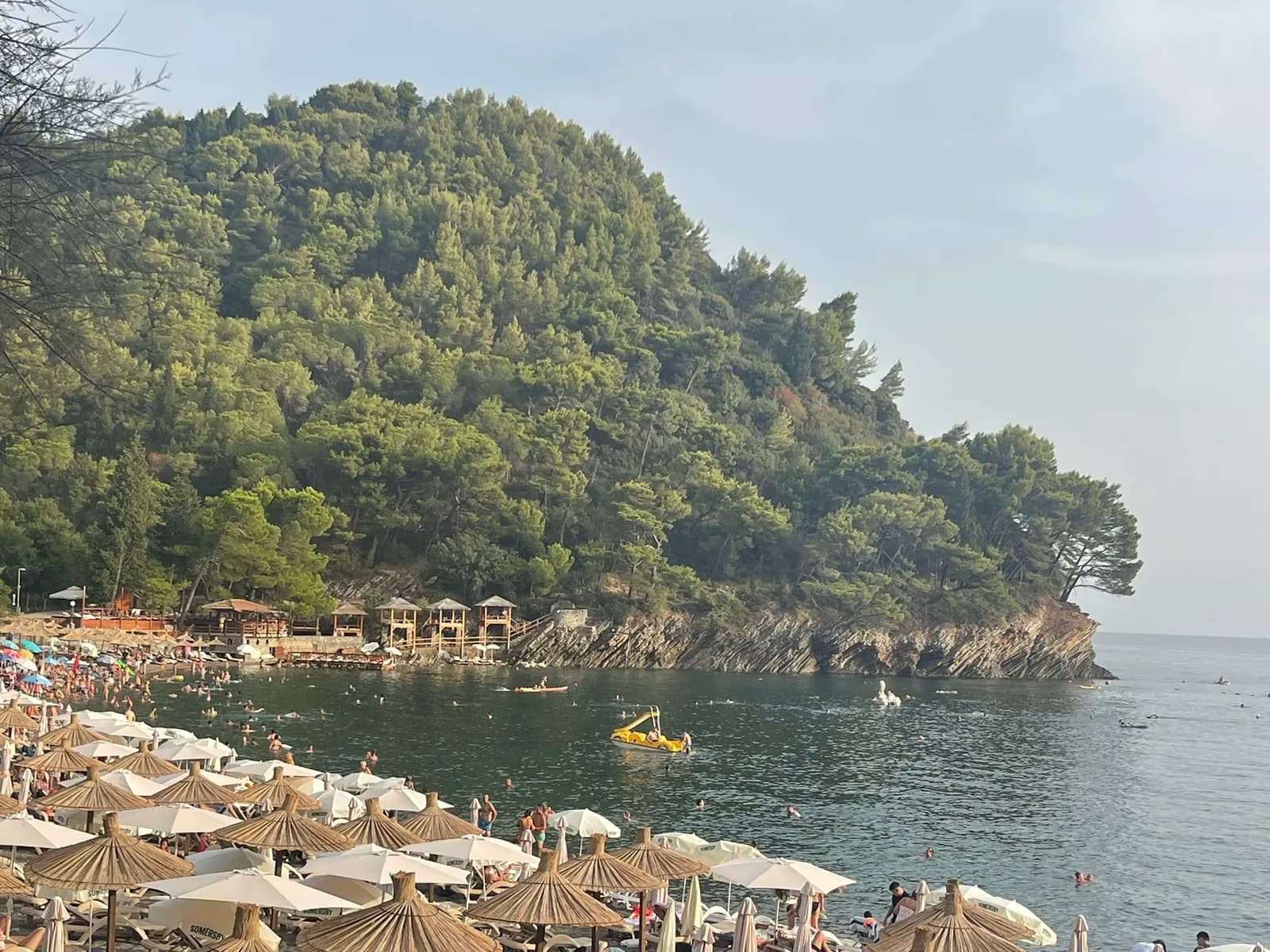
Buljarica is not an empty beach waiting for a resort. It is a connected coastal landscape: roughly 2.25 km of mixed sand, gravel and stone; a brackish wetland threaded by channels; protected marine habitat; a living village; and Gradište Monastery above the plain. Treating the green land behind the shore as “nothing” misses the main reason this bay is unusual.
A practical visit starts with four questions. Where is the organized swimming sector? What safety flag is flying? Which ground is beach, wetland or protected marine area? And which services actually operate today? Signs, operators and weather determine conditions on the day.
| Key fact | Do not assume |
|---|---|
| Beach length about 2,250 m | Every metre is serviced or supervised |
| Beach area listed at 72,850 m² | All of it is usable in every season |
| Mixed sand, gravel and stone | One footwear or swimming condition throughout |
| Coast and sea within Katič Nature Park | Identical protection across every inland parcel |
| 178 bird taxa in a 2017 inventory | 178 species visible on one visit |
| Gradište documented in 1305 | Traditional 1116 date is written proof |
How long is Buljarica Beach?
The strongest official planning figure is approximately 2,250 m. It appears in the Katič Nature Park management plan for 2023–2027. Budva’s tourism organization gives the same length and a beach area of 72,850 m². A shorter Coastal Zone Management description rounds the length to 2 km; that is compatible with an approximate 2.25 km figure, not evidence of a different beach.
Official descriptions call it the longest beach on the Budva Riviera. The Petrovac-side section is described as sandy, while most is gravelly or stony. Storms, river flow and seasonal work can rearrange sediment, so use what is underfoot rather than an old promise of uniformly fine sand. Water shoes may help on coarse sections, but they do not replace caution in waves.
| Measure | Value | Note |
|---|---|---|
| Official planning length | ≈2,250 m | Near Petrovac |
| Tourism listing area | 72,850 m² | Near Petrovac |
| Surface sequence | sand → gravel → stone | Approximate dimensions do not define today's safe-swim zone |
Source: morskodobro.me, budva.travel
Beach, wetland and sea: three connected systems
Buljarica’s visual signature comes from the low plain immediately behind the beach. It contains permanent and temporary water, streams, channels, pools, reedbeds and other wetland habitats. Salty influence from the coast mixes with fresh water, making this one of the remaining brackish wetland systems on Montenegro’s Adriatic shore.
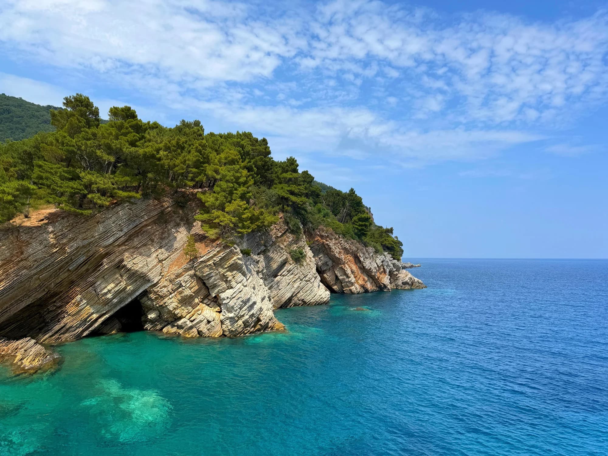
The sea is another layer. The coast and marine area at Buljarica fall within the nationally significant Katič Nature Park declared in 2021. Its management plan identifies Posidonia oceanica seagrass meadows as the dominant marine habitat across much of the protected area from Petrovac and the Katič islets south toward Cape Dubovac. Seagrass is habitat, not an inconvenience to clear; boats should use authorized anchoring and never assume a bare-looking patch is safe for an anchor.
Protection labels require precision. The shore has long appeared in official protected-area materials, and the marine/coastal strip is within Katič. That does not automatically make every inland field parcel subject to one identical protection zone. A current 2025–2026 project is still collecting wetland data and preparing restoration recommendations. “The whole bay is protected” is therefore too blunt to guide either a visitor or a planning argument.
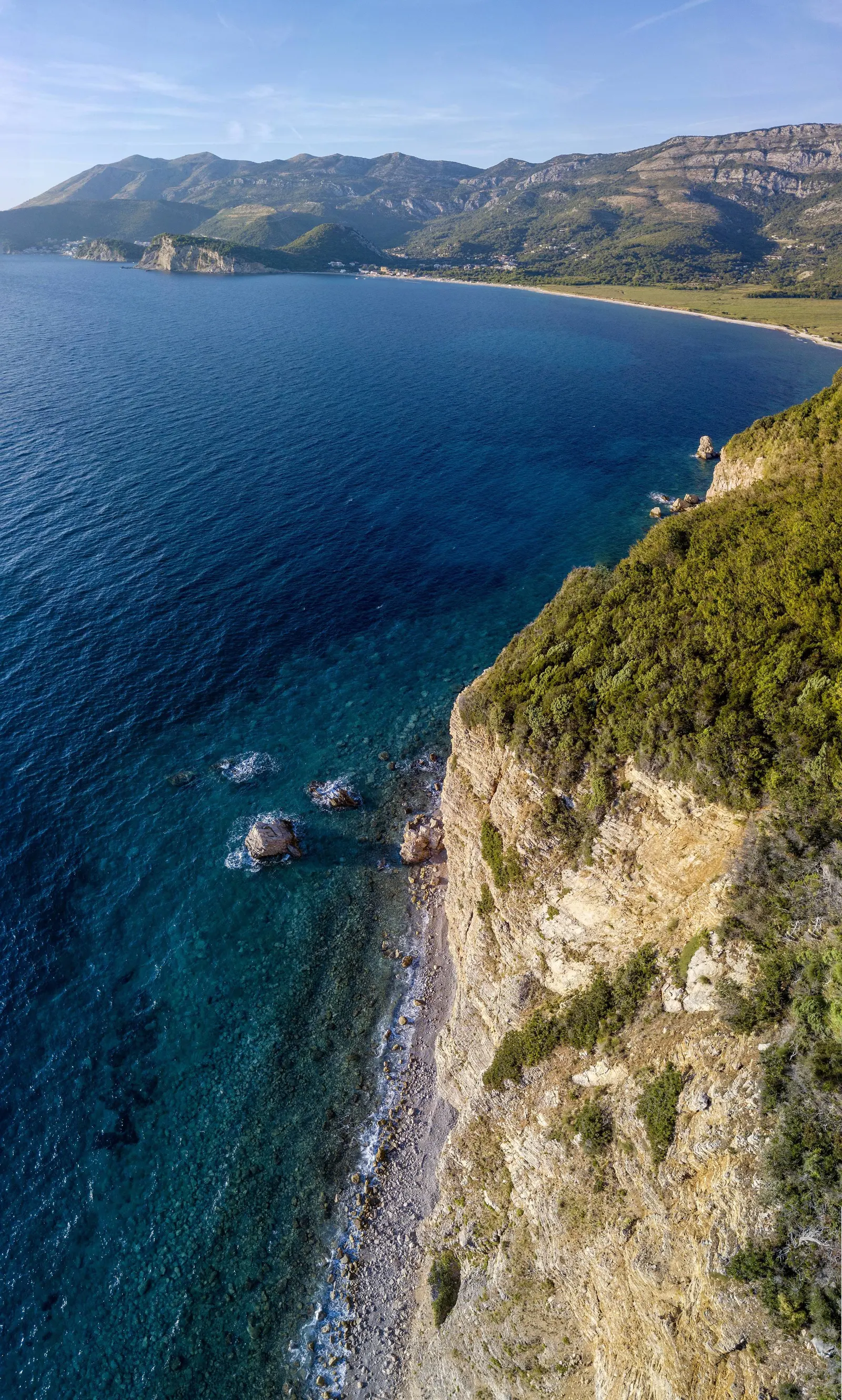
| Zone | Character | Status |
|---|---|---|
| Wetland | channels + pools | brackish habitats |
| Beach | sand + gravel | protected shore |
| Sea | Posidonia habitat | Katič Nature Park |
| Overall | Ecological connection | does not erase legal boundaries |
Source: gov.me, morskodobro.me, drustvoekologa.me
What the biodiversity numbers actually say
A 2017 ecosystem assessment recorded 472 animal taxa across its main inventory groups, including 178 bird taxa, 22 reptiles and 11 amphibians. It also listed 63 marine fish, 175 insect taxa and 23 mammals. These figures describe research effort across habitats; they are not a checklist a casual observer can complete from a beach towel.
Later herpetological work gives the wetland particular weight. The Montenegrin Ecologists Society reported that Buljarica’s 22 reptile species represented about 60% of reptiles registered nationally, and its 11 amphibians about 73%, using the reference totals available at the time. Research in 2021 focused on freshwater turtles as indicators of habitat connectivity.
The current 2025–2026 “Studied to Be Preserved” project is updating data for the European pond turtle and Balkan terrapin, assessing pressures and developing restoration recommendations. That active research is a reason to keep out of channels and reeds. It is not an invitation to handle, bait or crowd wildlife.
Responsible wildlife watching
Use the beach edge or already-established public routes; do not create a trail into reeds or cross water channels. Watch from a distance with binoculars, keep dogs controlled, take litter out and never move a turtle from the road or water unless instructed by a qualified local rescue authority. Dawn and dusk may improve observation, but low light also makes uneven ground and traffic harder to see.
For a fuller habitat guide, continue with our dedicated Buljarica wetland article. For a wetland with a formal birdwatching framework elsewhere on the coast, compare Tivat Solila. The two places should not be assumed to have identical access rules or infrastructure.
Gradište: culture above the plain
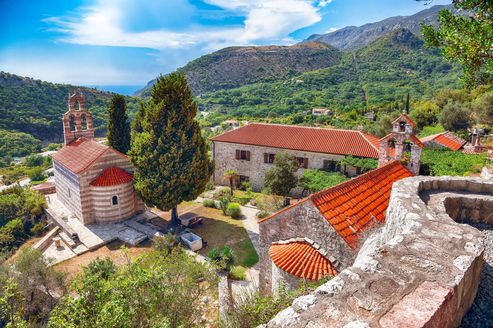
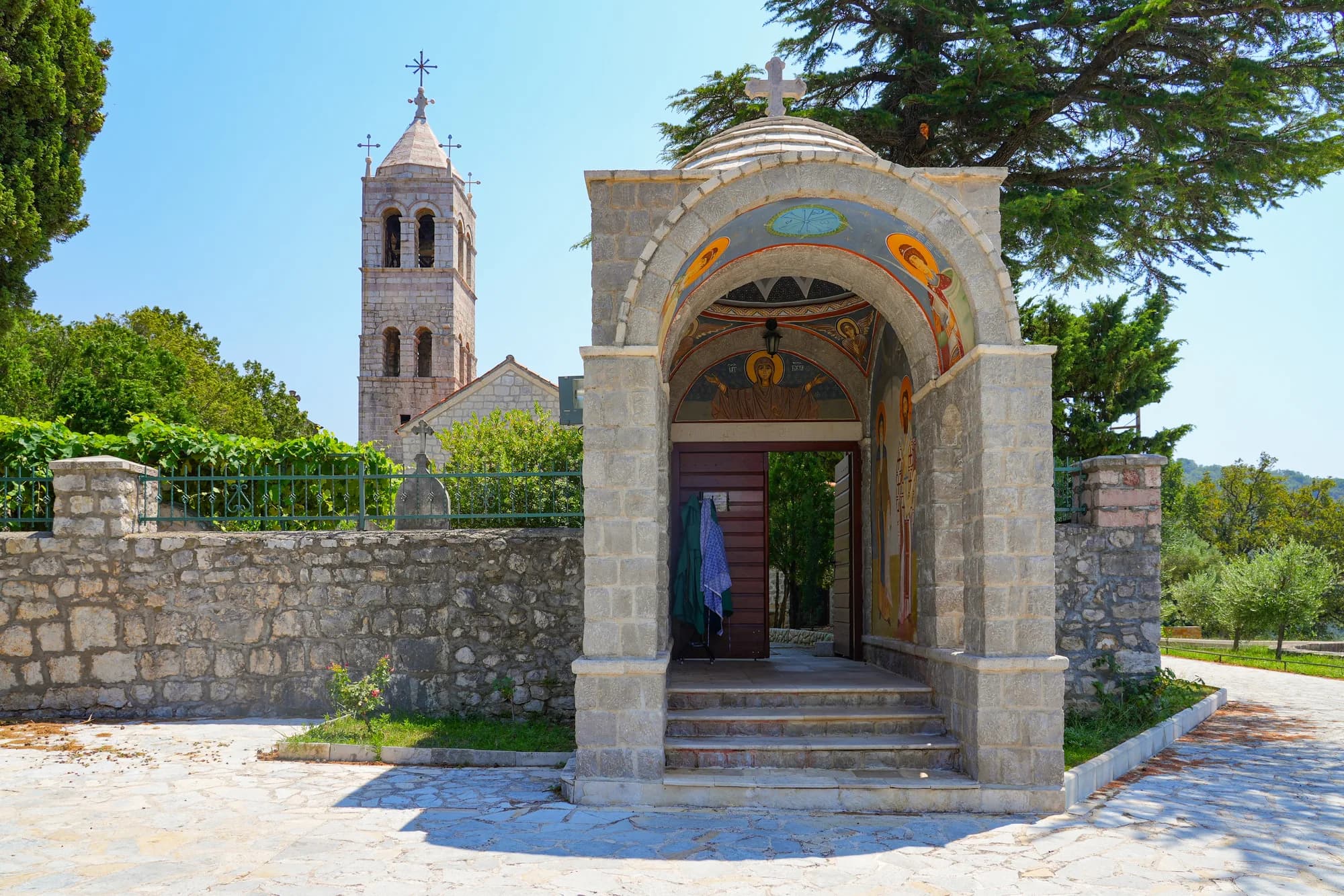
Gradište Monastery makes Buljarica a cultural landscape as well as a biodiversity site. Budva’s tourism organization distinguishes tradition from documentation: tradition places its foundation in 1116, while surviving written records first mention it in 1305. The two dates describe different kinds of history.
The walled complex contains three churches and residential quarters. St Nicholas is the principal church; the others are dedicated to St Sava and the Dormition of the Mother of God. The tourism authority highlights the St Nicholas frescoes and valuable iconostases, including the unusual animal-headed representation of St Christopher. Budva Museums and Galleries describes substantial scholarly monograph and conference work on the complex rather than reducing it to a viewpoint.
This is an active religious site. Dress and behave accordingly, keep voices low, do not interrupt worship, and ask before photographing interiors or people. The monastery does not publish dependable daily visitor hours, so confirm access before a special journey. See our broader Katič and Sveta Nedjelja guide for the offshore cultural geography visible from the Petrovac side.
| Item | Detail |
|---|---|
| 1116 | foundation tradition |
| 1305 | first written mention |
| Churches | St Nicholas · St Sava · Dormition |
| Visiting | Active monastery: verify access and ask before interior photos |
Source: budva.travel, muzejiigalerijebd.me
Development plans: what is and is not current
Buljarica has appeared in tenders, masterplans and promotional concepts for years. Old material imagined marinas, golf and large mixed-use tourism. None of that makes a particular project inevitable in 2026. Montenegro adopted a national Spatial Plan through 2040 in June 2025, but the Government explicitly says that strategic plan gives direction and does not impose a concrete building project or specific location; local plans make later urban and construction decisions.
The bay faces urbanization pressure while retaining valuable wetland and marine habitats, active research and protected coastal space. Any real proposal must be evaluated through the planning, ownership, environmental-assessment and permitting records that apply to that exact footprint. An undeveloped field does not prove that nothing is approved; promotional language does not equal a construction permit.
| Step | Stage |
|---|---|
| 1 | National strategic direction |
| 2 | Local planning decision |
| 3 | Environmental assessment |
| 4 | Site-specific permits |
| 5 | Lawful construction |
Source: gov.me, drustvoekologa.me
Practical swimming decisions in 2026
At 2.25 km, Buljarica is longer than one managed bathing unit. Do not infer lifeguard coverage from the beach name. The coastal manager’s published rules say an organized bathing area should have an information board, marked sea boundary, rescue equipment, licensed lifeguards and safety flags. A green flag means bathing is considered safe; yellow means limited and potentially dangerous; red means prohibited or that the lifeguard is not on duty.
On arrival, locate the signed organized sector and read its current board. Check the flag, lifeguard hours, services and boundaries before entering. If there is no board, marked zone or visible lifeguard, treat the water as unsupervised. Open exposure means conditions can change; do not use a calm photograph or a past visit as today’s forecast.
Facilities vary along the shore. Budva Tourism lists a camp and several restaurants or cafés in the hinterland, but does not guarantee their current hours, prices or season. Carry water, sun protection and footwear, and take waste away. Do not drive or park on wetland vegetation, block access or follow an informal track simply because another vehicle did.
| Step | Action |
|---|---|
| 1 | Find the signed organized sector |
| 2 | Read services, hours and boundaries |
| 3 | Check flag and lifeguard duty |
| 4 | Swim within the marked zone |
| If none | No board or lifeguard? Treat the water as unsupervised |
Source: morskodobro.me
Getting there without false precision
The Coastal Zone Management page places Buljarica at about 42.194159° N, 18.964105° E and describes it as 2 km from Petrovac. That distance is orientation, not a promise of a particular walking time. Start point, heat, luggage, road crossings and the exact beach entrance all matter.
For public transport, verify the route, stop and departure with the operator on the day; coastal services do not all follow one fixed stopping pattern. For driving, choose a lawful signed parking area and be prepared to turn back if full. Do not count roadside shoulders, beach access or wet ground as parking. Our first-time Montenegro guide covers wider transport planning, while the high-season guide explains why timetable slack matters.
If Buljarica’s flags, exposure or facilities do not fit your group, keep a fallback rather than forcing the day. Nearby Lučice Beach is a separate cove with its own current conditions; check its board rather than assuming it behaves like Buljarica.
Before setting out
Use fixed facts—beach scale, protected-area boundaries and monastery history—for orientation, but check variable conditions directly. Transport, parking, safety flags, supervision, access and operating services can change by day and season.
Confirm parking prices, restaurant hours, campsite availability and bus frequency before relying on them. Crowd levels and sea temperatures vary, and no part of an exposed beach is guaranteed safe regardless of the current flag and conditions.
Frequently asked questions
Is Buljarica Beach 2 km or 2.25 km long?
The coastal manager’s short listing rounds it to 2 km, while the Katič management plan and Budva Tourism give about 2,250 m. Use 2.25 km as an approximate planning figure, not a survey to the centimetre.
Is the whole beach sandy?
No. Budva Tourism describes the Petrovac-side part as sandy and most of the shore as gravelly or stony. Conditions can change seasonally.
Is all of Buljarica protected?
The coast and marine waters are within Katič Nature Park, and the beach appears in protected-area records. The inland wetland is ecologically valuable and under active conservation research, but do not assume every parcel has one identical legal regime.
Are there lifeguards along all 2.25 km?
Do not assume so. Identify the signed organized bathing sector, read its board and check the flag and lifeguard duty. Without those signals, treat the water as unsupervised.
Can I walk into the wetland to watch birds?
Use established public routes and watch from the edge. Entering reedbeds or channels damages habitat, increases wildlife disturbance and may put you on unsafe or non-public ground.
Was Gradište Monastery founded in 1116?
That date is preserved as tradition. Budva Tourism says the first written mention is from 1305. Presenting both with their evidence labels avoids turning tradition into a document.
Is a marina or golf resort definitely being built?
No current site-specific permit establishes that certainty. Old concepts and tenders are not permits. A real project requires local planning, environmental assessment and site-specific approvals.
Buljarica rewards visitors who read the whole bay. The beach is the visible edge of a wetland and marine system, while Gradište records centuries of cultural life above it. Check the water like a swimmer, move through the plain like a guest, and rely on current posted conditions and effective approvals when plans can change.

.JPG&w=2048&q=75)