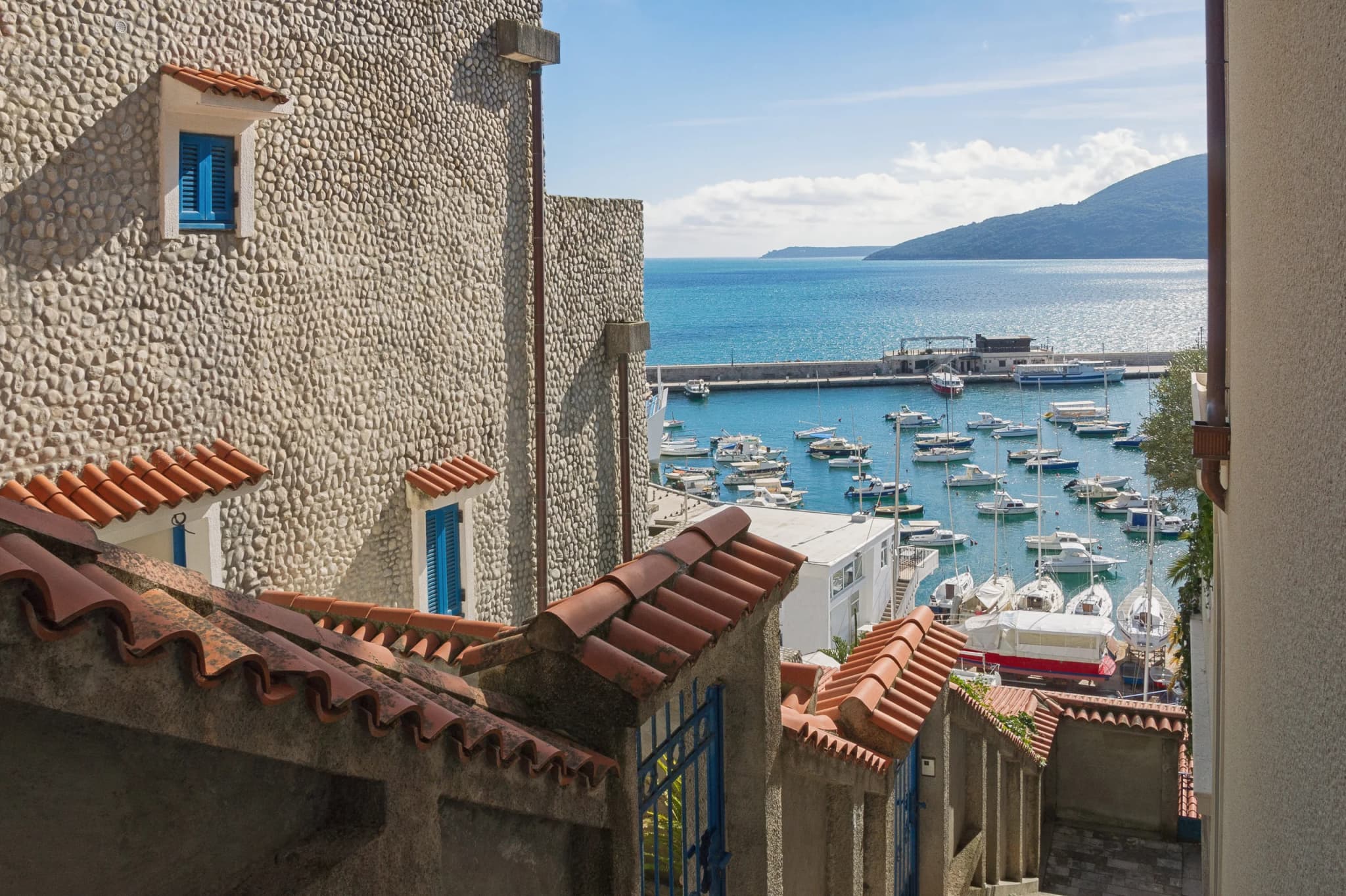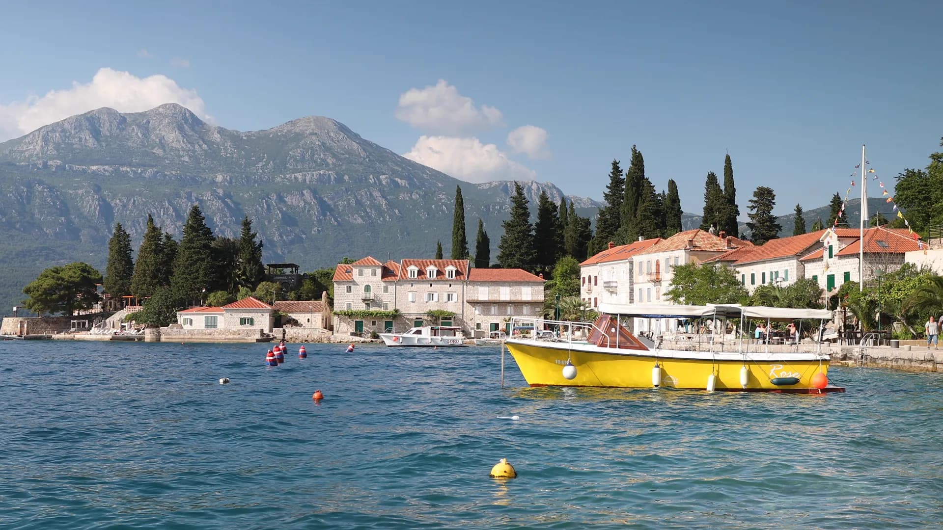
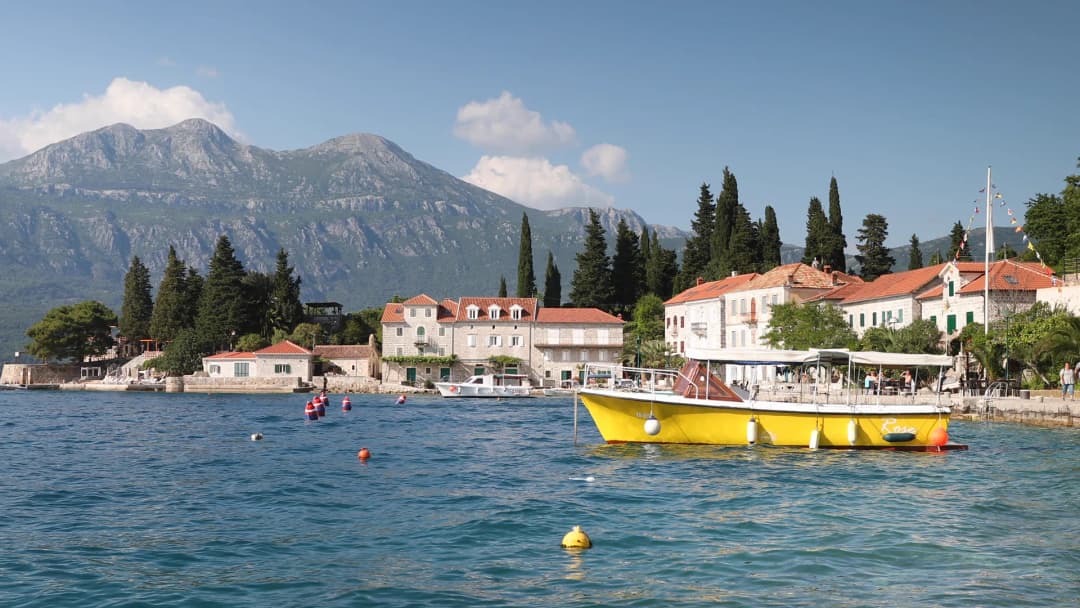
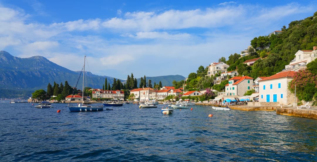
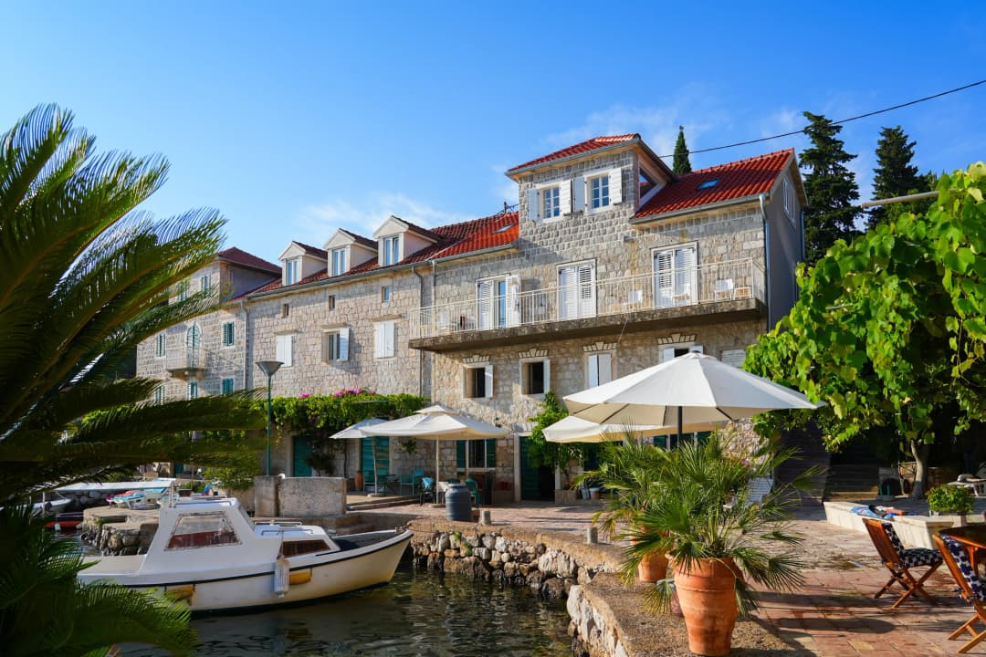
Rose is a small stone harbour on the Luštica Peninsula, facing the entrance to the Bay of Kotor. It is easy to describe as a fishing village and harder to understand honestly. The waterfront can look almost theatrical from a boat—pale masonry, green shutters, red roofs and the Orjen massif across the water—but Rose is not an open-air museum. It is a compact living settlement where homes, restaurants, bathing edges, moorings, old religious buildings and layers of maritime history occupy the same narrow strip.
Rose (pronounced "RO-seh") sits at the very tip of the Lustica peninsula, guarding the point where the bay meets the open Adriatic Sea. With a permanent population of barely more than 100 people, it is one of the most remote and unspoiled settlements on the Montenegrin coast: a small cluster of old stone houses arranged around a sheltered harbour, backed by a fortified complex on the headland and surrounded by wild, largely uninhabited coastline. Its isolation—it sits at the end of a long, winding road with no through traffic—has preserved that character. The only sounds are waves against the harbour wall, seagulls above the fortress and the occasional putt-putt of a fishing boat returning with the day's catch.
This article replaces a legacy road diary with a source-led guide. The old account recorded a memorable drive from Tivat Airport and valuable local details, but compressed distinct documentary dates, treated a seasonal trip as a fixed route and implied that old transport information remained current. Rose rewards curiosity; it does not need embellished continuity or a guaranteed boat timetable.
Rose in one sentence
Come for a harbour rather than a resort: walk the waterfront, read the stone fabric closely, swim only where access is clear, and build the day around verified transport. Travellers seeking a broad beach, nightlife or abundant parking should choose another base. Those who value a small settlement, boat arrival and long views across the bay may find Rose unusually satisfying—for travellers seeking an authentic, uncommercialised corner of the Mediterranean, it is as close to perfection as the Montenegrin coast offers.
Where Rose sits—and why that matters
Rose occupies the north-facing shore near the outer end of Luštica. Across the water are the Herceg Novi side of the bay and the steep mass of Orjen; farther west, the entrance opens to the Adriatic. That position gave the harbour meaning long before modern tourism. Shelter, surveillance, navigation and exchange all mattered at a threshold between open sea and inner bay, and the site's strategic value has given Rose a military importance far exceeding its size.
UNESCO’s listing for the Natural and Culturo-Historical Region of Kotor describes a cultural landscape whose towns and settlements developed in close relationship with the bay. Rose lies outside the core medieval towns most visitors associate with the listing, but the wider protected setting and buffer documentation include the entrance to the bay, Luštica, Mamula and nearby coastal features. The important point is not a marketing label; it is that new construction, marine traffic and landscape change can affect the integrity of the bay as a whole.
Today Rose exists in a peaceful limbo between its martial past and an uncertain future. Proposals for tourism development surface periodically, but the village's isolation and limited infrastructure have so far protected it from the large-scale development that has transformed other parts of the coast.
How to get to Rose: road or boat
| Approach | What it gives you | What to verify | Main limitation |
|---|---|---|---|
| Boat from the Herceg Novi side | The defining arrival view and no peninsula drive | Current operator, departure point, return, weather and last sailing | Services can be seasonal or disrupted |
| Car from Tivat/Luštica | Flexibility to combine peninsula stops | Road condition, parking and daylight | Narrow, winding sections and limited space on arrival |
| Taxi or arranged transfer | No navigation or parking search | Written one-way/return price and pickup signal | Return requires a reliable arrangement |
| Bicycle | Slow landscape immersion | Heat, gradients, traffic, water and repair kit | Not a casual flat coastal ride |
Rose is located at the western tip of the Lustica peninsula. From Herceg Novi, the drive takes approximately 25 minutes along a narrow, winding road that traverses the peninsula through scrubby Mediterranean landscape of wild herbs, holm oak and dry stone walls. From Tivat Airport, allow about 35 minutes. The road is paved but narrow in places—drive with care, especially when meeting oncoming vehicles on blind corners.
There is no regular public bus service to Rose. A car, scooter or bicycle is necessary, or you can take a boat from Herceg Novi—water taxis and excursion boats run to Rose during the summer season, and arriving by sea is by far the most scenic and memorable approach. The boat ride takes about 20–25 minutes and passes the dramatic coastline of the Lustica peninsula, the Blue Grotto and the island fortress of Mamula before rounding the headland into Rose's harbour.
The Herceg Novi municipality has historically described a year-round passenger connection and a short crossing measured in nautical miles. Treat that as historical orientation, not a live schedule. A public-transport tender or tourism brochure proves that a service was planned or promoted at a given time; it does not prove that a boat will run at your required hour today. Confirm the operator, exact pier, return and weather policy directly. A water taxi advertised “on request” is not the same as a scheduled public line.
The road approach is part of the experience, but the National Tourism Organisation’s “Life on Luštica” panoramic-road material warns that the roughly 40-kilometre circuit uses narrow, winding roads and merits a full day. Rose is not the place to test a nervous driver at dusk. If you want a gentler base on the peninsula, compare our guide to Bjelila.
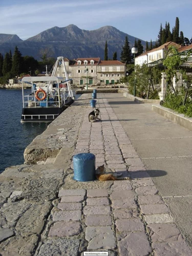
The village itself is tiny and entirely walkable in five minutes. No cars circulate within it—the road ends at a small parking area above the harbour. Beyond the village, footpaths lead along the rocky coastline to secluded coves and swimming spots, and a path climbs to the fortress above.
Arriving by water
From the bay, the settlement appears as a low, continuous edge. The scale is intimate: boats, quays, terraces and front doors are close together. Step ashore without assuming every stone platform is public. Keep bags compact, do not block mooring points and ask before using a restaurant or accommodation ladder for swimming.
Visitors based near Herceg Novi can use our Herceg Novi guide to plan the mainland side, but a same-day return still depends on current transport. If you arrive by boat, confirm your return time in advance—you do not want to be stranded after the last water taxi departs. Save the operator’s number, identify a backup taxi or transfer and agree what happens if wind changes.
Driving the peninsula
From Tivat Airport, the route turns onto Luštica and gradually leaves the airport plain for a limestone peninsula of olive groves, dry-stone walls, villages and newer development. The old article’s appeal came from that contrast. Its exact timing cannot be carried forward: summer queues, road work, wrong turns and parking can change the day materially.
Download the route, start with fuel and water, and do not let navigation send you onto a track that appears unsuitable. Yield patiently on narrow sections, use passing places and take particular care on the final descent to the village. Do not park in a passing place, private gate or emergency access. If combining Rose with other villages, choose one or two. A chain of hurried photo stops misses the peninsula’s strongest quality—distance from the main coastal strip.
A harbour made of layers, not a single origin story
Rose's history stretches back far beyond its current sleepy appearance. The village's name is believed to derive from an ancient Illyrian or early Slavic word, though local legend also connects it to the wild roses that once grew abundantly on the surrounding hillsides. Archaeological evidence suggests the site has been inhabited since antiquity, valued for its commanding position overlooking the strait between the bay and the open sea.
Local histories attach several ancient names and dates to Rose. Herceg Novi municipal accounts distinguish a documentary mention in 841 from reported Saracen destruction in 867. Those are different events, not competing attack dates. They show that the entrance to the bay has a strong historical memory, but municipal tourism copy is not the same as a peer-reviewed excavation report.
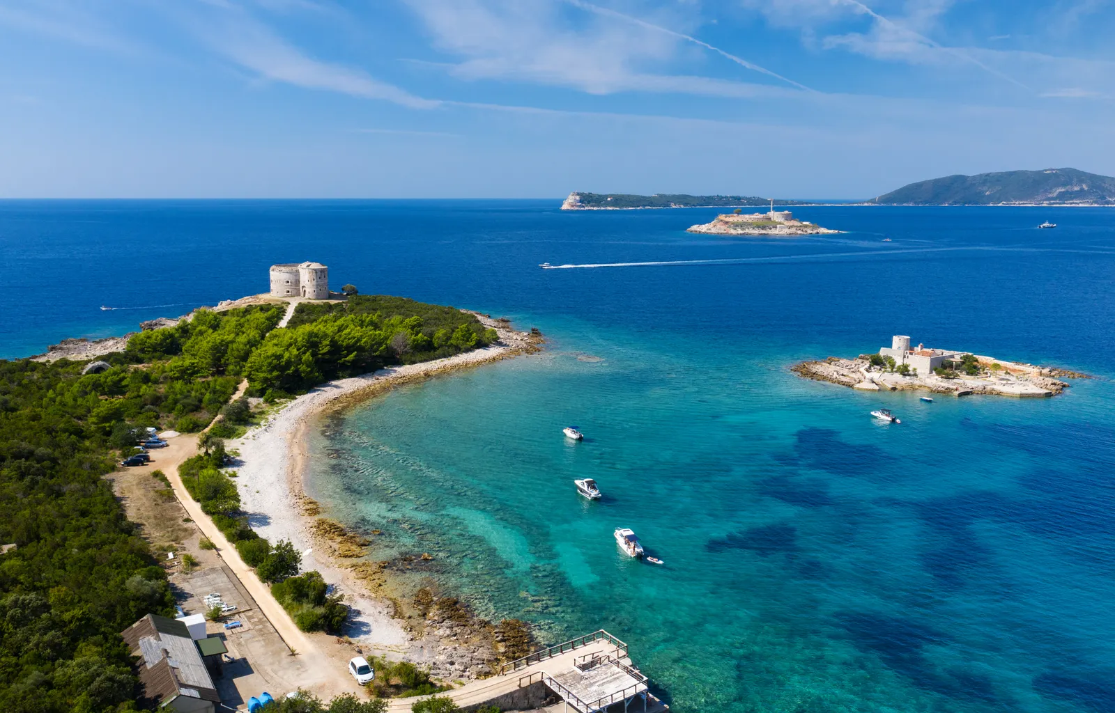
During the Venetian Republic's long rule over the Bay of Kotor (1420–1797), Rose served as a lookout post and fishing settlement. The Venetians understood the strategic importance of the bay entrance and maintained a presence here, though the village remained tiny. The real transformation came under Austro-Hungarian rule in the 19th century, when the empire embarked on an ambitious programme of coastal fortification. Fort Rose was constructed in the 1850s as part of an integrated defence system that included the fortress on Mamula Island, Fort Arza on the opposite headland, and batteries on the Croatian side at Prevlaka. Together, these fortifications created a formidable crossfire zone that made the bay entrance virtually impregnable.
During World War I, the fortifications saw action as Austro-Hungarian forces defended the bay against French and British naval attacks. In World War II, the area was occupied by Italian and then German forces. After the war, the Yugoslav military maintained a presence in the area, and Fort Rose served various military purposes before being abandoned in the latter decades of the 20th century.
Physical evidence gives the better foundation for the earlier record. Government planning material identifies Malo Rose among underwater-archaeological sites with amphora finds and notes threats to submerged heritage. Municipal material also reports anchors, ceramic fragments and a shipwreck associated with a sixteenth-century Spanish vessel. The responsible conclusion is modest: the waters around Rose preserve evidence of long maritime use. It is not evidence that every building or custom continued unchanged from antiquity.
| Date | Record | Evidence type |
|---|---|---|
| 841 | documentary mention | Documentary record |
| 867 | reported Saracen destruction | Reported event |
| early 1500s | reported Spanish wreck evidence | Archaeology |
| 1783 | church date in municipal record | Inscription |
| today | manage setting and submerged heritage | Ongoing |
Source: hercegnovi.me
The churches: look closely, name cautiously
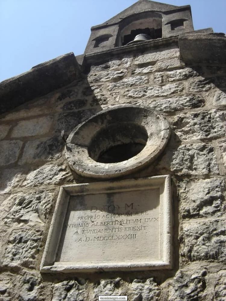
The municipality’s English page records the Church of the Holy Virgin as dating to 1783. A surviving inscription and bell-tower fabric are among the details a visitor can observe, but access, denomination and naming vary across translations. Dress respectfully, keep voices low and do not assume an unlocked door or permission to photograph an interior.
Rose also appears in broader accounts of religious and maritime settlement around Herceg Novi. For regional context before the written medieval period, see our archive article on the prehistoric and ancient Boka region. It should be read as background, not as proof of a specific claim about one Rose building.
Forte Rose: architecture before mythology
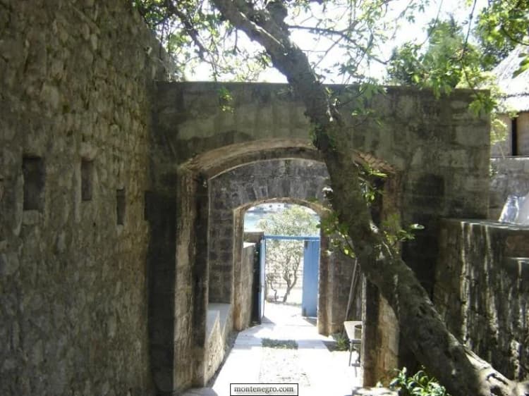
The fortified complex at the edge of the settlement is often called Forte Rose, or Fort Rose. Reported as an Austro-Hungarian fortress built in the 1850s as part of the bay's coastal defence system, it is a substantial stone structure with multiple levels, gun emplacements, ammunition magazines and underground passages, sitting on the headland above the village. Its stone passages make a strong image, but a visitor should distinguish the visible structure from loosely repeated claims about who built every phase. Fortifications at the mouth of Boka were adapted under different powers and for changing military needs.
Abandoned for decades, the complex is described as an atmospheric ruin overrun with fig trees and wild vegetation, its gun emplacements still pointing out to sea. From the ramparts there are commanding views of the bay entrance, Mamula Island, the Croatian coast at Prevlaka and the open Adriatic stretching to the horizon; the combination of military architecture and natural reclamation is a scene photographers find irresistible. That said, current ownership, hospitality use and public access must be confirmed—historic importance does not create a right of entry, and proposals for the wider area change. The fortress is unrestored and unfenced: explore with caution, especially with children, wear solid shoes, watch for loose stonework, and carry a headlamp or torch if you plan to look into the underground passages.
The FortNet regional heritage brochure places the wider Bay of Kotor within a dense network of coastal defences. For a clearer comparison with documented urban fortifications, our guide to Kanli Kula and Forte Mare explains how access, interpretation and setting differ on the Herceg Novi side.
Sunset from the fortress
Rose faces west toward the open Adriatic, making it one of the very few places in the Bay of Kotor where you can watch the sun set directly over the sea. The view from Fort Rose as the sun sinks below the horizon, painting the sky in shades of orange and purple with Mamula Island silhouetted in the foreground, is genuinely breathtaking. Bring a drink, a blanket and something to eat—make an evening of it. Bring sun protection too: there is very little natural shade on the fortress headland or along the coastal paths, and if you stay for sunset you will be walking back in fading light.
Mamula Island and the strait
Mamula Island is visible from Rose, sitting in the middle of the bay entrance just a few hundred metres offshore. The island is dominated by a circular fortress built in 1853 by Austro-Hungarian general Lazar Mamula. During World War II, it was used as a concentration camp by Italian fascist forces—a dark chapter that is commemorated at the site. The island has been developed into a luxury resort, but boat trips around the island offer excellent views, swimming opportunities in the crystalline waters, and a sense of the strategic geography that made this strait so important to successive empires.
Underwater archaeology is not a souvenir hunt
Amphora fragments, anchors and wreck material are compelling because the sea can preserve routes that written tourism histories simplify. They are also vulnerable. Do not lift ceramics, move stones, anchor on a known site or publish a precise find location without guidance from the competent heritage authority. An object’s archaeological value depends on context—where it lay, with what, and in which layer—not on how attractive it looks on a shelf.
Snorkelling and diving
The rocky coastline around Rose supports rich marine life, making it one of the best snorkelling spots in the entire Bay of Kotor region. The underwater rocks are home to sea urchins, starfish, octopus, moray eels, and schools of colourful wrasse and damselfish. For experienced divers, the waters around the bay entrance offer deeper exploration including underwater caves, the submerged foundations of the fortress walls, and the possibility of encountering larger pelagic fish that enter from the open Adriatic. Several dive centres based in Herceg Novi offer guided dives in the Rose area.
Recreational divers should ask a licensed centre about legal access, current restrictions and site conditions. A claim that “many wrecks” exist near Rose does not authorise independent exploration. Visibility, currents, boat traffic and depth add safety concerns even before heritage rules are considered.
The waterfront: public path, private thresholds
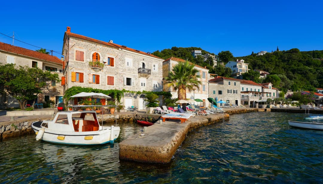
Most of Rose’s visual pleasure comes from a slow walk: limestone blocks, shuttered facades, garden walls, mooring rings and the changing alignment of mountains across the water. Keep to evident public circulation. The intimacy that makes the village attractive also means a camera can point directly into somebody’s home or meal. Ask before photographing people, doorways or private terraces.
Fishing and the working harbour
Rose is still a working fishing village, and the few remaining fishermen can sometimes be persuaded to take visitors out in their boats for a morning of line fishing in the waters around the bay entrance. This is not a commercial tourist operation—it depends on personal contact and willingness—but if you stay in the village for a few days and get to know the locals, the possibility exists. Your accommodation host can help facilitate. Even watching the fishermen mend their nets and sort their catch on the harbour wall is a pleasant way to spend a morning.
Where to eat
Ribarsko Selo (Fisherman's Village) is the main restaurant in Rose, serving freshly caught fish grilled over an open fire, along with traditional accompaniments like blitva (Swiss chard with potatoes), fresh salads, bread baked in a wood oven, and local wine from the Plantaze winery. Dining on the terrace beside the harbour, with fishing boats bobbing in the foreground and the fortress looming above, is a quintessentially Mediterranean experience. The menu depends on what the sea provides each day—ask the waiter what is freshest. Expect to pay 15–25 euros per person for a generous meal.
Given Rose's isolation, this is essentially the only dining option in the village. Restaurants can be an excellent reason to linger, but opening days and kitchen hours are seasonal. A table with a view is not proof of fresh local catch; ask what the fish is, where it came from and how it is priced before ordering. If you are spending a full day exploring the coastline, bring snacks, fruit and plenty of water. A small kiosk near the harbour sometimes sells cold drinks and ice cream in the peak summer months, but do not rely on it.
For variety, the restaurant at Mirista bay (reachable by the coastal walk or by boat) offers another excellent seafood dining option in a spectacular setting, with tables set on a rocky terrace directly above the water; it operates in summer. For alternatives on the opposite shore, compare our guide to restaurants with sea views, then verify the individual business directly.
Swimming: small edges, real constraints
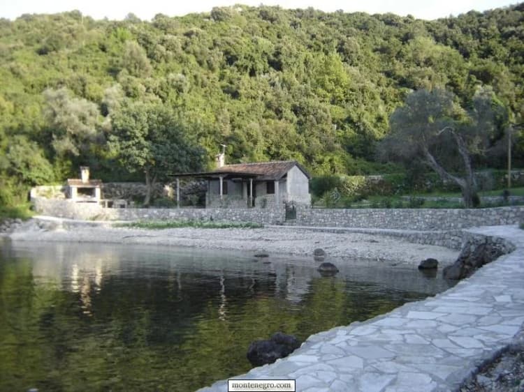
Rose is not a conventional beach destination. Visitors enter from stone platforms, small coves or compact pebble edges. The main beach in the harbour is small and pebbly, but short walks along the rocky shore in either direction reveal hidden coves and swimming spots where you are likely to be completely alone even in high summer. The place historically called Male Rose offers a sheltered-looking cove, but a photograph cannot confirm today’s public access, water quality, seabed condition or services. Inspect the entry and exit before swimming, watch for mooring lines and boats, and never dive into unfamiliar water.
Rose is surrounded by some of the cleanest, most pristine waters on the Montenegrin coast. The water is extraordinarily clear—you can see the seabed many metres down, with fish darting among the submerged rocks. The sea here is open Adriatic rather than enclosed bay water, so it tends to be cleaner and slightly cooler than the inner bay, with a refreshing quality that is particularly welcome on hot days.
Water shoes are essential for swimming from the rocky shores around the village: the rocks can be sharp and sea urchins are present in some areas. Do not treat footwear as a substitute for checking depth and hazards. Families should supervise children at the water’s edge; quay drops and boat movement are different from a gently shelving beach. Take all litter away and avoid soaps or sunscreen application immediately before entering a tiny enclosed cove.
Rose and the rest of Luštica
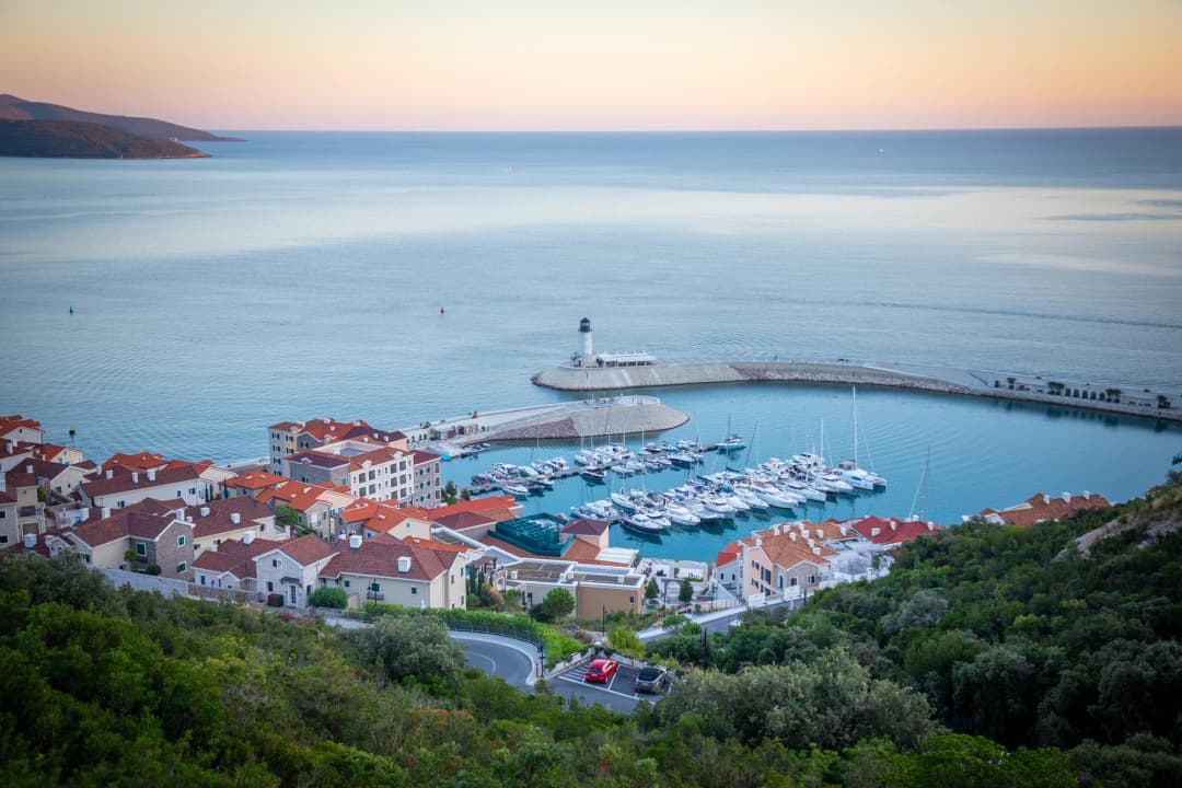
The peninsula is not one product. Historic villages, olive landscapes, old military positions, small coves and large new developments sit within short map distances but represent very different experiences. The National Tourism Organisation promotes the “Life on Luštica” panoramic route as a full-day drive. Use that framing: Rose is one deliberate stop, not an item to squeeze between airport pickup and sunset.
On foot, a rough but scenic coastal path leads south from Rose along the uninhabited western shore of the Lustica peninsula toward the bay of Mirista. The walk takes about 30–40 minutes and passes through pristine Mediterranean maquis vegetation of wild rosemary, sage and juniper, with dramatic rocky coastline and several accessible swimming coves along the way. Mirista itself is a beautiful sheltered bay with clear water and a summer restaurant. The walk is moderately challenging due to uneven terrain—wear sturdy shoes and bring water.
Nearby coastal settlements provide useful contrasts. Njivice, across the water near Herceg Novi, has a different road connection and shoreline character. Our concise Rose destination guide is useful for accommodation orientation; this article supplies the deeper reporting and evidence cautions.
A half-day that works
- Verify both legs first. Boat passengers confirm the return; drivers decide the parking fallback.
- Arrive before peak heat. Walk the waterfront while orientation is easy and terraces are quieter.
- Read one layer deeply. Choose architecture, maritime history or a careful swim rather than claiming to “do” all of Rose.
- Eat or pause without a hard deadline. Seasonal service and small kitchens require patience.
- Leave a transport buffer. A missed boat or a dark peninsula road can turn a calm visit into a logistical problem.
When to go
Rose is primarily a summer destination, best visited from June through September when the sea is warm enough for comfortable swimming, the weather is reliably sunny and the restaurant is operating at full capacity. July and August are peak months when the village sees its maximum (still modest) number of visitors; they also bring warmer water, more boat activity and pressure on the narrow waterfront. Early June and late September offer a sweet spot of warm weather, fewer people and a more tranquil atmosphere.