Durmitor’s UNESCO status is often reduced to a badge beside a photograph. The actual case is more useful: a 32,100-hectare Natural World Heritage property recognised for scenery, geological processes and biodiversity, with a boundary history and conservation obligations that continue long after inscription. Reading that dossier changes how a visitor understands the mountain.
This article is the evidence layer, not another general itinerary. For fees, current trail checks and a practical visit, use our UNESCO Durmitor visitor guide. Here the questions are different: What exactly did UNESCO inscribe? Why three criteria? How does the Tara biosphere reserve differ? What did the World Heritage Committee ask Montenegro to address in 2025? And what should a visitor do with that knowledge?
The dossier in one table
| Field | UNESCO record | Common mistake |
|---|---|---|
| Property type | Natural World Heritage | Calling the inscription “natural and cultural.” |
| Inscription | 1980; modification in 2005 | Treating UNESCO status as a one-time award with no later boundary work. |
| Area | 32,100 hectares | Repeating an inherited 20,000-hectare UNESCO figure or mixing it with a park-area claim. |
| Criteria | (vii), (viii), (x) | Using nearby monuments as if they were the inscription basis. |
| Core landscape | Durmitor massif and Tara canyon system | Assuming every place marketed as “Durmitor” lies inside the property. |
| Related designation | Tara River Basin Biosphere Reserve, 182,889 hectares | Using biosphere-reserve and World Heritage boundaries interchangeably. |
| Current oversight | Periodic state-of-conservation decisions | Assuming inscription prevents every damaging proposal automatically. |
Three protected scales, three different jobs
What the sources say
Durmitor National Park, the World Heritage property and the Tara River Basin Biosphere Reserve are related, but they are not synonyms. UNESCO records the World Heritage property at 32,100 hectares. Its Man and the Biosphere programme gives the Tara River Basin reserve as 182,889 hectares—more than five times larger—and describes a landscape that includes communities and wider resource relationships.
The national park is a domestic legal and management unit. The World Heritage property is the area recognised for Outstanding Universal Value under the Convention. The biosphere reserve is a larger programme landscape intended to connect conservation, research and sustainable development. A map pin cannot explain all three.
This distinction matters when evaluating a development, choosing a route or describing a conservation success. “Outside the national park” does not automatically mean irrelevant to the biosphere reserve or to views, water and wildlife connected with the World Heritage property. Equally, an activity elsewhere in the biosphere reserve is not automatically inside the World Heritage boundary.
Why Durmitor qualifies: vii, viii and x
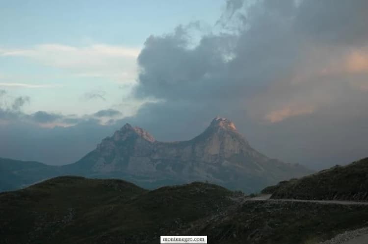
Criterion (vii) concerns superlative natural phenomena and exceptional beauty. UNESCO’s synthesis emphasises the dramatic limestone massif, glacial lakes and the Tara canyon. This is the visual Durmitor most visitors recognise, but beauty is only one-third of the inscription logic.
Criterion (viii) is geological and geomorphological. Durmitor records glacial and karst processes: sculpted relief, caves, cirques, lakes and a canyon cut through a long geological history. A peak list alone cannot communicate this. The relationship between rock, ice, water and time is the subject.
Criterion (x) addresses biodiversity and habitat. UNESCO points to the range of ecosystems produced by altitude, geology and climatic influence, including important forest and high-mountain habitats. The criterion is not permission to chase wildlife for photographs; it creates a stronger reason to reduce disturbance.
| Criterion | Theme | Elements |
|---|---|---|
| (vii) | SCENERY | massif • lakes • canyon |
| (viii) | EARTH HISTORY | glacial • karst • river |
| (x) | BIODIVERSITY | habitats • species |
Source: whc.unesco.org
For a practical field reading of lakes, paths and safety, see Durmitor and Black Lake. For the broader regional route, the Durmitor destination guide separates the massif from the wider travel region.
The boundary is a conservation instrument
Durmitor was inscribed in 1980. UNESCO says a 2005 extension made the World Heritage property coincide with the national-park boundaries then in force. That did not end the story. The World Heritage Committee’s 2025 decision welcomed work towards restoring park boundaries to their pre-2013 alignment and recommended that, after expansion is finalised, Montenegro submit a minor boundary modification and establish a buffer zone.
Those verbs matter: “welcomed,” “recommended,” “after” and “submit” describe a process. They are not proof that a 2026 extension and buffer zone are already complete. A responsible article reports the last confirmed decision instead of drawing a new boundary from political announcements.
| Stage | Status |
|---|---|
| 1980 | inscribed |
| 2005 | extended |
| 2025 | alignment welcomed |
| FUTURE | submission recommended |
Source: whc.unesco.org
Tara Canyon is both spectacle and system
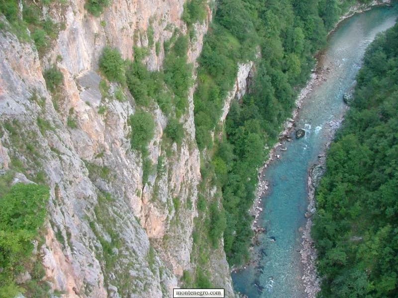
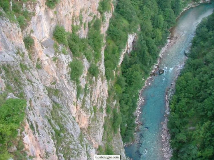
UNESCO’s biosphere page describes the Tara canyon as about 80 kilometres long and up to 1,300 metres deep. Those figures explain scale, not a viewing guarantee from every road or bridge. The canyon is a water system, habitat corridor and lived landscape; it cannot be reduced to rafting copy.
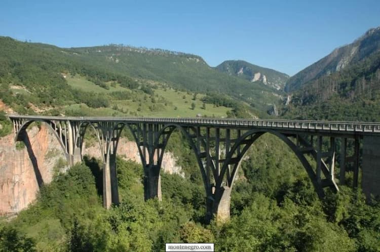
The World Heritage Committee’s 2025 decision requested continued monitoring of motorway-related impacts and updates on hydropower proposals, including impact assessment aligned with World Heritage requirements. The important principle is cumulative effect: a project outside a photographed viewpoint can still change water, noise, habitat connectivity or the experience of the property.
Four conservation questions active in the record
Boundary integrity: Do domestic park lines and the World Heritage property protect the same values, and will a buffer zone address outside pressure? Transport infrastructure: Are motorway effects measured over time rather than dismissed after construction? Hydropower: Are proposals assessed for their full World Heritage impact before decisions? Ski development: Does new infrastructure enter the property or damage its Outstanding Universal Value?
On ski expansion, the Committee used unusually strong language: expansion of ski infrastructure within the property would constitute ascertained danger. That is not a claim that all existing skiing is banned. It is a boundary- and impact-specific warning about further development inside the World Heritage property.
| Pressure | Required response |
|---|---|
| BOUNDARY | align + buffer |
| MOTORWAY | monitor effects |
| HYDROPOWER | assess first |
| SKI EXPANSION | inside property: danger |
Source: whc.unesco.org
This is why rankings and “last chance” travel language can mislead. Our audit of international coverage of Montenegro shows how repetition can turn claims into received wisdom. UNESCO monitoring is slower and more exacting: it asks what changed, what evidence exists and whether value remains intact.
A proposed plan is not an adopted plan
In June 2026 the Government published a package of proposed national-park management plans for 2026–2030. The Durmitor document itself is marked Predlog—proposal. It contains useful diagnosis, including an observation that earlier trail marking and signage were insufficient and caused orientation problems, especially for foreign visitors. But useful diagnosis does not turn the proposal into final law or an adopted operating programme.
The correct editorial pattern is: identify the document’s status, attribute the observation, and check later for adoption. The wrong pattern is to say “the 2026–2030 plan requires…” without proof it entered force. This distinction also matters when comparing park governance with Biogradska Gora National Park.
Practical decisions before entering Durmitor
World Heritage does not make a mountain controlled or risk-free. The park lists 25 mountain trails totalling about 150 kilometres, but a trail inventory is not a condition report. On 30 April 2026, the park asked people not to use mountain trails or organise summit ascents because heavy snow made conditions unfavourable. That warning was dated; it should not be recycled as an August closure. Its lesson is that “official trail” and “safe today” are different facts.
Official bear guidance recommends groups, marked trails, no food or waste left behind, and a calm retreat without running or sudden movement during an encounter. Montenegro’s Mountain Rescue Service adds the basics: forecast, route, equipment, a shared plan, and no high winter mountain without experienced companions. The Žabljak and Durmitor base guide helps translate those checks into accommodation and transport decisions.
Choose the day before choosing the objective. Start with the National Parks contact and tariff page, then check its current notices and a recent mountain forecast. Ask whether the intended entrance, road and trail are open; whether snow, water or maintenance changes the route; and whether a ranger recommends a lower alternative. A general forecast for Žabljak does not describe wind, cloud or temperature on an exposed summit. If the answers remain unclear, use a low, managed area or postpone the mountain route.
Match the plan to the least-experienced person. Record the route, turnaround time and expected return, and give that plan to someone who is not on the walk. Carry navigation that works without signal, sufficient water and food, insulation and rain protection, and a charged phone; equipment is useful only when the group knows how to use it. A trail name, distance or social-media track does not reveal exposure, navigation difficulty or the effect of lingering snow. For winter or technical terrain, use qualified local expertise and the current direction of the park or rescue service.
Build an exit decision in advance. Turn around for deteriorating cloud, lightning risk, unexpected snow, lost waymarks, injury, fatigue or a pace that defeats the agreed return time. Do not “solve” uncertainty by following an unofficial shortcut. In an emergency, communicate location, route and condition as precisely as possible and follow rescue instructions. The conservative choice protects rescuers as well as visitors.
Reduce pressure at the busy edge. Park only where permitted, keep access clear, remain on lawful surfaces, carry all waste out and never feed wildlife. Use toilets and designated facilities where provided. If a viewpoint or path is crowded, waiting or choosing another managed stop is better than widening the trail. These are small decisions, but they connect directly to the inscription’s habitat and landscape values.
Keep the evidence chain current. Save the park contact, rescue guidance and the page containing any warning you relied on, together with its date. Recheck on the morning of departure because a notice can become stale in either direction: an old restriction may have ended, or a new hazard may have appeared. Fees also belong to the same-day check; this dossier intentionally avoids freezing a tariff into long-lived editorial copy. If a commercial operator’s advice conflicts with the park or rescue service, pause and resolve the conflict with the competent authority before setting out.
| Step | Action |
|---|---|
| 1 | UNDERSTAND THE PROTECTED VALUES |
| 2 | CHECK PARK + WEATHER TODAY |
| 3 | MATCH ROUTE + EQUIPMENT |
| 4 | TURN BACK EARLY |
Source: nparkovi.me, gss-cg.me
A field-reading sequence without peak collecting
- Begin low: use a managed, currently open visitor area to read glacial relief, water and forest together. The purpose is observation, not reaching a summit immediately.
- Separate the criteria: identify what belongs to scenic experience, what records earth processes, and what depends on habitat protection. One feature can support more than one criterion.
- Notice edges: roads, buildings, ski infrastructure and visitor concentration show why boundary and buffer-zone questions matter.
- Choose one safe route: check the park, weather and equipment rather than treating a list of 25 trails as a challenge.
- Leave no new pressure: stay on lawful routes, take waste out, avoid wildlife pursuit and do not amplify unofficial shortcuts.
Travellers assembling a national-park route can compare our five Montenegro stops for 2026. For another case where the attraction’s popular name can obscure physical limits and safety, see the Blue Cave planning guide.
Frequently asked questions
Is Durmitor a cultural World Heritage Site?
No. UNESCO lists Durmitor as a Natural World Heritage property under criteria (vii), (viii) and (x). Cultural heritage in the region is significant but is not the basis of this inscription.
How large is the UNESCO property?
The current World Heritage record gives 32,100 hectares. Do not substitute the 182,889-hectare Tara River Basin Biosphere Reserve or inherited park-area figures.
Does UNESCO status mean every project is banned?
No. It means Montenegro must protect Outstanding Universal Value and evaluate threats. The 2025 decision addresses specific boundary, motorway, hydropower and ski-development concerns.
Was the buffer zone finished in 2026?
The 2025 Committee decision recommended a future minor boundary modification and buffer zone after park expansion is finalised. This dossier does not claim those steps were completed.
Is the 2026–2030 management plan final?
The located government package and Durmitor document are explicitly proposals. Their observations can be attributed, but their measures should not be described as adopted without a later decision.
Are Durmitor’s 25 trails safe whenever the park is open?
No. The count is an official network inventory. Snow, weather, closures, waymarking and individual ability require a same-day decision.