An Ottoman market town in the upper Lim valley, under the highest mountains in Montenegro — with about ten people abroad who call it home for every one still living in it.
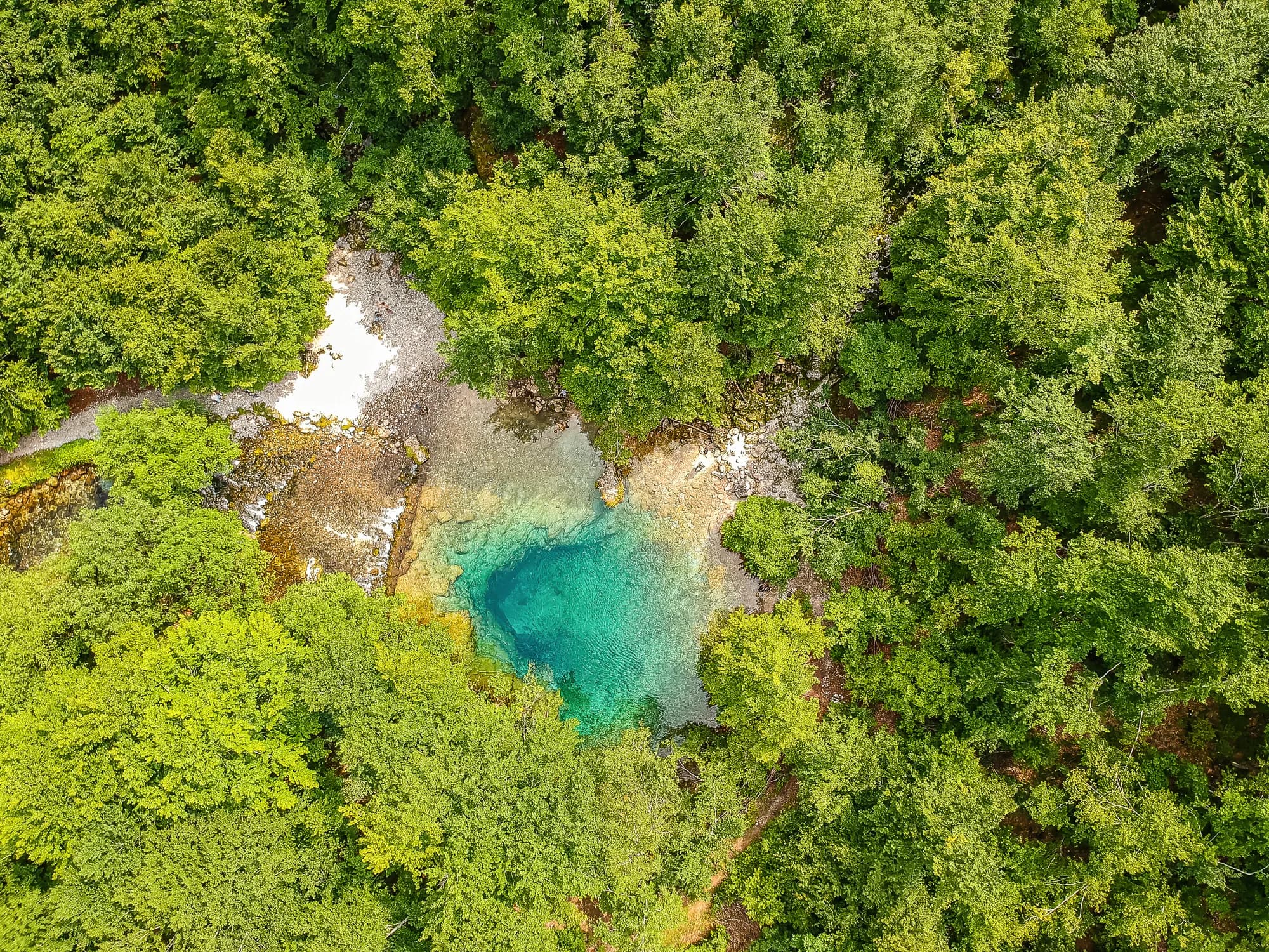
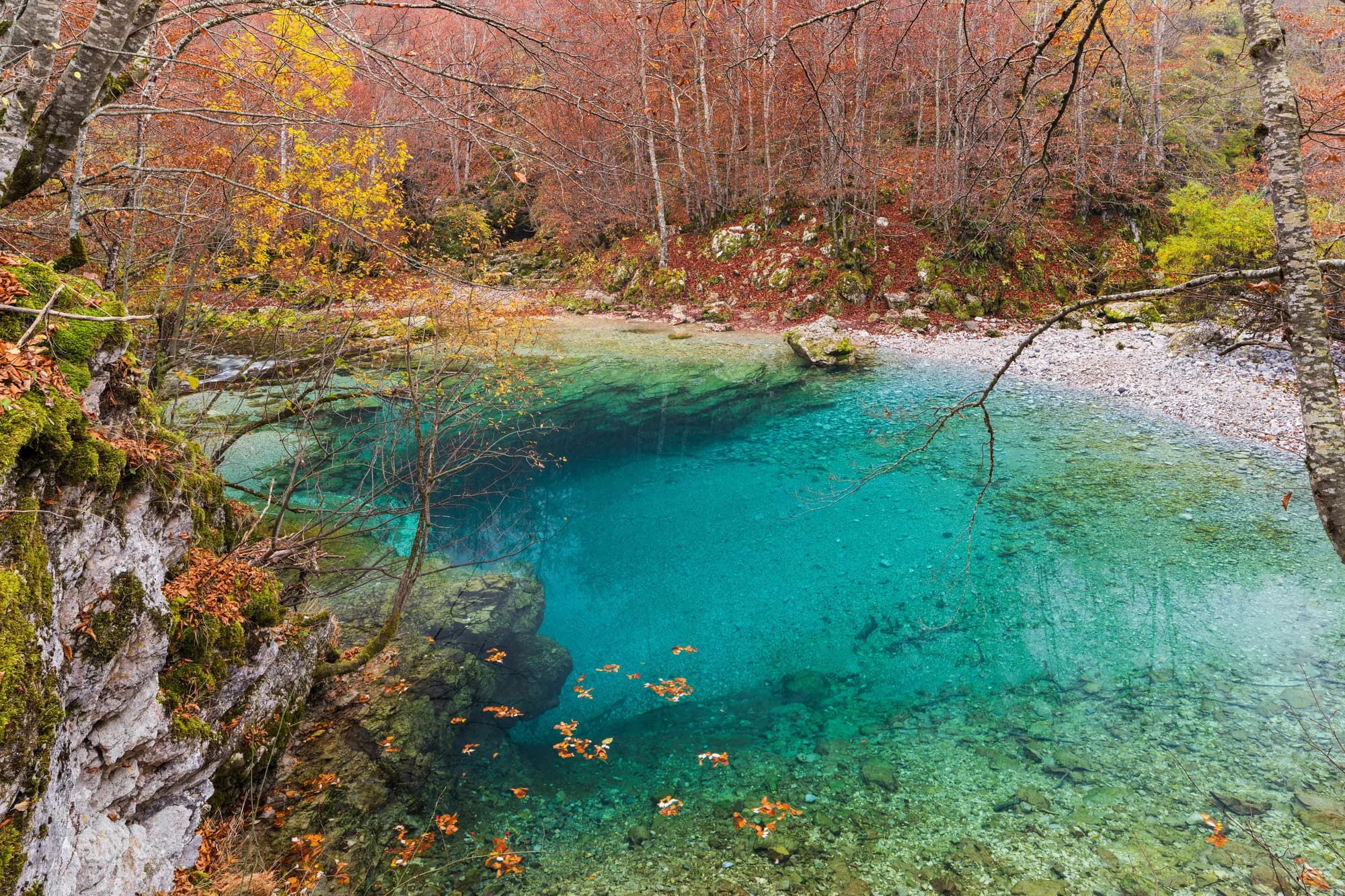
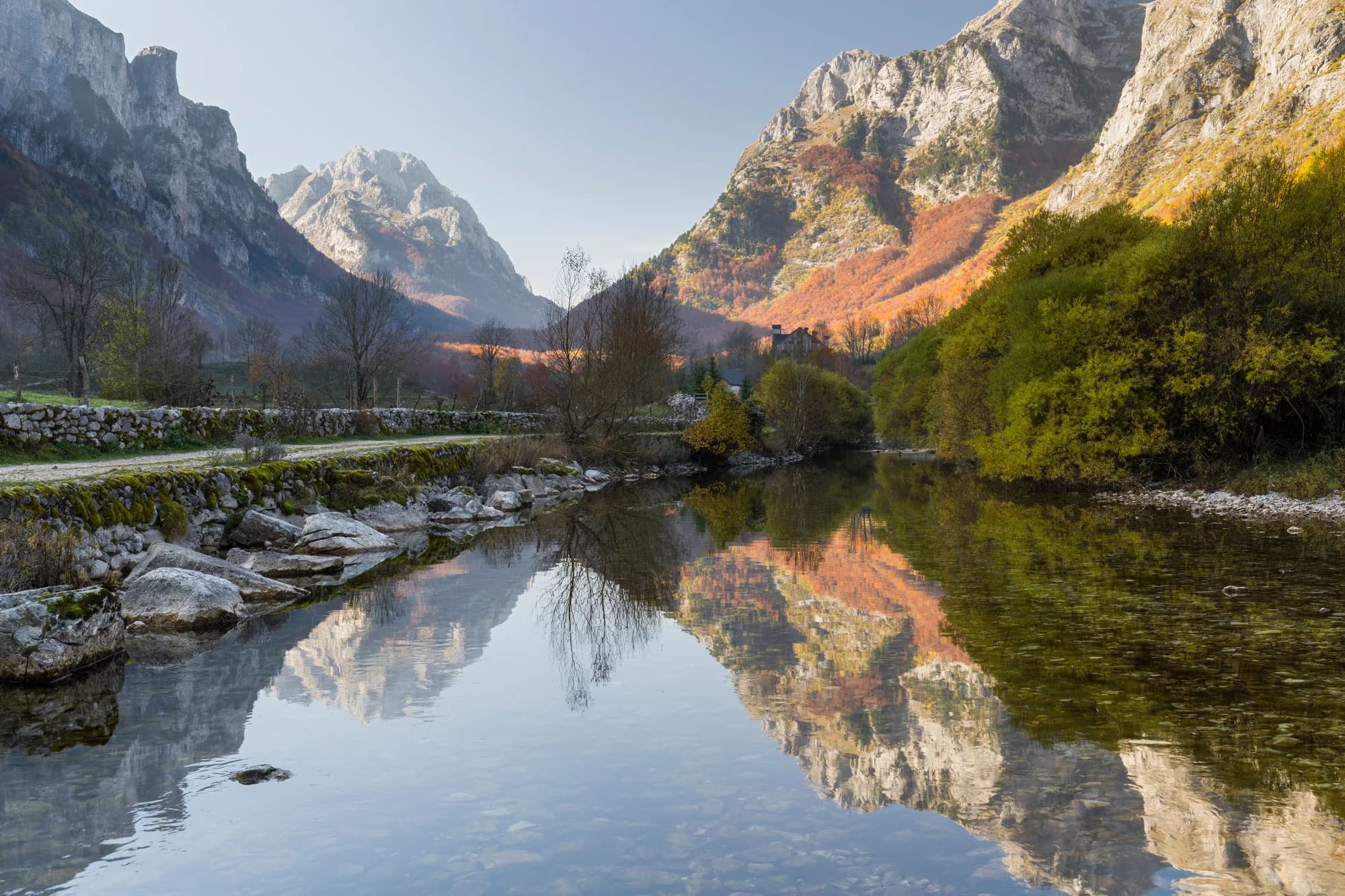
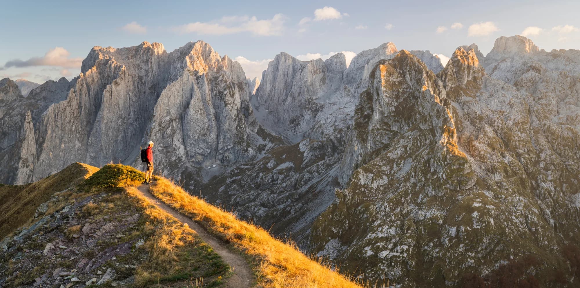
Gusinje is a small mountain town in the far east of Montenegro, a few kilometres from the Albanian border and hard against the wall of the Prokletije - the Accursed Mountains, the highest and least tamed range in the Dinaric chain. It sits on a flat valley floor at around 900 metres with peaks rising steeply on three sides, and it serves as the gateway to Prokletije National Park and the Prokletije range behind it. The town itself blends Ottoman heritage with mountain culture. Gusinje was a frontier settlement of the empire for centuries, and its mosques, older houses and the layout of the centre still reflect that; the Vezir's Mosque dates from the seventeenth century. The population is mixed Bosniak and Albanian, the food follows suit with pies, dairy, lamb and endless coffee, and the rhythm of the place is markedly different from the coast. Gusinje became a municipality in its own right in 2013, having long been administered from neighbouring Plav, whose lake lies ten minutes down the valley. What brings people here is what lies above. The Ali-Pasha Springs, also known as Oko Skakavice, surface at the foot of the mountains just outside town: cold water welling straight out of the rock into a stunning turquoise pool under old trees, a short walk from the centre and a standard summer gathering spot. The Grebaje valley to the south is a flat green trough closed by the vertical faces of Karanfil and Volušnica. Ropojana leads the other way toward Vusanje, the Grlja waterfall and the border, and trails from here feed into the long-distance Peaks of the Balkans route. Come between June and September, since snow lingers late at altitude and the high routes need summer conditions. Accommodation is mostly family-run guesthouses, with mountain huts and katuns operating in the valleys through the season. Gusinje suits hikers, climbers and travellers who want the country's wildest corner and are happy to trade comfort for scale.
A few hours
Half a morning covers the town. The valleys are the reason to come.
One full day
One town, two valleys, and the highest ground in Montenegro ten kilometres off.
A weekend
Gusinje town
Best for the čaršija, the shops and the bus — with both valleys inside ten kilometres
Grbaja valley
Best for the valley floor eight kilometres up, for walkers who want the rock at the door
Vusanje
Best for the last village before the Albanian border, at the mouth of the Ropojana
Plav
Best for thirteen kilometres east on the lake — more rooms, and the road out to Podgorica
The small end of the country
Residents by municipality, 2023 census
Gusinje is the fifth-smallest of Montenegro’s twenty-five municipalities: 3,933 people across 157 km², of which the town itself is 3.73 km².
Where Gusinje actually lives
People who count the town as home, by where they are
For every person living in the town, about ten more abroad — mostly in the United States — count it as where they are from. The emigration came in waves after 1913 and never stopped.
Who visits Montenegro
Share of foreign overnight stays, 2025
MONSTAT · 2025
Census population, Gusinje municipality
The municipality has lost one resident in nine since 2003, and all of the loss is in the villages: the town itself went from 1,673 people in 2011 to 1,877 in 2023 while Gusinje as a whole fell from 4,027 to 3,933. Its real size is somewhere else — the municipality reports 18,400 people who trace their origins to the town, most of them in the United States.
From the tax register of 1485 to the First Balkan War, Gusinje was an Ottoman town for 427 years. Widths are to scale.
Ottoman defter of the sanjak of Scutari, 1485; Mariano Bolizza, 1612–14; Battle of Novšiće; MONSTAT.
A day at 1,014 metres
Walking hours, not beach hours
Meanwhile, in 1879
Novšiće — on 4 December 1879 League of Prizren forces under Ali Pasha of Gusinje beat back Marko Miljanov’s Montenegrins about four kilometres north of Plav. The Treaty of Berlin had awarded Plav and Gusinje to Montenegro the year before; the award was never carried out. The Ottoman press called the fight the Gusinye Incident.
Istanbul — in 1880 the Great Powers gave up on the handover and the Ottomans ceded Ulcinj on the Adriatic as compensation instead. Gusinje stayed Ottoman until the annexation of October 1912.
Peja — Ali Pasha — born Ali Hasan Shabanagaj in Gusinje in 1828 — was made mutasarrıf of the Ottoman sanjak of İpek in 1881, and died there in March 1888. Gjergj Fishta made him the central figure of the eighth canto of Lahuta e Malcís.
Menlo Park — Edison’s carbon-filament lamp burns through the night of 21 October 1879.
“A lively Albanian town.”
Evliya Çelebi, 1675
Çelebi recorded the town in his Seyahatnâme sixty-three years after the fortress was finished. The bazaar was why the place existed: the Kosovo Vilayet register of 1852 counted 350 shops, eight madrasas and five mosques against 1,500 households, and in 1893 there were still 240 shops.
Search thousands of hotels and apartments with live prices.
We may earn a commission from partner links. This helps us keep Montenegro.com free for travelers.
Search hotels, apartments and guest houses with live availability.
We may earn a commission from partner links. This helps us keep Montenegro.com free for travelers.
Gusinje lies in the far east of Montenegro, about 10 km beyond Plav in a bowl of the Prokletije mountains, right against the Albanian border. It is roughly two hours from Podgorica and the last town before the high peaks.
A group of powerful karst springs a short walk from the town, where the Vruja rises fully formed out of the ground beneath the mountains. The meadows around them are a local picnic spot and the easiest short outing from Gusinje.
A glacial valley south-west of the town, walled by the vertical rock of the Karanfili peaks. It is the most photographed place in the Prokletije, has a few huts and a campsite, and is the trailhead for most serious walking here.
It is one of the best bases in the country. Routes lead up to Volusnica for the classic view of the Karanfili, over the border to Theth in Albania, and onto the Peaks of the Balkans circuit. Guides are available in the village.
Small, largely Albanian and Bosniak, with mosques, a market and a strong tradition of emigration — many families spend part of the year abroad. Summer is when the town fills up, both with returning families and with walkers.
For crossing into Albania or Kosovo on the mountain routes, yes: a cross-border permit must be arranged in advance, usually through the national park office or a local guide. Allow several days for it.
No — the nearest is Podgorica Airport (TGD), 124 km away by road.
74.6 km by road, about 1 h 54 min by car.
The UK Foreign, Commonwealth & Development Office (FCDO) has no advisory against travel to Montenegro; it last reviewed its guidance on 13 August 2026. That is their assessment of the country as a whole, not ours and not a judgement about Gusinje, so read it yourself before you travel. The emergency number in Montenegro is 112.
JunLake Ropojana at its fullest — the seasonal lake at the head of the Ropojana shows at the beginning of summer and dries to a grassy meadow by August or September
AugThe gathering at the Ali Pasha springs — on 2 August thousands come out to the springs for music, dancing and food — the town’s own holiday
The nearest places to Gusinje, at their true positions — Mateševo is about 33 km away in a straight line.
Schematic. Positions and straight-line distances from the coordinates we hold for each place; mountain roads make the drive longer. Coastline and Lake Skadar © OpenStreetMap contributors.
Gusinje in numbers
96 households, 21 unmarried men and four widows on an imperial tax register
the valley floor; Zla Kolata, 2,534 m and the highest point in Montenegro, is about 10 km south
2023 census, the town itself — 3,933 in the whole municipality
the Vizier’s Mosque, built by Kara Mahmud Bushati on the site of a mosque of 1626; the Čekića mosque is older still, 1687
Prokletije becomes Montenegro’s fifth and newest national park, 16,630 ha across Plav and Gusinje
its own municipality again, 61 years after the status was revoked
MONSTAT, Census 2023 · Ottoman defter of the sanjak of Scutari, 1485 · National Parks of Montenegro
Best time: June · July · September
| Place | By road | Driving |
|---|---|---|
| Plav | 13.2 km | about 20 min |
| Murino | 21.6 km | about 33 min |
| Andrijevica | 33.7 km | about 47 min |
| Berane | 50.9 km | about 1 h 9 min |
| Podgorica | 74.6 km | about 1 h 54 min |
| Budva | 133.5 km | about 3 h 10 min |
| Kotor | 145.5 km | about 3 h 21 min |
Road distances routed over OpenStreetMap data, © OpenStreetMap contributors. Driving times are free-flow and take no account of summer traffic or a queue at the ferry ramp.
Gusinje is a base, not a stop. The Peaks of the Balkans trail — 192 km through Montenegro, Albania and Kosovo — passes between Lake Ropojana and Qafa e Pejës.