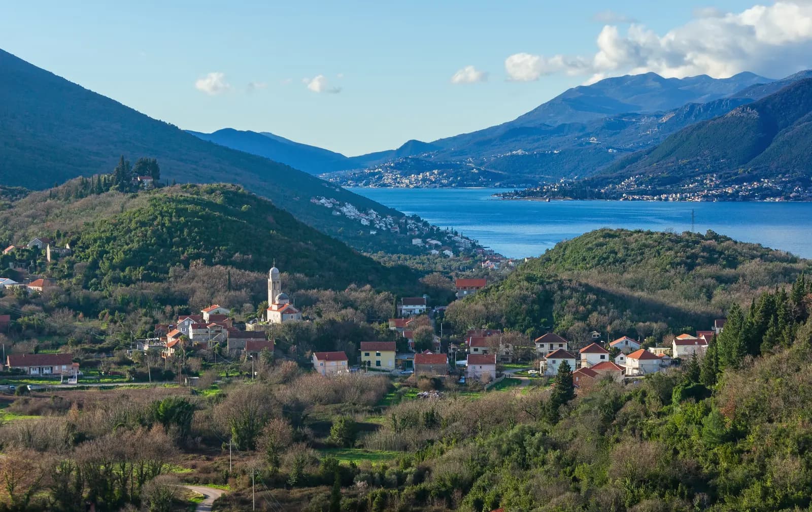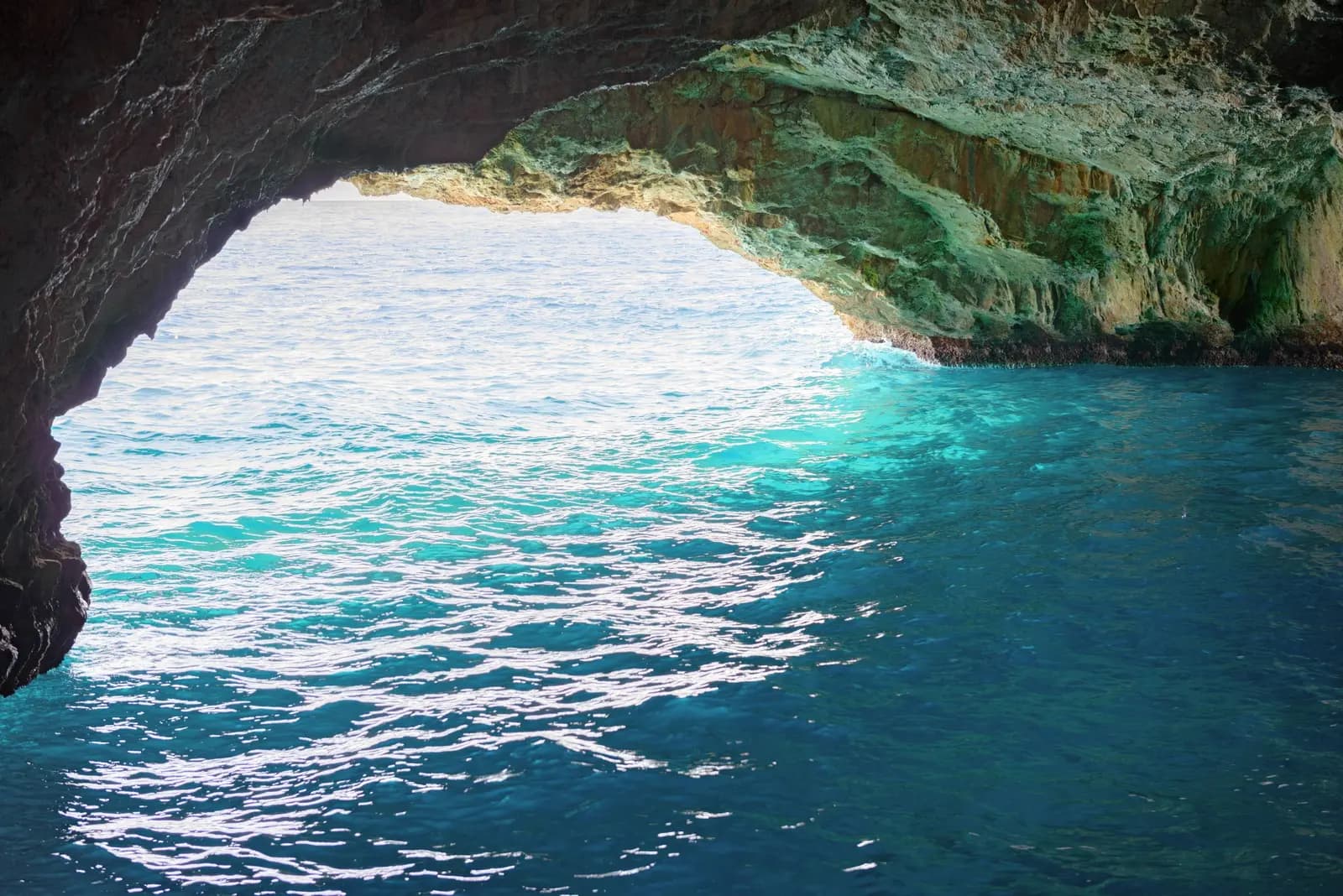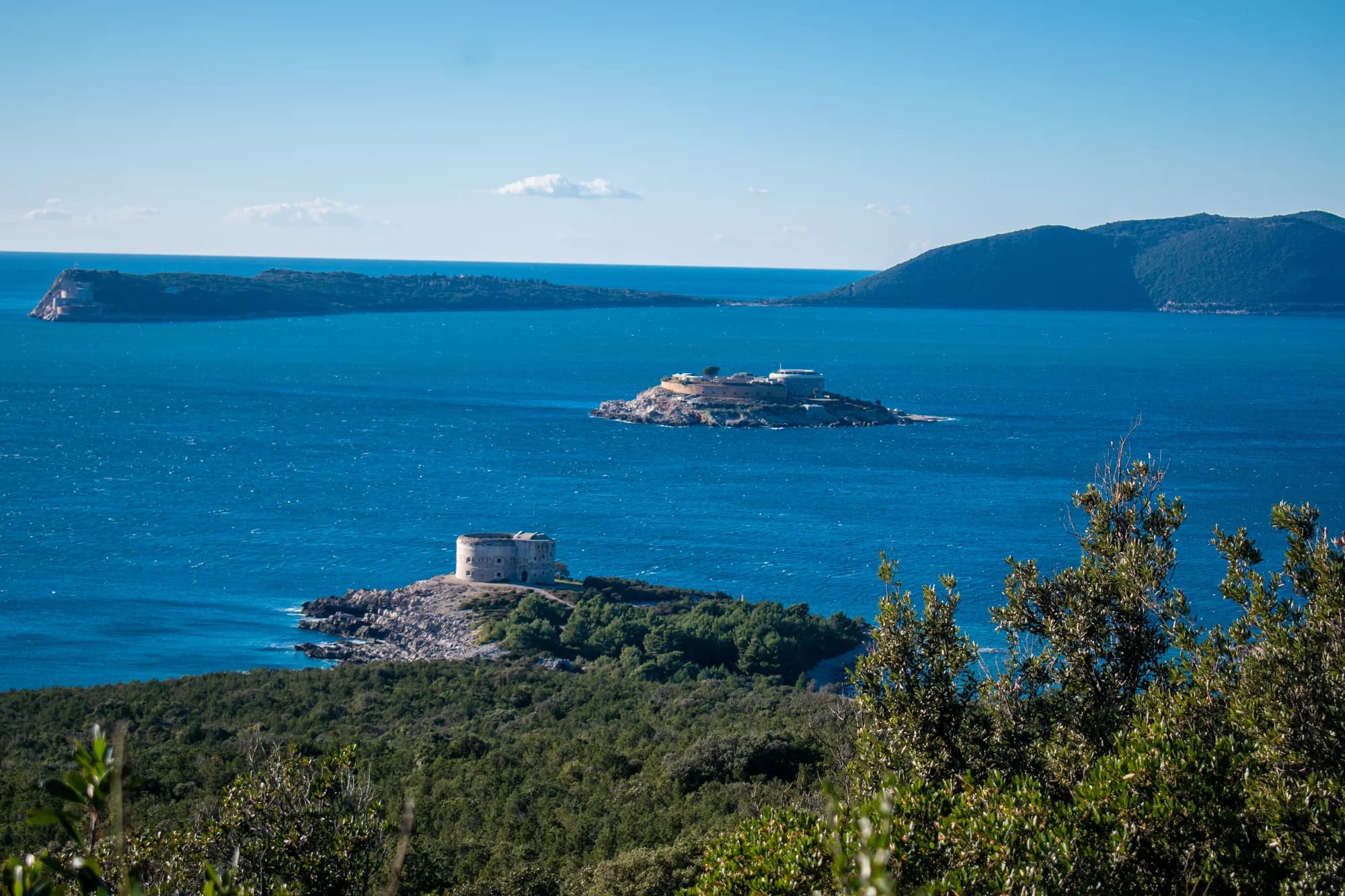
Luštica makes you choose. Turn inland and the peninsula becomes a slow road of stone villages, olive terraces and sudden views across Boka. Turn toward the outer coast and it becomes a boat journey: pale coves, dark fort walls and the blue light of a sea cave. Try to collect everything in a hurried afternoon and the road will win. Give one route enough time, and Luštica begins to make sense.
This is not one resort, one beach or one scenic drive. It is a peninsula of two coasts. The sheltered side faces Tivat and the interior of the bay; the exposed side meets the Adriatic around Žanjice, Mirište and the entrance to Boka. Between them sit working villages and a modern waterfront town. The best day here starts by deciding which Luštica you actually want.
Luštica in 60 seconds
| Your priority | Choose | Allow | Main constraint |
|---|---|---|---|
| Villages, olive landscape and viewpoints | Life on Luštica panoramic road | A full day | Narrow, steep sections and slow progress |
| Blue Cave, coves and Boka entrance | Outer-coast boat trip | A flexible half or full day | Motor-vessel prohibition, sea state and operator judgement |
| A quiet waterfront pause | Rose with nearby road stops | Several unhurried hours | Parking and seasonal service variation |
| Easy promenade, food and services | Luštica Bay and Radovići | Two to four hours | It shows the new peninsula, not the whole peninsula |
| Road and sea without rushing | One overnight on Luštica | Two days | Requires two separate plans and weather flexibility |
If you have only one day and calm conditions matter most to you, make the road circuit your fixed plan and the boat trip your optional plan. If the Blue Cave is the reason you came, arrange a reputable operator first and let that operator make the final call on the water. Luštica rewards flexibility more than a rigid list of stops.
One peninsula, two coastlines
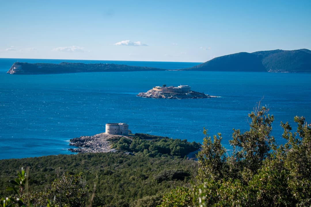
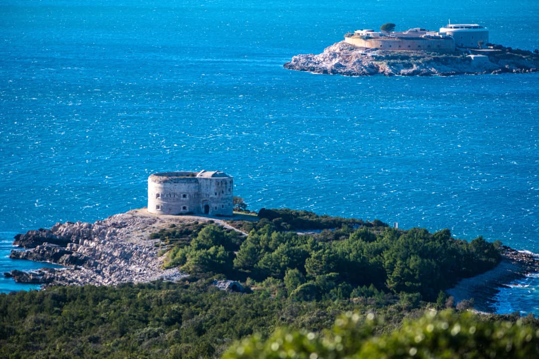
The inner coast reads like part of Boka: villages sit above or beside calmer water, and the road keeps revealing the bay from a new angle. The outer coast feels more abrupt. Here, bare rock, low vegetation and open water frame the defensive line of Arza, Mamula and Prevlaka. The National Tourism Organisation’s fortress guide identifies those three as Austro-Hungarian fortifications around the point where Boka meets the open sea.
That geography explains why a short distance on a map can become two different trips. Rose looks across the bay toward the Herceg Novi side, but reaching it by road means following the peninsula. Žanjice may be linked to Herceg Novi by seasonal excursion boats, while a car must travel around by land. Never convert a water crossing into an assumed driving time.
Journey one: the 40-kilometre village road
The official Life on Luštica panoramic road is the peninsula’s strongest answer to the usual beach checklist. Tivat Tourist Organisation describes it as a winding 40-kilometre route and recommends setting aside a full day. Its own warning matters: parts are narrow and steep. This is a landscape to read slowly, not a loop to race before dinner. Download the official English route map before leaving reliable data coverage.
The promoted route moves through Bjelila and Krašići before climbing into the village interior around Zabrđe, Klinci, Mrkovi, Tići and Mardari, then returns toward the modern coast. The map numbers 18 points, but the number is not a challenge. Choose three or four places where you will actually stop. Churches, farm gates, lanes and fort approaches may have different access conditions; admire from public ground unless entry is clearly invited.
How to make the road interesting
Begin with a question instead of a list: how did people make a life on this stony peninsula? Then look for the answers in the route—the placement of houses, shade around village centres, dry-stone boundaries, cultivated ground and the relationship between settlement and water. The official route’s name, “Life on Luštica,” is a useful instruction. It turns an attractive drive into a connected story.
Pause before the first narrow section to adjust mirrors, secure loose objects and agree who will navigate. Use marked pull-offs rather than stopping in a traffic lane for a photograph. Keep lunch flexible: a farm visit or tasting is an appointment, not something to assume from a map pin. Tivat Tourist Organisation also promotes a Luštica Passport and audio guide; confirm current collection or access details before depending on either.
Cyclists and walkers should treat the 40-kilometre figure cautiously. Heat, gradients, limited shade and shared narrow roads can turn a scenic line into a serious undertaking. For a trip built around walking rather than driving, use the broader Montenegro hiking guide to frame route selection, water and turnaround decisions.
Journey two: Žanjice, Mirište and Blue Cave
The outer coast is a water story. Žanjice works as a beach stop and, when operators are running, a departure point for nearby coastal trips. Mirište puts the fortification landscape in view. Blue Cave provides the famous colour, but the colour is not a switch that turns on at a guaranteed hour: sunlight, water and sea conditions shape the experience.
The official Montenegro tourism page locates Blue Cave on Luštica near Herceg Novi and explains the blue appearance through sunlight reflecting in the water. The practical consequence is simple. A navigation-safety rule announced by Montenegro's Ministry of Maritime Affairs on 25 May 2026 prohibits motor-powered vessels from entering the Blue Cave area; only vessels without motor propulsion may enter. Ask an operator exactly where the motorboat stops, whether a compliant non-motorized transfer is part of the trip, and what happens when conditions rule out entry. Do not treat swimming from a motorboat as a workaround: swimming permission, supervision and sea conditions are separate decisions. The Blue Cave entry and safety guide explains the visit in more detail.
What the beach day is really like
Žanjice and Mirište are useful names for orientation, not guarantees of silence, sand or a particular set of services. Expect hard coastal surfaces and bring footwear that works on pebbles and rock. In the busy season, arrive with a parking alternative and enough water that a delayed lunch does not become the day’s defining event. Outside the busiest months, the tradeoff reverses: more space may come with fewer open services and fewer boats.
If a boat day is cancelled, do not spend the afternoon chasing another skipper who will ignore the same sea. Switch to the village road, Rose or Luštica Bay. Dobreč is another water-oriented cove, but access and services deserve their own check; read the Dobreč guide before making it a target.
Journey three: Rose and the threshold of Boka
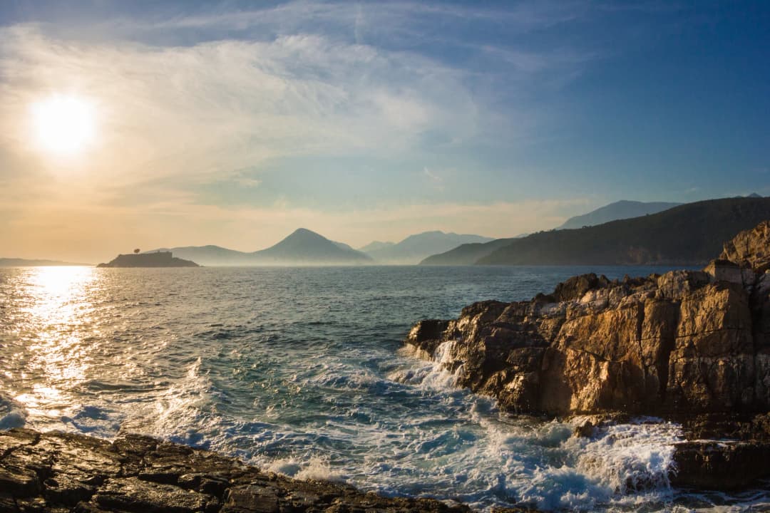
Rose is the peninsula at speaking volume. A small waterfront, stone facades and boats across the channel create a strong sense of arrival without demanding a catalogue of attractions. Come to walk, look across the water and let lunch take the time it takes. It works especially well as the quiet half of a day paired with one inland village or a pre-arranged boat trip.
Its apparent closeness to Herceg Novi is the classic Luštica illusion. The towns face each other across water, while the roads belong to different sides of the bay entrance. Check the actual road route or a confirmed boat service for your date. Never promise yourself a quick hop based only on the view. For more detail, use the focused guide to Rose; if you are staying on the opposite shore, the Meljine guide helps place the Herceg Novi side of the water.
Old Luštica and new Luštica Bay
Luštica Bay is not a substitute for the peninsula’s village road, and the village road is not a moral rebuke to a modern marina. They answer different needs. The old landscape offers irregular lanes, scattered settlements and long views. The new waterfront offers an easy promenade and a concentration of food, drink and shopping in Marina Village and Centrale. Check the current directory, then confirm the individual venue and its opening hours before setting out.
Use Luštica Bay deliberately. It is a comfortable first stop while you orient yourself, a weather fallback when the open coast is unwise, or an easy evening after the panoramic road. It is also practical for travellers who need level walking and services close together. If you spend the entire visit there, you have seen a polished district on Luštica—not Luštica in full. For the nearby everyday base, see Radovići. For the wider story of large coastal developments, read the Montenegro coast investment overview.
Three itineraries that do not fight the geography
Four hours: choose one strong fragment
From the Tivat side, pair Radovići with the Luštica Bay waterfront, or drive only a short confirmed section of the panoramic route and return before you begin clock-watching. From a suitable Luštica base, Rose plus one nearby viewpoint is enough. Four hours is not enough for a speculative drive to the far end, a beach stop and a Blue Cave boat trip.
One day: road or water
For the road day, start early, follow the official route direction, stop in a small number of villages and finish where dinner does not require another race. For the water day, confirm the operator and departure point, then allow the skipper to shape the order around conditions. Add beach time after the boat, not before a fixed departure. This is the version that can include Žanjice, the fort views and Blue Cave without pretending they are independent appointments.
Two days: earn the full contrast
Drive the panoramic road on the more stable land-weather day and reserve the calmer sea window for the outer coast. Stay on or near the peninsula so you can swap the days without losing hours. Rose can sit between them as an evening pause. This is also the best rhythm for combining Luštica with a wider seven-day Montenegro route: give the peninsula its own night rather than squeezing it between Kotor and Budva.
When Luštica disappoints
Luštica can feel frustrating if you expect a continuous coastal boulevard. The roads do not connect every seductive map pin in a straight line. Parking can be awkward, shade can disappear, and a village that looks atmospheric in a photo may offer no visitor service at all. A closed gate is not a failed attraction; it is a boundary. A sea cave cancelled for weather is not poor customer service; it may be the soundest decision of the day.
The peninsula also contains sharp contrasts. Construction and polished new districts sit within driving distance of old agricultural landscapes. Summer brings the most services and the most pressure. Quieter periods bring room to breathe but less certainty about boats, meals and beach facilities. Anyone who needs barrier-free routes, frequent toilets or predictable public transport should choose specific accessible stops rather than treating the full peninsula as one easy attraction.
Practical planning
Getting there and moving around
A car gives the most control over the village road, but only if the driver is comfortable with narrow lanes, gradients and reversing to a passing place. Save the official map offline and carry a charged phone. Do not count on mobile navigation to identify private lanes or legal parking. If you do not want that driving, book a local driver or a defined tour rather than improvising a chain of taxis between remote stops.
Boats solve different geography. Confirm the precise pier, return arrangement, cancellation policy, passenger capacity and whether shade or life jackets are provided. A boat from the Herceg Novi side does not automatically solve onward road transport on Luštica. Treat land and sea legs as separate bookings unless one operator explicitly joins them.
Best time and daily rhythm
Late spring and early autumn usually make the inland road more comfortable than the hottest part of a summer day, but services may be less frequent. In summer, use the cool morning for villages or a confirmed boat departure and keep the afternoon simple. In any season, compare the latest Montenegro forecast from the national service, available through the World Meteorological Organization, with an operator’s same-day marine judgement.
What to bring
Carry more water than a waterfront itinerary suggests, sun protection, grippy footwear, a light layer for the boat and a dry pouch for phone and documents. Water shoes are useful on rocky entries. For a road day, add offline navigation and something to eat in case your chosen stop is closed. For a boat day, ask about flotation equipment and never jump or swim until the crew says it is safe. Montenegro’s national emergency number is 112, but coverage and response time are reasons to plan conservatively, not reasons to take more risk.
Where to stay
Stay near Radovići or Luštica Bay for easier access to services and the Tivat side. Choose Rose or a smaller settlement for atmosphere only after confirming parking, luggage access, meals and the exact route. If your main goal is an excursion boat from Herceg Novi, staying across the water may be simpler than sleeping on Luštica—but then treat the peninsula’s road circuit as a separate day. Wherever you stay, confirm visitor registration responsibilities; the tourist tax and registration guide explains the national framework.
Frequently asked questions
Is Luštica worth a day trip?
Yes, if you choose one coherent version of it. The full panoramic road can fill a day, and an operator-led outer-coast trip can fill another. A rushed attempt to combine both usually replaces experience with transit.
Do I need a car?
A car is the most flexible way to explore the village road, but it is not ideal for every driver. A booked driver or defined tour is more relaxing if narrow, steep roads make you uncomfortable. Boats serve the coastal experience, not the inland circuit.
Can I always enter Blue Cave?
No. Motor-powered vessels are prohibited from entering; cave entry is permitted only in a vessel without motor propulsion. Wind, swell, current rules and the skipper’s assessment still matter. Swimming from a motorboat is not an automatic alternative. Plan for a coastal ride whose route may change, not a guaranteed cave entry.
Is Luštica good with children?
It can be, when the day is shortened and matched to heat, swimming confidence and road tolerance. Choose one beach or promenade, bring shade and water, and ask a boat operator about child flotation equipment before booking.
Should I stay overnight?
Stay overnight if you want both the village road and the outer coast. The extra night creates room to swap plans when the sea changes and lets Rose or the waterfront become an evening rather than another timed stop.
Can I rely on online maps?
Use them for broad orientation, then use the official panoramic-road map and current local advice. A line on a screen may not show road width, a private entrance, construction or a practical place to turn around.