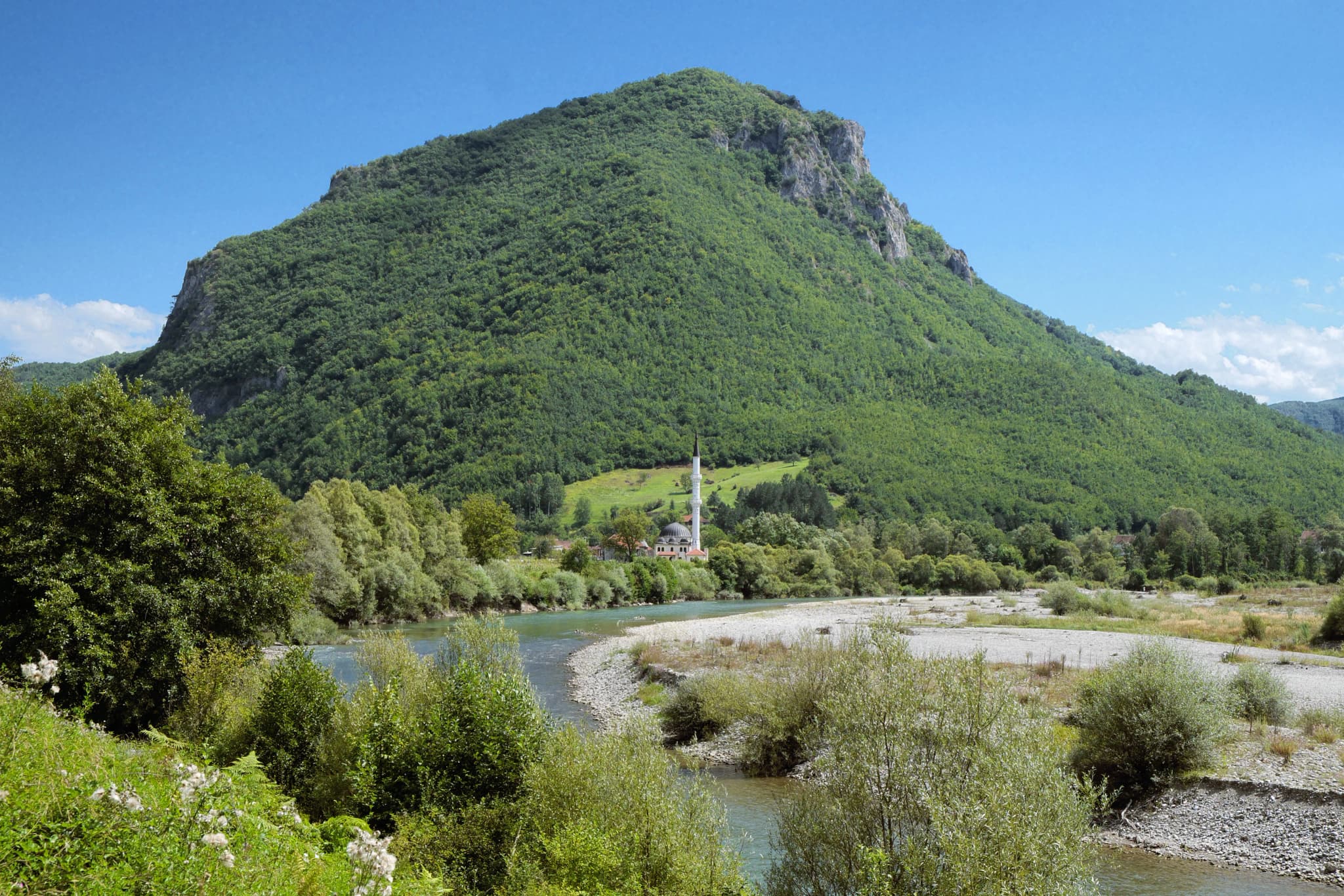
Đalovića Gorge may now be easier to visit than many old guides suggest, but current access still needs confirmation. On 21 August 2026, Montenegro’s public broadcaster reported a promotional walk and said the opening of a marked, arranged four-kilometre route for organised groups and individual walks had been officially announced. National tourism guidance still says that entry into the deeper cave system is for experienced speleologists.
That distinction controls every sensible plan. Plan for the protected karst landscape and river gorge only after the responsible local manager confirms the walking route is accepting visitors. Treat the cave mouth as a boundary unless a competent authority or qualified caving organisation explicitly provides access. Do not interpret the route announcement, construction reports or a cable-car proposal as proof that the underground tourism complex is operating.
Two names, and two different evidence levels
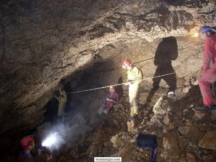
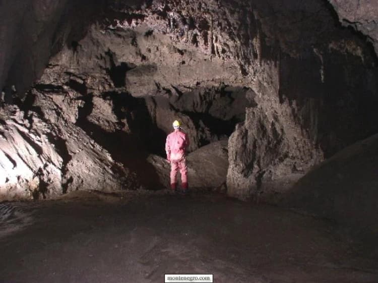
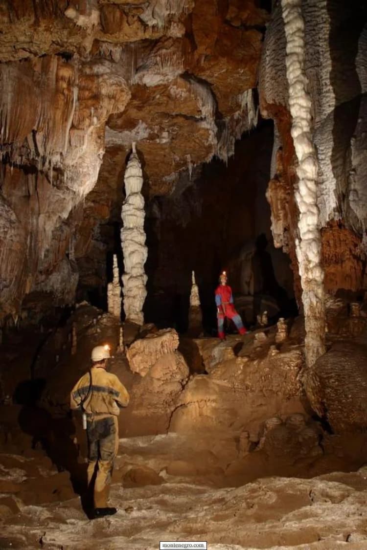
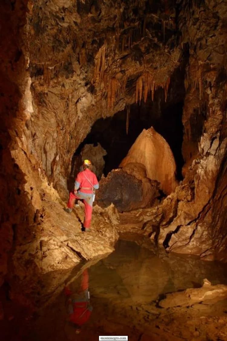
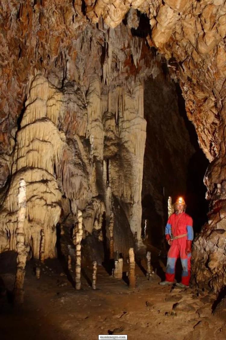
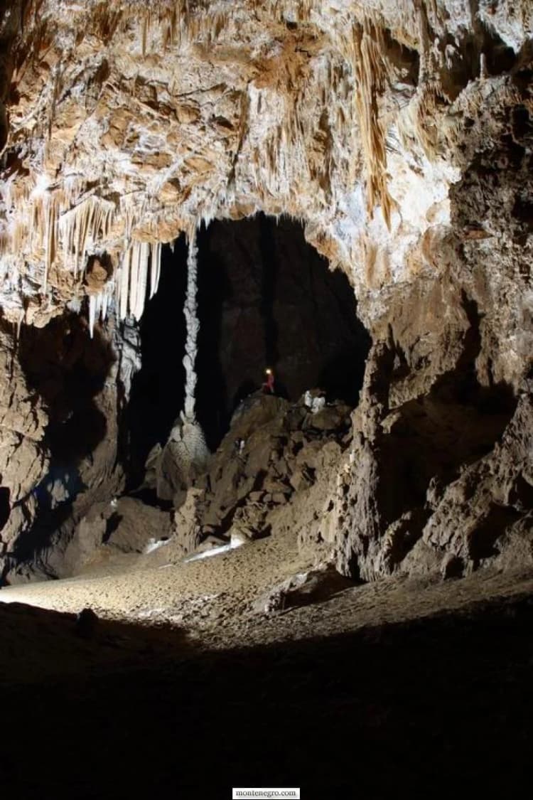
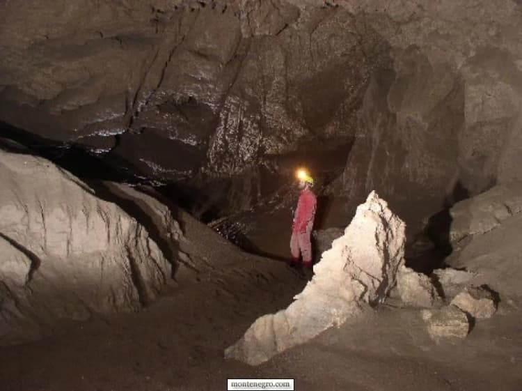
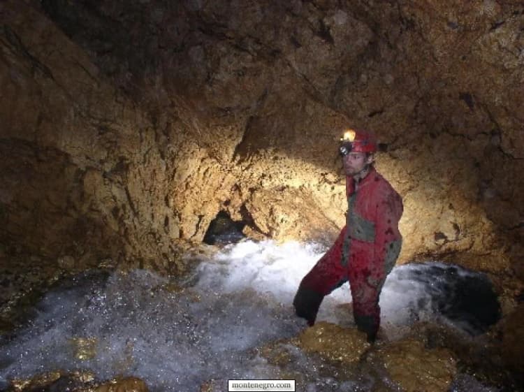
The original Montenegro.com story joined two subjects: an expedition account about a newly explored cave called Brno and a short note about Đalovića Cave. It credited a contributor from Bijelo Polje and a group of Czech speleologists, reported that Brno was around 500 metres deep, and described a siphon at the expedition’s limit. The photographs remain valuable records of people moving through a demanding underground environment.
What the archive cannot do is certify today’s survey. Cave lengths and depths change as passages are explored, connected, resurveyed or reclassified. The old story supplied no survey drawing, expedition report or stable institutional citation. This revision therefore preserves “Brno” as attributed archive testimony rather than silently upgrading its measurements into present fact. Visitors should not use it as a route description.
What is verified about Đalovića Gorge and cave
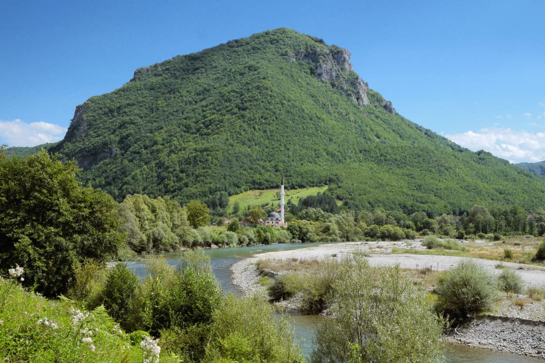
Đalovića Gorge lies in the Bistrica area near Bijelo Polje in north-eastern Montenegro. The protected-area profile describes a gorge approximately 7.5 kilometres long, with a depth or relief reaching 627 metres. A current government project document places the cave entrance at 764 metres above sea level. These numbers describe the landscape and entrance; they do not mean there is a 7.5-kilometre maintained visitor path or a 627-metre public descent.
The national tourism organisation’s speleological guidance describes large passages, lakes, formations and siphons, then makes the important access point: only experienced speleologists can enter. Water is part of the system, not decorative background. Rainfall and underground flow can alter conditions far from where the rain falls.
| Element | Status | Caution |
|---|---|---|
| Gorge route | announced 2026 | confirm locally |
| Cave mouth | check locally | do not infer entry |
| Deep cave | experienced | speleologists |
| Tourism works | project status | not operation |
Source: rtcg.me
What was announced in August 2026—and what was not
RTCG’s 21 August report says a promotional walking tour took place and that opening a four-kilometre arranged route for organised and individual walks was officially announced. Its headline calls the gorge open, but the text does not publish hours, a start date or an operating contact. Treat it as strong evidence of readiness and public intent, then obtain current confirmation before travel.
It is not evidence that the full cave, a proposed 814-metre tourist segment, a cable car or all visitor facilities entered service. Those belong to a multi-part development programme with contracts and construction phases announced over several years. A contract award, installed component or reported percentage of completion is not the same as a public opening with hours, tickets, trained staff and an emergency plan.
| Component | Best-supported status on 28 August 2026 | Visitor decision | Live check |
|---|---|---|---|
| Four-kilometre gorge route | Opening officially announced after a promotional walk on 21 August; no operating schedule cited | Confirm before planning an outdoor hike | Tourism Organisation of Bijelo Polje or protected-area manager |
| Cave mouth | Destination within the wider landscape; no blanket entry permission established | Observe barriers and current instructions | Local authority on the day |
| Deeper cave system | National guidance says experienced speleologists only | Do not enter as a casual visitor | Qualified caving organisation and land manager |
| Cable car, visitor centre and show-cave works | Documented as separate infrastructure projects | Do not assume operation or book around an announced completion target | Official operational notice |
Practical plan for walking the gorge trail
Start with a same-week check through the Tourism Organisation of Bijelo Polje or the protected-area manager. Ask whether the complete marked route is open, whether “four kilometres” describes one direction or the total walk, where authorised parking begins, whether recent rain has affected bridges or river crossings, and whether any section currently requires organised access. Do not rely on an old map pin alone.
Carry water, food, a charged phone, a small first-aid kit and a layer for shade or changing weather. Wear footwear with tread. Limestone can be polished, broken and slippery; fallen leaves conceal edges. A marked path reduces route-finding uncertainty but does not remove natural hazards. Turn around before darkness, rising water, thunder or a damaged crossing turns inconvenience into an emergency.
Tell someone your intended route and return time. Mobile coverage in steep terrain should never be assumed. Families should judge the walk by the least confident person rather than by distance alone. Dogs, drones, fires and camping may be controlled inside a protected natural monument; check rules instead of treating the absence of a sign as permission.
Weather and water are the real timetable
A four-kilometre label says little about exposure. In a gorge, shade can keep rock wet while open sections become hot; a short shower can affect mud and crossings; rainfall upstream can matter even when the trailhead is dry. Forecasts are therefore a first screen, not a substitute for local information. Ask specifically about the Bistrica valley and the marked trail rather than only checking Bijelo Polje’s town forecast.
Set a decision threshold before leaving. Cancel or select a town day if heavy rain, thunderstorms, damaged infrastructure or an official warning is reported. During the walk, turn back for rapidly discoloured water, a rising stream, repeated rockfall, lightning, a missing bridge or signage that closes the route. Do not continue because an online itinerary says the cave mouth is the day’s required endpoint.
Cold air near an entrance can be striking in summer, but it does not prove safe ventilation or access. Fogging glasses, wet ledges and temperature change can make a boundary area slippery. Stay outside any controlled underground section, give other walkers room and keep enough daylight for the return. In shoulder seasons, frost and early darkness reduce the margin further.
There is no shame in turning the outing into a valley visit. The protected landscape, local settlement pattern and Bistrica river remain meaningful without reaching a named endpoint. A conservative decision also protects rescuers from an avoidable callout in terrain where communication and evacuation are difficult.
Why infrastructure status needs cautious reading
Government material divides development around Đalovića Cave into several connected but distinct works: access roads, a visitor centre at Bistrica, a cable-car route and underground arrangements. A current capital-project report is useful for understanding scope and spending, but it is not a visitor timetable. Older government announcements document contracts for a visitor centre and a second phase of cave works; they show intent and chronology rather than a guaranteed opening date.
The often-repeated figure of about 17 kilometres explored and the proposed 814-metre visitor section occur in development-era reporting. Both can be meaningful within their dated context, yet neither answers the traveller’s immediate question: “Can I legally and safely go inside today?” Only an operational notice, current site management and visible controls can answer that.
This caution protects the project as well as the visitor. Karst tourism needs lighting, evacuation planning, staff, monitoring and limits designed around the cave’s climate and water. Announcing access before those systems are operational would create pressure to bypass barriers and could damage formations or habitats.
Local value does not depend on entering the cave
The wider project has often been framed through infrastructure: a road, visitor centre, cable car and arranged cave section. Those may eventually change how people reach and understand the site. Yet the area already has value as a protected gorge, a rural landscape and part of Bijelo Polje’s northern visitor economy. Walking, local food and a properly interpreted landscape can support that value without forcing underground access.
Ask local providers exactly what their service includes. “Đalovića tour” might mean transport to Bistrica, a walk on the public trail, a guided nature interpretation or technical speleology; those are not interchangeable. Seek a written meeting point, duration, equipment list, cancellation rule and access statement. A rural-household listing or tourism-office referral confirms a provider’s context more reliably than a copied phone number in an old forum.
Spend deliberately but do not treat payment as permission. Buying lunch or hiring transport does not override protected-area rules, private land, trail closure or cave controls. Conversely, visitors who use free public walking access should still minimise waste, respect residents and consider local services when they genuinely improve the day.
This approach keeps the destination useful while official facilities evolve: verify what exists, pay for real services, and let current management—not promotional momentum—define the boundary.
How to read the Brno archive responsibly
The Brno account has a human value that a project report does not. It records collaboration between a local contributor and visiting Czech speleologists, the uncertainty of an unexplored continuation, and the excitement of a team working at a siphon. Removing that history would make the page tidier but poorer.
The responsible approach is attribution. “The contributor reported” is different from “the cave is.” A later survey may revise a depth, connect a passage to another system or standardise a different name. Until a current survey publication can be cited, the archive’s approximate 500-metre figure remains an old report. The images receive the same treatment: they are attached to the expedition contribution, but individual chambers and formations are not named without metadata.
Responsible behaviour in a protected karst landscape
Stay on the arranged route, carry all waste out and leave rocks, plants and formations in place. Do not write on stone, build cairns, play amplified sound or feed animals. A cave formation can take far longer to grow than a visitor can perceive, while mud from one boot can affect a previously isolated surface.
At the cave boundary, do not cross gates, ropes or warning signs. A phone light and walking shoes are not caving equipment. Helmets, redundant lights, thermal protection and ropes are only part of the answer; route knowledge, water assessment, communication, rescue planning and team skill matter more. The national guidance’s “experienced speleologists” standard should be read literally.
Photography should never require leaving the path or touching a formation. Keep flashes and strong lights away from animals. Drone use can disturb wildlife and other walkers and may require permission. If a guide asks a group to avoid a section, accept the instruction even when old photographs suggest somebody once stood there.
Build a northern itinerary without overloading the day
Use Bijelo Polje as the regional base, then choose one substantial nature outing. The shorter Bijelo Polje overview and practical Bijelo Polje note provide additional orientation. Do not pair an uncertain gorge return with a long late-afternoon transfer simply because two places look close on a small map.
If you want a broader context for technical exploration, read the archive on canyon exploration. For a managed national-park contrast, plan a separate day around Biogradska Gora. The northern Montenegro photo essay shows why Durmitor and Biogradska Gora deserve time rather than being squeezed into the gorge day.
Season changes the calculation. The guide to Montenegro in December helps with a winter framework, but it is not evidence that the gorge trail is winter-ready. Budget travellers can use the 2026 trip-cost guide for national planning while confirming local transport and guiding costs directly. For perspective on the country’s rising visibility, the international-press review is useful—provided attention does not become permission to rush fragile places.
Frequently asked questions
Is Đalovića Gorge open without a guide?
RTCG reported on 21 August 2026 that opening the four-kilometre route for organised and individual walks had been officially announced after a promotional tour. Because the report gives no operating schedule, confirm current individual access with the local tourism organisation or protected-area manager.
Can ordinary visitors enter Đalovića Cave?
Do not assume so. Montenegro’s national tourism guidance says deeper entry is for experienced speleologists. The gorge-route announcement does not override gates, local instructions or professional caving requirements.
Is the cable car operating?
Official documents describe the cable car and associated facilities as components of a development project. This review found no sufficiently clear current operational notice establishing normal public service, hours and fares. Verify directly before planning around it.
How long is the public walk?
The announcement describes a four-kilometre arranged route. Confirm whether it is operating, whether the figure is one-way or total, and which start and turnaround points are active; do not infer walking time from distance alone.
Is Brno cave 500 metres deep?
The legacy contributor reported an approximate 500-metre depth and a siphon. Without a current authoritative survey, this article preserves that as an attributed historical account rather than a verified modern measurement.
Can I visit after heavy rain?
Postpone until the responsible local body confirms conditions. Gorge paths, bridges and underground water can be affected after rain, including when the entrance area appears calm.