Plav: Montenegro's Mountain Lake Town at the Edge of the Accursed Mountains
Plav is a remote mountain town on the shores of Montenegro's largest glacial lake, serving as the gateway to the wild Prokletije Mountains and the Peaks of the Balkans trail.
Updated Originally published 20 min readby Pavle Obradović
Plav is a remote mountain town on the shores of Montenegro's largest glacial lake, serving as the gateway to the wild Prokletije Mountains and the Peaks of the Balkans trail.
Plav: Where the Accursed Mountains Meet the Lake
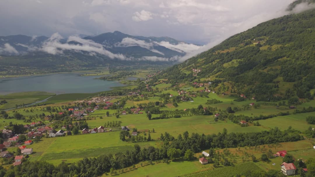
Plav is a small mountain town in northeastern Montenegro, dramatically positioned on the shores of Plav Lake (Plavsko Jezero) at an altitude of 906 metres. Backed by the soaring, snow-streaked peaks of the Prokletije Mountains — known in English as the "Accursed Mountains" — Plav is one of Montenegro's most remote and scenically stunning destinations. The town has a distinctive character shaped by centuries of Montenegrin, Albanian, and Bosniak cultural influences, making it feel unlike anywhere else in the country. Mosques and churches stand within walking distance, Turkish-style bazaar streets mix with Yugoslav-era buildings, and the surrounding countryside echoes with pastoral traditions that have endured for centuries.
For adventurous travellers, Plav is the gateway to Prokletije National Park, Montenegro's newest national park (established in 2009) and home to some of the wildest, most dramatic alpine terrain in the entire Balkans. With pristine glacial lakes hidden in high cirques, towering peaks exceeding 2,500 metres, and virtually empty hiking trails through landscapes that feel more like Patagonia than Europe, the Plav region richly rewards those willing to venture off the beaten path. This is frontier travel in the best sense — challenging, authentic, and unforgettable.
How to Get There
Plav lies in Montenegro's far northeast, approximately 170 km from Podgorica (3-3.5 hours by car). The most common route follows the E65 highway north from Podgorica through the Morača Canyon to Kolašin, then continues northeast through Andrijevica to Plav. The final 30 km from Andrijevica passes through a beautiful valley with the Prokletije peaks growing progressively more dramatic ahead of you.
An alternative route from Podgorica goes via Berane (approximately the same distance but sometimes faster depending on road conditions). From the coast, Plav is a solid 5-hour drive from Budva or Kotor, making it a destination that requires commitment — but the journey itself, through some of Montenegro's most spectacular mountain scenery, is part of the reward.
Regular bus services run from Podgorica to Plav with 2-3 departures daily (approximately 4 hours, 10-12 euros). Buses also connect Plav to Berane (1 hour) and, less frequently, to Gusinje (15 minutes). The bus station is in the town centre. There is no airport or railway anywhere nearby.
Within Plav, the town centre is compact and easily walkable. A car is essential for exploring the surrounding mountains, lake shores, and the road to Gusinje (10 km south) and the Albanian border beyond. There is no formal car rental in town, so arrange one in Podgorica before driving up. Local taxis operate at very reasonable prices (a trip to Gusinje costs about 5-7 euros).
Best Time to Visit
The hiking and outdoor season runs from June through September, when mountain trails are free of snow and wildflowers blanket the high meadows in extraordinary displays of colour. July and August are warmest, with daytime temperatures of 20-28°C in town, though afternoon thunderstorms are common at altitude and can develop very quickly. June sees the last of the snowmelt filling waterfalls and streams to their fullest.
Climate at a glance
Best time: April · May · October
May and October are transitional months — cooler (10-18°C) but often with clear, stable weather and far fewer visitors. These shoulder months can be excellent for lower-altitude hiking and exploring the lake and town. The Prokletije peaks above 2,000 metres may still have snow patches in early June and can see early snowfall by late September.
Winters are cold and snowy, transforming the area into a dramatic white landscape. Plav receives significant snowfall and temperatures can drop below -15°C. Tourist infrastructure is minimal in the off-season, but for those seeking solitude and winter mountain scenery, it is starkly beautiful. The lake partially freezes in the coldest winters.
Top Things to See and Do
Plav Lake (Plavsko Jezero)
Plav Lake is the largest natural glacial lake in Montenegro, stretching over 2 km in length and up to 9 metres deep, surrounded by mountain meadows and framed by the towering Prokletije peaks. The lake is popular for fishing (it holds trout, carp, and chub), swimming in summer (the water warms to a pleasant 20-22°C by July), and peaceful lakeside walks along the footpath that follows part of the southern shore.
At sunrise, with mist rising from the still water and the mountain reflections crisp in the morning light, Plav Lake is one of the most beautiful sights in Montenegro. Small boats are available for hire on the lakefront, and kayaking is possible though you'll need to bring your own equipment. The lakeshore is also a popular spot for local fishermen, and watching them cast their lines as the sun sets behind the mountains is an evocative end to any day.
Prokletije National Park
Prokletije National Park protects the Montenegrin portion of the Accursed Mountains, a range that extends across Montenegro, Albania, and Kosovo with peaks exceeding 2,690 metres (Maja Jezerca, the highest, lies just across the Albanian border). The Montenegrin section includes spectacular glacial cirque lakes, dramatic limestone peaks, alpine meadows, and some of the most pristine wilderness in Europe.
The park's most popular hiking destinations from the Plav side include Hridsko Jezero (Visitor's Lake) — a stunning turquoise cirque lake at 1,970 metres altitude, reachable by a marked trail taking 4-5 hours from the trailhead — and Bukumirsko Jezero (Bukumir Lake), another glacial lake at 1,443 metres. Both hikes require good fitness and proper equipment. The park supports brown bears, wolves, chamois, and golden eagles, and its wildflower meadows in June and July — filled with gentians, orchids, and edelweiss — are among the finest in the Balkans.
The Old Town and Redžepagić Tower
Plav's small Old Town features a charming mix of Ottoman-era wooden houses with protruding upper floors (čardaci), a 16th-century mosque, and narrow bazaar streets. The most important historical monument is the Redžepagić Tower (Kula Redžepagića), a fortified stone tower house dating to the 18th century that once served as the seat of the region's most powerful family. The tower is partially restored and offers a glimpse into the feudal life of the Albanian and Bosniak beys who dominated the region under Ottoman rule.
Walking through the old quarter, you'll notice the multi-ethnic character of Plav — Bosniak, Albanian, and Montenegrin Serb communities have coexisted here for centuries. This cultural mosaic, with its distinct architecture, cuisine, and traditions, gives Plav a richness and depth that is unique in Montenegro.
Peaks of the Balkans Trail
Plav is a key stop on the famous Peaks of the Balkans long-distance trail, a 192 km circular route through Montenegro, Albania, and Kosovo that has become one of Europe's most celebrated trekking routes since its inauguration in 2013. The trail passes through Plav and nearby Gusinje, with stages leading over high passes into Albania's Valbona Valley and Kosovo's Rugova Gorge. Even if you're not hiking the whole trail, several day stages starting from Plav offer world-class mountain trekking through remote valleys and over high passes with panoramic views.
Ali Pasha Springs (via Gusinje)
Just 15 km south of Plav, near the village of Gusinje, the Ali Pasha Springs (Ali-Pašini Izvori) are one of Montenegro's most extraordinary natural phenomena — vivid turquoise karst springs erupting from beneath a sheer cliff face. The springs are easily combined with a Plav visit and should not be missed. See our Gusinje guide for full details.
Fishing on Plav Lake and Mountain Streams
The Plav area is one of Montenegro's best destinations for freshwater fishing. Plav Lake holds brown trout, carp, and chub, while the mountain streams flowing down from the Prokletije are rich with wild brown trout. Fishing permits are available locally and are very affordable. The Lim River, which flows through Plav, is another excellent fishing spot. Local guides can be arranged through guesthouses for those wanting to explore the more remote streams.
Day Trip Suggestions
Gusinje and Ali Pasha Springs: The small mountain village of Gusinje, just 10 km south, is the gateway to the Ali Pasha Springs and the Grbaja Valley. Allow a full day to explore the springs, hike into the valley, and experience the village's unique atmosphere.
Hridsko Jezero (Visitor's Lake): This stunning glacial lake at 1,970 metres is one of the most beautiful mountain lakes in the Balkans. The hike from the trailhead above Plav takes 4-5 hours one way — make it a full-day excursion and start early.
Andrijevica and the Komovi Mountains: The small town of Andrijevica, 30 km west, sits at the base of the Komovi mountain group, which offers challenging hiking to peaks above 2,400 metres. The views from the Komovi summits rival anything in the Alps.
Where to Eat and Drink
Restoran Jezero — Overlooking the lake, this family-run restaurant serves freshwater fish (trout and carp from the lake), traditional burek, grilled meats, and home-style Montenegrin dishes. Their tavče gravče (slow-baked beans) and home-baked bread are simple but excellent. In summer, the lakeside terrace is the best spot in town for a meal.
Local bakeries: Plav's bakeries serve some of Montenegro's best burek and pita (filled pastries with cheese, spinach, or meat). Fresh from the oven in the morning, they cost under a euro and are enormously satisfying — perfect fuel for a day of hiking.
Guesthouse meals: Many of Plav's guesthouses offer home-cooked evening meals featuring local specialities: slow-roasted lamb, stuffed peppers, fresh salads from kitchen gardens, homemade bread, and the inevitable homemade rakija to start. These family meals are often the culinary highlight of a Plav visit — ask your host about dinner when you check in.
Tea and coffee culture: Plav's Ottoman heritage is evident in its coffee culture. Several small cafés in the old town serve traditional Bosnian-style coffee (bosanska kafa) prepared in a copper džezva and served with sugar cubes and rahat lokum (Turkish delight). Taking an hour to sit and sip coffee in one of these cafés is an essential Plav experience.
Where to Stay
Accommodation in Plav ranges from small guesthouses and family-run pensions to apartments near the lake. The experience tends toward the authentic and personal — expect warm hospitality, home-cooked meals, and local knowledge freely shared. Options are more limited than in coastal resorts, so booking in advance during the July-August peak is wise.
Several guesthouses are located along the lake shore, offering direct water access and mountain views. In town, simple pensions provide clean, comfortable rooms at very affordable prices (typically 20-35 euros per night including breakfast). For the best selection of vetted properties, check montenegro.com for available properties in the Plav area, where you can find authentic mountain hospitality at excellent value.
Practical Tips
Bring cash — ATMs exist in Plav but can be unreliable. Most small businesses, guesthouses, and restaurants in Plav and surrounding villages don't accept cards. Withdraw enough cash in Podgorica or Berane before arriving.
Carry good hiking boots, rain gear, and warm layers if venturing into the Prokletije, even in midsummer. Weather changes rapidly above 1,500 metres, and hypothermia is a real risk in sudden storms.
The road from Plav to Gusinje and onward to the Albanian border at Valbona is a stunning 20-minute drive through dramatic mountain scenery — don't miss it even if you're not crossing the border.
Mobile phone signal is patchy to nonexistent in the mountains. Download offline maps (Maps.me or Google Maps offline) before heading out on any trails.
Locals are incredibly hospitable — if invited for coffee or rakija by a Plav resident, it's polite to accept. These spontaneous encounters are often the most memorable part of a visit.
The Peaks of the Balkans trail requires no special permits for the Montenegrin sections, but if you plan to cross into Albania or Kosovo, carry your passport and check visa requirements.
Stock up on hiking supplies (snacks, water purification, first aid) before leaving Podgorica — options in Plav are limited.
If planning to hike to Hridsko Jezero or other high-altitude lakes, consider hiring a local guide through your guesthouse. The trails can be faint in places, and local knowledge is invaluable for weather, route finding, and wildlife awareness.
Photography opportunities are extraordinary. The lake at sunrise, the Prokletije peaks at sunset, and the atmospheric old town all reward a photographer's patience.
Lake Plav: a measured water system
Montenegro's 2024 register of nationally significant waters is the clearest baseline. It places Lake Plav at 907 metres, with a surface area of 1.99 km², shoreline of 7.52 km, average depth of 3.8 metres and maximum depth of 9.15 metres. The same register describes it as Montenegro's largest mountain lake by surface area.
The hydrology is simple enough to orient a visit. The Ljuča enters the lake; the Lim leaves it and runs north. Plav lies immediately against the northern and northeastern side. This is not an isolated blue bowl: it is a shallow link in a river system, bordered by settlement, fields, wet margins and roads.
Shallow does not mean harmless. Depth changes, cold water, vegetation, soft margins, wind and the absence of supervision can all matter. The lake's clear or calm appearance does not certify it for swimming, drinking or launching a craft. Ask the Tourist Organisation of Plav or a competent current operator where an activity is allowed, what equipment is supplied and whether conditions are suitable that day.
The water body also needs restraint. A government lake study describes sediment and vegetation pressures and confirms the Ljuča–lake–Lim connection. Use established access; do not drive onto wet meadow, push through reeds for a photograph or treat a quiet bank as a private launch.
Plav town: heritage without a single neat date
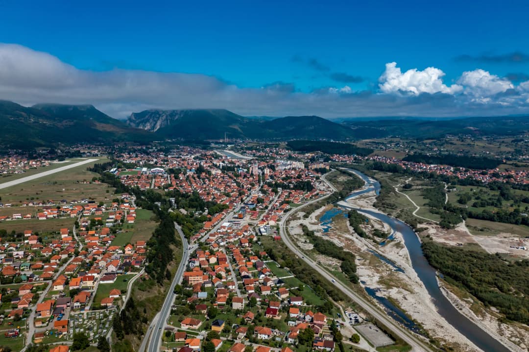
The local tourism organisation describes Plav as concentrated around the lake and the Lim within the northeastern Plav–Gusinje basin. That geography explains the compact first impression: water, cultivated land, religious buildings, towers, homes and steep mountain horizons share one view.
Redžepagić Tower is the most useful place to learn how carefully the town's past must be read. Plav's municipal cultural inventory lists it as a protected secular building from the second half of the 17th century. The detailed tourism page for the tower says the builder has not been established with certainty, records an attribution to Hasan-beg Redžepagić in 1671, and separately preserves a tradition that reaches back to the 15th century.
Those accounts should not be flattened into an invented exact birthday. What is clearer is the building type: a residential-defensive tower with thick stone lower walls, small defensive openings and a timber upper element. The local page says it became a museum in 1979 and has housed costume, handicrafts and tools since 2011. That is historical context, not a live opening schedule. Confirm interior access before structuring the day around it.
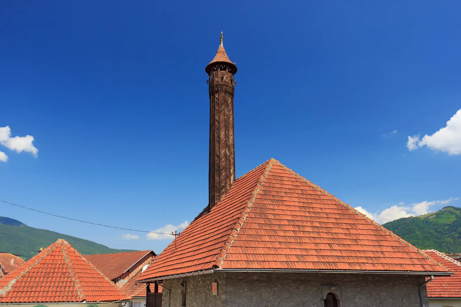
The inspected production photograph shows a stone mosque and wooden minaret in Plav. It is presented as living religious architecture, not used to identify an exact building or construction date.
The same municipal inventory includes the Old Imperial Mosque and Holy Trinity Monastery in Brezojevica among protected immovable heritage. These are community and religious places, not a themed display. Dress and speak with ordinary respect, do not block entrances, and ask before photographing interiors, worshippers or residents. For a longer heritage corridor north through Brezojevica and Murino, use the dedicated Plav-to-Murino guide.
One tower, three levels of certainty
Source of claim
Dating
Confidence
Inventory
Second half of 17th century
Documented record
Attribution
1671
Attributed
Tradition
Reaches to the 15th century
Oral tradition
Builder
Uncertain
Preserve the disagreement
Source: plav.me, plavto.me
Prokletije: use Plav as a base, not as a trailhead label
Prokletije National Park was established in 2009. National Parks of Montenegro gives an area of 1,660 hectares across the municipalities of Plav and Gusinje. The park is only part of the much larger Prokletije massif, so “in Prokletije” does not automatically mean “inside the national park,” and “from Plav” can describe a transport direction rather than a walk beginning in town.
The official park page identifies Zla Kolata at 2,534 metres and highlights Hridsko Lake. The park's July 2026 guidance places Hridsko at 1,970 metres, surrounded by molika pine, within a strict nature reserve. That is a reason for conservative behaviour: stay on the intended route, do not cut vegetation, move deadwood, build fire rings or turn folklore about bathing and coins into visitor practice. The specialist Hridsko Lake guide explains its hydrology, disputed basin origin and route choices in depth.
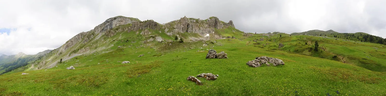
The inspected production panorama shows open alpine meadow and a broken ridge. It is not route evidence: the exact location, peak and present trail conditions are not established by the photograph.
Official route figures—and what they do not mean
The park's active-holiday directory lists a Hridsko Lake trail segment as 3.1 km, linear, “easy,” and about one hour. It also lists the Grbaja–Volušnica–Popadija–Grbaja circuit as 10.2 km, “medium,” and about 5 hours 30 minutes. Those labels and times belong to the publisher, not to every visitor.
Most importantly, the 3.1 km figure is not the distance from Plav town to Hridsko Lake. Reaching the stated trail requires a separate approach whose road condition, start point and parking need confirmation. Grebaje is on the Gusinje side. Residual snow, heat, storms, fire restrictions, erosion and daylight can transform the practical difficulty of either plan.
Park fees in 2026
The current official Prokletije price page lists a €3 day ticket per person, including the visitor centre and educational trails. It separately lists guide services at €40 for four hours and €80 for eight hours, plus rentals and parking charges. A December 2025 park notice launched a €13.50 annual ticket for 2026 covering all five national parks.
Prices, payment points, guide availability and rental stock are operational details: recheck them directly before relying on them. The visitor centre is in Gusinje, not central Plav. Children under 15 are exempt from entry and visitor-centre/educational-trail fees under the park's general ticket information, but families should still confirm any rental or guided-service charge.
Food, evenings and the value of staying two nights
The park's gastronomy page identifies kačamak, gotovac, cicvara, cheeses, dairy products, meat, pies and preserved vegetables as regional food traditions. Treat that as a vocabulary for asking what a kitchen actually serves—not a guarantee that every restaurant offers every dish, or that one recipe represents every household.
Two nights make Plav more useful. Arrival day can absorb a delayed bus or long road journey; the next morning can begin with a live mountain check; and the final morning leaves room for the lake and tower if weather cancels the hike. That is a stronger plan than making a summit, museum interior and onward connection all depend on one rigid day.
Getting there and practical 2026 planning
The Tourist Organisation of Plav gives the usual route from Podgorica via Kolašin, Ribarevina and Berane as about 180 km. Use the distance for orientation, not a fixed drive time. Check road conditions through the Automobile and Motorcycle Association of Montenegro, allow for works and weather, and avoid building a tight airport connection around a best-case map estimate.
Bus claims age quickly. Confirm the exact operator, departure date, stop, ticket method, luggage rules and return before travel. A car provides flexibility for trailhead approaches, but it does not create parking rights on meadow, forest road or private land. Save maps offline and refuel before remote excursions.
For mountain days: Montenegro's tourism authority advises checking the forecast, using marked trails, wearing layered clothing and durable non-slip footwear, and carrying sufficient water, a charged phone and a flashlight. Add an offline track, power reserve, food, sun protection and a turnaround time. Ask the park about snow, closures, fire restrictions and route marking. For cross-border hiking, use the Montenegro–Albania planning guide and obtain current permission rather than following an informal line across the frontier.
Emergency: call 112 in Montenegro. Give coordinates, the named route or nearest settlement, group size, injury and immediate hazards. Mobile reception is not guaranteed, so tell someone your plan and expected return before leaving.
A realistic two-day Plav plan
Day 1 morning: orient from an established lakeside point. Identify the settled northern shore, Ljuča inflow direction and Lim outflow without entering reed beds or private fields.
Day 1 afternoon: walk central Plav, view Redžepagić Tower and nearby religious architecture respectfully. Confirm rather than assume interior access.
Day 1 evening: contact the park or a licensed guide, check mountain weather, download the named route and decide whether Day 2 remains viable.
Day 2 option A: make one properly planned Prokletije outing—Hridsko, Grebaje/Volušnica or another named route—not a collection of distant pins.
Day 2 option B: if conditions are poor, stay low: return to Lake Plav, extend through Brezojevica, or use the Gusinje regional guide for a basin-scale cultural day.
Build flexibility before elevation
Stage
What happens
Day 1 · Lake + town
Orientation · heritage · live checks
Forecast + route check
Conditions decide the branch
Conditions suitable
One named mountain route
Conditions poor
Low-level basin alternative
Source: plavto.me, montenegro.travel
A Brief History of Plav
The Plav area has been inhabited since antiquity, with archaeological evidence of Illyrian settlements in the surrounding mountains. The name Plav derives from the Slavic word for "blue" or "flooded," referring to the lake that dominates the landscape. During the medieval Serbian state, the region was part of the broader Raškan territory, and several medieval churches and monasteries dotted the surrounding valleys.
Ottoman rule, which lasted from the 15th century until 1913, profoundly shaped Plav's character. Unlike much of Montenegro, which fiercely resisted Ottoman control, the Plav basin was firmly integrated into the Ottoman system. Many local families converted to Islam, and the town developed a distinctly Ottoman character with mosques, bazaars, and tower houses. The Redžepagić family became the most prominent local dynasty, and their fortified tower house (kula) still stands as the town's most important historical monument.
Plav was among the last territories incorporated into Montenegro, joining the kingdom only after the Balkan Wars of 1912-1913. This late incorporation, combined with its geographic isolation, has preserved a cultural identity that remains distinctly different from the rest of Montenegro. The town's multi-ethnic character — with Bosniak, Albanian, and Montenegrin Serb communities living side by side — gives it a cultural richness and complexity that is fascinating to experience.
Quick answers
When is the best time to visit Plav?+
The hiking and outdoor season runs from June through September, when mountain trails are free of snow and wildflowers blanket the high meadows in extraordinary displays of colour. July and August are warmest, with daytime temperatures of 20-28°C in town, though afternoon thunderstorms are common at altitude and can develop very quickly.
The Tourist Organisation of Plav gives the usual route from Podgorica via Kolašin , Ribarevina and Berane as about 180 km . Use the distance for orientation, not a fixed drive time. Check road conditions through the Automobile and Motorcycle Association of Montenegro, allow for works and weather, and avoid building a tight airport connection around a best-case map estimate.
Restoran Jezero — Overlooking the lake, this family-run restaurant serves freshwater fish (trout and carp from the lake), traditional burek , grilled meats, and home-style Montenegrin dishes. Their tavče gravče (slow-baked beans) and home-baked bread are simple but excellent.
Accommodation in Plav ranges from small guesthouses and family-run pensions to apartments near the lake. The experience tends toward the authentic and personal — expect warm hospitality, home-cooked meals, and local knowledge freely shared.
Pavle Obradović is from Herceg Novi. He was Manager of Montenegro.com, then Director of the Herceg Novi Tourism Organization, and is now Coordinator for Investment and Development Projects at the Municipality of Herceg Novi. He holds a BSc in International Hospitality and Service Management from the Rochester Institute of Technology (RIT).
···
Updated · Originally published
Montenegro Travel Newsletter
Get weekly stories, guides, and insider tips about Montenegro delivered to your inbox.