Podgorica's history is easiest to understand as a landscape of overlapping centres, not a city that merely changed its name five times. Roman Doclea developed near the Zeta and Morača; medieval records identify Ribnica and later Podgorica; Ottoman rule reshaped the settlement around Stara Varoš; twentieth-century bombing destroyed much of the prewar fabric; and socialist Titograd expanded across the river. Modern Podgorica contains evidence of all those phases, but they are not interchangeable names for one continuously preserved urban core.
The city's chronology becomes clearer when documented dates are separated from local tradition and later interpretation. This guide follows the visible layers from Doclea to Titograd and turns them into a practical historical walk. For transport, seasonal planning and a general itinerary, use our companion practical Podgorica city guide.
Podgorica's historical layers at a glance
| Layer | Secure point | Where to look | Important limit |
|---|---|---|---|
| Ancient Doclea | Roman-period remains begin in the early first century CE | Archaeological site north-west of the centre; City Museum collections | Doclea is not simply an old name for the present city |
| Medieval Ribnica / Podgorica | The city records “Podgorica” in a 1326 Kotor archive document | Ribnica–Morača confluence and surviving religious sites | Material remains do not prove every later origin story |
| Ottoman Podgorica | Official city chronology dates Ottoman control from 1474 | Stara Varoš, Clock Tower, mosques and street pattern | The quarter is fragmentary and lived-in, not an intact museum |
| Montenegrin and Yugoslav city | Podgorica entered Montenegro after the 1878 Berlin settlement | Nova Varoš street grid and civic centre | Political transfer and urban rebuilding were processes |
| Titograd and modern capital | Republican capital from 13 July 1946; Podgorica name restored 2 April 1992 | Bridges, blocks, institutions and the east–west city | Postwar modernism should not be treated as an absence of history |
| Centre | Period | Note |
|---|---|---|
| Doclea | early 1st c. CE | Ancient centre |
| Podgorica name | 1326 record | Medieval Ribnica and Podgorica |
| Ottoman phase | 1474 | Stara Varoš |
| Montenegro | 1878 | Post-1878 expansion |
| Titograd | 1946–1992 | Socialist period |
Source: podgorica.me, podgorica.travel, muzeji.podgorica.me
Before Podgorica: Doclea is a neighbour, not a former street plan
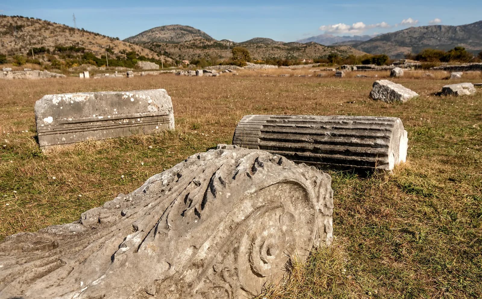
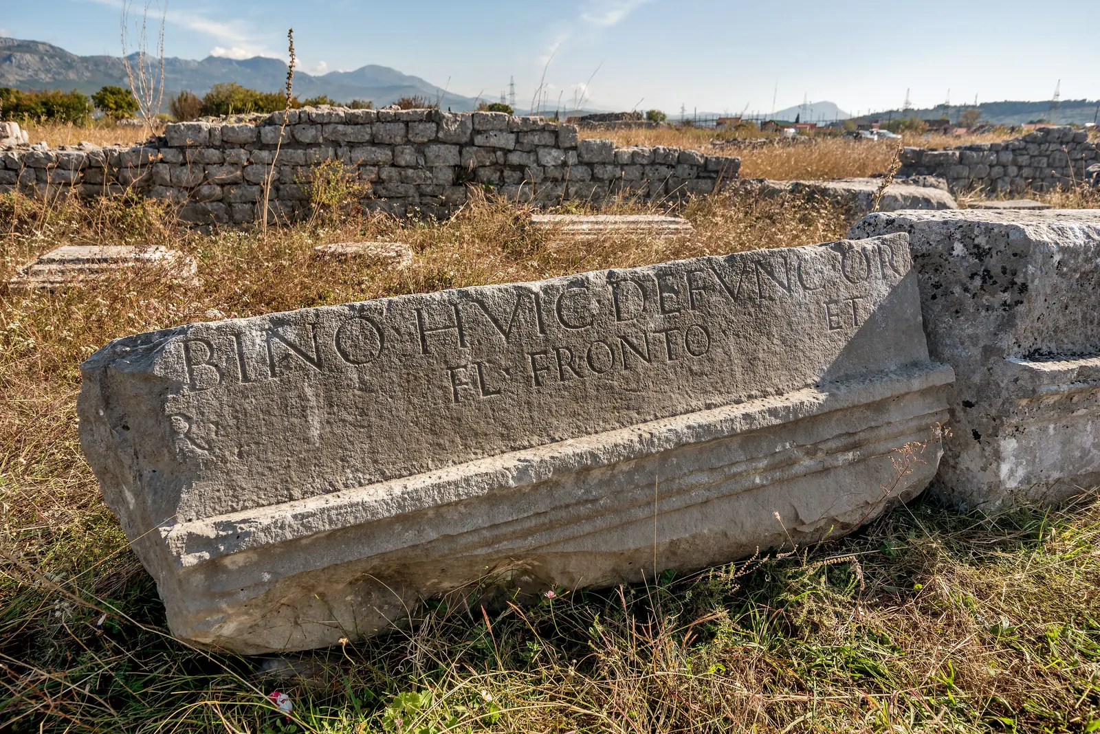
The most visible ancient urban evidence lies at Doclea, around four kilometres from today's centre near the meeting of the Zeta and Morača. The Tourism Organisation of Podgorica dates the surviving Roman-period remains from the first decade of the first century CE. The archaeological department of the Museums and Galleries of Podgorica describes a collection built through research at Doclea and other sites, including prehistoric, Roman and medieval material.
Doclea was a major ancient settlement in the same wider landscape, but it was not simply modern Podgorica under an earlier name. Names in classical geography, later civic narratives and excavated settlements do not automatically refer to one continuous street grid. Its importance is best understood as a regional urban predecessor rather than as the first stage of an unbroken modern city.
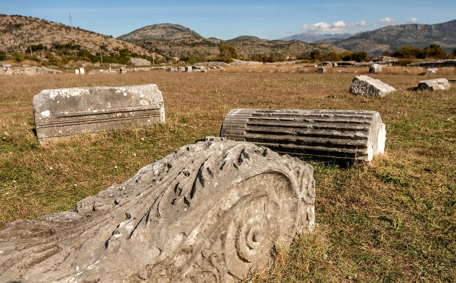
Visit the City Museum before or after the site if interpretation matters to you. Its archaeological department currently publishes regular hours, but operational details can change. Doclea itself should not be assumed to have staff, shade, toilets or step-free routes on the day of a visit. The distinction between collection and site is useful: one preserves objects and context; the other makes the river plain and urban scale legible.
Ribnica, the 1326 name and the danger of a perfect origin story
Medieval Podgorica is present in both record and place, but not as a fully preserved medieval town. The Capital City's official chronology says Podgorica is first recorded under that name in a 1326 document held in the Kotor archive. It links the name to Gorica hill. Earlier Ribnica remains part of the city's historical vocabulary, especially around the river confluence, but no single founding date explains the gradual development of the settlement.
The Church of St George beneath Gorica is a better example of cautious dating. The official tourism organisation places it broadly between the ninth and eleventh centuries and notes later rebuilding. That range communicates antiquity without pretending the present fabric belongs to a single construction event. The source does not establish current opening, service or visitor-access conditions, so verify before attempting entry.
| Evidence level | What it supports |
|---|---|
| Documented | Podgorica name appears in a 1326 Kotor archive record |
| Broadly dated | St George: 9th–11th centuries, with later rebuilding |
| Traditional | Sastavci bridge's Roman origin is presented as belief |
Source: podgorica.me, podgorica.travel
The small stone bridge at Sastavci makes the same point. The tourism organisation reports a belief that it is Roman, rather than presenting a confirmed archaeological date. Its value does not depend on winning an antiquity contest. The confluence, bridge, surviving masonry and later city together show how residents repeatedly used the same topography.
Ottoman Podgorica: what survives in Stara Varoš
The Capital City dates the start of Ottoman control to 1474. The tourism organisation describes Stara Varoš as the Ottoman-period core between 1474 and 1879 and dates the Clock Tower to the eighteenth century. Today the quarter retains a different scale from the modern centre: low buildings, narrower streets, religious sites and the tower. But destruction and redevelopment mean it should not be advertised as a complete Ottoman ensemble.
Read it in fragments. The Clock Tower is an urban marker, not evidence that every surrounding building is contemporary. Mosque buildings are part of the quarter's sacred architecture; if entry is permitted, follow posted rules and avoid interruption. The street pattern helps explain movement between the Ribnica and later commercial areas. For comparison with a smaller fortified settlement in the same broad plain, our history of Spuž shows how Ottoman military geography worked beyond the capital.
Stara Varoš also complicates the phrase “turbulent history.” Political labels alone can erase ordinary life, religious plurality and incremental building. The official chronology supplies dates; the surviving district supplies scale; neither provides a complete social history. A visitor should resist turning the quarter into an exotic contrast with “European” Nova Varoš.
1878, Nova Varoš and a capital growing beyond the old core
The Congress of Berlin settlement in 1878 brought Podgorica into the Principality of Montenegro. The city then expanded beyond Stara Varoš, and a more regular street grid developed in Nova Varoš. This shift is easier to read in the relationship between the two quarters than through a single population snapshot.
This period should not be reduced to replacement of an “oriental” town by a “modern” one. Cities absorb administrative systems, property patterns, migration and building practices unevenly. The river still divided and connected neighbourhoods; markets and religious communities persisted; new civic ambition appeared beside older fabric. The Zeta plain remained economically important, a relationship still visible in the capital's food and wine geography. Our Montenegro wine-route guide follows that wider landscape without claiming Podgorica's urban history began in a vineyard.
| Zone | Character |
|---|---|
| Stara Varoš | Ottoman core |
| Sastavci | confluence |
| Nova Varoš | later grid |
| East bank | postwar city |
Source: podgorica.me, podgorica.travel
World War II: bombing and reconstruction
Podgorica's official civic history says the city was bombed more than seventy times during World War II and liberated on 19 December 1944. The raids caused immense loss and transformed the physical city, leaving reconstruction as one of the defining forces in its later development.
The limited survival of prewar buildings does not mean Podgorica lacked earlier history. Destruction, clearance and subsequent rebuilding altered the street scene, while surviving quarters and monuments became isolated points within a rapidly changing capital. The postwar city grew from this rupture rather than replacing an empty landscape, and that contrast remains visible throughout the centre today.
| Wartime record | Detail |
|---|---|
| 70+ | bombings recorded |
| 19 December 1944 | liberation of the city |
Source: podgorica.me
Titograd: the capital moved into a different scale
Podgorica became the capital of the People's Republic of Montenegro under the name Titograd on 13 July 1946. Reconstruction and republican institutions expanded the city beyond its older quarters. Wide roads, residential blocks, public buildings and later bridges are historical evidence of a new political and demographic scale.
Socialist planning responded to destruction, housing demand, administration and mobility; it also produced uneven public space and later development pressures. The resulting landscape is part of the city's history, not a blank interval between older monuments and the present. Comparable twentieth-century transformations elsewhere in Montenegro—such as the remaking of the Piva landscape around a dam—are explored in our Piva history.
The name Titograd lasted until 2 April 1992, when Podgorica was restored. A name change did not erase the housing, institutions or daily routes built during the socialist period. Nor did it return the city to a prewar form. This is why a historical visit must cross the Morača instead of ending at the Clock Tower.

The modern capital: population and national importance
What the sources say
MONSTAT's final 2023 census release records 179,505 usual residents in Podgorica municipality, 28.78% of Montenegro's population. Municipality and compact city are not identical, but the figures establish the capital's national weight. Administrative, educational, transport and commercial roles explain why Podgorica can feel unlike resort Montenegro.
That concentration is visible during an ordinary walk. Ministries, universities, courts, cultural institutions and transport corridors sit within a city used daily by residents from across the country. Cafés and public spaces are part of working routines rather than a preserved visitor district. For travellers, this makes Podgorica most rewarding when approached as contemporary Montenegro's civic centre, with historical fragments embedded inside it, rather than as a conventional monument-to-monument destination.
Podgorica's importance rests on its measurable role as Montenegro's administrative, educational, transport and commercial centre. Promotional superlatives add little to that story. Contemporary image-making deserves the same scrutiny; our audit of global press coverage shows how repeated framing can harden into unsupported consensus.
Podgorica is still a practical gateway to the rest of the country. But “half an hour to the Adriatic” and “one hundred kilometres from everything” are not responsible planning statements: destination, route, traffic, works and weather vary. The country-level first-time Montenegro guide is a better tool for connecting the capital with coast and mountains. For cultural routes shaped by roads and working landscapes, the Orjen cultural-landscape guide offers a useful contrast.
Practical history walk: evidence in one day
Begin early at Stara Varoš and the Clock Tower, then continue to Sastavci and the Ribnica–Morača confluence. Cross into Nova Varoš, pause at the City Museum if open, and climb or skirt Gorica to place St George's church in the landscape. Use the afternoon for modern civic space and the east bank. Add Doclea only if you have transport, daylight and enough time to read an open archaeological site without rushing.
What the sources say
Heat materially changes this plan. MONSTAT's 2024 Statistical Yearbook records a July 2023 mean temperature of 29.6°C and an observed monthly absolute maximum of 40.9°C in Podgorica. Those are historical observations, not a forecast, but they explain why exposed ruins and midday road crossings are poor defaults in summer. Check current warnings, carry water, use shade and move indoor stops into the hottest hours. Winter visitors can consult our December Montenegro guide for seasonal context rather than assuming coastal operating patterns apply in the capital.
- Verify museum hours. The archaeological department publishes hours, but exhibitions and holidays change access.
- Do not climb ruins. Doclea is cultural heritage, not an adventure structure.
- Respect sacred sites. Treat churches and mosques as places where access may be restricted and follow posted rules.
- Keep layers separate. A Roman site, medieval record and Ottoman quarter answer different historical questions.
- Use current transport data. Check the municipal portal before relying on a route or departure.
Frequently asked questions
Was Doclea the original name of Podgorica?
That formulation is too simple. Doclea was an important ancient settlement in the same wider landscape. Modern Podgorica developed through later centres and records. Treat Doclea as a regional urban predecessor, not the identical city under an earlier label.
When was Podgorica first mentioned?
The Capital City's official history records the name in a 1326 document from the Kotor archive. That is a first recorded mention, not necessarily the date a settlement began.
When did Podgorica become Titograd?
The official chronology gives 13 July 1946, when Titograd became capital of the People's Republic of Montenegro. The name Podgorica was restored on 2 April 1992.
Was Podgorica completely destroyed in World War II?
The civic history says it was bombed more than seventy times. The raids caused extensive loss and were followed by major postwar rebuilding, but “completely destroyed” is too imprecise to describe a complex wartime record.
What is the best place to understand the city's history?
No single stop contains it. Pair Stara Varoš and Sastavci with the City Museum, Gorica and a modern east-bank walk. Add Doclea for ancient context if conditions and transport permit.