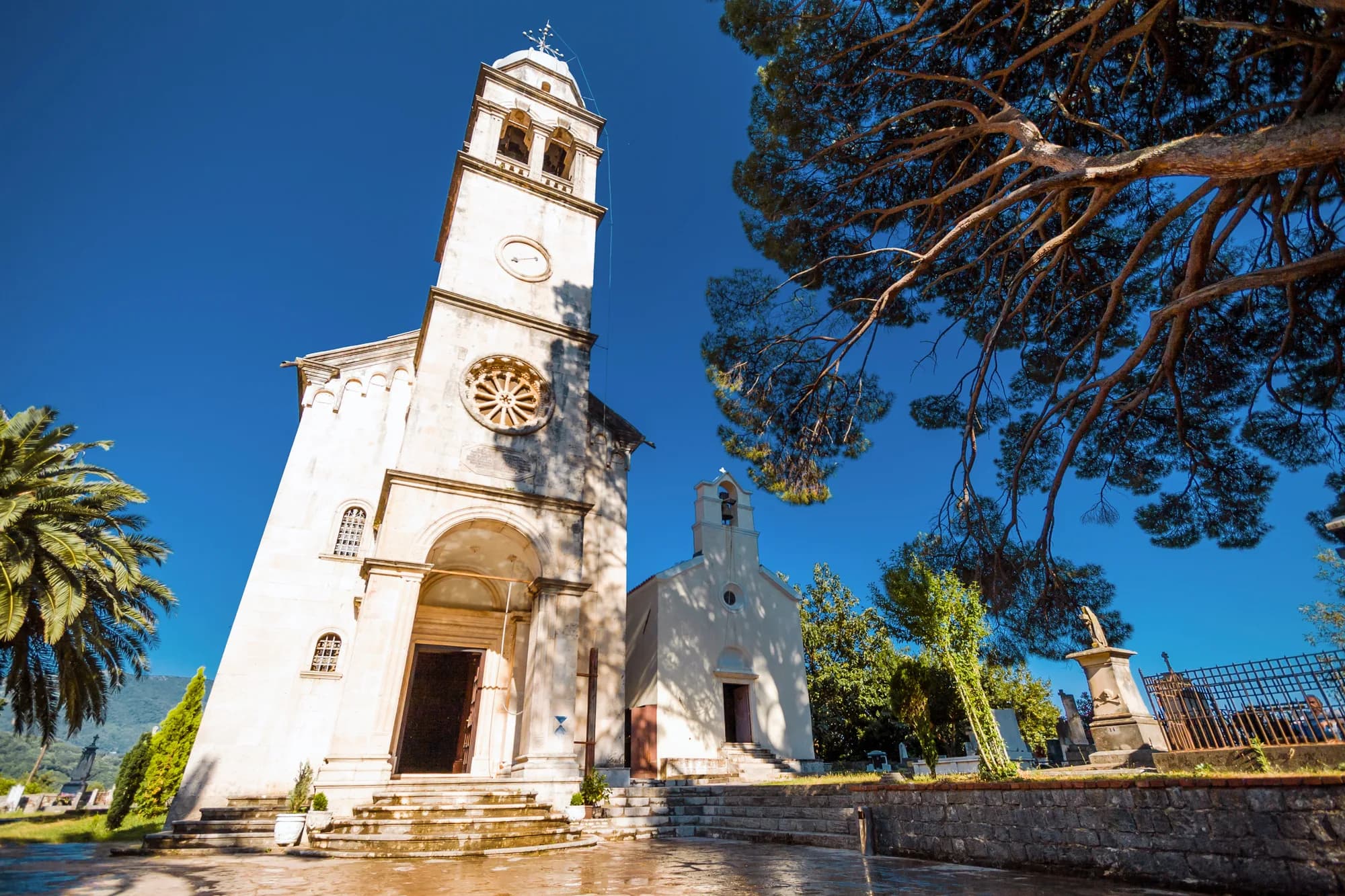
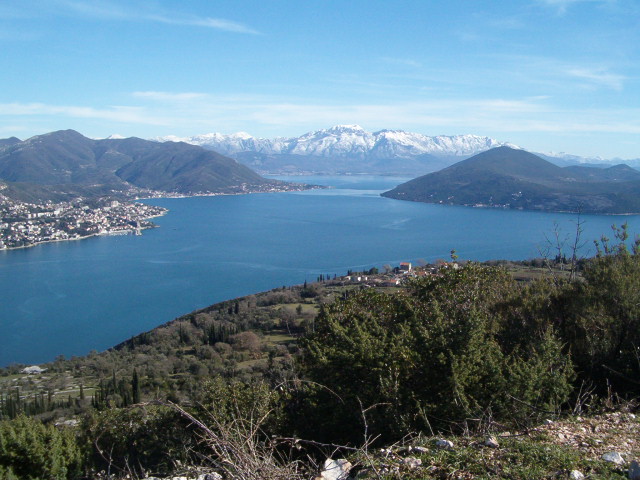
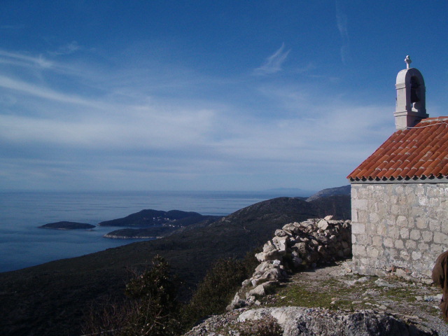
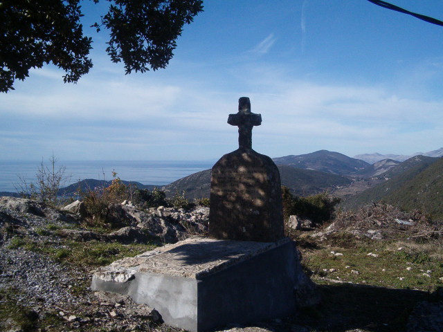
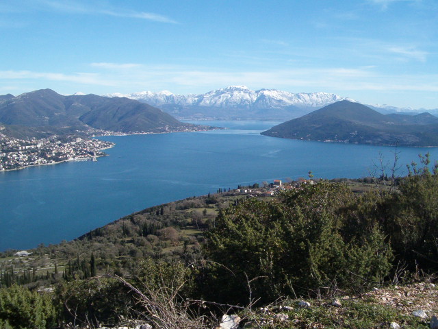
Ilinica is the ridge above Žvinje and Igalo where a small church, a grave and a stone monument connect Herceg Novi to the Napoleonic wars. The place is often introduced for its immense view over the Bay of Kotor and Konavle. Yet its real value lies in a more difficult story: French soldiers died here in 1806, and another generation of French soldiers erected their memorial in 1919.
This is not a signed urban attraction with predictable opening hours. It is an exposed, lightly interpreted border-area landscape reached through an inhabited village. Visit for history and perspective, but prepare as for a mountain walk, respect the grave and church, and never use an old photo essay as a substitute for current route knowledge.
What happened at Ilinica in 1806?
The Adriatic was caught inside the upheaval of the Napoleonic era. After French victories reshaped control of Dalmatia, forces under General Auguste Marmont advanced from the Dubrovnik direction against positions around Herceg Novi. A municipal account of the Ilinica commemoration says the soldiers remembered here fell on 29 and 30 November 1806. It describes a common grave of roughly ten men beside the Church of St Elijah.
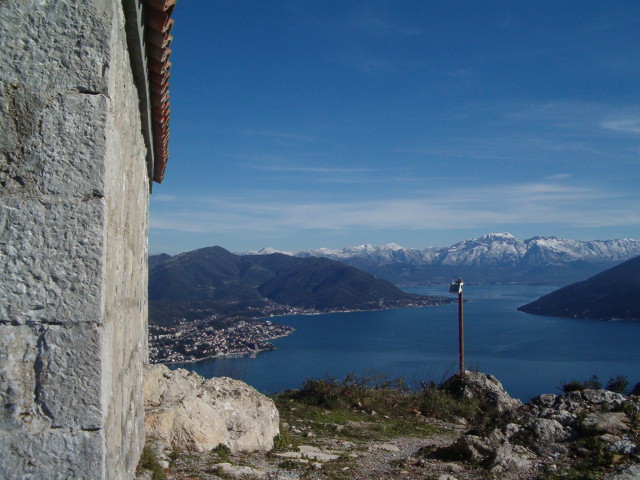
The ridge makes its strategic interest understandable without romanticising battle. It overlooks approaches to the bay, the Sutorina and Igalo area, and the coastal passage toward Konavle. Holding high ground could reveal movement below, but exposure, rough terrain and limited routes also made it dangerous. The landscape is evidence of why armies wanted the position, not proof of every tactical detail repeated in later storytelling.
| Year | Event |
|---|---|
| 1806 | Soldiers killed |
| 1919 | Memorial erected |
| 2023 | European network |
Source: hercegnovi.me
The 1919 monument: remembrance by another generation
The monument was not erected immediately after the 1806 fighting. Municipal and tourism sources identify its builders as French soldiers of the 126th detachment who were in the Bay of Kotor in 1919, after the First World War. They commemorated compatriots killed more than a century earlier. That chronological separation gives Ilinica unusual depth: veterans emerging from one European conflict marked the dead of another.
Later commemorations reinforced reconciliation rather than triumph. Representatives of the French Embassy, Herceg Novi municipality and the Avenir association have gathered at the site around Armistice remembrance. The language in the municipal record stresses victims and lessons of war, not victory by one people over another. The restrained approach suits a common grave better than the legacy headline “Conquest of Ilinica.”
Why Ilinica matters again in 2026
Herceg Novi joined the European Federation of Napoleonic Cities in 2023 because of Ilinica. In 2026, the municipality hosted the federation’s general assembly as part of Destination Napoleon, a certified European cultural route. The city’s assembly announcement explicitly connects membership to the grave and monument.
That international recognition does not transform Ilinica into a staffed attraction. It changes the interpretive frame. The site belongs in a network of places shaped by Napoleonic administration, movement and war, while remaining a local church landscape above Žvinje. Visitors should expect subtle heritage rather than a reconstructed battlefield.
Read the landscape in layers
Ilinica’s view can dominate attention. To the east and south lies the entrance to the Bay of Kotor; westward is Konavle in Croatia. Below are the settlements and routes through which people, goods and armies moved. Behind, the ground rises toward the Orjen system. This is where maritime and mountain histories meet.
Begin the wider story in the town. Our guide to Herceg Novi Old Town explains the fortifications that controlled the coast, while Boka’s prehistoric and ancient periods place the 1806 episode in a much longer human landscape. The Savina Monastery guide adds a religious and cultural counterpoint.
| Point | Direction |
|---|---|
| Ilinica | church + grave |
| Konavle | west |
| Orjen | inland |
| Igalo + bay | below |
Source: hercegnovi.travel
Planning the approach responsibly
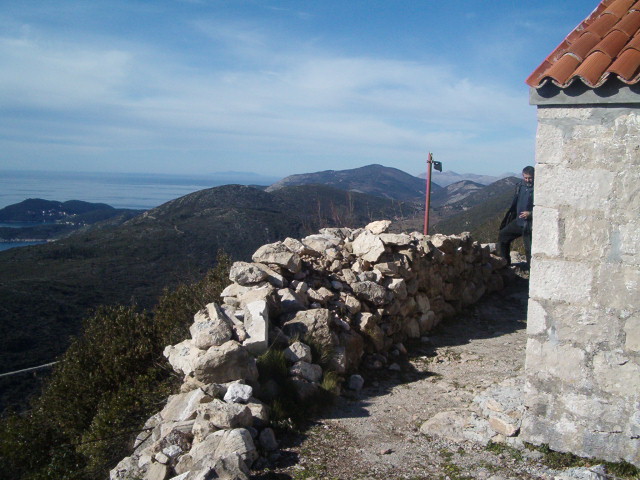
No current official source reviewed for this update provides a dependable public trail distance, duration, parking point or waymarking specification. For that reason, this guide does not repeat an old “half-day” promise. Conditions may change with vegetation, erosion, private access, road works or local maintenance. Historic photographs of a track are not proof of today’s surface.
Ask the Herceg Novi Tourism Organisation, a licensed local guide or accommodation host for current access through Žvinje. Share your plan with someone who is not walking. Carry an offline map, a charged phone, water, sun protection and a wind layer. Wear footwear suited to loose rock and thorny vegetation. If the route is unclear, turn back rather than improvising across terraces or private land.
Ilinica is close to the international border. Stay on confirmed Montenegrin paths and do not treat a ridge line as permission to cross. Border rules, land ownership and mobile-map lines are different things. If a local sign, barrier or resident indicates no access, respect it. For an easier introduction to the city’s upper and lower levels, use our Herceg Novi visitor guide.
| Question | Proceed only when | Turn back or change plan when |
|---|---|---|
| Route | A current local source confirms the approach | The path disappears, crosses a closure or enters private land |
| Weather | Heat, wind, cloud and fire risk are manageable | Visibility falls or an official warning applies |
| Time | There is ample daylight for the return | The margin depends on maintaining a fast pace |
| Group | Everyone has water, footwear and confidence | Anyone is unwell, overheated or anxious on exposure |
| Memorial | The area can be entered without disrupting worship | A service, commemoration or maintenance needs privacy |
Practical choice: independent walk or local guide?
Choose a local guide when nobody in the group knows the access, when vegetation may obscure minor paths, when historical interpretation is a main reason for going, or when a multilingual visitor needs help speaking with residents. A guide cannot cancel heat, fire risk or border restrictions, but can reduce uncertainty about the route and explain what the monument’s short inscriptions leave out.
An independent visit is reasonable only after obtaining fresh route information and matching it to the group’s ability. The lead walker should be comfortable reversing the route without signal. Keep the group together at junctions, agree on a turnaround time before departure and place the slowest comfortable pace at the centre of planning. Do not divide so that one person returns alone.
There is no shame in using a town-based alternative. The site does not become more historically meaningful because a visitor reached it during unsafe weather. Museum material, the Old Town fortifications and the municipal cultural-route story can provide a responsible introduction until conditions improve.
Before leaving, tell the group what will make the outing successful: reaching a safe viewpoint, understanding the memorial and returning with energy in reserve. A summit-style objective is the wrong measure here. The grave, church and village deserve attention without turning residents’ access roads into a race against the clock.
Weather, fire and exposure
The slope above Igalo can be much hotter than the waterfront because there is less shade and more reflected heat. Start early in warm months, carry more water than an urban walk requires and abandon the outing during heat warnings. In rain, limestone and leaf-covered rock become slippery. Low cloud can remove both the view and navigational landmarks.
Strong wind is another reason to shorten the visit, especially near exposed edges. During high fire danger, do not smoke, light flames or park over dry vegetation. If a fire or emergency blocks the route, call Montenegro’s emergency services and follow official instructions rather than attempting a shortcut.
| Check | Questions |
|---|---|
| Route | Locally confirmed? No closed access? |
| Weather | Heat, wind, cloud? Fire warning? |
| Margin | Enough water? Daylight to return? |
Source: hercegnovi.travel
At the church and memorial
Move quietly, cover shoulders and knees if entering a church is permitted, and never interrupt worship or maintenance. Do not climb, lean equipment against or rub inscriptions on the monument. Avoid moving stones or leaving flags, candles and objects unless a custodian has designated a place. Take litter back with you.
Photograph the memorial as a grave, not a prop. The people commemorated have no connection to a visitor’s costume, joke or victory pose. If another group is holding a remembrance, wait outside their space. The most useful interpretation distinguishes the men who died in 1806, the men who built the monument in 1919 and the later communities who maintain remembrance.
A better half-day context
Do not pair Ilinica with a long list of distant attractions. If you descend toward Igalo, Villa Galeb introduces a different twentieth-century political layer. In Herceg Novi, literary Topla and the town museum’s art and history provide weather-proof alternatives. Our Herceg Novi area guide helps choose a base without promising a trail transfer.
Frequently asked questions
Is Ilinica a formal tourist attraction?
No. It is a church and memorial landscape above Žvinje, without the dependable hours, staff or route infrastructure of a museum. Verify access locally.
Who is buried at Ilinica?
Municipal sources report a common grave of roughly ten French soldiers killed in fighting on 29 and 30 November 1806.
Why does the monument date from 1919?
French soldiers present in the Bay of Kotor after the First World War erected it to compatriots killed more than a century earlier.
Can I follow the route shown in the 2003 photographs?
Do not assume so. The photographs are historical records, not a maintained current track. Obtain fresh local guidance and respect private or closed access.
Is the border nearby?
Yes, the landscape is close to Croatia. Remain on confirmed Montenegrin routes and never cross a border away from an authorized crossing.