The Albanian-speaking centre of Krajina: chestnut woods above the steep south-western shore of Lake Skadar, eighteen kilometres from Bar in a straight line and forty-two by road.
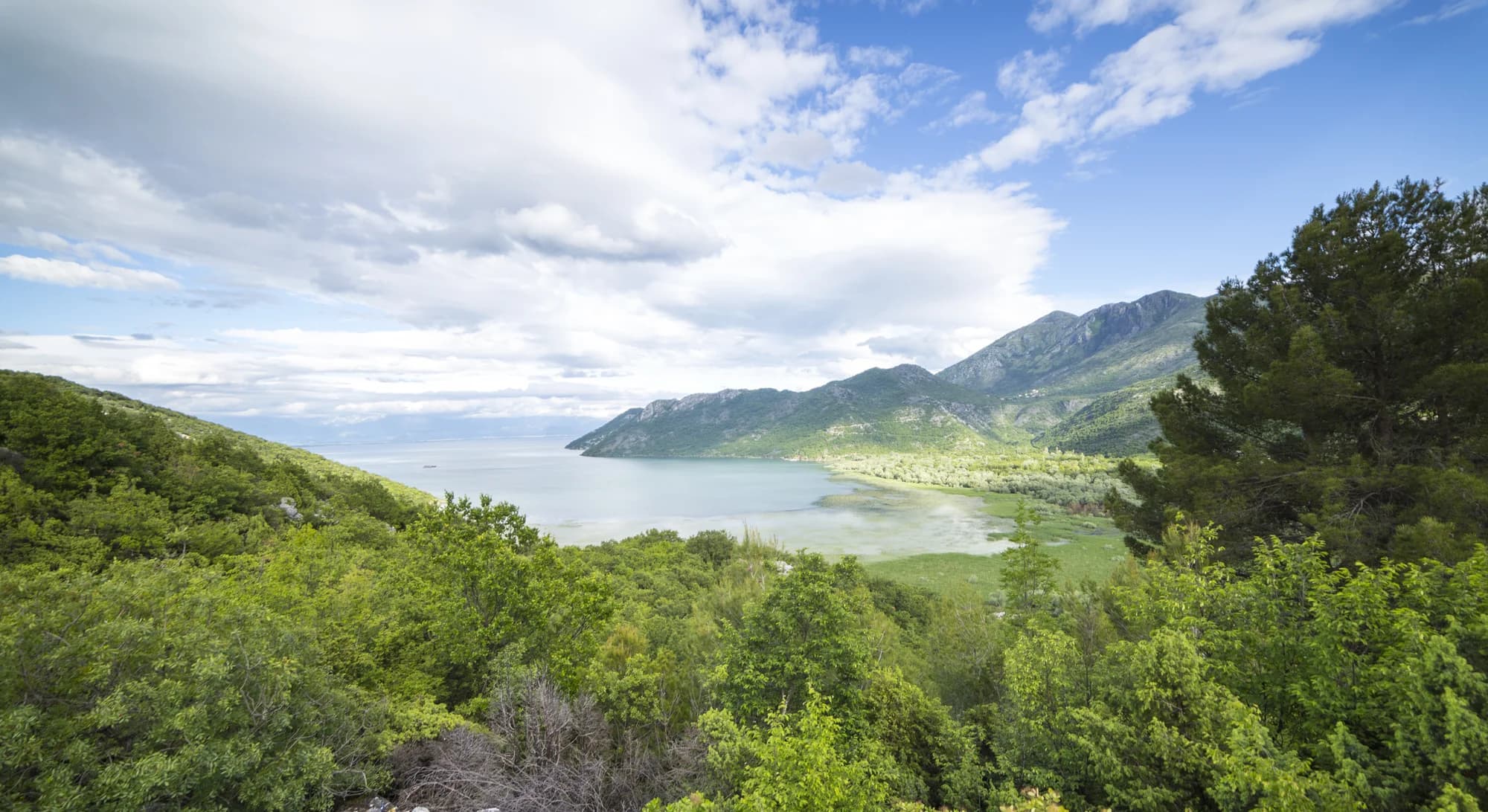
Ostroš is the main village of Krajina, the belt of hill country along the south-western shore of Lake Skadar in Bar municipality. It stands on terraced slopes above the water, with the lake spread out below and the long ridge of Rumija rising behind it, separating the basin from the Adriatic. The road that climbs out of Bar, crosses the mountain and drops down toward Ulcinj passes through here, which is why a settlement of this size has long acted as the local centre for the smaller hamlets scattered around it. The character of the place is agricultural and unhurried. Stone houses sit among olive groves, fig trees, vineyards and sweet chestnut woods, and the chestnut harvest still shapes the local autumn. Most families here are ethnic Albanian, and the village keeps its own language and cooking alongside the wider Montenegrin one. There is a school, a mosque and a few shops and cafés; anything more than that means driving down to Bar or round to Virpazar. What brings visitors is the lake. Below the village the shoreline at Murići has a pebble beach shaded by chestnut trees, and small boats run from there to Beška and Starčevo, two medieval island monasteries still in use. All of this lies inside Skadar Lake National Park, where pelicans, herons and cormorants feed among reed beds and summer carpets of water lilies. Fishermen still work the shallows from flat-bottomed boats. Ostroš suits travellers who want the lake without the tour buses and who are comfortable with a rented car and simple facilities. Late spring and September are the best months: the water is warm, the light is long, and the heat in the basin has eased. Autumn brings the chestnuts and the clearest views from the Rumija road.
Krajina by village
Residents by settlement, 2023 census
No village on this shore reaches 250 people. Ostros is the district’s centre by about fifty residents, and by having the school.
Which side of Rumija you live on
Residents by settlement, Bar municipality, 2023 census
Bar municipality holds 45,812 people and almost all of them face the Adriatic. On the lake side of the ridge the census figures run to three digits.
Who visits Montenegro
Share of foreign overnight stays, 2025
MONSTAT · 2025
Census population, Ostroš municipality
Veliki Ostros has lost two residents in five since 2003 — 416, then 332, now 244 — and Mali Ostros is down to 80. The emptying is older than the numbers: thousands of Krajina families left for Western Europe and the United States between the late 1960s and the early 1970s, and the district as a whole fell from 1,963 people in 2003 to 1,555 in 2011.
Krajina was a political centre of Duklja: Prince Vladimir’s court stood on this shore, by tradition on the Kraljič hillock at Koštanjica, three kilometres west. Widths are to scale.
Chronicle of the Priest of Duklja; Mijović & Kovačević (1975); Nemanja annexed Duklja in 1186; the 1485 defter of the Sanjak of Scutari, established 1479; the district’s western half passed to Montenegro in 1878, its eastern half in 1912; RTCG, July 2026.
A day in Krajina
A village of 244 has no rush hour — it has a road
Ostros reaches the press for two things: its chestnuts, and its road.
CdM The 11th Koštanijada draws several thousand people to Ostros on 20 November — honey, herbal teas, goat cheese and carp fresh from the lake on the stands.
Vijesti A travel column drives the Virpazar–Ostros–Stari Bar circuit of Panoramic Route 3 and likes everything about the Ostros leg except the road surface.
Feral (Bar) The 17th Krajinska koštanijada opens in Ostros on 15 November, inaugurated by Bar’s deputy mayor and folded into the programme for the town’s liberation day on the 24th.
RTCG Preparatory work starts on 17 km of the Ostros–Vladimir regional road: €15m before VAT and about €18m with it, contractor Putevi Bar, with bridge repair, a wider carriageway, retaining walls and landslide remediation.
Nearly seven years separate the complaint from the contract, and the contract covers the road south of Ostros, over to Vladimir in Ulcinj municipality — not the stretch back to Virpazar.
Meanwhile, in 1016
Prespa, 22 May 1016: Jovan Vladimir, ruler of Duklja, is beheaded in front of a church in the Bulgarian capital on the orders of Ivan Vladislav, the empire’s last tsar.
Krajina — his widow Kosara, daughter of Tsar Samuel, brings the body home and lays it in the church of the Virgin by Ostros, the one tradition credits to her. It stood there before him: her father-in-law Petrislav had already been buried in it. She was buried at his feet.
Constantinople: Basil II is grinding down what is left of the First Bulgarian Empire. It ends two years later.
England — Cnut the Great takes the throne after the death of Edmund Ironside, and Danish rule begins.
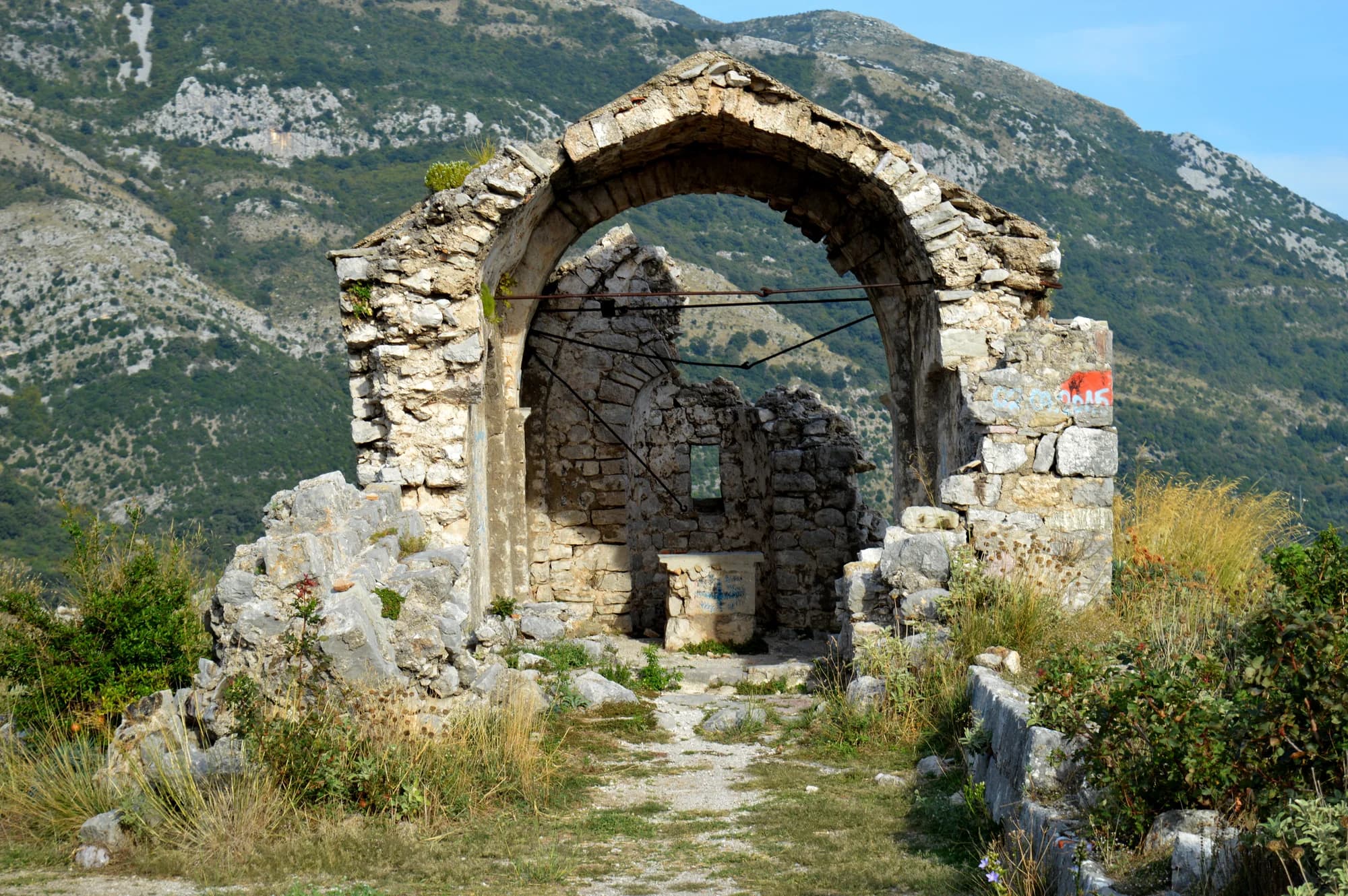
Ostros today — Prečista Krajinska is a ruin 800 metres east of the houses, on the R-15. Its five-storey bell tower, partly rebuilt, is the one part still standing; the relics have been in the Orthodox cathedral in Tirana since about 1995 and come back only for the saint’s feast day.
“He seemed to her sweeter than honey and the honeycomb.”
Local legend
The legend of Vladimir and Kosara
“Told to sink a well like the twelve-metre one Prince Vladimir dug at Ostros, the young man reached ten metres — so he dug twelve wells instead, and was accepted as a son-in-law.”
Local legend
The twelve wells of Boljevići
Search thousands of hotels and apartments with live prices.
We may earn a commission from partner links. This helps us keep Montenegro.com free for travelers.
Search hotels, apartments and guest houses with live availability.
We may earn a commission from partner links. This helps us keep Montenegro.com free for travelers.
Ostros is on the southern shore of Skadar lake, in the Krajina district of Bar municipality, close to the Albanian border. It is about 40 minutes from Bar over the hills and roughly the same from Virpazar along the lake.
The strip of hill country between Rumija and the lake, and one of the most distinctive corners of Montenegro: predominantly Albanian and Muslim, planted with chestnut, olive and fruit, and largely out of sight from the main roads.
Chestnuts above all. The groves on the slopes above the lake supply the country and support an autumn harvest that still shapes the local year, alongside olives, figs and the lake fishery.
Yes. Boats go out from the shore below the village into the southern arm of the lake, which is quieter and less visited than the Virpazar side, with reed channels and good birdwatching.
The island monasteries of Beska and Starceva Gorica, both medieval and both reached only by boat, lie in this part of the lake. The lakeside road towards Virpazar is one of the best drives in southern Montenegro.
Barely, which is the appeal and the caveat. There are a few rooms and konobas, and little else; come with a car, arrange a boat locally, and treat it as a day out rather than a resort.
No — the nearest is Podgorica Airport (TGD), 57 km away by road.
30.2 km by road, about 36 min by car.
The UK Foreign, Commonwealth & Development Office (FCDO) has no advisory against travel to Montenegro; it last reviewed its guidance on 13 August 2026. That is their assessment of the country as a whole, not ours and not a judgement about Ostroš, so read it yourself before you travel. The emergency number in Montenegro is 112.
SepGrape Festival, Virpazar — 34 km up the shore: the grapes, wine and winemakers Virpazar is known for
NovKrajinska Koštanijada — the chestnut fair in Ostros, run by the local community inside the programme for Bar’s liberation day; the 17th edition opened on 15 November 2025
DecDays of Wine and Bleak, Virpazar — December on the lake: the best wine and the best song about wine are judged, and the ukljeva is eaten
The local plate
Krajina counts more than twenty thousand chestnut trees and the forest is protected by law. The district is named for them twice over: the hamlet three kilometres west is Koštanjica in Montenegrin and Gështenjë in Albanian, and both words mean chestnut. The crop is gathered in autumn — cars park along the road through the woods — and part of it is exported.
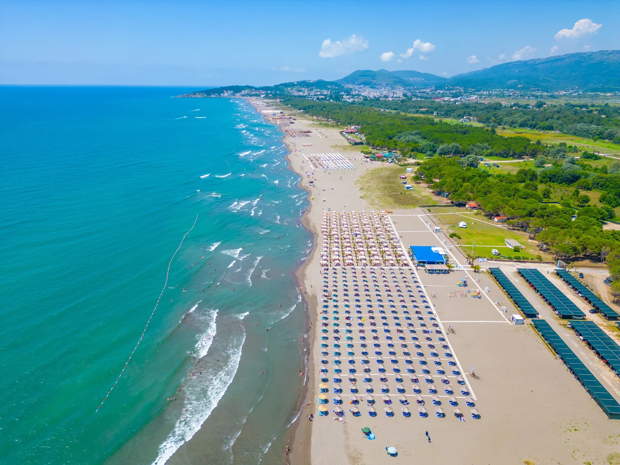
Where The Koštanijada stands in Ostros each November: honey, herbal teas, goat cheese and carp fresh from the lake. Otherwise the restaurant at the Murići beach camp, 17 km along the shore, serves home cooking under the chestnuts and olives
The nearest places to Ostroš, at their true positions — Tuzi is about 31 km away in a straight line.
Schematic. Positions and straight-line distances from the coordinates we hold for each place; mountain roads make the drive longer. Coastline and Lake Skadar © OpenStreetMap contributors.
Ostroš in numbers
2023 census, Veliki Ostros settlement — 324 with Mali Ostros next door
the houses stand on the Rumija slope, some 230 m above the water
Kosara reburied Jovan Vladimir at Prečista Krajinska, 800 m east of the village
the lake below became a national park — 370–530 km², the largest in the Balkans
Podgorica, 65 minutes by road; Tivat is 97 km and nearly two hours
MONSTAT 2023 census (settlement level) · Lake Skadar National Park · Prečista Krajinska after Mijović & Kovačević, Gradovi i utvrđenja u Crnoj Gori (1975) · road distances measured on OSRM
A few hours
An hour is the honest length of a stop here, and the monastery is the reason you stopped.
One full day
The circuit is signposted "Između dvije čarobne obale" — between two magical shores — and has been open since May 2017. Drive it slowly: the €18m rebuild covers the road south of Ostros, not the one you came in on.
Murići
Best for the nearest real beds — four wooden bungalows and a restaurant under old chestnuts and olives, beside 600 m of sand, 17 km back along the shore
Virpazar
Best for the lake’s tourist village, 34 km up the R-15: guesthouses, a railway station, September’s grape festival
Bar & Stari Bar
Best for hotels and the old town — 42 km by road, south to Vladimir and then up the coast, though only 18 as the crow flies
Best time: May · June · September
| Place | By road | Driving |
|---|---|---|
| Pečurice | 30.2 km | about 36 min |
| Dobra Voda | 33.7 km | about 43 min |
| Virpazar | 35.4 km | about 39 min |
| Ulcinj | 37.3 km | about 43 min |
| Podgorica | 62.8 km | about 1 h 10 min |
| Budva | 76.6 km | about 1 h 35 min |
| Kotor | 97.4 km | about 2 h 2 min |
Road distances routed over OpenStreetMap data, © OpenStreetMap contributors. Driving times are free-flow and take no account of summer traffic or a queue at the ferry ramp.