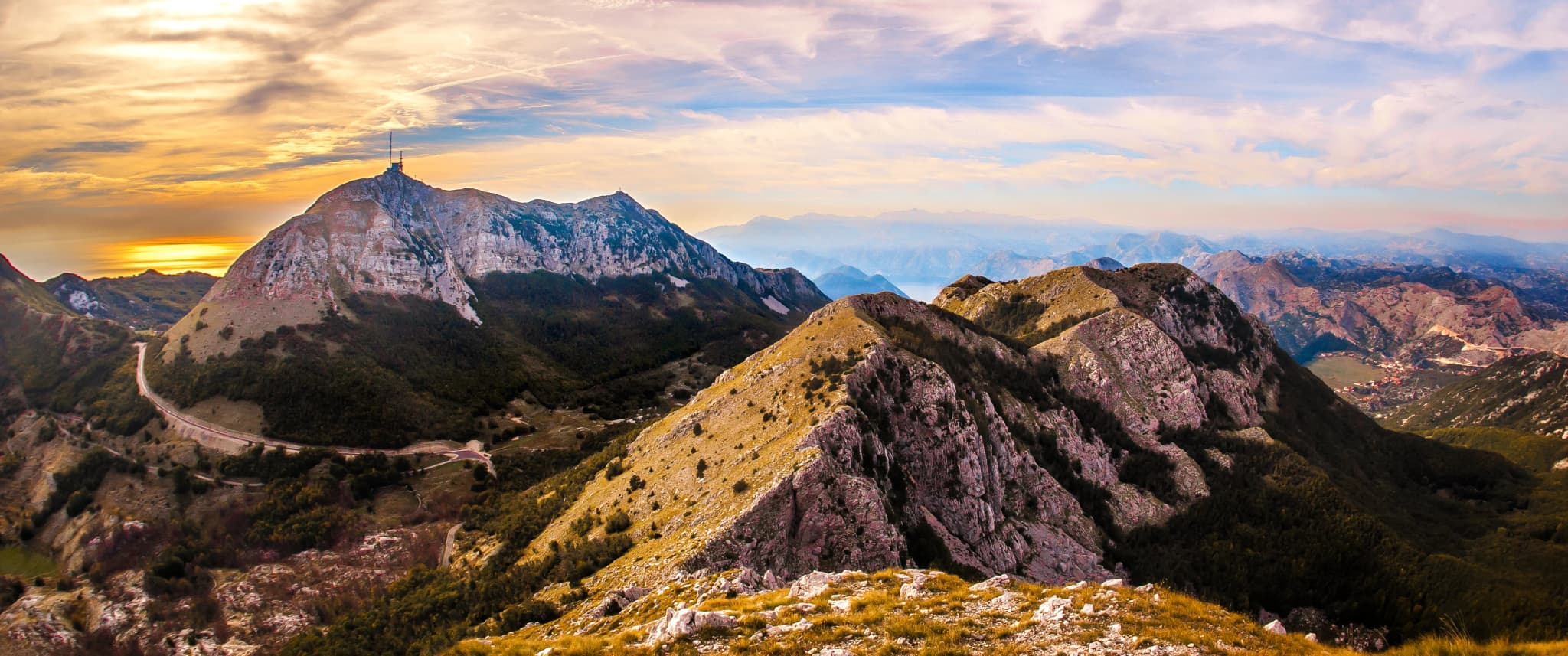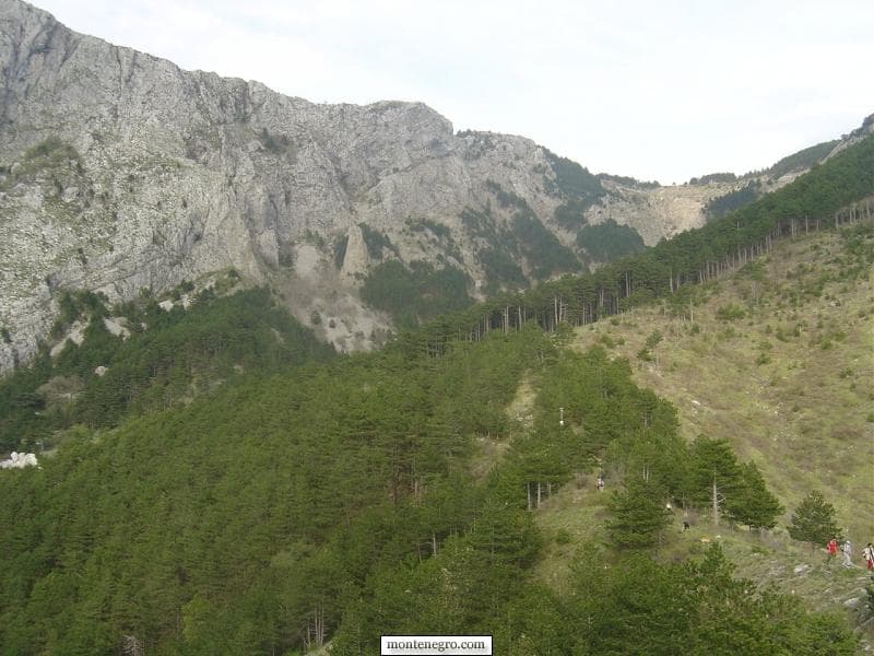
Between Ivanova Korita on Lovćen and Kotor at sea level lies more than one “old road.” There is the historic carriage road curling above the bay, a web of older foot and caravan paths, and a present-day network of marked national-park trails. They overlap in landscape and memory, but not necessarily on the ground. Treating them as a single signed route can turn a beautiful archival story into unsafe directions.
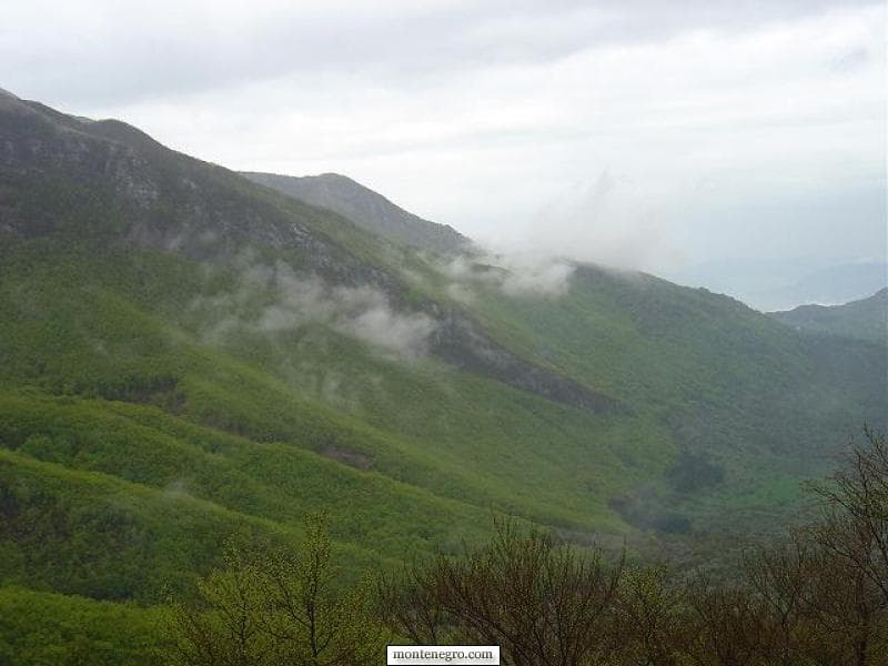
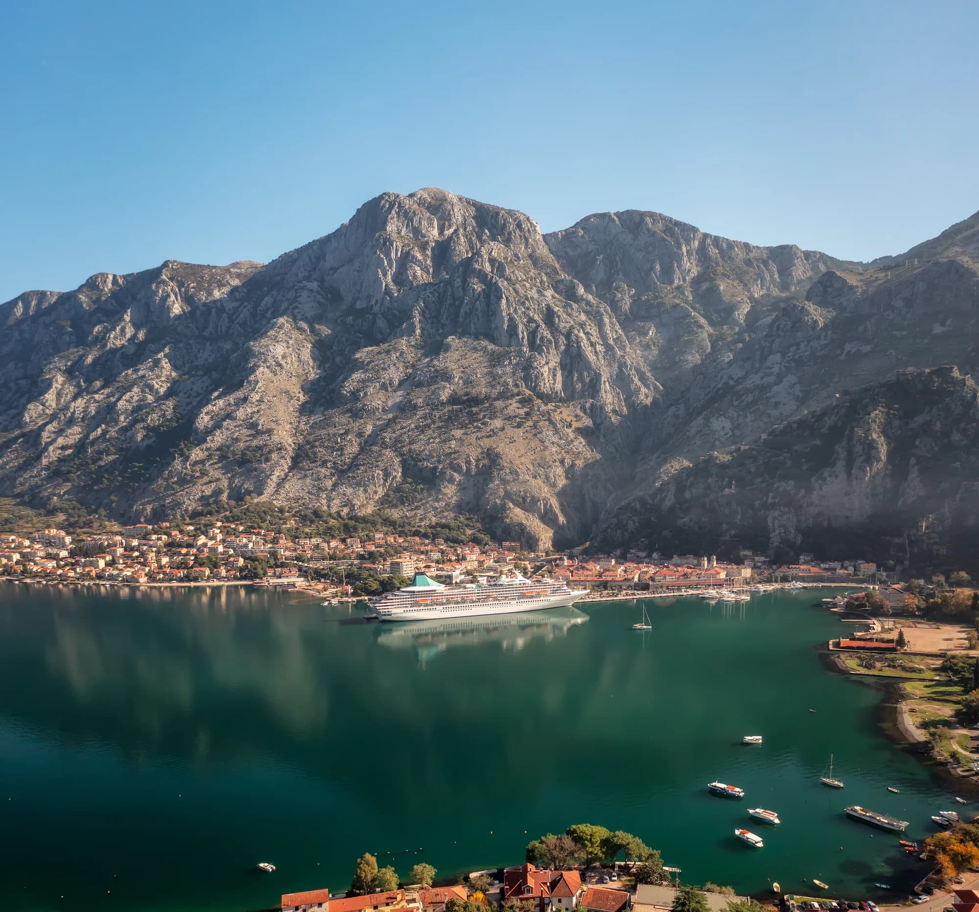
This article began as a photographic descent by Đorđije Kalezić: April snow, a katun house, new beech leaves, storm clouds and the moment Boka opened below. We preserve that sequence as original reporting. Around it, this revision builds an evidence-led way to understand the routes and decide whether to walk independently, hire a guide or choose a documented park circuit instead.
Original field notes and photographs: Đorđije Kalezić. Research update and safety review: Montenegro.com editorial team, August 2026.
The essential distinction: three route families
| Route family | What supports it | What it does not prove | Best use |
|---|---|---|---|
| Historic Kotor–Njeguši carriage road and serpentine | UNESCO and official panoramic-road documentation | That every section is a pedestrian trail or traffic-free | Landscape and transport history; cautious driving or a separately verified walk |
| Older foot and caravan paths | Local memory, field traces and the Montenegro.com archive | A continuous maintained route, current waymarks or legal access | Guided interpretation and archival reading |
| Marked Lovćen National Park trails | National Parks route descriptions and management planning | A direct signed trail all the way from Ivanova Korita to Kotor | Current-day hiking based on confirmed trail information |
The popular phrase “Ladder of Kotor” is often applied loosely to a stone zigzag above the town. It should not be stretched across the whole mountain. UNESCO’s documentation discusses the historic serpentine carriage road as part of the cultural landscape, while National Parks describes marked routes around Ivanova Korita and the Lovćen interior. Neither source certifies the complete line implied by the earlier article’s addendum.
For a broader orientation to the massif, use our Lovćen guide. For another first-person mountain archive, compare All Roads and Paths Lead to the Mountains. These are context, not substitute route cards.
What the original photographs establish
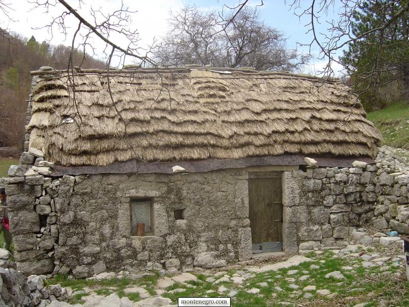
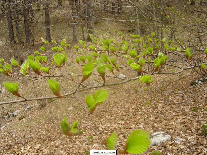
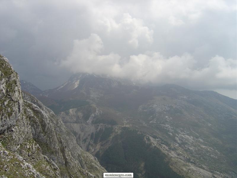
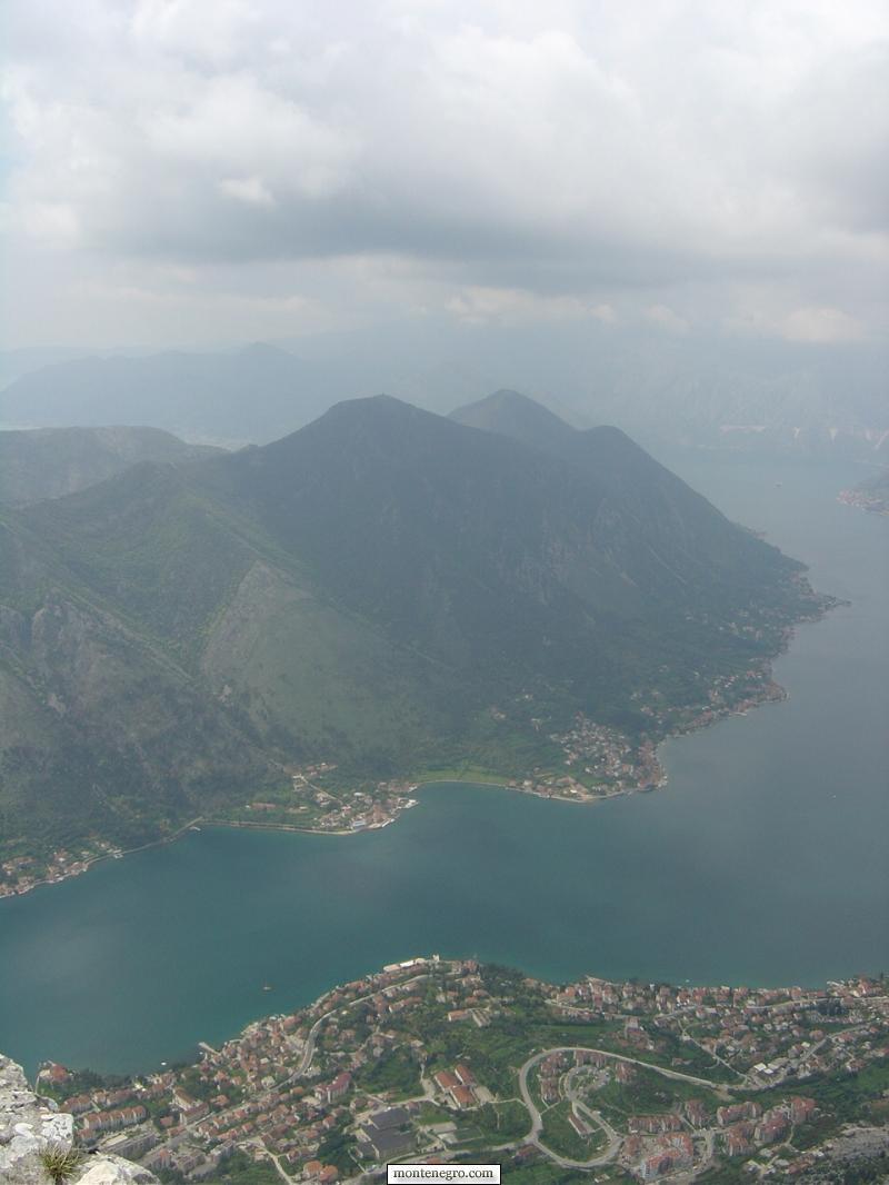
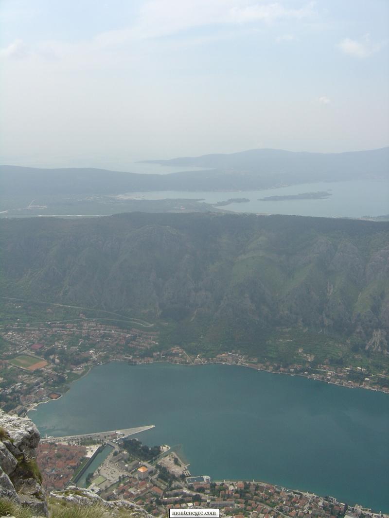
The archive establishes a journey, not a survey. Snow lay in shaded upper terrain. A stone katun building retained a traditional roof form. Fresh leaves marked spring lower down. From openings in forest and rock, the photographer saw the inner bay, Muo and Kotor. Cloud developed over Štirovnik and Jezerski Vrh. Those observations are valuable because they show how abruptly conditions and perspective can change across the mountain.
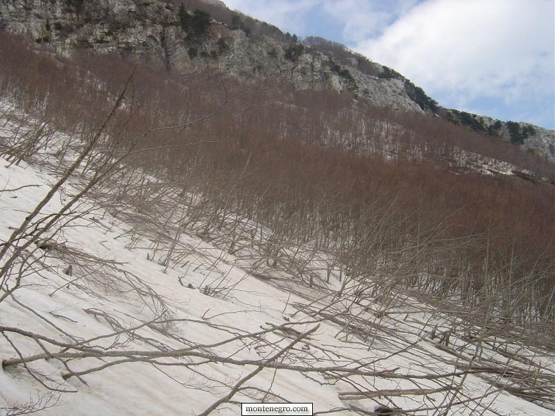
They do not establish that the same tread is visible now, that a gate remains open, that storm damage has been cleared or that a waymark links every photographed point. This is the core editorial boundary. A narrative can preserve memory without pretending to be a current GPX file.
Ivanova Korita: the reliable planning anchor
Ivanova Korita is the practical anchor for exploring the high park. National tourism material identifies a visitor centre there, while National Parks publishes active-holiday information and named routes in the wider area. The park describes five hiking trails and notes that parts of its network follow old Austro-Hungarian cut-stone roads. Its 2026–2030 draft management plan lists routes including Ivanova Korita–Mausoleum, the Wolf Trail, visitor-centre links toward Kraljevo počivalo and Zlatarice, and a line toward Majstori and Stanjevići.
That list is useful precisely because it is limited. It does not identify a single official through-hike from Ivanova Korita to Kotor. Ask the visitor centre which marked trail is open, whether waymarks are intact, where it ends and whether transport is needed. If your real goal is a mountain day rather than a descent to town, a verified circuit may be the better choice. Our older Lovćen hiking story adds atmosphere but should also be checked against current park advice.
How the mountain-to-market story fits
The old roads mattered because Kotor was a port and market while Montenegro’s interior settlements depended on movement across the karst. Official “Sea and Heights” panoramic-road material describes the old road toward Njeguši as a link by which products were brought to Kotor, and attributes its engineered form to Josip Slade. UNESCO’s listing for the Natural and Culturo-Historical Region of Kotor emphasizes the relationship between fortified towns, settlements and the bay’s steep setting.
That history is not merely picturesque. Every gradient and turn reflects what people, pack animals and later vehicles could negotiate. The road’s visual power comes from engineering laid across a cultural landscape. It is misleading to call the whole system an untouched ancient trail, just as it is misleading to reduce it to a scenic driving shortcut.
| Evidence type | Source | What it shows | Caution |
|---|---|---|---|
| Marked trails | National Parks | Current route names | Verify opening, end point and waymarks |
| Old foot paths | Archive + local memory | Field traces | Do not assume a continuous maintained route |
| Carriage road | UNESCO + NTO | Engineered serpentine | Historic significance does not remove traffic |
Source: nparkovi.me
Weather can change before altitude does
The original photographs move from snow to spring growth and then into cloud. Lovćen’s proximity to the Adriatic creates dramatic views, but exposure, wind and rapidly reduced visibility can erase the very landmarks hikers rely on. A sunny Kotor waterfront is not proof of clear ground higher up. Nor does an April archive prove snow will remain in the same places in another year.
Check a mountain forecast, not only a coastal one. Carry a warm layer and rain shell even when starting below, plus more water than a city walk. Turn around before navigation becomes uncertain. Lightning, hard snow, ice, wildfire restrictions and high wind each justify choosing another day.
Practical planning: choose the evidence before the route
- Define the objective. Is it a marked park hike, the historic road, a view above Kotor or a guided reconstruction of older paths?
- Ask the right authority. Use National Parks for park routes, a licensed guide for unmarked connections and road authorities or current local advice for carriage-road conditions.
- Obtain a current track. A screenshot, paragraph or archival photo sequence is not offline navigation.
- Solve both ends. A one-way descent needs confirmed transport, daylight margin and a plan if the route ends somewhere unexpected.
- Set a decision time. Agree when to turn around for weather, route ambiguity or delay.
The Mountain Rescue Service of Montenegro advises choosing a route that matches ability, not hiking alone, telling others the plan, following marked trails and carrying boots, weather protection, a map and compass. Apply that literally. A phone is useful but can fail through battery loss, water, impact or poor signal.
If your priority is reading an old settlement path without reconstructing this mountain-to-sea line, our Gornji Stoliv guide offers a lower-altitude comparison across the bay. Travellers focused on the wider landscape can use our Bay of Kotor guide and arrange a shorter verified walk above town.
How to verify a route description
A useful route description can be audited before anybody puts on boots. It names the start and finish precisely, carries a recent date, identifies who maintains the path, describes the marking system and provides a track or map whose scale suits navigation. It also states where the author turned, which junctions are ambiguous, whether water is reliable and what transport is required at the far end. A description that offers only a poetic destination and an approximate descent is a story, not a route card.
Check at least two current layers. First, ask National Parks or a qualified guide whether the intended line is open and recognised. Second, compare the supplied track with a current topographic map and recent condition report. A social-media trace can show where one person went; it cannot establish permission, waymark quality or suitability. If the line crosses private land, a closed construction area or a road cut, turn back rather than creating a bypass.
Record the verified plan offline and share it with somebody who is not walking. Include the party names, vehicle location, expected finish and overdue time. On the mountain, mark the last certain point whenever the route becomes ambiguous. This simple habit prevents uncertainty from accumulating across several wrong turns.
Finally, test the route description against the least experienced person in the party. A plan that works only if everybody moves at the author’s pace is not a group plan. Add time for photography, food, navigation checks and careful descent; identify the last point from which retreat remains straightforward. If a guide proposes a route, ask what happens when cloud closes the viewpoint, a participant slows or transport at the finish changes. Good contingency planning is specific enough to use before anyone is tired.
Carry identification, emergency contact details and essential medication where another group member can find them. In colder months, pack an insulating layer separately from the rain shell so one wet item does not remove the whole safety margin.
Three lower-risk ways to read the landscape
You do not need to complete a mountain-to-sea traverse to understand the old connections. A marked loop from Ivanova Korita can reveal forest, pasture and engineered stone while keeping the start and finish at a known visitor hub. A guided heritage walk on a verified section can focus on path construction and trade history. A cautious drive on the official panoramic road can show how quickly the Lovćen plateau opens toward Boka, provided the driver is comfortable with narrow bends and current road conditions.
Each option preserves a different part of the original experience. The loop prioritises walking; the guided section prioritises interpretation; the road prioritises the engineered transition. None is an inferior substitute for an undocumented through-route. Choosing the evidence-supported objective is the more serious form of exploration.
For a close study of vernacular buildings rather than a long descent, the Montenegro.com archive Through the Houses shows how stone, roof form and settlement can be read at walking pace. Use it as visual context and continue to respect ownership and access.
Heritage etiquette on old paths
Stone paving, retaining walls and water structures are infrastructure as well as heritage. Do not pull stones from a wall to improve a seat or build a cairn. Avoid cutting switchbacks: repeated shortcuts accelerate erosion and obscure the logic of the old route. Close gates as found, keep dogs controlled around livestock and do not enter a katun building because it appears unused.
Photography also benefits from restraint. The archive’s strength comes from sequence—the snow, house, forest, cloud and bay—not from standing on an unstable edge. Use a secure position, keep equipment compact and allow weather to remain part of the picture without chasing it into exposure. If thunder is building, the correct photograph may be the last one before retreat.
The descent: knees, loose stone and traffic
Descending is not automatically easy. Sustained downhill movement loads knees and quadriceps; polished stone, leaf cover and loose limestone reduce grip. Trekking poles can help when used competently, but they do not make an unknown route marked. Pace should preserve control rather than chase a promised duration.
Where a walking line meets a road, assume drivers may not expect pedestrians. Use visible clothing, move single-file and avoid blind bends. The official panoramic-road map itself warns motorists about narrow winding conditions. Historic character is not pedestrian separation.
Emergency plan
In Montenegro, call 112 for a general emergency. The Mountain Rescue Service asks callers to give who is calling, what happened, where, when, how many people are affected, injuries, weather and what assistance is available. Send coordinates if you can, but also describe the last certain landmark, path surface and direction of travel.
Stay together unless remaining creates an immediate danger. Protect an injured person from cold and rain, conserve battery and follow rescue instructions. An actual 2025 rescue above Kotor after a snakebite is a reminder that incidents can occur close to a famous town; proximity to roofs does not guarantee rapid access.
Arriving in Kotor
The original text ends with footsteps returning to the stone streets and waterfront. That transition remains the journey’s point: routes across Lovćen connected communities to Kotor’s market and port, and from the port to a much wider world. Today’s visitor should arrive without turning that history into a costume. Clean mud from footwear, respect private thresholds, and remember that a modern recreational descent reproduces neither the hardship nor the purpose of earlier travel.
For city context after the mountains, see the Kotor guide. If you are comparing Montenegro’s mountain seasons, the archival Durmitor early-summer story shows why a calendar date alone cannot describe high terrain.
Frequently asked questions
Is there one marked trail from Ivanova Korita to Kotor?
We did not find an official current source confirming a single marked through-route matching the archival descent. Verify a specific track with National Parks or a licensed local guide.
Is the whole route the Ladder of Kotor?
No. That label is often used for a particular zigzag above Kotor. The historic carriage road, older footpaths and current park trails are related but distinct.
How long does the descent take?
No universal time is responsible without a confirmed route, conditions and walker profile. Obtain a current route card or GPX, then plan daylight and contingency around it.
Can I hike it in April?
Possibly, but the archive records April snow and rapidly changing conditions. Check current mountain weather, snow and trail status; choose a lower or marked circuit if uncertain.
Should I walk alone?
Montenegro’s Mountain Rescue Service advises against hiking alone. For an uncertain historic connection, a competent guide is the stronger choice.