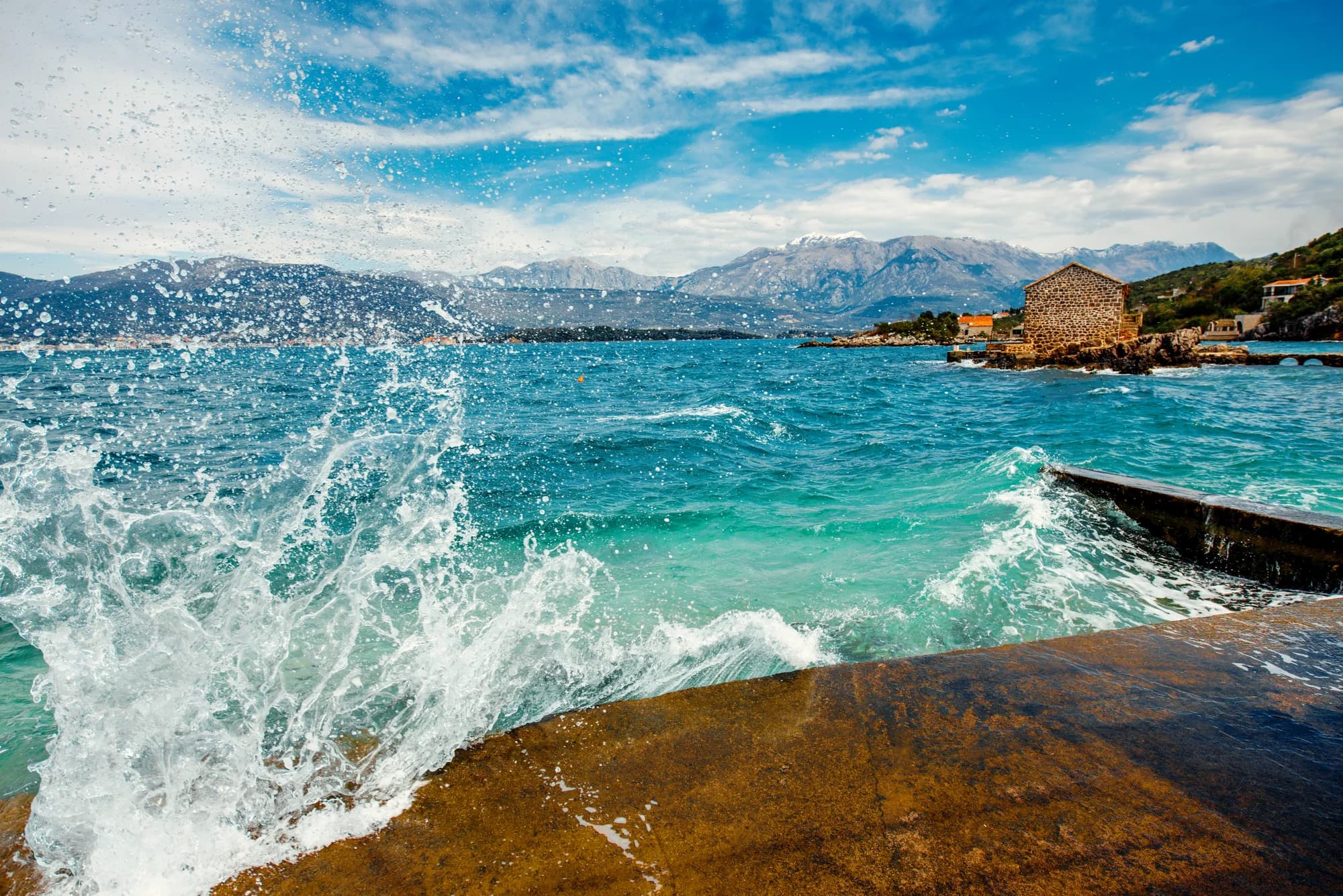
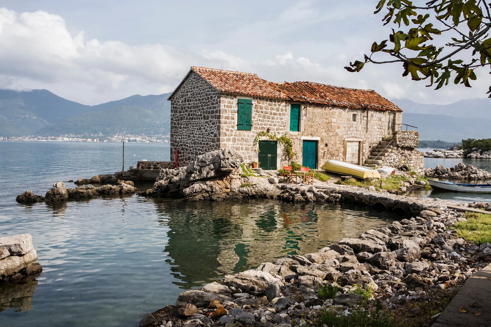
Twenty adapted stone houses on a low point in the Bay of Kotor, a sea channel running between them, Sveti Marko across the water.
Bjelila is a small settlement on the Luštica peninsula, on the sheltered inner side that faces the Bay of Kotor rather than the open Adriatic. It belongs to the Krtoli area of the Tivat municipality, a stretch of gentle coastline and low hills that has been farmed and fished for centuries. The oldest part of the village is a compact group of stone houses right at the water, with a small harbour and a strip of waterfront that catches the evening light across the bay — the kind of place that was built for boats and olive presses rather than for views, and ended up with the views anyway. The character of the peninsula shapes everything here. Olive groves, figs, pomegranates and maquis cover the slopes, drystone walls terrace the ground, and the older architecture is the honest local stone construction of the bay, with heavy roofs and shuttered windows built to handle both summer heat and winter bora. The water in this part of the bay is calm and shallow near the shore, good for swimming and for children, and small boats are still the most natural way to move between the coves. Position accounts for the recent attention. Tivat, its airport and the Porto Montenegro waterfront are minutes away by road, Kotor and Herceg Novi are within easy reach, and the beaches on the seaward side of Luštica — Plavi Horizonti, Trašte and the coves around Bigovo — are a short drive over the ridge. New building has arrived along parts of this coast, but Bjelila itself remains small. It suits travellers who want a quiet base close to the bay's main towns without staying in them: couples, families, sailors, and anyone who plans their day around swimming and a long lunch. May to October is the swimming season, with June and September the most comfortable months.
Krtoli’s villages stood deep inland until the 18th century, and came to the water only when the raiding stopped. Widths are to scale.
sr.wikipedia: Кртоли, Михољска превлака, Специјални резерват природе Солила. Two bands compress: the first spans Nemanjić Serbia and the later Zeta of the Balšići, and the Austrian band covers the Napoleonic interlude in the bay.
A day on the point
Twenty-odd houses, a channel between them, sea on both sides
Meanwhile, in 1776
Krtoli, 1776: a Serbian folk school opens in the parish, reckoned the oldest folk school on the soil of today’s Montenegro.
The waterline — Krtoli’s villages have stood deep inland, out of reach of raiders from the sea. As the raiding recedes, families build on the water itself: Bjelila, Kakrc, Donji Krašići, Kaluđerovina.
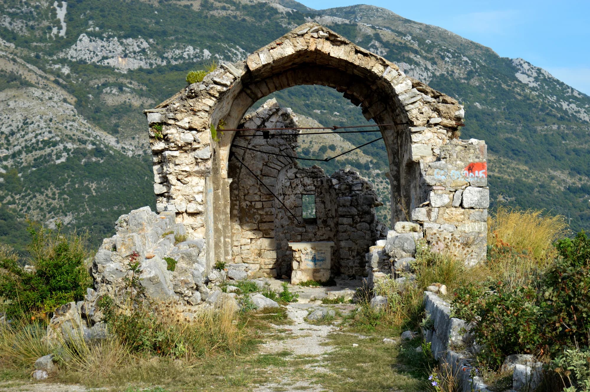
Prevlaka — the Archangel Michael monastery across the water, St Sava’s Zeta see since 1219, has lain in ruins since the mid-15th century; the Holy Trinity church that stands there now is still 57 years off.
Venice — the Republic that has held the bay since 1420 has 21 years left. Austria takes over in 1797, and the stone houses outlast them both.
“Mali Sveti Stefan — little Sveti Stefan: twenty-odd old stone houses, adapted, on a point of their own.”
Local legend
The local name for Bjelila, recorded in the Serbian Wikipedia entry on the hamlet
Search thousands of hotels and apartments with live prices.
We may earn a commission from partner links. This helps us keep Montenegro.com free for travelers.
Search hotels, apartments and guest houses with live availability.
We may earn a commission from partner links. This helps us keep Montenegro.com free for travelers.
Bjelila is on the Lustica peninsula, on the sheltered inner side facing the Bay of Kotor rather than the open Adriatic. It belongs to the Krtoli area of Tivat municipality, minutes from Tivat and its airport by road.
The oldest part is a compact group of stone houses right at the water, with a small harbour and a strip of waterfront that catches the evening light across the bay — built for boats and olive presses rather than for views, and left with the views anyway.
Yes. The water in this part of the bay is calm and shallow near the shore, which makes it comfortable for children, and small boats are still the most natural way to move between the coves. May to October is the season.
Olive groves, figs, pomegranates and maquis cover the slopes, with drystone walls terracing the ground. The older architecture is the honest local stone of the bay, with heavy roofs and shuttered windows built for summer heat and winter bora alike.
MarSpring passage at Solila — spring and autumn are the reserve’s two windows; entry free, the observation tower open
AugThe hamlet at full house — twenty-odd resident families become over three hundred people
OctAutumn passage at Solila — the other window — around 35 of the 110-plus recorded species stay to winter on the flats
The local plate
Bjelila appears in the record as one thing: a small, quiet fishing place. Fresh water feeds it — the springs Mali and Veliki Frutak, Mala and Velika Spila and the Rijeka stream all run into the Oko cove here, and the sea off Bjelila is rated the cleanest on the Montenegrin coast, a judgement credited to the Institute of Marine Biology in Kotor.
The nearest places to Bjelila, at their true positions — Topla is about 20 km away in a straight line.
Schematic. Positions and straight-line distances from the coordinates we hold for each place; mountain roads make the drive longer. Coastline and Lake Skadar © OpenStreetMap contributors.
Bjelila in numbers
adapted stone houses on the point — the whole of Bjelila
2023 census, Gošići settlement — Bjelila is its shore hamlet
the Krtoli islands offshore: Sveti Marko, Ostrvo cvijeća, Gospa od Milosti
species recorded at Solila, the reserve up the shore toward Tivat
Solila — protected since 2008, a Ramsar wetland since 2013
Tivat, by the Krtoli shore road
MONSTAT 2023 census (Gošići settlement) · Serbian Wikipedia (Bjelila, Krtoli) · Solila Special Nature Reserve · OpenStreetMap road distance
A few hours
Bjelila is twenty houses and a swim. An hour is the honest length.
One full day
A bird reserve, a monastery island and a fishing hamlet, all within a few kilometres of each other.
Bjelila point
Best for the stone houses themselves — water on both sides of the channel, and the whole hamlet is twenty houses
Gošići
Best for the village Bjelila is counted under, inland behind the shore: 202 residents at the 2023 census
Krašići
Best for the next village west along the shore, with thirty stone houses on the water and a newer resort to rent from
Radovići
Best for the largest Krtoli settlement, 537 residents at the 2023 census, just inland
Best time: May · June · September
| Place | By road | Driving |
|---|---|---|
| Bigovo | 4.4 km | about 34 min |
| Uvala Maslina | 9.3 km | about 52 min |
| Luštica | 14 km | about 56 min |
| Kotor | 17.9 km | about 57 min |
| Budva | 19.8 km | about 57 min |
| Podgorica | 79.9 km | about 2 h 15 min |
| Žabljak | 179.3 km | about 4 h 13 min |
Road distances routed over OpenStreetMap data, © OpenStreetMap contributors. Driving times are free-flow and take no account of summer traffic or a queue at the ferry ramp.
Tivat, its airport and the Porto Montenegro waterfront are minutes away, Kotor and Herceg Novi within easy reach, and the seaward beaches of Lustica — Plavi Horizonti, Traste and the coves around Bigovo — a short drive over the ridge.
Travellers who want a quiet base close to the bay's main towns without staying in them: couples, families, sailors, and anyone who plans the day around swimming and a long lunch. June and September are the most comfortable months.
No — the nearest is Tivat Airport (TIV), 9 km away by road.
From about 13 °C in February to 25 °C in August. It holds above 22 °C from June to September, which is the swimming season. Regional normals from the Bar station, not a city-precise reading.
4.4 km by road, about 34 min by car.
The UK Foreign, Commonwealth & Development Office (FCDO) has no advisory against travel to Montenegro; it last reviewed its guidance on 13 August 2026. That is their assessment of the country as a whole, not ours and not a judgement about Bjelila, so read it yourself before you travel. The emergency number in Montenegro is 112.