Cetinje is the historic royal capital of Montenegro, a compact and walkable city perched at approximately 670 metres (2,198 feet) above sea level on the Cetinje plateau, cradled by mountain peaks at the foot of Mount Lovcen (1,749 m). With a population of around 15,000, it bears the official...
15,000residents
1485first recorded
55 kmto the airport
Jun–Septhe busy months
Updated Originally published 49 min readby Pavle Obradović
Cetinje is the historic royal capital of Montenegro, a compact and walkable city perched at approximately 670 metres (2,198 feet) above sea level on the Cetinje plateau, cradled by mountain peaks at the foot of Mount Lovcen (1,749 m). With a population of around 15,000, it bears the official...
Cetinje – The Old Royal Capital of Montenegro
“A museum city at the foot of Mount Lovcen, where the soul of Montenegro was forged through centuries of defiance, faith, and literary brilliance.”
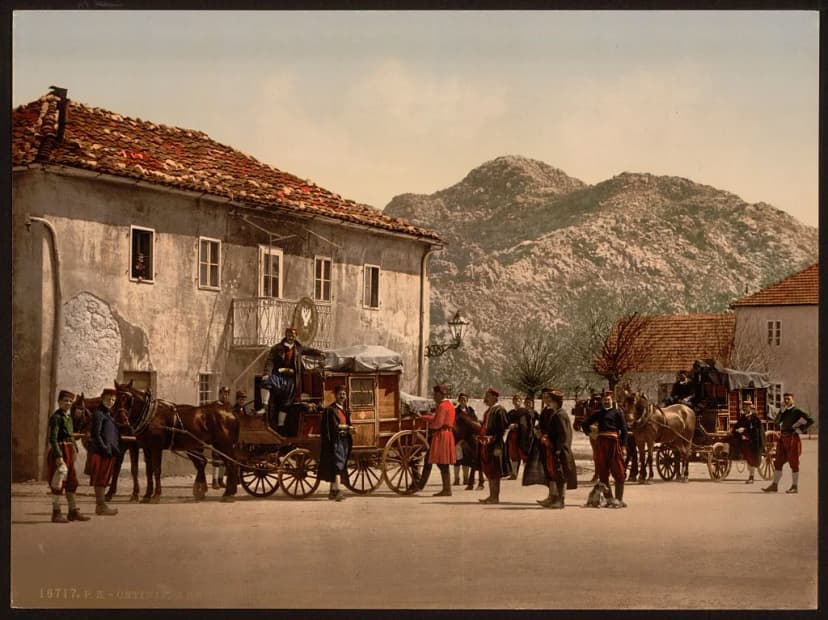
Tucked into a small karst field at the foot of Mount Lovcen, Cetinje feels like stepping into a different Montenegro altogether. There are no beach bars here, no cruise ship crowds, no souvenir shops hawking refrigerator magnets. Instead, you find wide boulevards lined with linden trees, faded embassies that once hosted ambassadors from Europe’s great powers, and a monastery holding relics that have drawn pilgrims for centuries. This is Montenegro’s soul — the town that served as the nation’s capital for over four hundred years and shaped everything from its literature to its national identity.
Overview
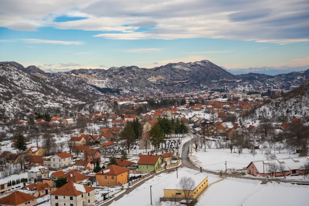
Cetinje is the historic royal capital of Montenegro, a compact and walkable city perched at approximately 670 metres (2,198 feet) above sea level on the Cetinje plateau, cradled by mountain peaks at the foot of Mount Lovcen (1,749 m). One planning source puts the town nearer 590 metres; either way, this is a mountain town, not a coastal one, and the difference matters mainly for what you pack. Population figures are given as around 15,000, though some guides count fewer than 14,000 residents. Cetinje bears the official designation of Old Royal Capital (Prijestonica) – a unique constitutional status shared by no other city in Montenegro. While Podgorica serves as the administrative capital, Cetinje remains the spiritual, cultural, and ceremonial heart of the nation, and it rewards visitors who come looking for substance over spectacle.
Often called the “City of Museums” or “Museum City”, Cetinje packs six museums into its small footprint, along with former royal palaces, historic monastery complexes, and a remarkable collection of 19th-century embassy buildings that testify to its former status as a European capital. Its Historic Core is inscribed on the UNESCO World Heritage Tentative List, recognized as a heritage ensemble of exceptional importance for its harmonious unity of heterogeneous architectural elements, individually protected monuments, parks, and regular urban matrix [1][2].
Cetinje is also known as the “Town of Books” – books have been printed, read, and preserved here since the 15th century, when a printing house produced the first printed book of the South Slavs in Cyrillic script [1].
Day trips
How far a day reaches
30 min
30 min
45 min
Geography and Landscape
The municipality of Cetinje is located in the southwestern part of Montenegro between the romantic Boka Kotorska in the west, the Budva Riviera known for its sandy beaches in the south, the picturesque Skadar lake basin and the fertile Zeta-Bjelopavlić plain in the east and Niksic field and Bijeli Rudin in the north. The area of the municipality is 910 km2, 6.6% of the territory of Montenegro. It borders seven municipalities (Kotor, Tivat, Budva, Bar, Podgorica, Danilovgrad, Niksic). The main road lines are oriented in three directions: towards Titograd (46 km), Kotor (45 km and Budva 33 km) and the fourth through Katunska Poverša to Grahovo and Nikšić.
The nearest airports to Cetinje are in Golubovci near Podgorica (58 km), Tivat (57 km) and Ćilipi near Dubrovnik (115 km). Podgorica airport is used the most.
From a germological point of view, the surface of the municipality is characterized by the development of mainly karst relief. In addition to the dominant karst forms, there are also glacial, river and lake relief elements. The territory of the municipality can be divided into three less characteristic spatial units, namely: the Katun karst surface, the Lovćen mountain range and the western edge of the Skadar Basin.
The Katun karst surface
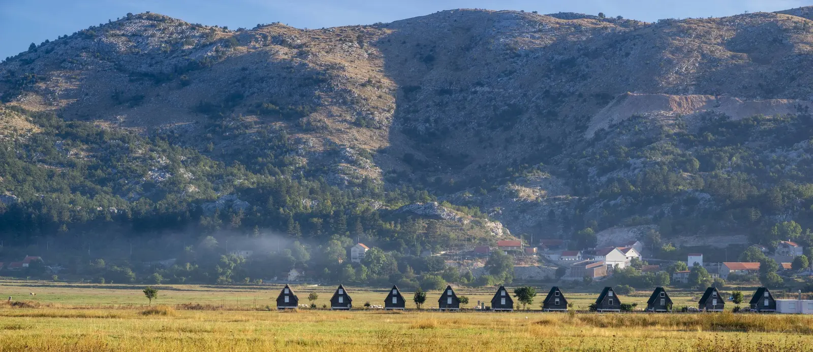
Geomorphologically, the Katun area is not simple. It has the appearance of a highly undulating karstified plateau whose average height is 700-1000 m, from which rise limestone hills and ridges, as well as entire high mountains. It leaves the impression of a petrified turbulent sea whose depressions resemble waves below and the elevations resemble wave crests. That is why it is popularly called “stone sea”. The surface of Katun is actually shaped by all the surface forms of the karst relief, chaotically distributed (scrapes, gullies, coves, karst fields), and it also abounds in underground karst phenomena (pits and caves). The most famous cave is Duboki Do (340 m) in Njeguško polje, and Lipska and Cetinjska (Manastirska) caves near Cetinje and Obodska near Rijeka Crnojevića stand out from several caves, from which the river of the same name emerges with a strong spring.
Of the multitude of surface diverse, deep and specific karst forms, the most important is the Cetinjsko polje, even though its plane is relatively small – only 4.5 km2. It enabled and predisposed the creation and development of Cetinje as a city settlement.
The Lovćen mountain range
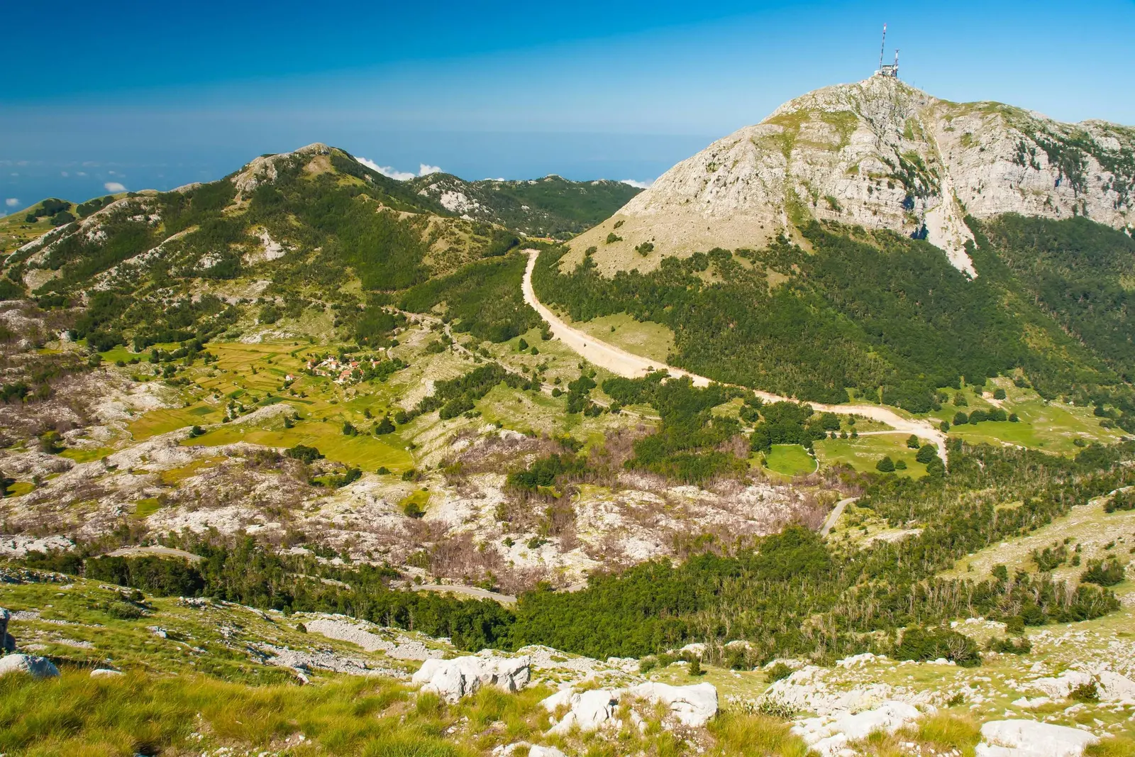
The area of the Lovcen mountain range includes the western part of the territory of the municipality. Lovćen descends vertically, in almost vertical sections, towards the sea (Bokokotorsko Budva prijmoje), and in the northeast and east it gradually passes into Katunska površ and Cetinjsko polje. Between the highest peaks of Lovcen (Stirovnik 1679 m, Jezerski vrh 1166 m, Babljak 1631 m – the mausoleum’s own peak of Jezerski Vrh is elsewhere given as 1,657 m) there are deep karst depressions – bays, the deepest in the entire area (Kuk, Bizaljevac, Vuci Do, Veliki and Mali Bostur), some of which are up to 200 m deep. Others, on the other hand, become significantly shallower, such as Ivan’s Korita and Dolovi – the most spacious bays in the central part of the mountain. Ivan’s beds (1200 m) have the greatest economic and touristic importance, as does Jezerski vrh, where Njegos’s mausoleum is located.
The western edge of the Skadar Basin
The part of the Skadar basin that belongs to the municipality of Cetinje covers mainly the southeastern part of its territory, which gravitates to Lake Skadar. According to its geographical features, this area is quite different from the previous ones. It is lower and less rugged, so it is characterized by significantly milder forms of relief, which results in, among other things, greater traffic accessibility. Of the bays, Dobrsko-gornjoceklin bay stands out as the largest, on the edge of which is the famous Lipska cave. In the extension of this bay, but at a lower level, it built its rather deep and winding valley of the Crnojevića river – a tributary of Lake Skadar.
The Lovćen National Park is of special importance, covering an area of about 2000 ha of mostly beech forests. It forms a unique whole in terms of phytogeography and tourism. And the fauna is scarce, especially when it comes to hunting and economically useful species. An exception to this is the bird life and fish population in the area of the Crnojević River and Lake Skadar. The bird fauna is represented by over 150 species of waders and other birds, while the fish population has about thirty species. In addition to the economic benefits of this fauna, there are solid prerequisites for the development of hunting and fishing tourism.
Cetinje Monastery
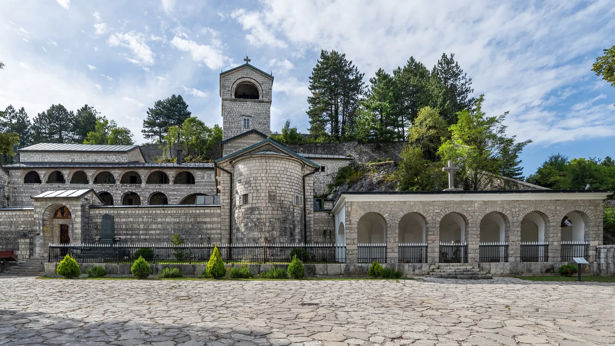
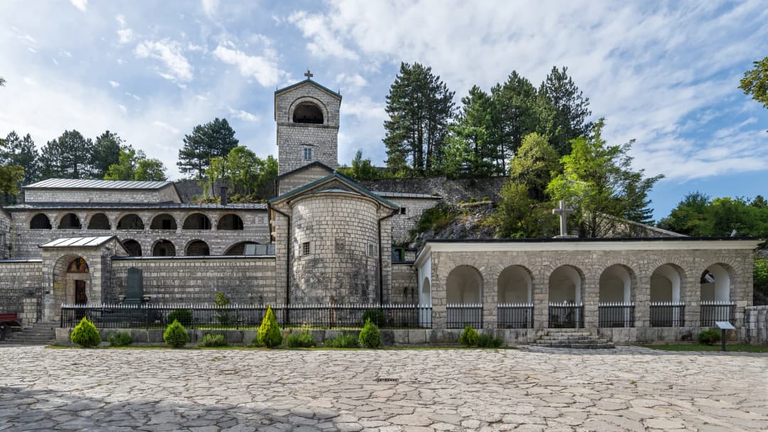
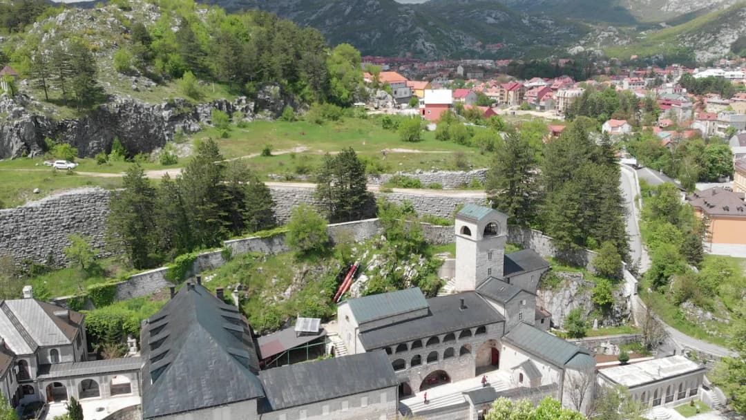
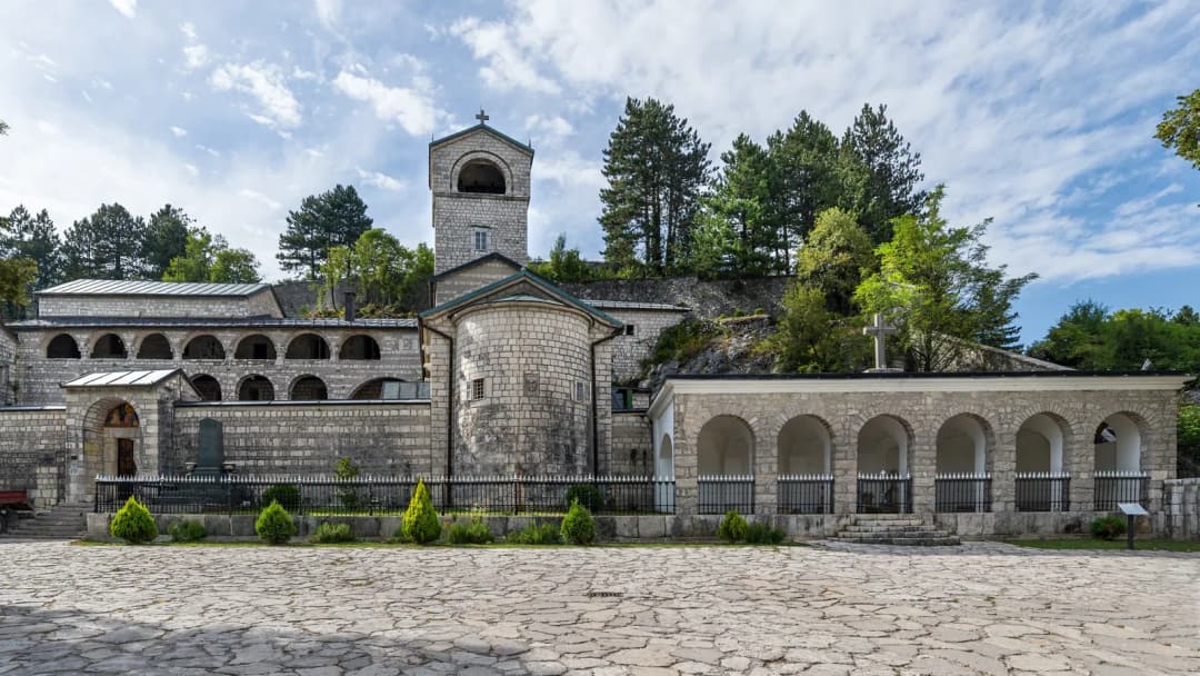
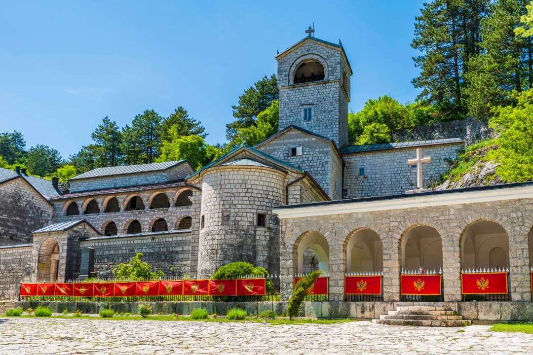
The Cetinje Monastery (Cetinjski manastir) is the most important religious and cultural site in Cetinje, the spiritual centre of Montenegro, the seat of the Montenegrin Metropolitan of the Serbian Orthodox Church, and one of the holiest places in the Orthodox Christian world. Originally founded in 1485 by Ivan Crnojevic, the monastery has been destroyed and rebuilt multiple times due to Ottoman attacks and raids. The current structure dates primarily to 1785, rebuilt under Metropolitan Petar I Petrovic-Njegos (later canonized as Saint Peter of Cetinje); other accounts date the present building to 1701, raised on the foundations of the earlier monasteries. Its thick stone walls and modest exterior give no hint of what lies inside [16][17].
Sacred Relics: The monastery treasury houses some of the most significant Christian relics in existence:
The Right Hand of Saint John the Baptist – believed to be the very hand that baptized Jesus Christ in the River Jordan. This relic has an extraordinary provenance: from Jerusalem to Constantinople, through the possession of Byzantine emperors, Ottoman sultans, the Knights Hospitaller on Malta, Russian tsars, and Serbian kings. When the Bolshevik Revolution scattered the Romanovs, the hand was brought to Montenegro by members of the exiled Romanov family – first to Ostrog Monastery and later to Cetinje. In 2006, it was briefly taken to Russia where millions venerated it before it was returned to Cetinje [16][17][18].
A Fragment of the True Cross (the Holy Cross on which Jesus was crucified).
The remains of Saint Peter of Cetinje (Metropolitan Petar I Petrovic-Njegos, canonized 1834).
The monastery also preserves the Bishop’s Crown of Saint Peter of Cetinje and important historical manuscripts, and is credited in some accounts with holding the icon of the Philermos Mother of God, traditionally attributed to Saint Luke the Evangelist – the same icon that the National Museum lists among the treasures of its Art Museum collection. It remains an active monastery and a major pilgrimage destination [16][17].
Visiting: Entry is free (donations appreciated) and the monastery is open daily. Dress modestly – shoulders and knees must be covered, and women are asked to wear a headscarf and skirt. Photography inside the chapel is not permitted. The relics are not always on display; a monk may bring them out for small groups, so patience is part of the experience. A church shop sells candles, icons, and devotional items. This is a working religious institution, not simply a tourist exhibit: keep voices low, follow photography signs, and accept that worship or community needs may restrict access.
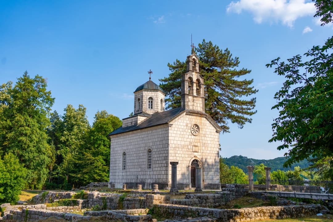
Ćipur and the civic centre
Nearby, the Court Church at Ćipur and archaeological traces locate the visitor close to the Crnojević foundation story. Avoid treating sacred objects as a checklist; the more durable insight is the monastery’s continuing role beside the institutions of the former state. From here, cross the historic core slowly. Government House — Vladin Dom — was designed for the machinery and ceremony of the state. The squares and pedestrian streets around it reveal how short the distance was between court, church, administration and foreign missions. The compact scale is not a weakness in the story; it is the story.
Religious, dynastic and civic sites share the same compact historic landscape.
King Nikola’s Palace (Museum of King Nikola)
Across the main square from the monastery stands the palace of King Nikola I Petrovic-Njegos, the last ruler of independent Montenegro. Construction began in 1863 and the building was completed in 1867, originally as a residence for Princess Darinka, widow of Prince Danilo I. After her exile, it became the home of Prince (later King) Nikola I and his family, and served as the royal residence until 1918. The palace was redecorated and extended several times, with its final adaptation in 1910 for the proclamation of the Kingdom. Nikola was a fascinating figure — a poet, a politician, and a shrewd dynast who married his daughters into the royal families of Italy, Serbia, and Russia, earning himself the nickname "Father-in-Law of Europe." [9][12]
Since 1926, the palace has functioned as a museum and is now a department of the National Museum of Montenegro. Its rooms and collections trace the development of the Montenegrin state through 1918, including court life, diplomacy, military history and the ruler’s public image. The ground floor displays royal furniture, personal effects, and ornate reception rooms, giving you a tangible sense of court life in a kingdom grand in ambition if modest in size. The entrance hall displays the Montenegrin Crown Jewels – the most popular exhibition in the entire National Museum system [9][12].
The weapons collection is the real draw. The museum holds an extraordinary array of swords, rifles, pistols, and edged weapons accumulated over centuries of conflict, alongside 44 captured Ottoman battle flags and military decorations that fill the upper rooms. A library and archive of more than 10,000 items includes copies of the incunabula from the Crnojevic printing house. For anyone interested in Montenegrin history, this museum alone justifies a trip to Cetinje.
It is the strongest first stop for a visitor who knows little about the country: the building connects objects to the political story rather than presenting the royal family as decoration. If this theme interests you, compare Cetinje’s inland court with King Nikola’s seaside palace in Bar.
Practical info: Listed individual price €8; also part of the combined National Museum ticket (given variously as approximately 10 EUR for all five departments and as a €20 collective ticket – see the museum circuit table below).
Cetinje’s ceremonial buildings are close enough to connect on a single walking route.
Biljarda — The Billiard Hall (Njegos Museum)
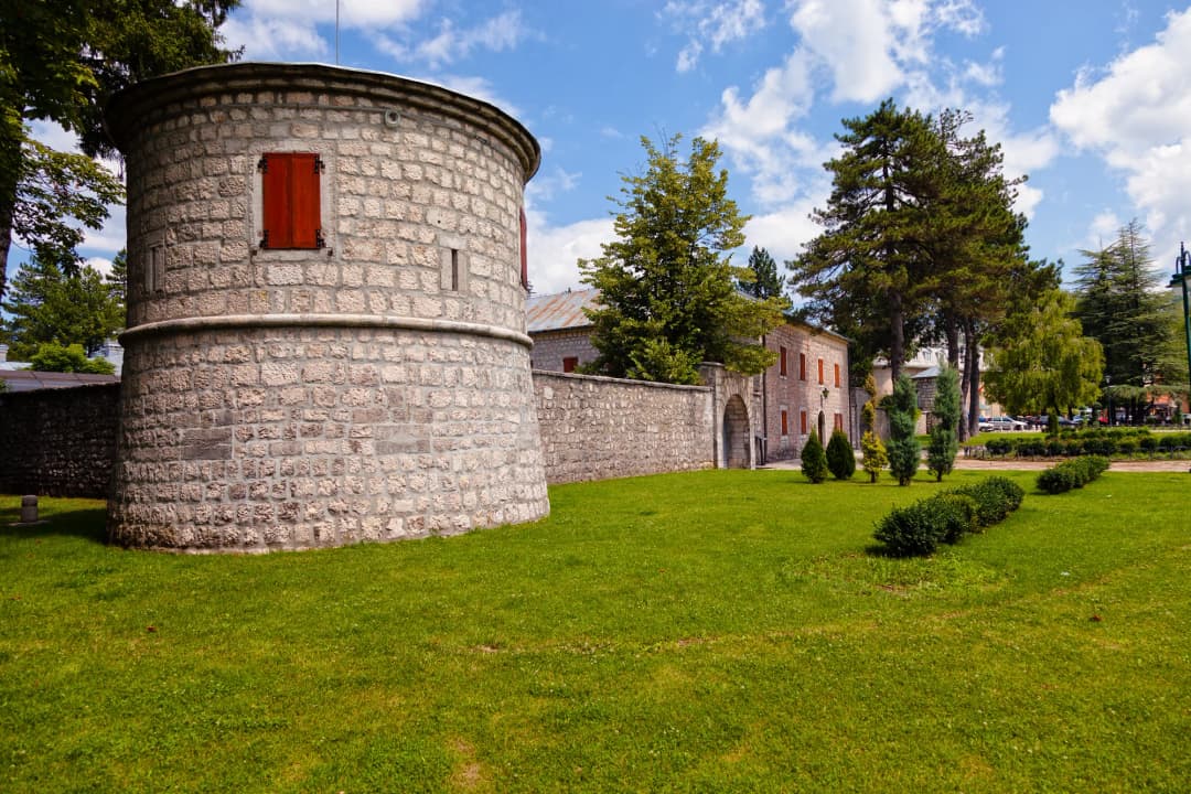
Just steps from the monastery, the Biljarda is a castle-like fortified residence built in 1838 for prince-bishop Petar II Petrovic-Njegos, Montenegro’s most celebrated literary figure. The building was constructed with significant financial help from Russia, and its thick walls and corner towers give it the appearance of a small fortress rather than a palace — fitting for a ruler who governed a land perpetually at war. The restrained stone building is valuable precisely because it conveys how small and exposed the governing centre remained [7][19].
The name Biljarda comes from the billiard table that Njegos loved to play on – the first and only billiard table in Montenegro at the time. Accounts of its origin differ: one says Njegos had it transported from Vienna, another that it was imported from Italy. Both agree on the punchline – the table had to be carried on the backs of men from the port of Kotor up through the mountains to Cetinje, an absurd logistical feat that says something about both Njegos’s tastes and the determination of the people who served him. The original table is still on display inside.
Founded as a museum in 1951, the Biljarda presents Njegos as ruler, bishop and writer through his personal effects: manuscripts, books and editions (including material associated with The Mountain Wreath), portraits – among them the most famous portrait of Njegos himself – coins, weapons, his bishop’s cross and garments, documents, period furniture, and of course the billiard table [7][19].
The Relief Map: In a separate glass-walled pavilion adjacent to the main museum sits an extraordinary three-dimensional topographical relief map of Montenegro, covering approximately 180 square metres, built to a scale of 1:10,000 by area and 1:15,000 by height. Its authorship is reported two ways: as the work of Austrian cartographers in the 19th century, and as a model created by the Austro-Hungarian military during their occupation in 1916-1917. Every mountain, valley, and river is rendered in extraordinary detail. Standing above it, you begin to understand Montenegro’s geography in a way that no flat map can convey — the impossibly rugged terrain that made this country so difficult to conquer [7][19].
Njegoš also connects Cetinje to other parts of the country. Our guide to literary Topla in Herceg Novi follows his early education, while the route through Njeguši leads toward his mausoleum on Lovćen. These links turn the museum from an isolated collection into part of a geographic story.
Practical info: Open daily 09:00-17:00. Admission: 3 EUR adults, 1.50 EUR children [19]. The National Museum’s own price list gives a €5 individual ticket, and seasonal daily hours are published per building – check before travelling.
Stone façades and mature trees define much of the central museum district.
Blue Palace (Plavi Dvorac)
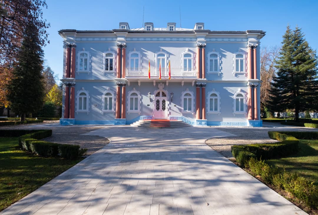
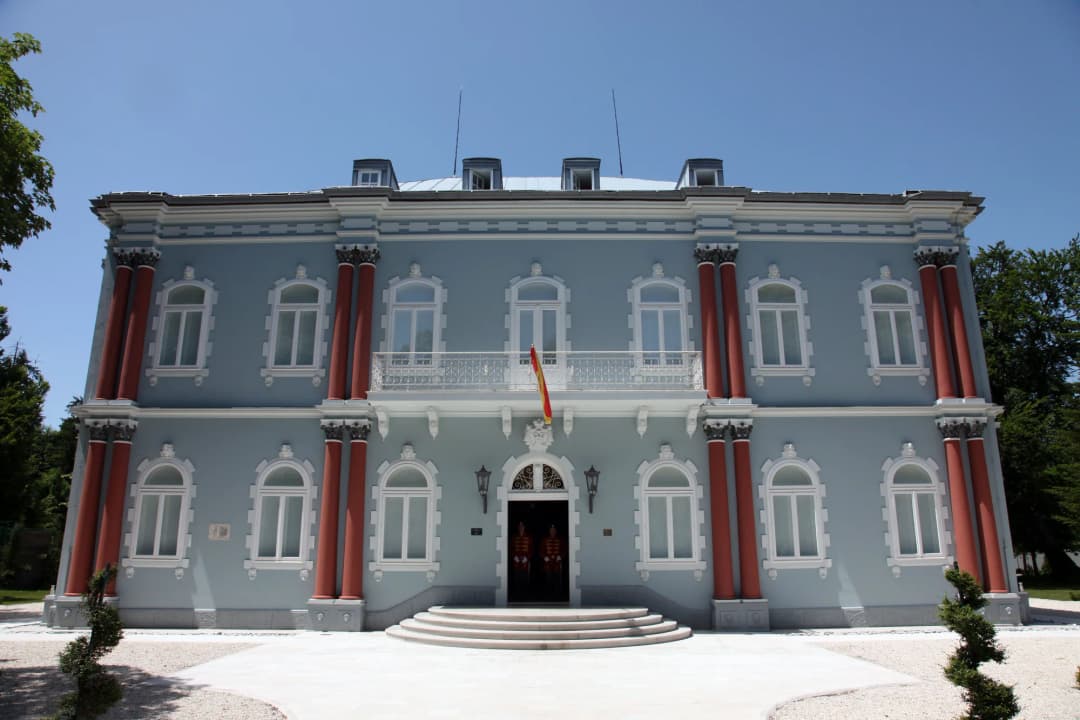
The Blue Palace was built in 1894-1895 in late Empire style as the residence of Crown Prince Danilo, heir to the Montenegrin throne. The project was overseen by Italian architect Camillo Boito [15][20].
Crown Prince Danilo and his wife lived in the palace until 1916. During the interwar Kingdom of Yugoslavia period, it housed the Cetinje Gymnasium (secondary school). Under socialist Yugoslavia, it was converted into a gallery and museum. In 2010, after extensive renovation funded by a grant from the Government of Norway, the Blue Palace became the official residence of the President of Montenegro [15][20].
Note: As the presidential residence, the Blue Palace is not open to the public, but its exterior and surrounding grounds are a major landmark worth seeing.
Vlach Church (Vlaska Crkva)
The Vlach Church (Vlaska crkva), dedicated to the Nativity of the Virgin Mary, is the oldest surviving building in Cetinje, predating the city’s official founding. Built around 1450 – some 30 years before Ivan Crnojevic established his court – it stands on the site of a Bogomil necropolis that once contained around 150 stecak tombstones (the ornate monumental medieval gravestones characteristic of the western Balkans). Most were built into the church’s foundations during its restoration; only two stecci have been preserved, still lying at the entrance to the churchyard [21][22].
The church gets its name from the Vlachs (shepherds) who tended Ivan Crnojevic’s cattle. Originally constructed from sticks, switches, and mud, it was rebuilt three times: first in dry stone, then stone with lime mortar, and finally receiving its current form in 1864 (one account dates that restoration to 1866). Inside, it is modest — simple icons and a quiet atmosphere [21][22].
The Rifle-Barrel Fence: What draws visitors is the fence. The churchyard is enclosed by a railing constructed in 1897 from captured Ottoman rifle barrels taken during the victorious Montenegrin-Ottoman War of 1876-78 – 1,550 barrels by one count, approximately 1,544 by another. The barrels stand vertically, creating a barrier that is both functional and deeply symbolic: one of the most striking war monuments in the Balkans, not a statue or a plaque, but an everyday object fashioned from the instruments of warfare. It is also one of the most photographed features of Cetinje [21][22].
Embassy Row: Walking the Former Diplomatic Quarter
One of Cetinje’s most distinctive features is its collection of former embassies — grand European buildings that look slightly out of place in this small mountain town. After the Congress of Berlin granted Montenegro international recognition in 1878, the great powers sent their representatives to Cetinje, and each commissioned a building in a style that projected its own identity and prestige. The result is unique in the Balkans: a remarkable open-air museum of late 19th and early 20th century diplomatic architecture, an architectural atlas in miniature [10][11]:
Austro-Hungarian Embassy (1899) – Designed by architect Dr. Joseph Slade, this spacious building features ground floor and attic levels, with a Roman Catholic chapel along the north side. German legation buildings are also present in the quarter.
Russian Embassy (1903) – Designed by Italian architect Corradini, with elaborate Baroque decoration in stucco. This imposing building now houses the Faculty of Fine Arts of the University of Montenegro.
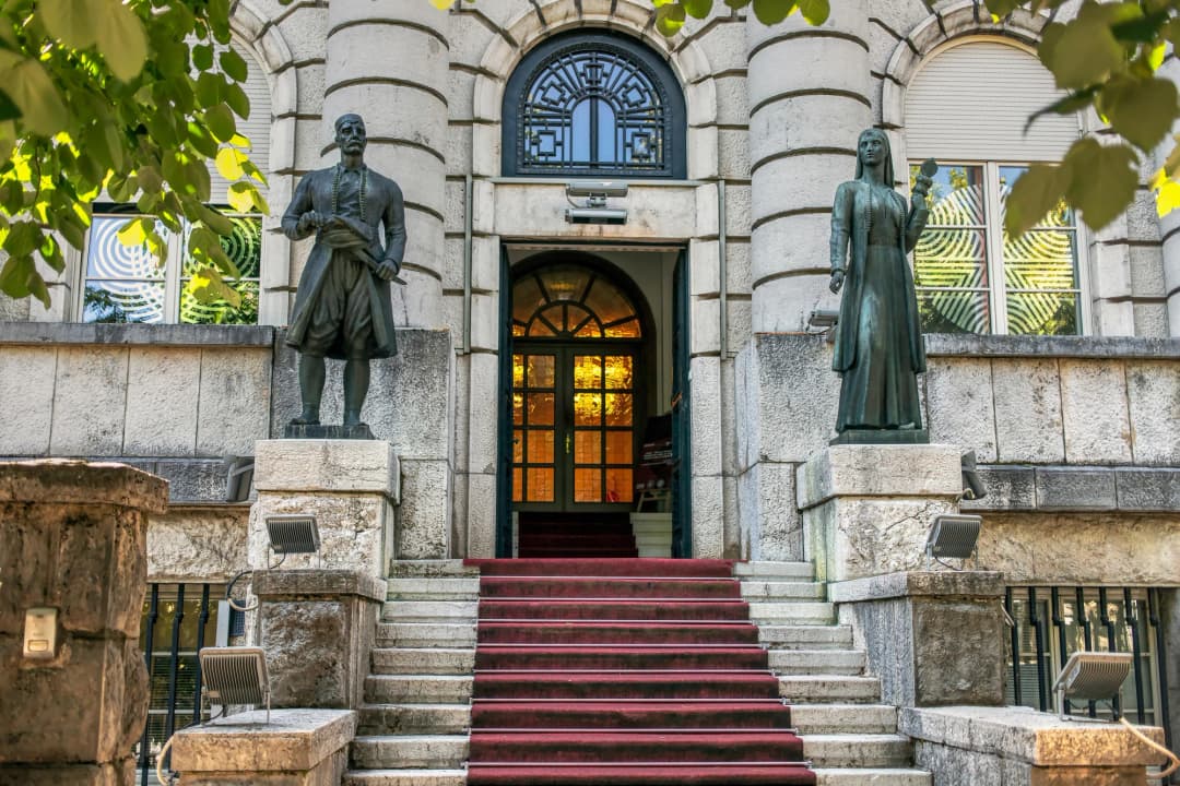
French Embassy (1910) – A striking Art Nouveau building with ceramic tile facade decoration, built for the proclamation of the Kingdom and designed by architect Paul Gaudet. Located on the main street (Njegoseva ulica), it is one of the most photographed buildings in the city and now serves as part of the National Library.
Italian Embassy (1910) – Also built for the Kingdom proclamation year; today the Central National Library "Djurdje Crnojevic."
British Embassy – Now houses the University of Montenegro Music Academy.
Turkish (Ottoman) Embassy – Now the Faculty of Drama.
Serbian Embassy – The building now contains the Ethnographic Museum.
United States Embassy – The U.S. did not build a dedicated structure; the secretary of the embassy operated from the Grand Hotel, while the ambassador was based in Athens.
What makes this remarkable is the concentration. In most capitals, embassies are scattered across a large city. In Cetinje, you can walk past the diplomatic missions of six or seven great powers in ten minutes — a physical reminder of a time when this town of a few thousand people was a legitimate player on the European stage.
A useful walk links the central museums with the former Russian, French, Italian and British diplomatic buildings, then continues through residential streets. The walk works best as context after the King Nikola Museum: the court’s international relationships become physically visible. Note that some former legations now have institutional uses — universities, libraries, galleries and cultural facilities — and are not conventional visitor attractions. Appreciate exteriors from public streets, respect signs and never assume that an open gate means public access. Exact occupancy changes over time, so treat a current city map or visitor-office advice as more reliable than an old list [10][11].
Former legations give Cetinje an unusually varied diplomatic streetscape.
The National Museum of Montenegro: The Essential Circuit
The National Museum of Montenegro is not a single building but a complex institution overseeing five separate departments spread across Cetinje’s historic centre: King Nikola’s Museum, the Art Museum, the Historical Museum, the Ethnographic Museum, and the Njegos Museum at the Biljarda. It also administers the Njegos Mausoleum on Mount Lovcen and the Njegos Birthplace in the village of Njeguski. Their schedules differ, and trying to “do the museum” without choosing buildings first is the easiest way to waste a day. The table below is a decision aid based on the museum’s live hours and price pages checked on 29 August 2026.
National Museum sites in Cetinje: visitor-planning snapshot checked 29 August 2026. Prices and operating status can change.
Site
Best for
Listed individual price
Current planning note
King Nikola Museum
Royal court, diplomacy and statehood
€8
Long summer hours; shorter weekday winter schedule
Biljarda / Njegoš Museum
Njegoš, literature and nineteenth-century rule
€5
Seasonal daily hours listed
Art Museum
Montenegrin and Yugoslav visual art
€5 combined with Historical Museum
Confirm which galleries are accessible
Ethnographic Museum
Dress, domestic life and material culture
€4
Seasonal hours listed
Historical Museum
Political and social history
Part of combined ticket
Listed closed when checked
Collective ticket
Visitors planning several museum sites
€20
Ask what is open before buying
Art Museum of Montenegro
Founded in 1950 with an initial collection of 240 works, the Art Museum of Montenegro (Umjetnicki muzej Crne Gore) is one of the oldest and most prestigious cultural institutions in the country. Housed in the Vladin Dom (Government House), its collection has grown to over 3,500 artworks spanning centuries – one account puts the total at more than four thousand pieces [23][24].
The collection is organized into sub-collections including: the Collection of Icons, the Collection of Montenegrin Fine Arts, the Collection of Yugoslav Fine Arts, the Collection of Foreign Artists, the Collection of Reproductions of Frescoes (medieval frescoes), the Collection of Caricatures, and several legacy collections [23][24].
A particular treasure is the Icon of Our Lady of Philermos (Filermosa), a precious 9th-century Byzantine icon traditionally attributed to Saint Luke the Evangelist. This icon, together with the Hand of Saint John the Baptist and the fragment of the True Cross, came to Montenegro through the Russian imperial family. The icon collection, while small, includes works that span centuries of Orthodox religious art [1][16].
National History Museum and Ethnographic Museum
The National History Museum holds an impressive array of period weaponry, artifacts from Roman and prehistoric archaeological sites, and materials documenting Montenegro’s long struggle for independence and its political and social history. The Ethnographic Museum, housed in the former Serbian Embassy, is considered one of the best-curated ethnographic collections in Montenegro, displaying traditional costumes, tools, household items, musical instruments and crafts that illustrate the daily life of Montenegrin people through the centuries – a window into the rural life in the mountains that surrounded and sustained Cetinje [12][24].
These two collections provide different ways into Montenegrin culture: one through artistic production, the other through clothing, craft and domestic objects. They reward visitors who have already seen the royal and Njegoš collections. However, the National Museum’s current working-hours page lists the Historical Museum as closed. Do not build an itinerary around that gallery until the museum confirms reopening. A collective ticket can still be useful, but ask staff which sites and rooms are operating that day.
Tickets and planning
The National Museum offers a combined ticket (quoted at approximately 10 EUR in one listing and €20 on the museum’s current price page) granting access to all five departments: 1. Museum of King Nikola (Royal Palace) 2. Njegos Museum – Biljarda 3. Art Museum of Montenegro 4. National History Museum 5. Ethnographic Museum. It saves money compared with purchasing individual entries if you plan to visit more than two sites, and individual department tickets are also available at each location. Plan at least half a day if you intend to visit more than two of the sites. The Cetinje Monastery is free to visit (donations appreciated) [9][12][19].
Culture and Events
The Intellectual Heart of Montenegro
Cetinje has been Montenegro’s intellectual and cultural capital since the 15th century. Its unique atmosphere – part museum, part university town, part mountain retreat – sets it apart from every other city in the country. The concentration of national institutions (the National Museum, the National Library, state archives, and university faculties) in such a small city creates a sense of cultural density unmatched elsewhere in Montenegro.
Njegos and the Literary Legacy
Petar II Petrovic-Njegos (1813-1851) is considered the greatest Serbian and South Slavic writer. His masterwork, The Mountain Wreath (Gorski vijenac, 1847), written in Cetinje and published in Vienna, is a modern epic written in verse as a dramatic play – combining three major modes of literary expression. Set in 18th-century Montenegro, it deals with the struggles of Njegos’s ancestor Metropolitan Danilo I to unite the warring Montenegrin tribes against Ottoman domination [7][8].
The work’s themes – the struggle for freedom, justice, and dignity; the conflict between good and evil; humanity’s yearning for liberation – give it universal significance far beyond its regional setting. Njegos is celebrated with a national holiday, Njegos Day (November 13), and his legacy permeates every aspect of Cetinje’s identity [7][8].
Cetinje Biennial of Visual Arts
First organized in 1991, the Cetinje Biennial (Cetinjsko bijenale) is an international art exhibition held every two years. Artists, creators, and critics from around the world gather in Cetinje to exhibit works and participate in workshops. The biennial has featured distinguished Yugoslav and European creators across fine arts, applied arts, and performance art [25].
Summer at the Old Royal Capital
Cetinje hosts one of Montenegro’s most popular cultural events: “Summer at the Old Royal Capital” (Ljeto u Prijestonici), an annual arts festival running from June through September with nearly 100 events. The programme includes [25][26]:
Royal Fest – Hard rock and alternative music festival
Cetinje Jazz Fest – Jazz performances
Espressivo – Classical music concerts
Cucka jeka – Traditional festival in Kobilji Do village
Njegusko ljeto – Summer events in Lovcen and Njeguski
Folklor – Traditional folk performances
Additional programming includes author readings, publication launches, fine art exhibitions, and film screenings.
Traditional Crafts and Preserved Atmosphere
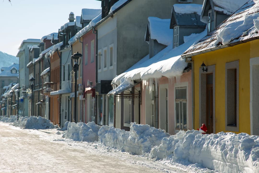
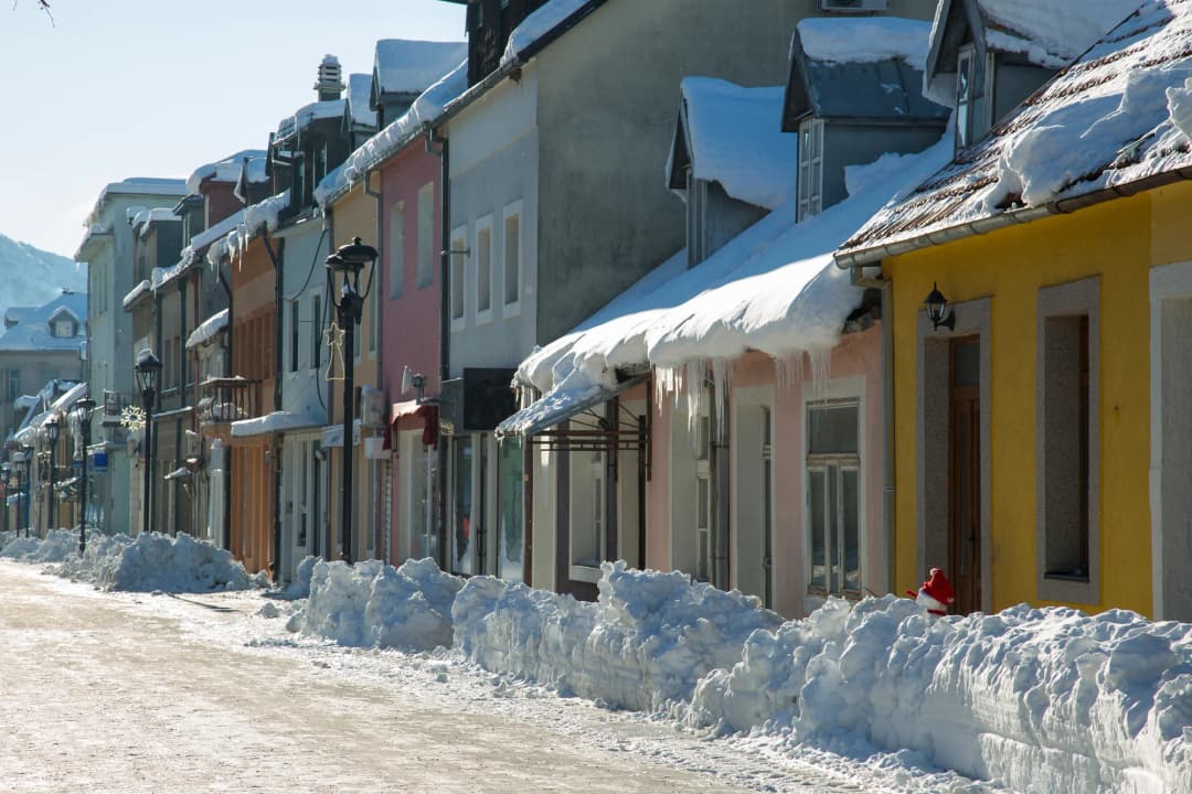
Cetinje retains a remarkably preserved historic atmosphere that many visitors describe as feeling like stepping back in time to the 19th century. The main street, Njegoseva ulica, is partly pedestrianized and lined with well-preserved pastel-coloured houses shaded by arching linden trees – a style quite different from the Venetian architecture of the coast [26][27].
Lovcen National Park and the Njegos Mausoleum
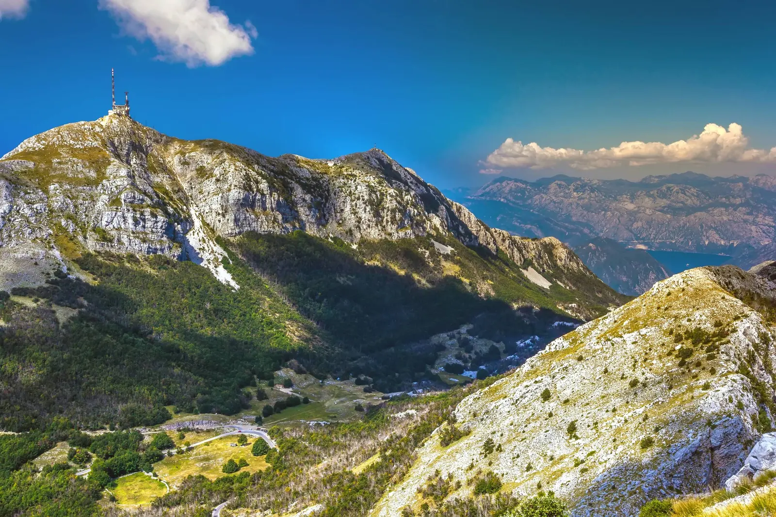
No visit to Cetinje is complete without ascending Mount Lovcen. Lovcen National Park lies within the Municipality of Cetinje and begins almost immediately outside town – approximately 30 minutes by car from the city centre – and the road to the summit winds through dense beech and pine forests with increasingly dramatic views at every turn. It is one of Montenegro’s most visited natural sites. The mountain is deeply symbolic: its name “Crna Gora” (Black Mountain) gave Montenegro its name [28][29].
The centrepiece of Lovcen is the Njegos Mausoleum, perched at 1,657 m on Jezerski Vrh, the mountain’s second-highest peak. Designed by world-renowned Croatian sculptor Ivan Mestrovic and built between 1970 and 1974, it is the highest mausoleum in the world. Reaching it requires climbing 461 stone steps, partly through a dramatically lit tunnel carved through rock – a passage that rises 60 metres through the mountain before emerging on the summit platform. The climb is steady but manageable for anyone in reasonable health; take your time and pause to catch your breath [28][29].
Inside, two granite caryatids guard the tomb, and beneath a golden mosaic canopy composed of 200,000 tiles sits a 28-tonne statue of Petar II Petrovic-Njegos, carved from a single block of black granite, resting in the wings of an eagle with the bird perched on his arm and an open book in his lap. The crypt below is lined in green marble. It is a monument of extraordinary power, matching the scale of the mountain itself [28][29].
But it is the view that most visitors remember. On a clear day, the panorama from the mausoleum platform encompasses half of Montenegro: the Adriatic Sea, the Bay of Kotor, Lake Skadar, the mountains of Durmitor in the north, parts of Albania and Croatia, and on exceptionally clear days even the coasts of Italy across the Adriatic. There are few viewpoints in Europe that offer such a range of landscapes in a single panorama [28][29].
Note: The national park entrance fee is separate from the mausoleum admission, and the mausoleum itself is administered by the National Museum of Montenegro.
Njeguski, prsut and the birthplace of Njegos
Nearby, the village of Njeguski – birthplace of Njegos, whose family home is also administered by the National Museum – is famous for its locally produced prsut (smoked dry-cured ham) and cheese. Several family producers offer tastings at homesteads along the road, and a stop here combines naturally with the mausoleum visit.
Hiking and Cycling
Beyond the mausoleum, Lovcen National Park offers hiking trails of varying difficulty. Ivanova Korita, the park’s recreational centre, sits at a lower elevation and serves as a base for several routes; the area also has picnic facilities, a restaurant, and a small visitor centre with trail maps. You can hike from Ivanova Korita to the mausoleum in approximately 1.5 to 2 hours — a moderate-to-difficult trek covering about 9 kilometres with over 400 metres of elevation gain. More broadly, the Cetinje municipality offers excellent outdoor recreation [34]:
Lovcen National Park hiking: Well-marked trails including moderate loop hikes along Skarda Lake, climbs to Jezerski Vrh, and extended ridge walks with panoramic views. Many trails are shaded, making them pleasant even in summer heat.
Mountain biking: Routes from Cetinje include challenging off-road climbs of 7-10% grade to the highest peaks of Lovcen, with thrilling downhill descents.
Epic descent to Kotor: An extraordinary cycling route descends from the Njegos Mausoleum (1,657 m) all the way down to Kotor at sea level – a total descent of over 1,650 metres.
The Kotor Serpentine Road (25 Hairpin Turns)
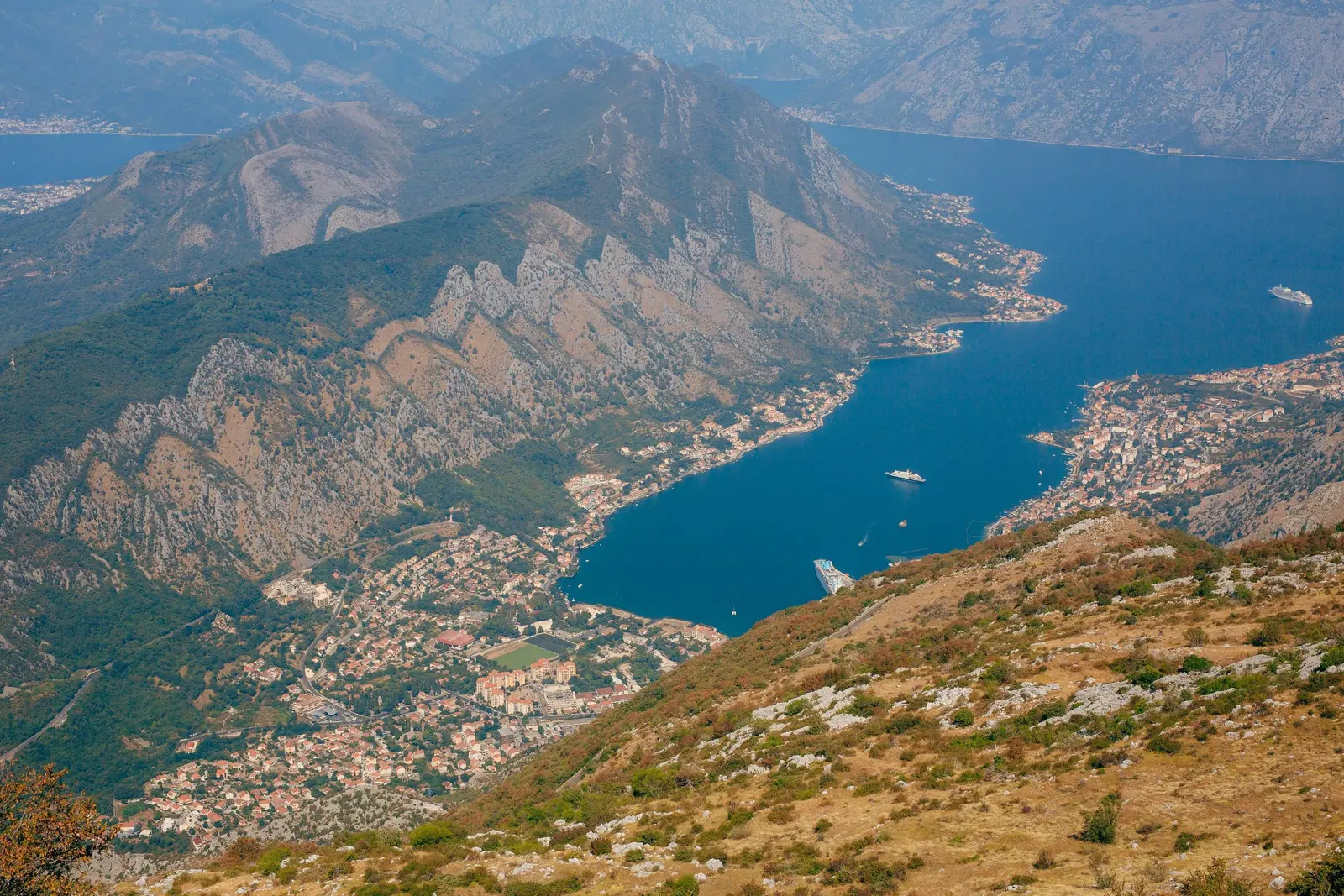
The scenic old P1 road connecting Cetinje to Kotor on the coast is one of the most spectacular drives in Europe. Completed in 1884 as a joint engineering project between the newly independent Montenegrin state and Austria-Hungary, it runs for approximately 36 km in total, and its celebrated serpentine section threads 25 hairpin bends over 8.3 kilometres, dropping more than 400 metres from the Lovcen plateau towards the Bay of Kotor [30].
Before this road was built, the only route between Kotor and the royal capital was a forested donkey trail. The serpentine sections are narrow (approximately 5 metres wide in places), with dramatic drop-offs offering breathtaking views of the Bay of Kotor far below. This drive is a must-do experience, though it demands an experienced and confident driver: the road is paved but narrow, so drive carefully around buses, set out early to avoid the tour coaches, and avoid it in poor weather [30].
Lipa Cave (Lipska Pecina)
Located just 5 km from Cetinje, on the edge of the Dobrsko-gornjoceklin bay, Lipa Cave is one of the largest cave systems in Montenegro, with approximately 2.5 km of passages and halls. The visitor experience includes a charming mini-train ride from the parking area to the cave entrance, followed by a guided walking tour of approximately 400 metres through the main tunnel and the spectacular Negus Hall with its impressive stalactite formations [31][32].
Practical info: - Tour duration: approximately 60 minutes (including train ride) - Cave temperature: constant 8-12 degrees C year-round (bring a light jacket) - No advance booking required; arrive 30 minutes before desired tour time - Seasonal closure: The cave is typically closed from November through March, reopening 1 April [31][32]
Skadar Lake and Rijeka Crnojevica
The route from Cetinje towards Podgorica passes near Skadar Lake, the largest lake in the Balkans and southern Europe, lying between Montenegro and Albania. The famous Pavlova Strana viewpoint offers one of the most photographed panoramas in all of Montenegro – a stunning vista of the Rijeka Crnojevica (Crnojevic River) as it winds in horseshoe meanders into the lake, encircling a pyramid-shaped green hill [33].
The charming village of Rijeka Crnojevica at the lake’s edge features an elegant arched limestone bridge built in 1853 by Prince Danilo. The village was historically an important trading post and the place where Montenegrin rulers had their summer residences before establishing Cetinje [33]. Further along the shore, boat tours from Virpazar (about 45 minutes from Cetinje) explore the lake’s islands, monasteries, and bird habitats — including one of Europe’s last pelican colonies.
Day Trips from Cetinje
Cetinje’s central position between the coast and the interior makes it an excellent base for day trips in several directions.
Lovcen Summit (30 minutes by car): The road from Cetinje to the Njegos Mausoleum parking area takes roughly 30 minutes; combine it with a stop at Njeguski.
Kotor via the Serpentines (45-60 minutes): The old P1 road and its 25 hairpins, with breathtaking views from above. Drive early to avoid tour buses on the narrow road.
Podgorica (30 minutes): The modern capital is a straight, easy drive from Cetinje. While Podgorica is not Montenegro’s most picturesque city, it has good restaurants, the Millennium Bridge, the Cathedral of the Resurrection, and serves as a transport hub for onward travel.
Lake Skadar (45 minutes): Boat tours from Virpazar, the Pavlova Strana viewpoint, and the village of Rijeka Crnojevica.
Lipa Cave (5 km): An easy half-day addition, weather-independent and reliably cool.
Where to Eat in Cetinje
Cetinje is not a culinary destination in the way that the coast is, and that is precisely its appeal. The restaurants here serve Montenegrin food for local people, not tourist menus with photographs. Portions tend to be large, prices are lower than on the coast, and the cooking is honest — traditional konobe with an emphasis on authentic, homestyle cooking.
Restaurant Kole is the standout. Located a few hundred meters from the Palace Square, it occupies a handsome building with a warm interior and serves what many locals consider the best food in town. The menu features Njeguski prsut (dry-cured ham from the village of Njeguski, just up the road), Njeguski sir (local cheese), smoked meats, lamb prepared several ways — boiled, roasted, or cooked in milk — and fresh carp from Lake Skadar prepared on volcanic lava stone. The koset (smoked beef ham) is excellent. International options exist on the menu but stick to the Montenegrin dishes. Open daily from early morning to late evening.
Beyond Kole, several kafanas and small restaurants around the main square serve reliable grilled meats, salads, freshwater fish and traditional stews. Cetinje is also a good place to try cicvara (a rich cornmeal and cheese dish) and kacamak (a similar preparation), both mountain staples that you will not often find on coastal menus. Local bakeries sell burek and other pastries for quick, inexpensive meals.
Coffee culture is strong in Cetinje. Sitting in one of the cafes on the main boulevard with a strong domestic coffee, watching the unhurried pace of the town, is itself a worthwhile experience.
Where to Stay
Cetinje has a limited but growing accommodation sector, and what exists is genuine and affordable. The absence of mass tourism is part of Cetinje’s charm – the city maintains an authentic, unhurried atmosphere [26][27].
Grand Hotel is the most established option — a three-star property in the center of town with clean rooms, an indoor pool, sauna, free breakfast, and an on-site restaurant. It is within walking distance of every major sight. Rooms start from around 70-80 euros per night, making it significantly cheaper than comparable hotels on the coast. Free parking is available. (Historical footnote: this is the same Grand Hotel from which the secretary of the American embassy once conducted United States business in the royal capital.)
Beyond the Grand Hotel, a growing number of small guesthouses, apartments, and private rooms are available through booking platforms. These tend to be family-run, modestly furnished, and very affordable — with the kind of warm hospitality that only non-touristy places can manage.
For those with a car, staying in Cetinje and driving to the coast for day trips is a budget-friendly alternative to booking accommodation in Kotor or Budva during peak season. If you would rather base yourself elsewhere, compare bases in Budva or Kotor; from inland, the Podgorica accommodation guide helps with an early start.
Getting to Cetinje and Getting Around
Getting there
From Podgorica: Approximately 30 minutes by car on a straightforward two-lane road (36 km via the M2.3 highway; the municipal road distance to Titograd is given as 46 km). Regular bus service operates throughout the day, with the journey taking about 40 minutes.
From Kotor via the Lovcen serpentines: This is the dramatic route — 25 hairpin turns climbing from the bay to the Lovcen plateau, then continuing to Cetinje. Allow 45 minutes to an hour (some sources say 60 minutes), or about 90 minutes via the main highway through Budva. The road distance is 45 km. The road is paved but narrow; drive carefully around buses. Not recommended in poor weather.
From the coast (Budva): Approximately 30 minutes by car (33 km), or about 30 to 40 minutes via Podgorica, slightly longer via the scenic mountain road.
Buses: Direct services from Podgorica, Kotor, Budva, Herceg-Novi, and Ulcinj. Schedules are limited, so check departure times in advance. Cetinje makes an easy day trip from any coastal town or from the capital.
Airports: There is no airport or railway station in Cetinje and no train service. The nearest airport is Podgorica (TGD), approximately 55 km away – the municipal figure for Golubovci near Podgorica is 58 km – and roughly 45 minutes by car. Tivat airport is 57 km away, roughly 50 minutes by car, and Ćilipi near Dubrovnik is 115 km. Podgorica airport is used the most.
Getting around
Cetinje’s historic centre is compact and entirely walkable. All major museums, the monastery, embassy buildings, and restaurants are within a 15-minute walk of each other. No public transport is needed within the city itself. A car is useful only for excursions to Lovcen National Park, Lipa Cave, or the Skadar Lake area.
Practical Tips: Hours, Weather and Access
Planning a National Museum visit in three steps
Step
Question to answer
1 · Building
Open today?
2 · Hours
Which season?
3 · Ticket
What is included?
Source: en.narodnimuzej.me
Check hours twice. The National Museum lists different summer and winter periods by building. At the time of checking, King Nikola Museum had daily summer hours from 11 April to 15 November, while its winter access was on weekdays with shorter hours. Biljarda and other sites followed their own seasonal schedules. Public holidays, exhibitions or maintenance can override published patterns.
Museum tickets. A combined ticket covering all five departments of the National Museum of Montenegro is the most economical option if you plan to visit more than two sites. Individual tickets are also available at each location.
Monastery dress code. Cover your shoulders and knees. Women should bring a headscarf and a long skirt or wrap. The monastery is a functioning religious site, not a museum, and dress requirements are taken seriously.
Expect mountain weather. Conditions can be cooler and wetter than the coast on the same day, and showers can begin abruptly. Bring a light layer and rain protection even when departing sunny Budva. The leafy centre offers shade, but not every route is sheltered.
Plan for mixed accessibility. Central distances are short, yet historic thresholds, steps, uneven paving and older interiors can create barriers. Ask the museum directly about the specific building, gallery and toilet facilities you need. Do not infer access at one museum from another.
Arrive without a fragile timing promise. Road traffic varies sharply by season, and navigation services can route drivers differently. Check live road conditions rather than relying on the old “twenty minutes” claim.
Cetinje is quieter than the coast. That is the point. Come here for the history, the culture, and the chance to see a side of Montenegro that most tourists miss entirely. The town moves at its own rhythm — shops may close for long lunches, and not everything runs on a strict schedule.
Time needed. A focused visit to the main sights can be accomplished in a half-day. But to see the museums properly, visit the monastery, and make the trip up to Lovcen, plan for a full day or — better still — an overnight stay. Two nights allow a genuinely relaxed pace, with time for a day trip to Kotor or Lake Skadar. The most rewarding way to experience both town and mountain is to spend a night in Cetinje, visit the museums and monastery in the afternoon, then drive up to the Njegos Mausoleum the following morning when the air is clearest and the views are best.
Language. English is less widely spoken here than on the coast, but younger residents and museum staff generally manage well. A few words of Montenegrin — dobar dan (good day), hvala (thank you), molim (please) — go a long way.
Cultural significance. Montenegrins view Cetinje with a reverence that is difficult to overstate. This is where their state was born, where their literature was printed, where their church has its seat, and where their independence was defended. Approach the town and its monuments with the respect that this history deserves.
Carry a photo ID only where your transport or ticket conditions require it, and keep valuables unobtrusive. The centre is compact enough that a paper note of addresses can be more useful than repeatedly navigating between adjacent buildings. If one site is unexpectedly closed, use the time for the embassy walk instead of rushing to replace it with a distant attraction.
Climate and when to visit
Cetinje has an oceanic climate (Koppen: Cfb) at 670 m elevation. It is notably one of the rainiest towns in Europe, receiving approximately 3,300 mm of precipitation annually – significantly more rain than the coast [35].
Summer (June-September): Warm and generally sunny, with average July temperatures around 20 degrees C. Afternoon thunderstorms possible, and mornings can be cool enough for a light jacket. This is the best time for hiking, cycling, and the cultural festival season.
Winter (December-February): Cold, with average January temperatures around 1.5 degrees C. Heavy snowfall is common at this altitude, and the road to Lovcen may be closed from November through March. Budget accommodation prices are lowest. Temperature extremes can reach -15 degrees C.
Best time to visit:May to September for the best combination of weather, open attractions (especially Lipa Cave from April), and cultural events. July-August are peak months.
Cetinje’s altitude makes layers and rain protection sensible even on a coastal day trip.
A Realistic One-Day Cetinje Itinerary
A one-day Cetinje plan
Time of day
What to see
Morning
Palace + Biljarda
Midday
Monastery
Afternoon
One collection + walk
Source: en.narodnimuzej.me
09:00–10:30: King Nikola Museum. Start with the political framework while your attention is fresh. In winter, confirm weekday opening before leaving the coast or Podgorica.
10:30–11:15: palace square and Ćipur. Read the relationship between the palace, church and old dynastic centre rather than rushing between doors.
11:15–12:15: Biljarda. Focus on Njegoš’s combined literary and governing roles, and allow time for the relief map in the glass pavilion.
12:15–13:00: monastery area. Allow flexibility if a service is taking place; the sacred relics are the highlight for most visitors.
13:00–14:00: lunch. Choose locally once you can see current menus and hours; this guide does not freeze a restaurant recommendation into a changing city.
14:00–15:30: one specialist collection. Choose Art or Ethnographic rather than exhausting both by default.
15:30 onward: embassy-quarter walk, taking in the Vlach Church and its rifle-barrel fence. Finish outside, where closing times matter less.
If you have a car and a longer day, swap the afternoon for the drive to Lovcen and the Njegos Mausoleum (2-3 hours round trip) or Lipa Cave (1.5 hours), and consider ending at the Pavlova Strana viewpoint over Skadar Lake on the road back towards Podgorica.
In the shorter winter schedule, reduce this to King Nikola Museum, Biljarda if open, the monastery exterior and a compact diplomatic walk. Visitors making a wider circuit can use the Grand Tour overview to place Cetinje between coast, mountains and the modern capital.
How to Visit Responsibly
Buy tickets from official desks, respect museum photography rules and avoid touching historic interiors. In religious spaces, prioritize the needs of worshippers. Former diplomatic buildings may be workplaces or institutions, so view them from public areas unless entry is explicitly offered. Finally, spread your time and spending beyond a rushed coach stop: a café break, specialist collection or guided walk adds more value than photographing the main façades in minutes.
Visitor Impressions and Reviews
Cetinje occupies a special place in visitor experience. Travellers consistently describe it as “one of the most underrated destinations in Montenegro” – a place with a palpable sense of history and a refreshingly unrushed atmosphere [26][27][36].
Common visitor impressions include:
“Stepping back in time” – The well-preserved 19th-century streetscape, the absence of modern commercial development, and the quiet pace of life create a feeling of having entered a different century.
“Museum city with real depth” – While some visitors note that certain museum exhibits could benefit from modernized displays, the sheer concentration of nationally significant collections in such a small area is consistently praised.
“A different spirit” – Many visitors describe Cetinje as having a different energy from the bustling coast – more thoughtful, more intellectual, more connected to Montenegro’s identity.
“Honest and authentic” – Unlike more touristic coastal towns, Cetinje is described as maintaining genuine Montenegrin character. Some visitors note that parts of the city show their age, with some buildings in disrepair, but this is often seen as adding to the authentic atmosphere rather than detracting from it.
The monastery and relics are consistently rated as the highlight, with visitors expressing awe at seeing relics of such historical and religious significance in a small, accessible setting.
Lovcen and the Mausoleum are rated as world-class experiences, with the 461-step climb rewarded by what many describe as the best panoramic view in all of Montenegro.
Cetinje is particularly recommended for travellers interested in history, culture, architecture, and religious heritage – and as a refreshing counterpoint to the beach-focused tourism of the Adriatic coast [26][27][36].
A Brief History of Cetinje
Before the city
Even before the establishment of Cetinje, there were settlements on this territory. There are traces of the habitats of the original people from the Paleolithic era. From that period, the Koronjina cave represents an important, still unexplored archaeological site. A large number of interesting stone tools were found in it. Around today’s Wallachian church there was a Bogomil necropolis with about 150 stećaks that were built into its foundations during the restoration of this building (1866), except for two that are still lying at the entrance to the church yard. In written sources, Cetinje is mentioned for the first time in 1440; however, the settlement dates back to the end of the 15th century.
Foundation by Ivan Crnojevic (1482)
Cetinje was founded in 1482 when Ivan Crnojevic (Ivan Crnojević), lord of Zeta, moved his capital from Obod above the Crnojevic River to a more defensible location on the field at the foot of Mount Lovcen. The relocation was driven by the relentless advance of the Ottoman Empire. Before that dramatic invasion of the Turks, the centre of the medieval state of Zeta had moved from Žabljak (1475) to Obod near Rijeka Crnojevića, and then to Cetinje a few years later. Ivan chose this site – a natural fortress surrounded by mountains – because it offered far better protection than the earlier capitals of Zabljak Crnojevica and Obod [3][4][5].
In 1484, Ivan built a fortified court (the Crnojevic Court) and in 1485 erected a monastery, moving the seat of the Zeta Metropolitan diocese from the monastery of St. Nikola on the island of Vranjina in Lake Skadar to Cetinje. (One account compresses this slightly, dating the castle to 1482 and the monastery endowment two years later.) This single act transformed Cetinje into both the secular and spiritual centre of the state of the Crnojevici – at that time already called Montenegro, territorially squeezed between the valley of the River Crnojevića and Boka Kotorska, on the poor and lean Lovćen karst. It is a dual role the city would hold for centuries [4][5].
The First Printing Press (1493)
Ivan’s son, Djurdje Crnojevic (Djuradj), established at Obod (and later at Cetinje) the first printing press in the Slavic south in 1493 – one of the first printing presses in southeastern Europe. It produced the Oktoih Prvoglasnik in 1493, the earliest printed book among the South Slavs. Church books were printed in Cyrillic script and illustrated with drawings of exceptional beauty. This was a landmark in South Slavic cultural history and is a point of immense pride for Montenegro [4][5][6].
Ottoman Period and Resilience
After the fall of the Crnojevic dynasty, Cetinje endured a long period of Ottoman pressure. The monastery was destroyed and rebuilt multiple times. It was not until the end of the 17th century, in 1697, that Cetinje began to flourish again under the rule of the Petrovic-Njegos dynasty, founded by Danilo Petrovic. Beginning with Bishop Danilo in 1697, the Petrovic dynasty ruled Montenegro for 222 years, governing from Cetinje through centuries of Ottoman pressure; the prince-bishops (vladike) ruled the country as a theocracy from Cetinje from 1516 to 1851, making the monastery their seat of power [4][5][6].
During this long stretch, Montenegro was one of the few territories in the Balkans that was never fully conquered by the Ottoman Empire. The Montenegrins fought from their mountain strongholds with such tenacity that the region earned the nickname “Serbian Sparta” — a comparison to the warrior society of ancient Greece that tells you everything about how this small land was perceived by its neighbors and enemies alike.
The Petrovic-Njegos Dynasty
The most famous of the prince-bishops was Petar II Petrovic-Njegos (ruled 1830-1851), who was simultaneously a ruler, Orthodox bishop, poet, and philosopher. He built the Biljarda residence in 1838, modernized Montenegrin governance, promoted education, and authored The Mountain Wreath (Gorski vijenac), considered the national epic of both Montenegro and Serbia [7][8].
After Njegos, his nephew Danilo I secularized the state (separating religious and political authority), and was succeeded by Nikola I Petrovic-Njegos, who ruled as Prince from 1860 and was proclaimed King of Montenegro in 1910 [5][9].
International Recognition and the Embassy Era (1878-1918)
The Congress of Berlin (1878) recognized Montenegro’s independence, ushering in a golden age for Cetinje, which suddenly found itself on the diplomatic map of Europe. Major European powers established diplomatic missions, and the small capital was transformed with grand embassy buildings in styles ranging from Baroque to Art Nouveau. The years from 1878 to 1914 were the glory days of Cetinje, when foreign intellectuals and diplomats flocked to the city [10][11].
Montenegro was proclaimed a Kingdom in 1910 under King Nikola I, and Cetinje became the capital of the Kingdom of Montenegro. The court was extended and redecorated for the coronation celebrations. During this era, Cetinje had embassies from Russia, Austria-Hungary, France, Great Britain, Italy, Turkey, the United States, and other nations [10][11][12].
World War I and Loss of Independence
During World War I, Montenegro fought alongside the Allied Powers. Austria-Hungary occupied Cetinje in January 1916. King Nikola fled to exile in France. After the war, the Podgorica Assembly of 1918 voted to unite Montenegro with Serbia and the emerging Kingdom of Serbs, Croats and Slovenes (later Yugoslavia), effectively ending Montenegrin independence and Cetinje’s role as a national capital [5][9].
World War II
During World War II, Italy occupied Montenegro in April 1941. The Italians attempted to establish a puppet “independent” Montenegrin state, with Cetinje as its administrative center. This was partly motivated by Queen Elena of Italy, who was born in Cetinje as the daughter of King Nikola I. However, a popular uprising erupted on 13 July 1941 – one of the first anti-fascist insurrections in occupied Europe. Insurgents besieged Italian forces in Cetinje. After Italy’s capitulation in September 1943, Nazi Germany took over the occupation until liberation in 1944 [13][14].
Post-War Period and “Old Royal Capital” Status
From the founding of the Crnojevici until the end of World War II, Cetinje was the capital of Montenegro. In 1946, that function passed to Titograd (now Podgorica), capital of the Socialist Republic of Montenegro. Cetinje retained its role as the cultural and intellectual centre. When Yugoslavia dissolved and Montenegro regained independence in 2006, Podgorica remained the seat of government, but Cetinje was constitutionally designated the Old Royal Capital (Prijestonica) – an acknowledgment that some things matter too much to forget. The Blue Palace was renovated to serve as the official residence of the President of Montenegro [5][6][15].
Summary
Cetinje is not merely a former capital – it is the spiritual and cultural anchor of Montenegrin identity. From the sacred relics of the monastery to the literary genius of Njegos, from the rifle-barrel fence of the Vlach Church to the diplomatic grandeur of the embassy quarter, from the alpine heights of Lovcen to the underground wonders of Lipa Cave, Cetinje offers a depth and richness of experience that belies its modest size. It will not dazzle you with beaches or nightlife. It will do something better: it will show you the history, the faith, and the stubborn independence that made Montenegro what it is. It is the essential inland complement to Montenegro’s celebrated coastline, and for travellers who want to understand this country rather than simply visit it, there is no better place to begin.
Quick answers
When is the best time to visit Cetinje?+
Cetinje has an oceanic climate (Koppen: Cfb) at 670 m elevation. It is notably one of the rainiest towns in Europe , receiving approximately 3,300 mm of precipitation annually – significantly more rain than the coast [35].
From Podgorica: Approximately 30 minutes by car on a straightforward two-lane road (36 km via the M2.3 highway; the municipal road distance to Titograd is given as 46 km). Regular bus service operates throughout the day, with the journey taking about 40 minutes .
Cetinje’s historic centre is compact and entirely walkable . All major museums, the monastery, embassy buildings, and restaurants are within a 15-minute walk of each other. No public transport is needed within the city itself.
Beyond the mausoleum, Lovcen National Park offers hiking trails of varying difficulty. Ivanova Korita , the park’s recreational centre, sits at a lower elevation and serves as a base for several routes; the area also has picnic facilities, a restaurant, and a small visitor centre with trail maps.
Cetinje is not a culinary destination in the way that the coast is, and that is precisely its appeal. The restaurants here serve Montenegrin food for local people, not tourist menus with photographs. Portions tend to be large, prices are lower than on the coast, and the cooking is honest — traditional konobe with an emphasis on authentic, homestyle cooking.
Cetinje has a limited but growing accommodation sector, and what exists is genuine and affordable. The absence of mass tourism is part of Cetinje’s charm – the city maintains an authentic, unhurried atmosphere [26][27].
Cetinje’s central position between the coast and the interior makes it an excellent base for day trips in several directions. Lovcen Summit (30 minutes by car): The road from Cetinje to the Njegos Mausoleum parking area takes roughly 30 minutes; combine it with a stop at Njeguski.
Pavle Obradović is from Herceg Novi. He was Manager of Montenegro.com, then Director of the Herceg Novi Tourism Organization, and is now Coordinator for Investment and Development Projects at the Municipality of Herceg Novi. He holds a BSc in International Hospitality and Service Management from the Rochester Institute of Technology (RIT).
···
Updated · Originally published
Montenegro Travel Newsletter
Get weekly stories, guides, and insider tips about Montenegro delivered to your inbox.




.jpg&w=2048&q=75)