Montenegro · Bay of Kotor
A river two hundred metres long, seven degrees cold, a Baroque church built of Korčula stone, and a shore street named for the morning it burned — the last quarter of Dobrota before the bay turns north.
Ljuta is the northern end of Dobrota, the seven-kilometre ribbon of captains’ houses that runs up the east shore of the inner Bay of Kotor from the old town, and it is named for the river that marks the boundary: a karst spring that bursts from the foot of the mountain and runs about two hundred metres to the sea at seven degrees, quietly in summer and, after heavy rain, with the fierce rush that gave it the name — ljuta, angry. The old flour mills that stood on it are now the Stari Mlini restaurant, family-run for over forty years and reachable by boat; the river mouth beside it is the coldest swim in the bay. Ljuta is not a census settlement of its own — MONSTAT counts it inside Dobrota’s 8,056 — and a local count in 2019 put its permanent residents at about 120, with three times as many people owning houses and holiday flats here. The village is a single row of stone houses along the shore street, the captains’ mansions of the Ivanović, Tripković, Dabinović and Milošević families among them, and in its middle, on a raised walled plateau by the water, stands the Baroque church of St Peter: begun around 1700 and finished in 1780, built of dressed stone the village’s seafarers shipped from Korčula, modelled on Our Lady of the Rocks at Perast, with three marble altars painted in Venice and a silver-clad Madonna the village has venerated since a vow made in the cholera year of 1855. The street is called Ulica 7. Novembra for the morning in 1944 when German troops landed here, lined up thirty civilians in front of the church, were talked out of the execution by the priest — “shoot me, not them” — and burned 34 of the village’s 41 houses. Five families came back and rebuilt. Today Ljuta is a place to stay rather than to tour: a few self-catering apartments, three small shops, a concrete bathing platform, the Blue line bus at the door, and the whole inner bay within a quarter of an hour — Orahovac 2 km north, Perast 7, Kotor’s old town 7 the other way, Tivat airport 15. The road north from the village towards Perast is the most open stretch of the whole shore.
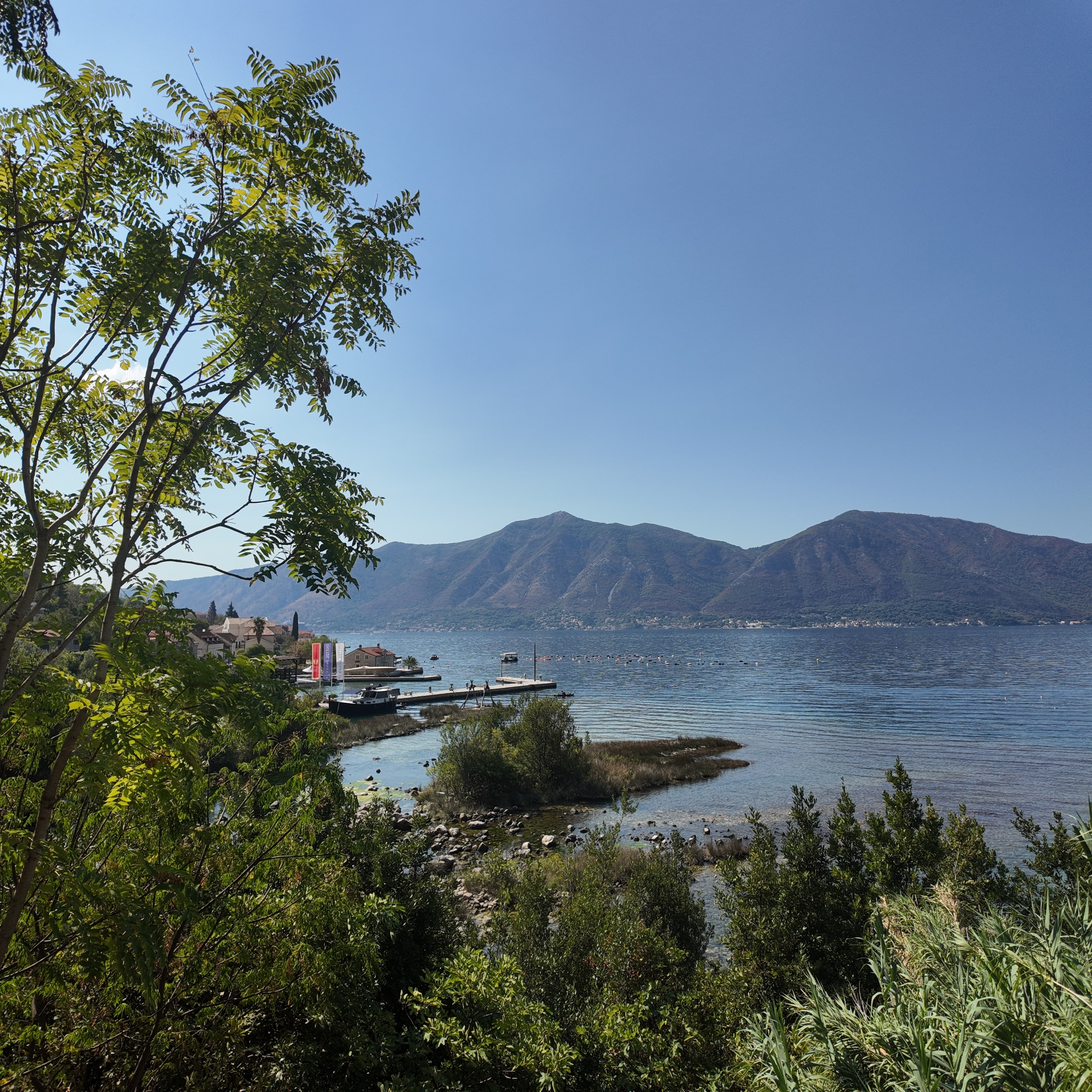
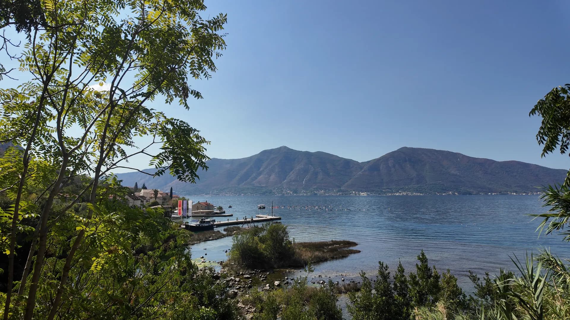
The bay from the Ljuta shore, through the trees
Footage: Montenegro.com, CC BY 4.0
Ljuta itself
Best for a handful of self-catering apartments in a row-built village that has kept its shape — three shops, one restaurant, a concrete bathing platform, and the bus outside the door
Dobrota, 4.5 km south
Best for the long seafront of captains’ palaces between here and Kotor, with far more rooms and the old town at the end of the walk
Orahovac, 1.8 km north
Best for the next village along, a pebble shore and the mussel farms; the two share a road, a bus and a spring-cold sea
Perast, 7 km north
Best for the bay’s museum town, two islets and the evening light; Ljuta is a fifteen-minute drive back for dinner at the mills
The north shore of the inner bay, by residents
Residents by census settlement, 2023 — Ljuta is counted inside Dobrota
Dobrota, the seven-kilometre ribbon of captains’ houses that runs from Kotor to the Ljuta river, holds more people than every other settlement on this shore together. Ljuta is its quiet northern end: about 120 of those 8,056, by the only count anyone has made.
Who visits Montenegro
Share of foreign overnight stays, 2025
MONSTAT · 2025
Ljuta’s dated history is Dobrota’s and Kotor’s — Venetian for nearly four centuries, Austrian for one — with a single day of its own that the shore street still carries in its name.
Wikipedia (en/sr) on Dobrota: 1260, 1717, 1814. Wikipedia (sr) on Ljuta: the church of 1700–1780 and the 1855 vow. Pasinović, Boka News 2019: 7 November 1944. UNESCO WHC 125: inscribed 1979. Kotor passed to Venice in 1420 and to Austria at Campo Formio in 1797, the frame every settlement on this shore shares.
Meanwhile, in 1944
Ljuta, on the foggy morning of 7 November 1944 German troops covering the retreat from Shkodër land from fishing boats; seven partisans are killed, thirty civilians are lined up before St Peter’s until the priest offers himself in their place, and 34 of the village’s 41 houses are set on fire. Five families come back and rebuild with their own hands.
The same autumn — the residents had been expelled and imprisoned on 25 September; the first families returned after 42 days, the evening before the landing.
Normandy: on 6 June the Allies land in France.
Belgrade — on 20 October the city is taken from the Germans, six weeks before Ljuta’s morning; the Bay of Kotor itself is cleared in November.
“Shoot me, not them.”
Don Gracija Ivanović, priest, to German soldiers in front of St Peter’s — 7 November 1944
About thirty civilians from Dobrota stood lined up on the church plateau. The soldiers gave up the execution; by evening 34 of Ljuta’s 41 houses had been burned and 77 people were homeless. The shore street is named 7. Novembra for the day. Account by Prof. Milenko M. Pasinović, Boka News, 2019.
Search thousands of hotels and apartments with live prices.
We may earn a commission from partner links. This helps us keep Montenegro.com free for travelers.
Search hotels, apartments and guest houses with live availability.
We may earn a commission from partner links. This helps us keep Montenegro.com free for travelers.
At the northern end of Dobrota on the east shore of the inner Bay of Kotor, 7 km from Kotor’s old town on the road to Perast. It is a quarter of Dobrota rather than a village of its own — the census counts it inside Dobrota’s 8,056 people; a local count in 2019 put its permanent residents at about 120.
About 180–210 m from the karst spring at the foot of the mountain to the sea, at around 7 °C. It is one of the shortest rivers in Montenegro; after heavy rain it runs with the force that gave it its name, which means “angry”.
A restaurant in the old flour mills on the river, family-run for over forty years, on the main road as you reach Ljuta from Kotor, with its own car park and a jetty for guests arriving by boat. Book ahead in summer.
St Peter’s, a Baroque church on a walled plateau by the water, begun around 1700 and finished in 1780 in dressed stone the village’s sailors shipped from Korčula, modelled on Our Lady of the Rocks at Perast. Its three marble altars were painted in Venice; the silver-clad Madonna on the north altar has been venerated since a vow in the cholera year of 1855.
Ljuta in numbers
the Ljuta, spring to sea: about 180–210 m of water at 7 °C, one of the shortest rivers in Montenegro
St Peter’s finished, eighty years after it was begun, in dressed stone the village’s sailors shipped from Korčula
permanent residents by a 2019 local count — Ljuta is not a census settlement; MONSTAT counts it inside Dobrota (8,056 in 2023)
Tivat, round the bay through Kotor; Kotor’s old town is 7 km
OpenStreetMap way 240236187 and my-sea.com (the river) · Wikipedia (sr) on Ljuta (the church) · M. Pasinović in Boka News, 2019, and MONSTAT Popis 2023 (people) · OSRM road distances
The shape of the bay
Towns at their true positions; the water drawn as a ribbon
Schematic — not a nautical chart.
RAW photo
3072 × 3072 · DNG · DJI Osmo Pocket 3
The camera’s own DNG, ungraded — develop it your way.
Download the DNG (20 MB)Download the full-size JPEG (3072 × 3072, 3 MB)Original recording and photograph by Montenegro.com, licensed CC BY 4.0: free to share and adapt, with credit to Montenegro.com. Using them commercially? Please credit Montenegro.com and link back to this page.
A Baroque church on a walled stone plateau by the sea, begun c. 1700 and finished in 1780 in dressed stone shipped from Korčula, modelled on Our Lady of the Rocks; three Venetian-painted marble altars and a silver-clad Madonna venerated since the cholera of 1855.
Open in Google MapsA karst spring at the foot of the mountain that runs about 200 m to the sea at 7 °C — one of the shortest rivers in Montenegro, and the northern boundary of Dobrota.
Open in Google MapsThe old flour mills on the river, restored as a restaurant and family-run for over forty years, reachable by road or by boat.
Open in Google MapsBest time: May · June · September
A few hours
Two hours, most of them at the table. The river is the reason to stop and the church the reason to look up; there is no beach service, no ticket, nothing managed.
One full day
For 7 November 1944, when German troops landed at Ljuta, lined up thirty civilians in front of St Peter’s and burned 34 of the village’s 41 houses. The priest, don Gracija Ivanović, stepped out and said “shoot me, not them”, and the execution was abandoned. Five families came back and rebuilt.
Yes, off a concrete bathing platform and the small gravel coves south of the village, in water noticeably colder near the river mouth. There is no bathing-water monitoring point at Ljuta itself; the nearest sampled sites are at Dobrota and Orahovac, both rated excellent in 2026.
For a quiet stay, yes: a few self-catering apartments, three small shops, the Blue line bus to Kotor outside the door, and Orahovac, Perast and Kotor all within a quarter of an hour. There is one restaurant, the mills; for more, Dobrota and Kotor are down the road.
No — the nearest is Tivat Airport (TIV), 15 km away by road.
From about 13 °C in February to 25 °C in August. It holds above 22 °C from June to September, which is the swimming season. Regional normals from the Bar station, not a city-precise reading.
The UK Foreign, Commonwealth & Development Office (FCDO) has no advisory against travel to Montenegro; it last reviewed its guidance on 13 August 2026. That is their assessment of the country as a whole, not ours and not a judgement about Ljuta, so read it yourself before you travel. The emergency number in Montenegro is 112.
The whole of the inner bay’s north shore in a day, with Ljuta as its quietest hour. The road north of the village is the most open stretch of it.