Montenegro · Bay of Kotor
A shore village under a bare mountain wall where the springs run into the sea, the mussel lines run across it, and — for once on this coast — the people are coming back.
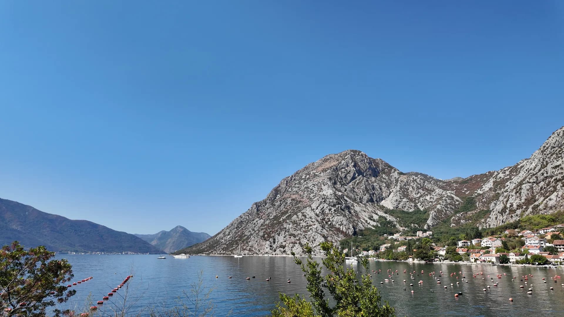
Orahovac is a shore village of 345 people on the north side of the inner Bay of Kotor, eight kilometres from Kotor’s old town on the road to Perast, squeezed between the water and the bare limestone wall the locals call the Orahovačke Grede. Springs rise all along this stretch — the Ljuta at the village’s southern edge and the Ercegovina above it supply most of Kotor municipality’s drinking water in summer — and they run straight into the bay, so the sea off Orahovac is colder and fresher than anywhere else in the Boka: the bathing-water station measured 24 parts per thousand of salt in late May 2026 against 38 in the outer bay, and rated the water excellent at every sampling of the season. The lines of floats offshore are a mussel and oyster farm. The village has been written down since 1399, when a Kotor notary spelled it Orachouez, and its church of St George on the rock Stanac — a chapel recorded in 1466, wrapped in a new nave in 1883, with early-seventeenth-century frescoes inside and cypresses and a walled graveyard around it — dominates every view of the place. Venetian from 1420, Ottoman with Risan from 1482 to 1684 and Venetian again after that, Orahovac held the third market in the bay and was the hinterland’s door to the sea; the paths that carried that trade still climb from the church to the abandoned hamlets of Gornji Orahovac and the Austro-Hungarian forts of Šanik and Vranovo brdo. The name, tradition says, came from the walnut trees whose nuts the villagers once sold along the coast, and the largest valley above is still called Orahov Do. There is no hotel — the World Heritage Committee asked Montenegro in July 2026 to hold the one that was planned — and no long beach, only small pebble coves between the old stone jetties, a couple of beach bars, a restaurant on the main road, and apartments and guest houses along the shore. That, and a population that has grown by a sixth since 2011 while every village around it shrank, is the whole point: the inner bay on the Kotor bus, without the crowds. Ljuta and its cold river are a kilometre south, Perast five and a half north, Tivat airport seventeen through Kotor.
Photographs: Montenegro.com
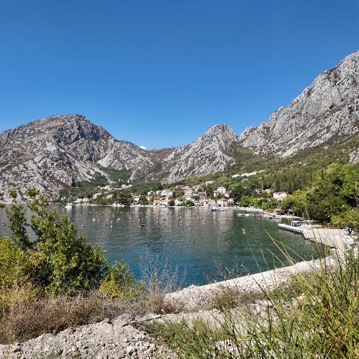
A slow pan across the inner bay from the Orahovac shore
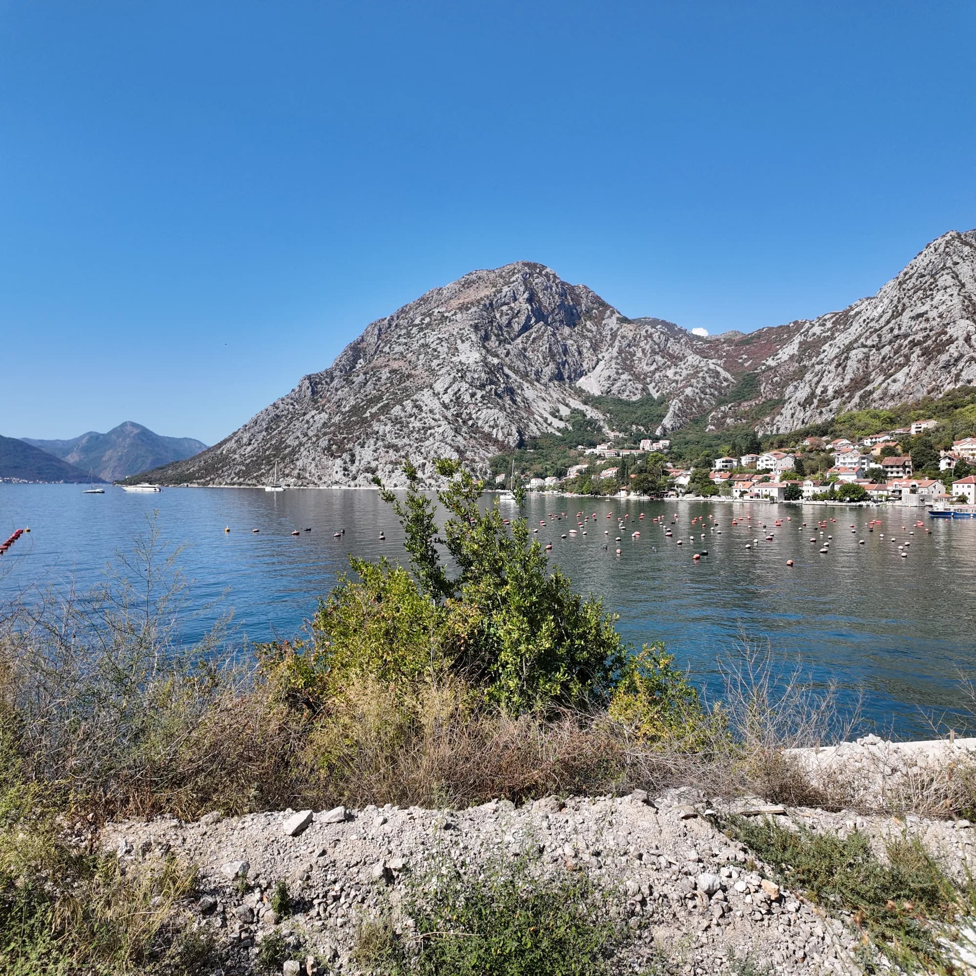
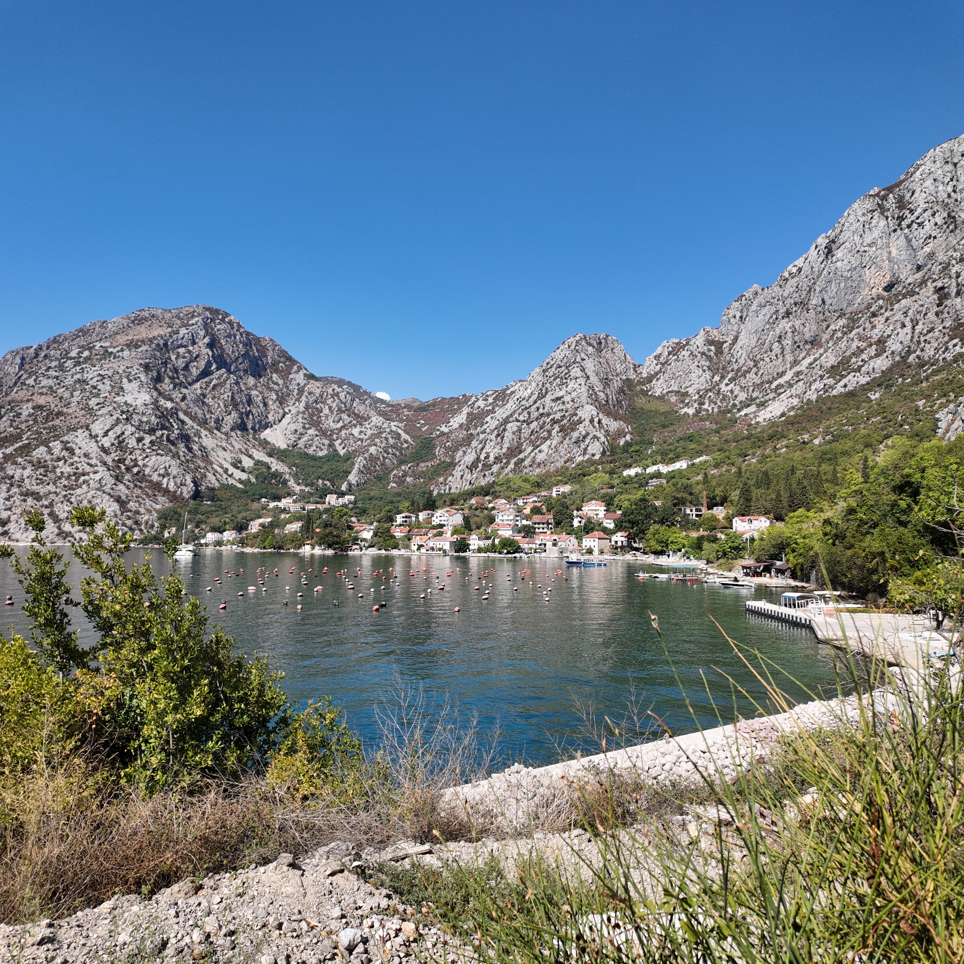
The mountain wall above Orahovac and the still water below it
A house with its own quay on the Orahovac shore
Small boats moored off the quay at Orahovac
Footage: Montenegro.com, CC BY 4.0
RAW photo
3072 × 3072 · DNG · DJI Osmo Pocket 3
The camera’s own DNG, ungraded — develop it your way.
Download the DNG (20 MB)Download the full-size JPEG (3072 × 3072, 3 MB)Original recording and photograph by Montenegro.com, licensed CC BY 4.0: free to share and adapt, with credit to Montenegro.com. Using them commercially? Please credit Montenegro.com and link back to this page.
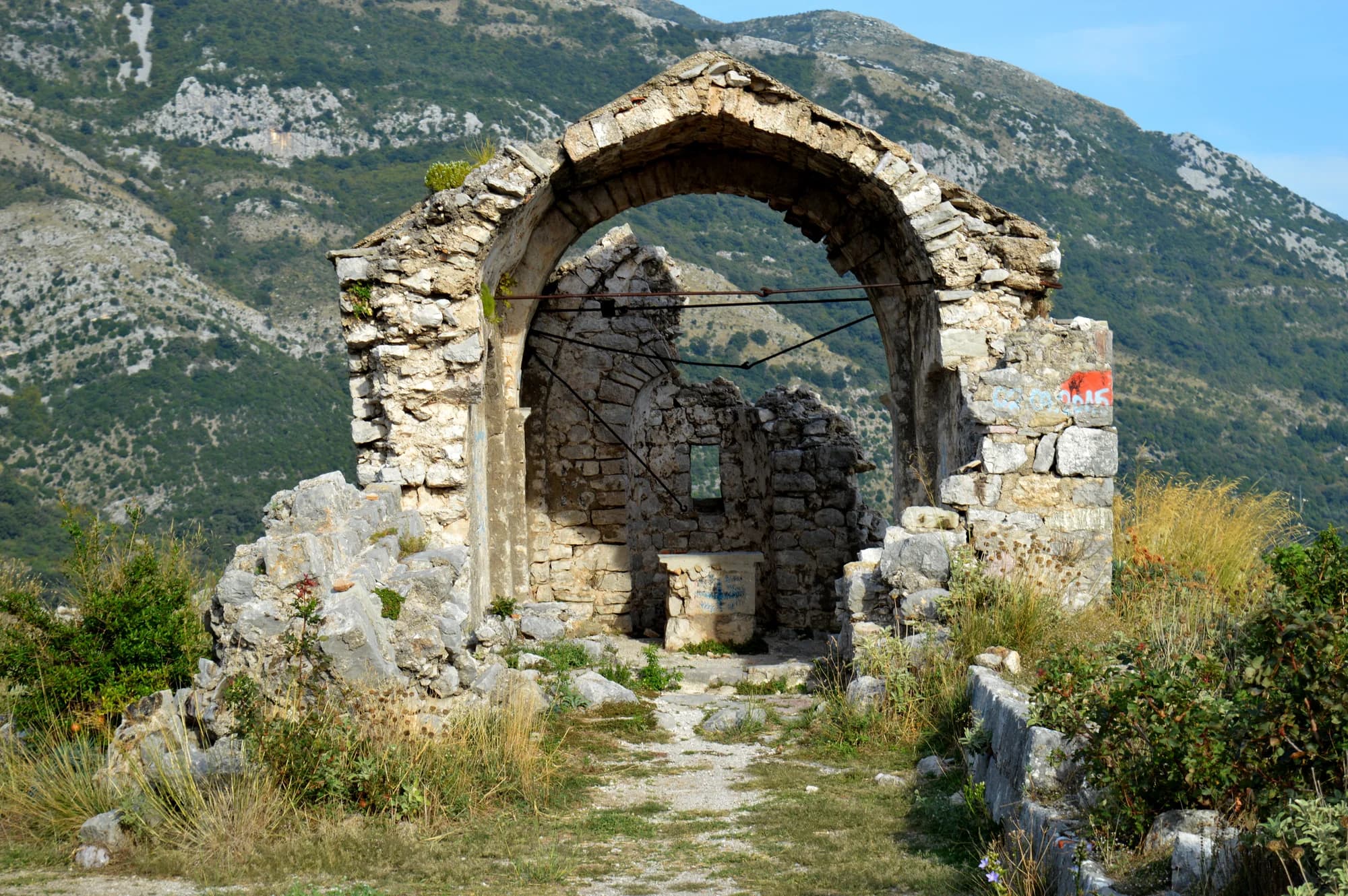
The parish church on the rock Stanac about 300 m above the shore: a chapel first recorded in 1466, enlarged with a new nave in 1883, with frescoes of the early 17th century, cypresses and a walled graveyard. A protected monument of the Kotor region.
Open in Google Maps
Small pebble coves between the old stone jetties along the village waterfront, with the coldest, freshest sea in the bay — springs run straight into it — and mussel lines offshore. Rated excellent at every bathing-water sampling in 2026.
Open in Google MapsThe shellfish farm whose float lines cross the bay off the village, with a restaurant and direct sales in season when it is trading.
Open in Google MapsA few hours
Two hours, and the swim is the point: the water was rated excellent at every sampling in 2026, and it is the coldest, freshest sea in the bay. Nothing is managed and nothing costs.
One full day
Orahovac itself
Best for apartments and guest houses along the shore road, no hotel — and, since July 2026, a UNESCO request that the planned one wait. Family-scale, quiet, on the bus
Ljuta, 1.2 km south
Best for a few more apartments, the mills restaurant and the river; the same cold sea and the same bus
Perast, 5.5 km north
Best for the bay’s museum town and its two islets, with rooms in the palaces and the evening crowds to match
Dobrota and Kotor, 6–9 km
Best for the long seafront of captains’ houses and the old town at the end of it — most of the beds on this shore, and the old town at the door
Twelve years on the inner bay
Population change by settlement, 2011 to 2023
Every village on the north shore of the inner bay lost people between the last two censuses — except this one. Orahovac gained a sixth: eight kilometres from Kotor, on the bus, with springs, and without a hotel.
Who visits Montenegro
Share of foreign overnight stays, 2025
MONSTAT · 2025
Census population, Orahovac municipality
The shore village grew from 179 people in 1948 to 319 in 1981, fell back for twenty years, and has grown again since 2003 — 345 at the last census, a sixth more than in 2011. The hamlets above it went the other way: 78 people in Gornji Orahovac in 1948, 13 in 1981, 15 today.
Orahovac was Venetian from 1420, Ottoman for two centuries with Risan, and Venetian again from 1684, when its market became the third in the bay. The church on the rock outlived all of them.
Skala Radio (March 2026) after Antoljak 1979: 1399, 1420, 1466, 1614. Lalošević (2019): Ottoman 1482–1684. Portal Analitika (2024): 1883, 1979 earthquake repairs. UNESCO WHC 125 (1979) and Decision 48 COM 7B.43 (2026).
Meanwhile, in 1466
Orahovac, in 1466 a Kotor document records the Ecclesia Sancti Georgii de Rechoavto — St George’s on the rock above the shore, then part of the Latin church of the bay. The chapel it names is the altar of today’s church; the rest was built around it in 1883.
Novi, across the bay — Herceg Stjepan Vukčić Kosača, the duke who gave Herceg Novi its name, dies in his town on 22 May.
Elbasan: Sultan Mehmed II raises a new fortress on the Shkumbin in his campaign against Skanderbeg — in the valley where the relics of St Jovan Vladimir, Bar’s patron, would be kept.
“Because of the connection to the hinterland, this place was the door of Montenegro to the sea — the area of Cuce gravitated to Orahovac. After liberation from the Turks in the 17th century, beside Kotor and Risan, the one in Orahovac was the third market in Kotor Bay.”
Prof. Ilija Lalošević, architect, on the village he is from
Interview, Total Montenegro News, 25 February 2019. The paths that carried that trade still climb from the church to the hamlets and the Austrian forts.
“Orahovac was once full of walnut trees, and its people carried the nuts to market along the coast and inland — and that, it is thought, is how the place got its name.”
Local legend
The walnut trees of Orahovac
Search thousands of hotels and apartments with live prices.
We may earn a commission from partner links. This helps us keep Montenegro.com free for travelers.
Search hotels, apartments and guest houses with live availability.
We may earn a commission from partner links. This helps us keep Montenegro.com free for travelers.
On the north shore of the inner Bay of Kotor, between Ljuta and Dražin Vrt on the road to Perast: 8.6 km from Kotor’s old town, 5.5 km from Perast and 17 km from Tivat airport by road through Kotor. The Kamenari ferry is the long way round from here.
Springs rise all along this shore and run straight into the bay — the Ljuta at the village’s southern edge and the Ercegovina above it. In late May 2026 the bathing-water station measured 24 parts per thousand of salt at Orahovac against 38 in the outer bay, and the water was rated excellent at every sampling of the season.
Small pebble coves between the old stone jetties rather than one long beach — the Kotor municipal plan says so in as many words. Access is free, there are a couple of beach bars, and parking on the shore is private or customers-only, so come early in July and August or take the bus.
The local plate
The float lines off the village belong to a shellfish farm — the Kotor plan zones this shore for mariculture, and Školjke Boke has grown oysters and mussels here for years. Steamed mussels with wine and garlic, oysters opened on the quay: the freshest thing in the bay, and the sea they come from is the one you swam in.
Where The oyster-farm restaurant on the shore road, or direct from the farm in season — check it is trading before you set out
Orahovac in numbers
2023 census, Donji Orahovac — up 16% since 2011, which almost nothing else on this shore can say; 15 more live in the hamlets above
St George on the rock Stanac first written down, as Ecclesia Sancti Georgii de Rechoavto; rebuilt 1883, frescoes of the early 1600s
small pebble coves between the stone jetties — the municipal plan says plainly there is no long beach here
the World Heritage Committee names the Hotel Orahovac project and asks Montenegro to stop it, pending review
Tivat, through Kotor — from here the Kamenari ferry is the long way round, 22 km just to the ramp
MONSTAT, Popis 2023 and 2011 (Donji Orahovac) · S. Antoljak, "Orahovac (Boka Kotorska)", Boka 11 (1979), via Skala Radio · Opština Kotor, DUP Orahovac i Dražin Vrt (2012) · UNESCO Decision 48 COM 7B.43 (2026) · OSRM road distances
The shape of the bay
Towns at their true positions; the water drawn as a ribbon
Schematic — not a nautical chart.
Best time: May · June · September
A mussel and oyster farm. The shore off Orahovac is zoned for shellfish farming, and the farm sells direct in season when it is trading; there is also an oyster-farm restaurant on the shore road. Never swim through the lines or take shellfish from them.
St George’s, on the rock Stanac about 300 m above the shore: a chapel first recorded in 1466, wrapped in a new nave in 1883, with frescoes of the early 1600s inside, cypresses and a walled graveyard around it. It is a protected monument and the parish church; a steep lane leads up from the village.
Yes. A marked path climbs from St George’s to the church of St Nicholas at Ravnice, 584 m up, and on through the abandoned hamlets of Gornji Orahovac to the Austro-Hungarian forts of Šanik and Vranovo brdo — a 12–13 km circuit that needs good legs, water and a full day.
No. Accommodation is apartments and guest houses along the shore road. A hotel project was planned; in July 2026 the UNESCO World Heritage Committee asked Montenegro to refrain from proceeding with it pending review.
No — the nearest is Tivat Airport (TIV), 17 km away by road.
From about 13 °C in February to 25 °C in August. It holds above 22 °C from June to September, which is the swimming season. Regional normals from the Bar station, not a city-precise reading.
The UK Foreign, Commonwealth & Development Office (FCDO) has no advisory against travel to Montenegro; it last reviewed its guidance on 13 August 2026. That is their assessment of the country as a whole, not ours and not a judgement about Orahovac, so read it yourself before you travel. The emergency number in Montenegro is 112.
Orahovac is the inner bay without the coach parties — a swim, a church on a rock, and a hard walk up to the forts that guarded this shore for Vienna. Kotor is fifteen minutes away for the evening.