Mojkovac, Montenegro: Complete Travel & History Guide
Mojkovac at 820 m, where the Tara canyon begins between Bjelasica and Sinjajevina: rafting, Biogradska Gora, the 1916 battle, where to stay and getting there.
Updated Originally published 37 min readby Pavle Obradović
Mojkovac, Montenegro: Complete Travel & History Guide
Overview
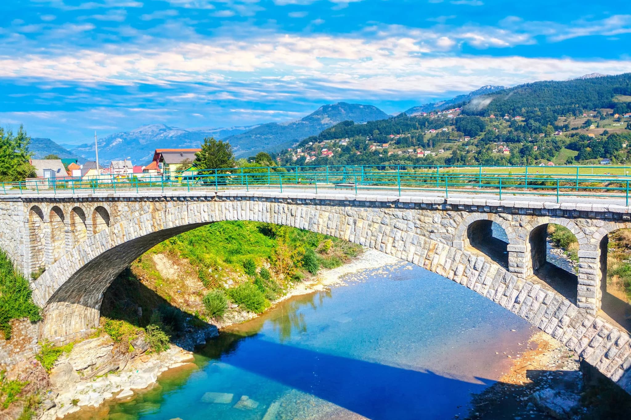
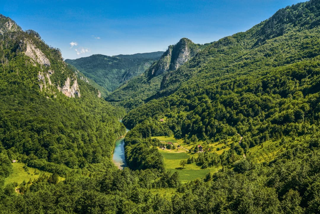
Mojkovac is a small mountain town situated at an altitude of 820 meters above sea level in northeastern Montenegro, at the foot of the Bjelasica and Sinjajevina mountain ranges. Often called “the small Switzerland of Montenegro,” this historic town is located at the beginning of the Tara River canyon and serves as a gateway to some of Montenegro’s most spectacular natural landscapes [1][2]. The town lies between the municipalities of Kolašin and Žabljak, making it an ideal base for exploring the northern region of the country.
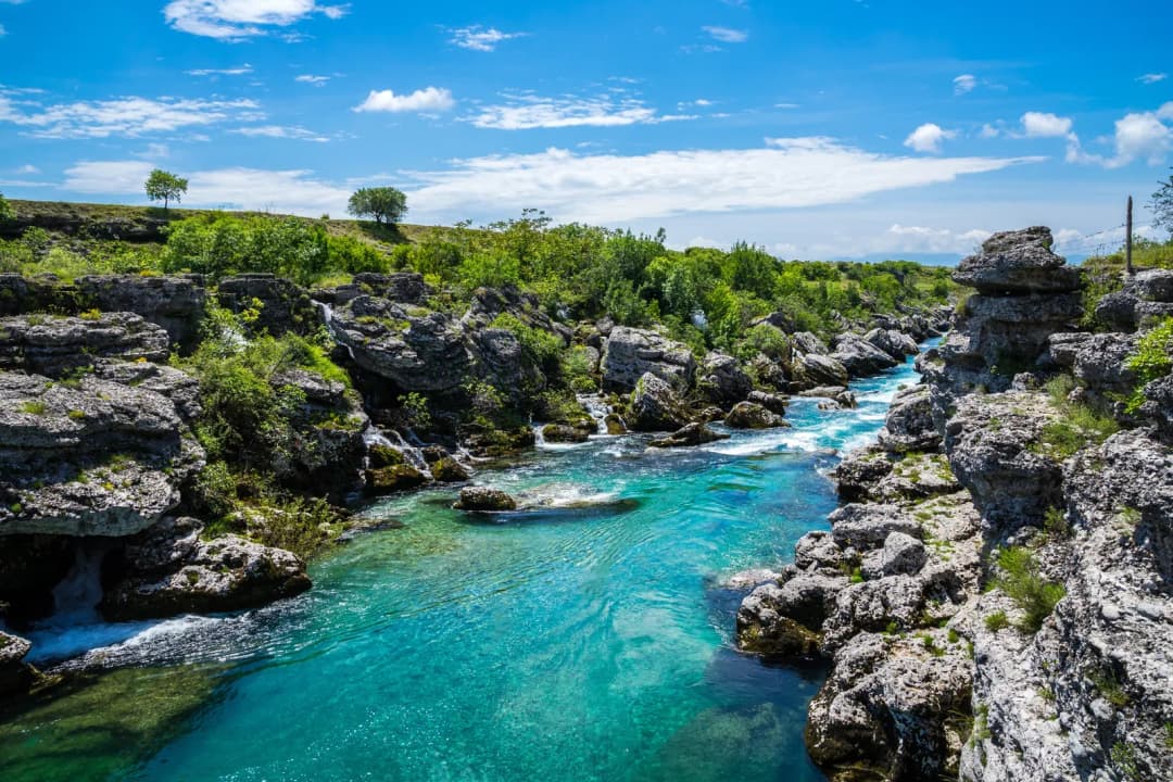
The municipality has a population of approximately 10,000 inhabitants and covers an area of 367 square kilometers. Mojkovac’s greatest natural wealth is the beautiful Tara River, which poets call the “Tear of Europe” - the longest river in Montenegro at 150 km [3][4], famous for its clear water, which should nevertheless be treated or filtered before drinking.
Top Attractions
Historical Sites
Battle of Mojkovac Memorial Just outside Mojkovac stands a monument commemorating the fallen heroes of the Battle of Mojkovac in 1916 [25]. This memorial honors the sacrifice of Montenegrin soldiers who fought valiantly against overwhelming odds.
Monument to Janko Vukotić A monument to Count Janko Vukotić (1866-1927), who led the Montenegrin army to victory in the Battle of Mojkovac, is beautifully placed on the main square in Mojkovac [26][27]. This monument to the Commander of the Montenegrin Sandzak Army in WWI is the work of sculptors Svetomir and Svetozar Radovic. Vukotić served as Prime Minister of Montenegro from May 1913 until July 1915 and was Chief of Staff of the Montenegrin Army during World War I [28].
Brskovo Archaeological Site Located 6 km from Mojkovac, the historical excavations of Brskovo include the ruins of the medieval mint (13th century) and the remains of what was once the most important silver mine in the Balkans [29][30]. Visitors interested in historical values can explore this fascinating site that offers a glimpse into Montenegro’s medieval commercial prosperity.
Morača Monastery Founded in 1252 by Stefan Vukanović of the Serbian Nemanjić dynasty, Morača Monastery is one of Montenegro’s most important religious and cultural monuments [31][32]. Stefan Vukanović, the grandson of Stefan Nemanja (father of Serbian statehood), founded the monastery possibly on his own lands [33].
The main sanctuary (katholikon) is a large one-nave church built in the Raška style, devoted to the Assumption of Mary, with a minor chapel devoted to Saint Nicholas [34]. The most famous among the frescoes is the 13th-century cycle of the prophet Elijah, one of the most important works of Serbian medieval art [35]. Despite being burnt down by the Ottomans for the first time in 1505, a significant part of the original 13th-century frescoes has survived, representing outstanding examples of medieval Balkan art [36][37].
For many years, the monastery played an important role as a cultural, spiritual, and educational center, as well as a center of resistance against the Ottoman Empire [38].
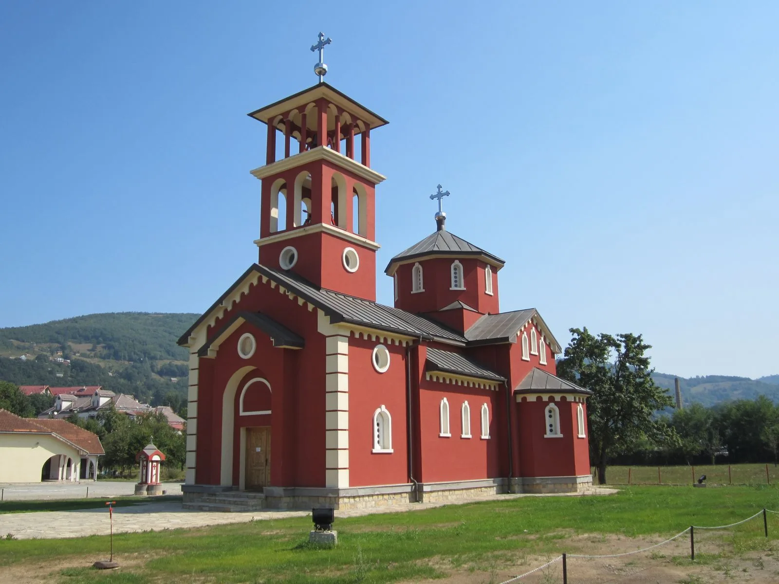
Church of Archangel Michael Built in the late 19th century, this church is another important Christian sanctuary in the area accessible from Mojkovac [39].
St. George Monastery Dating from the 16th century, this monastery represents another significant religious site near Mojkovac [40].
Natural Attractions
Biogradska Gora National Park One of Montenegro’s five national parks and believed to be its oldest (with history beginning in 1878), Biogradska Gora is located in the Bjelasica mountains between the rivers Tara and Lim [41][42]. The park covers 54 square kilometers and features one of Europe’s last three primeval forests [43].
The entrance to the park is situated along the road from Mojkovac to Kolašin, approximately 5 km from Mojkovac and 17 km from Kolašin [44][45]. Mojkovac is at 11.5 kilometers and a 20-minute drive from the park, making it a convenient base for visitors [46].
Biogradsko Lake is the centerpiece of the park, surrounded by virgin forest with trees over 500 years old. The park offers activities like hiking, cycling, and fishing [47]. To get to the park, visitors can take a local bus from Mojkovac and ask to be let off at the turn-off for Biogradska Gora National Park - it’s around an hour’s walk (5 km) from the main road to the lake [48]. Taxis and private cars from Mojkovac are also readily available [49].
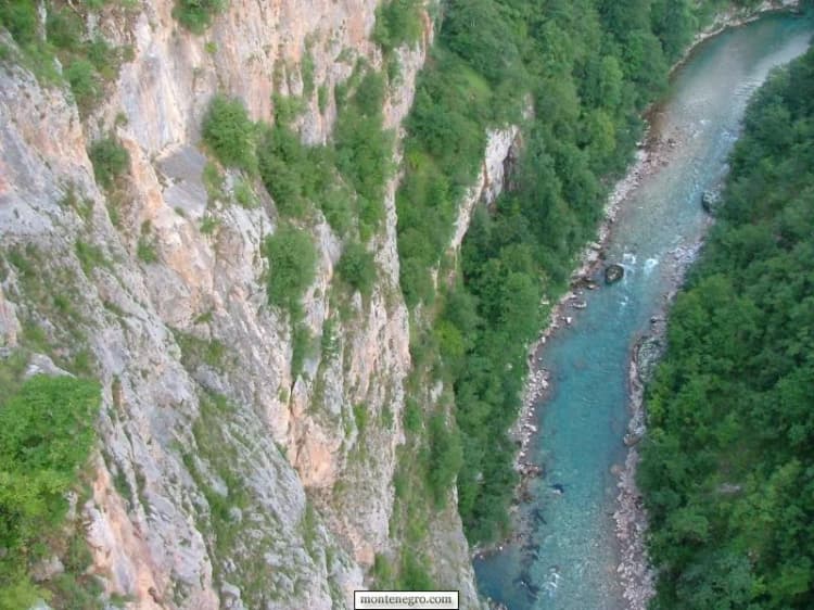
Tara River Canyon The Tara Canyon is the deepest canyon in Europe, reaching 1,300 meters at its maximum depth [50][51]. UNESCO recognized the importance of this ecosystem by including the canyon as part of Durmitor National Park World Heritage Site [52]. The Tara River is 150 km long [53]; its water is famous for its clarity but should be treated or filtered before drinking.
Located at the junction of Mojkovac, Pljevlja, and Žabljak in Durmitor National Park, the canyon offers spectacular scenery and world-class outdoor activities [54]. Mojkovac is positioned right at the beginning of the Tara River canyon [55].
Zabojsko Lake Lake Zabojsko, known as “The Mountain Eye of Sinjajevina,” is located on the northeastern slopes of Sinjajevina mountain at an altitude of 1,477 meters [56][57]. It is the third deepest lake in Montenegro at 19 meters depth [58]. The lake is 265 meters long (west-east direction) and 165 meters wide, with a surface area of 27,600 square meters [59].
Surrounded by dense coniferous and beech forest, Zabojsko Lake offers peace and exceptional natural beauty [60]. The water is clear, clean, and transparent up to 8 meters depth, with a summer temperature of 16°C [61]. The lake is home to trout and is strictly protected within Durmitor National Park [62]. Visitors can take a walk around the whole lake on a short and easy path [63].
Sinjajevina Mountain Plateau Sinjajevina is the most spacious mountain in Montenegro, occupying an area of over 60 square kilometers and measuring 35 to 40 km long and 10 to 15 km wide [64][65]. The greater part of Sinjajevina is actually an undulating plateau with a uniform landscape of karst sinkholes, fields, and grassy heads, with an average height of 1,600 to 1,700 meters [66].
Sinjajevina holds the largest pasture range in Montenegro and is built mainly of Triassic and Jurassic limestones and dolomites [67]. The mountain is bordered by powerful river canyons, with the Morača flowing in the south and the Tara surrounding the area on the eastern and northern sides [68]. The ascent of Mount Sinjajevina (2,277 m) typically starts from the center of Mojkovac [69].
Black Pine Forest One of the most significant and beautiful forest landscapes in Montenegro, the black pine forest is located in the canyon valley of the Tara River and offers a unique natural experience [70].
Đurđevića Tara Bridge Built between 1937 and 1940, the Đurđevića Tara Bridge is a significant engineering landmark designed by engineer Mijat Trojanović, standing 172 meters above the Tara River [71][72]. It’s one of the best places to see the Tara Canyon and has become an iconic symbol of Montenegro’s natural beauty.
Activities and Adventures
Rafting
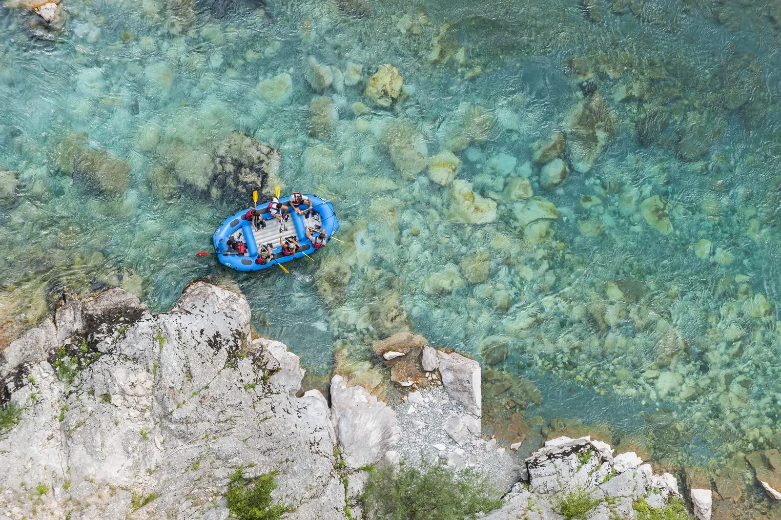
Rafting on the Tara River is one of the most popular attractions in Montenegro’s north, with Mojkovac serving as a starting point [73][74]. The Tara is one of the world’s top three most attractive rafting rivers [75]. The one-day route from Brstnovica to Šćepan Polje is 18 kilometers long and takes about 2 to 3 hours [76].
The rafting season lasts from April to October, with the early season reserved for experienced adventurers, while families with children can enjoy the Tara during the summer months [77]. Professional outdoor activity providers in Mojkovac offer rafting along with kayaking and canyoning experiences [78].
Zip Lining
The zip line at Đurđevića Tara Bridge offers a breathtaking experience, soaring at an altitude of nearly 150 meters (172 meters to be precise) above the plunging canyon gorge [79][80]. TARASPORT offers the longest zip line in Europe with a rope length of 1,200 meters [81]. The extreme zipline is just over 1 km in length and flies across the canyon at speeds up to 120 km/h [82].
Tara has two ziplines: yellow (824 m) and green (1,050 m) [83]. The zip-line slide itself takes about 3 minutes and can be repeated multiple times with additional payment [84].
Fly Fishing
Fly fishing has a long history on the Tara River, particularly in the area near Mojkovac, which is an exemplary location for this sport [85]. The Tara River is the number one river for fly fishing in Montenegro, rich in fish, primarily grayling and trout [86][87].
The fly fishing zone stretches for 8 km, with the upstream border passing right next to Biogradska Gora National Park [88]. The downstream zone extends to Mojkovac [89]. Fly fishing is catch and release only, and this part of the Tara River is exclusively allowed for fly fishing according to catch and release regulations [90][91].
Hiking and Mountain Climbing
The terrain around Mojkovac is ideal for hiking, with trails leading through Sinjajevina mountain plateau, Bjelasica mountain range, and Biogradska Gora National Park [92][93]. Sinjajevina (2,277 m) offers excellent hiking and climbing adventures with easily accessible routes from Mojkovac [94].
Alpinists from all over the world come to conquer the peaks of Bjelasica and Sinjajevina mountains [95]. The Via Dinarica long-distance hiking trail passes through the area, with Day 14 of the route connecting Mojkovac to Sinjajevina homestays [96].
Mountain Biking
Mojkovac Municipality is a hidden gem for mountain biking enthusiasts, offering exhilarating MTB trails that cater to all skill levels [97][98]. The region is nestled amidst majestic mountains and lush forests, providing diverse terrain perfect for mountain biking [99].
Popular trails include: - Vilusi Trail: Known for its technical sections and stunning mountain views [100] - Kolašin-Mojkovac Route: A scenic route through charming villages and pristine landscapes [101] - Lipovo Village Loop: Perfect for beginners on gentle slopes [102]
A 300-kilometer bicycle route introduces the magical east of Montenegro, bordered by Bjelasica Mountain and the town of Mojkovac on the northwest [103]. The terrain around Sinjajevina is particularly ideal for mountain biking [104].
Skiing and Winter Sports
Bjelasica mountain, which covers a large part of the municipality of Mojkovac, is a true splendor of natural beauty in winter [105]. In the eyes of skiers, its expanses are a challenge for skiing on rugged terrain, as well as for walking on snowshoes [106].
In the 2000s and onward, Mojkovac’s economy has emphasized winter tourism via ski facilities on Bjelasica mountain [107]. Future development plans predict a total of 224 kilometers of ski trails on Bjelasica, which will be covered by 52 ski lifts [108].
Snowshoes can be rented at the Durmitor and Prokletije National Park visitor centers, various ski centers, and the Mojkovac local tourist organization [109]. In winter months, Sinjajevina also offers opportunities for lengthy skiing adventures [110].
Paragliding
Weather conditions in Mojkovac favor paragliding flights throughout the year [111]. Mojkovac, surrounded by mountains, has ideal conditions for all kinds of winds [112]. The club “Phoenix” in Mojkovac has organized paragliding competitions, including individual inter-municipal championships attended by flyers from various Montenegrin clubs [113]. Anyone who wants to try this type of active vacation can do so through professional paragliders in tandem flights [114].
Other Activities
Horseback riding through the Tara canyon and surrounding areas [115]
Quad tours organized by professional outdoor activity providers [116]
Beach activities along the Tara River with free entry and lifeguard services [117]
Cycling tours through scenic routes in Durmitor National Park [118]
Practical Information
Best Time to Visit
Spring (April-May) and autumn (September-October) are ideal for hiking and exploring national parks [119]. The rafting season on the Tara River lasts from April to October [120]. Summer months are perfect for families with children to enjoy rafting and river activities [121]. Winter offers excellent skiing and snowshoeing opportunities on Bjelasica and Sinjajevina mountains [122].
For budget-conscious travelers, September to November typically offers the lowest hotel prices [123].
Getting There
Mojkovac is located in northeastern Montenegro and can be easily reached by:
Train: The railway line connects Mojkovac with Kolašin and other towns. The train stops at Mojkovac station, though it does not stop at the entrance to Biogradska Gora National Park [125]
The town is strategically positioned between Kolašin (approximately 20 km away) and Žabljak, making it an excellent base for exploring the northern region.
Tourist Services
TripAdvisor features 342 reviews of Mojkovac hotels, attractions, and restaurants [126]. Professional outdoor activity providers in town offer comprehensive services including: - Rafting expeditions - Kayaking and canyoning - Quad tours - Zip lining arrangements - Fly fishing guides - Mountain biking rentals and tours - Paragliding tandem flights
The local tourist organization in Mojkovac provides information and can assist with arranging activities and accommodations [127].
Why Visit Mojkovac
Mojkovac offers a unique combination of rich historical heritage, pristine natural beauty, and world-class outdoor adventures. Unlike more touristy coastal destinations, Mojkovac provides an authentic mountain experience where visitors can explore Europe’s deepest canyon, raft on one of the continent’s most beautiful rivers, walk through primeval forests, and stand on the site of a heroic WWI battle.
The town serves as a perfect base for exploring multiple national parks, engaging in adrenaline sports like zip lining and rafting, or simply enjoying the tranquility of mountain lakes and forests. Whether you’re a history enthusiast interested in medieval mining and WWI heritage, an adventure seeker looking for rafting and paragliding, or a nature lover wanting to explore untouched wilderness, Mojkovac delivers an unforgettable Montenegrin mountain experience.
Read the Tara protection labels correctly
The Tara gives Mojkovac its clearest geographic identity, but the legal and international labels need care. UNESCO’s Durmitor page says that Durmitor National Park includes the Tara River Canyon and that the Tara River Basin entered the biosphere-reserve network in 1976. Those are related conservation stories, not interchangeable boundaries. Do not describe every stretch of river beside Mojkovac as though it were automatically inside the World Heritage property.
For visitors, the distinction has a practical consequence. A river view, a rafting launch and a national-park site may involve different operators, rules and access points. Confirm the exact meeting location and responsible authority. If your plan extends toward the famous bridge and deeper canyon viewpoints, the Djurdjevića Tara guide explains that separate destination rather than collapsing the whole river into one attraction.
Tara protection layers
Layer
Note
Tara Basin context
Broader biosphere context
Durmitor NP
National park
Canyon
Inside the national park
Related designations
≠ identical boundaries
Source: whc.unesco.org, nparkovi.me
The wider Tara landscape changes character along its course; always confirm the exact access point behind an excursion description.
Brskovo: documented archaeology, not abandoned scenery
Brskovo is the strongest reason to look beyond Mojkovac’s modern centre. It was a medieval mining and trading landscape, but the most important update for a 2026 visitor is methodological: this is no longer honestly described as a place where archaeological research has never happened. A 2025 Cultural Heritage Administration permit authorized systematic work on specified cadastral parcels from 7 July to 1 September, with documentation and publication duties. A separate state decision allocated €20,000 for continued research and protective conservation.
That evidence makes Brskovo more interesting and less suitable for casual assumptions. The cited permit ended in September 2025, and these sources do not establish whether fieldwork is under way in 2026. Research funding does not mean there is a staffed museum, signed circuit, open excavation or safe parking place. In June 2026 the government also placed Brskovo in a digital tourism interpretation initiative. Digital storytelling can help visitors understand a fragmented landscape, but it still does not establish physical access.
Brskovo evidence timeline
Milestone
What it covers
2025 permit
systematic archaeology
2025 funding
research + conservation
2026 initiative
digital interpretation
Source: wapi.gov.me, gov.me
Start with the tourist organisation, ask what can currently be seen without entering a work area, and treat barriers as meaningful. Wear footwear for uneven ground and avoid removing stones or metal fragments. If access is unclear, a landscape view plus current interpretation is a better outcome than trespass. The site’s value lies in the evidence still being assembled.
Dobrilovina, Crna Poda and Zabojsko Lake
The Dobrilovina side combines religious heritage with the edge of the Durmitor protected landscape. The Eparchy of Budimlja and Nikšić records the monastery as dedicated to St George, mentioned in the sixteenth century and restored and consecrated in 1989. Use that source for institutional history, while remembering that a monastery is a place of worship and residence. Contact ahead, dress respectfully, keep voices low and accept that entry may not be available.
The tourism organisation describes Crna Poda as an old black-pine forest area and presents Zabojsko Lake as reachable from Dobrilovina by a macadam approach suitable for an all-terrain vehicle or by walking. Read that as orientation, not permission or a vehicle guarantee. The current Durmitor National Park management plan for 2026–2030 is the stronger frame for protected-area management. Before leaving the paved corridor, confirm park rules, surface condition, fire restrictions, snow and whether your rental agreement permits unpaved roads.
Backroad access decision
Check
Confirm with
Route confirmed?
authority / host
Vehicle suitable?
including rental rules
Weather and daylight?
current, not seasonal average
All yes: proceed
with turnaround time
Any no: stay low
use a valley alternative
Montenegro.com editorial framework
Bjelasica or Sinjajevina: choose one
A common itinerary mistake is to collect mountain names instead of planning one coherent day. Bjelasica and Sinjajevina offer different route networks and exposure. Pick one direction, one confirmed objective and one turnaround rule. If you want developed visitor infrastructure and a comparison with another base, read the Kolašin guide. If you want the broader cultural pull of Montenegro’s uplands, see All Roads and Paths Lead to the Mountains.
On open highland terrain, navigation can become difficult in cloud, water may be scarce and livestock-guardian dogs may be working. Do not assume a track visible on a map is signed or maintained. Carry offline mapping, water, layers and a charged phone; share the route; turn back before deteriorating weather closes your margin. For snow and road planning, use Montenegro in winter and the more detailed 2026–27 winter guide. During the shoulder season, the Durmitor spring-thaw guide explains why warm valley weather does not settle conditions higher up.
The Tara’s forested gorge landscape is a reminder that valley, canyon and plateau routes can have very different conditions on the same day.
Seasonal planning matrix for Mojkovac
Season
Conditions
Constraint
Approach
Spring
thaw • mud
river changes
keep alternatives
Summer
heat • storms
fire restrictions
start early
Autumn
shorter light
wet leaves • fog
turn back earlier
Winter
ice • snow
road controls
stay conservative
Source: worldweather.wmo.int
A useful town-and-valley day
Not every day needs a remote target. The official tourism site describes a 19-hectare recreation zone created on a rehabilitated former waste site, with a 1.5-kilometre walking and cycling track plus sports facilities. The environmental reuse is noteworthy, but the dimensions come from the destination manager and do not prove that every facility is available today. Ask locally about condition and access.
A sensible low-complexity day combines town orientation, the recreation area if open, a safe river view and time to arrange the next day directly. This is also the right plan after heavy rain or when a vehicle is unsuitable for unpaved approaches. Cafés, shops and accommodation hosts are logistical assets: use them to confirm road reports, guides and realistic departure times rather than merely passing through.
Mojkovac low-complexity day
Stage
Note
Town
orientation
Recreation
if available
Tara view
safe access
Confirm
tomorrow
Source: mojkovac.travel
Practical arrival and transport checks
Mojkovac has a railway station and road links through northern Montenegro, but a durable guide should not freeze a timetable or connection promise. For trains, check the official Railway Transport of Montenegro channel close to travel, then verify the specific service and any engineering disruption. For buses, ask the operator or station directly. Third-party aggregators are useful for discovery, not proof that a seasonal departure will run.
With a car, clarify fuel, parking, rental-road restrictions and roadside-assistance coverage before taking a mountain approach. Mobile signal can weaken away from the valley. Save essential numbers and maps offline. If an accommodation host arranges a guide or transfer, ask who operates it, what is included, where the exact meeting point is and what happens if weather cancels the plan.
Transport verification ladder
Step
Action
1
Start with operator data
2
Confirm the exact departure
3
Keep a same-day backup
Source: zpcg.me
A realistic two-day Mojkovac plan
Day one: understand the valley. Begin with the town, confirm the tourism office’s current advice and use the recreation zone or a safe Tara viewpoint as conditions allow. Spend the afternoon on Brskovo interpretation only after confirming access. If research or conservation limits the site, accept the limit and use the time to understand the medieval landscape from approved material.
Day two: make one mountain decision. Choose the Dobrilovina side, Bjelasica or Sinjajevina—not all three. Recheck the WMO channel carrying Montenegro’s national forecast, park information, route surface and daylight. Set a turnaround time before leaving. If any critical answer remains unknown, keep the day in the valley. The goal is not maximum distance; it is a coherent outing with enough reserve to respond to weather or access changes.
Two-day Mojkovac plan
Day
Options
DAY 1 · VALLEY
Town orientation; Tara / recreation option; Brskovo if confirmed
DAY 2 · ONE ROUTE
Dobrilovina side, or Bjelasica, or Sinjajevina
Principle
One confirmed objective beats three speculative detours.
Montenegro.com editorial framework
Safety and responsible access
Use current weather and local authority advice. River levels, thunderstorms, wildfire risk, snow and rockfall can make yesterday’s description irrelevant. Do not enter water, caves, mines or archaeological excavations without an authorized operator and explicit permission. Brskovo’s mining past is a reason for extra caution around shafts, unstable ground and industrial remnants, not an invitation to explore them.
On mountain roads, drive slowly enough to stop for livestock, forestry vehicles and damaged surfaces. On foot, close gates, give herds space, keep dogs controlled and carry out waste. At religious sites, photography and access are privileges rather than entitlements. In protected areas, use marked or locally confirmed routes and follow park rules. The safest plan preserves both the landscape and the option to return.
Mojkovac stop conditions
Stop or step down when…
Response
Access cannot be confirmed
Return to the valley
Storms or fire risk rise
Return to the valley
Vehicle is not appropriate
Return to the valley
Daylight margin disappears
Uncertainty is a condition, not an inconvenience
Montenegro.com editorial framework
Begin with the correct population unit
What the sources say
MONSTAT’s 2023 settlement workbook records 2,471 residents in the settlement named Mojkovac: 1,199 male and 1,272 female. The separate municipal release records 6,728 residents in Mojkovac municipality. The larger number covers Mojkovac plus settlements including Brskovo, Dobrilovina, Polja, Podbišće and Štitarica.
That distinction is practical. A municipal attraction can be a road trip from the town; it is not necessarily walkable from the station. Population also says nothing about how many taxis operate after the last train, whether a station is staffed, or whether a mountain accommodation provides pickup.
Use the railway as a dated search, not a printed promise
The official Railway Transport of Montenegro planner is the source to rerun for the actual travel date. Its station data identifies Mojkovac as station ID 18 and publishes coordinates of 42.952858, 19.586454. Coordinates locate the railway record; they do not prove step-free access, staffing, a taxi rank, a safe pedestrian route or luggage storage.
For a reproducible snapshot, the official API was queried for 15 September 2026. It returned four direct Mojkovac–Podgorica services, leaving at 04:10, 07:02, 09:42 and 20:59, and four direct Podgorica–Mojkovac services, leaving at 06:21, 17:40, 19:48 and 21:20. The same dated search returned four direct Mojkovac–Bijelo Polje trains. The underlying route records showed validity through 12 December 2026.
Those times are evidence of what the official search returned on 30 August for one future date. They are not a punctuality forecast. Search both directions because a fare or timetable can be directional, save the result, then check again shortly before departure. International trains can carry a compulsory reservation rule that differs from a local service; the planner itself warns that reservations on international trains cost extra.
Design the station transfer before buying the train
Start with the arrival that creates the fewest dependencies. A 04:09 arrival can be operationally worse than a later train if accommodation access begins hours afterward. A 22:54 arrival can fail if the host assumed you would come by car. Before booking, send the train number and planned arrival to the property, then obtain a named pickup person, phone number, meeting side of the station, price, payment method and late-running policy.
For an independent transfer, ask the Tourist Organization Mojkovac or its information center for current local contacts, but do not treat a directory as a confirmed booking. The organization publishes separate office and information-center numbers. Call the actual provider and reconfirm the day before travel.
The municipality’s transport page publishes regulations, taxi rules and road registers, but it does not currently present a passenger timetable that proves a bus from the station to Biogradsko Lake, Crna Poda, Dobrilovina or Brskovo. The safe conclusion is not “there is no bus”; it is “no trip-ready official local timetable was established.” Build a verified transfer or keep the day in town.
One rail arrival, four different last miles
Destination from MOJKOVAC rail station
What to verify
Room
host or taxi confirmation
Biogradska Gora
entrance + return transfer
Tara corridor
road endpoint + closure check
Brskovo
not casual sightseeing
Every last mile
Confirm driver · meeting point · price · return · failure plan
Source: api.zpcg.me, mojkovac.travel, mojkovac.me
Separate R-10 from the Đurđevića Tara bridge closure
Two official road notices describe different pieces of the journey. The government said the regional R-10 Đurđevića Tara–Mojkovac road would reopen on 31 December 2025 after the main Sokolovina landslide works. It also said asphalt and signage would follow when weather allowed. On 5 May 2026, the Transport Administration described final works at Sokolovina as still in progress.
A later notice concerns the Đurđevića Tara bridge on M-6. The Transport Administration scheduled a full closure from 06:00 on 10 August until 12:00 on 26 October 2026, naming Vrulja–Mijakovići as the alternative. That blocks crossing the bridge; it does not, by itself, say that every location reached from Mojkovac along R-10 is closed.
For a trip toward Crna Poda, Dobrilovina, the bridge or onward to Žabljak and Durmitor, write down the exact endpoint. Ask whether it lies before or after the bridge, then check later Transport Administration notices on the departure morning. Do not rely on a route app that has not incorporated a dated closure.
Three dated road facts for Mojkovac and Đurđevića Tara
Date
Notice
Detail
31 Dec 2025
R-10 reopened
main works complete
5 May 2026
final Sokolovina
works reported
10 Aug–26 Oct
M-6 bridge
full closure
Caution
Do not collapse three notices into one road status
Check the exact endpoint and newest notice
Source: gov.me
Plan Biogradska Gora as a complete return journey
What the sources say
National Parks of Montenegro announced Biogradska Gora open for visits from 16 March 2026. Its current visitor page lists a €4 daily ticket, with the visitor center and educational trails included, plus separate published fees for parking, rentals and guide services. Check the page again because opening, services and access can change with weather and park operations.
A train to Mojkovac is not a train to Biogradsko Lake. Confirm the entrance your driver will use, whether the vehicle reaches the agreed drop-off, the meeting point for return, mobile coverage, and what happens if the park closes or the trail plan changes. A one-way drop-off without a return agreement is not a car-free itinerary.
Five confirmations for a Biogradska Gora day from Mojkovac
Step
Confirm
Also confirm
1 · Status
open notice
weather
2 · Entry
which gate
current fee
3 · Out
driver
drop-off
4 · Trail
conditions
turnaround
5 · Back
pickup time
failure plan
Rule
The park ticket is one part of the day
No confirmed return = no confirmed day trip
Source: nparkovi.me
Treat the Tara corridor as protected landscape, not a safety certificate
UNESCO’s Tara River Basin profile records the biosphere reserve’s 1976 nomination, 182,889-hectare area, and an approximately 80-kilometre canyon reaching 1,300 metres at its deepest point. National Parks of Montenegro states that Durmitor territory includes part of Mojkovac municipality. The municipality describes the Tara, tributaries, Crna Poda and the canyon geography.
None of those designations certify untreated water as drinkable, guarantee a river level, or make an unguided launch appropriate. For rafting, obtain the operator’s legal identity, exact launch and finish, personal-protective equipment, guide credentials, cancellation rule, transport plan and current hydrological decision. The Montenegro adventure-sports guide provides broader questions to ask; the operator remains responsible for the day-specific plan.
A catalog-labeled Mojkovac stock photograph, visually reviewed at 1600 × 1065 pixels. It shows a raft, paddlers and a clear rocky channel; it does not identify the launch, operator, date, water level, permit or safety status.
Read Mojkovac’s environmental record as two different projects
The inherited article compresses several environmental issues into one vague “tailings rehabilitation” story. Current official sources require a two-site distinction.
First, the government reported the Zakršnica temporary landfill officially closed on 27 November 2025 after works valued at €4,227,940.46. Second, a January 2026 Brskovo project notice describes a 36-month, $273,880 program to assess soil, water, air and human exposure and develop remediation options. The notice explicitly says the project does not finance the remediation itself.
The same Brskovo notice says accredited 2024 testing found mercury concentrations from 24 to 556 ppm at some points and notes that the Rudnica flows through mine structures before joining the Tara. These are serious, site-specific findings. They do not justify a town-wide exposure claim, and they are not a reason to enter a former industrial area. Respect barriers and use environmental authorities—not tourism marketing—for updates.
Two sites, two statuses
Site
What it is
Status
Detail
Zakršnica
temporary landfill
closure reported 27 November 2025
€4.23m works
Brskovo
former mine site
assessment underway
36-month options project; not remediation funding
Caution
Completion at one site does not transfer to the other
Source: gov.me
A workable two-night, train-first structure
Arrival day: protect against timetable failure
Choose a daylight arrival when possible. Pre-book station pickup, check into town, and keep the first afternoon local. Record the accommodation’s exact relationship to the station rather than relying on “central Mojkovac.” If the train is late, the day still works.
Full day: choose one axis
Choose Biogradska Gora or the Tara–Dobrilovina corridor, not both. For the park, confirm gate, ticket, conditions and return pickup. For the Tara corridor, check R-10, the exact endpoint and whether the bridge closure affects the onward plan. A northern comparison with Bijelo Polje is easier by rail than attempting to chain multiple remote road sites.
Departure day: keep a rail-only fallback
Use a train departure with enough margin for the next fixed booking. If the mountain transfer cancels, take a local morning or use the railway toward the focused Bijelo Polje cultural walk. Travelers deciding whether the north deserves several nights can use the north Montenegro base guide before locking the sequence.
Practical decision checklist
Search ŽPCG for the exact date and both directions; save train numbers and recheck.
Confirm station pickup, price, meeting side and late-running policy in writing.
Choose one road axis per day and name the exact endpoint.
Check the newest Transport Administration notice, not only a route app.
For Biogradska Gora, confirm park status, entrance, fee, trail and return transfer.
For rafting, verify the operator, launch, equipment, guide, water decision and cancellation terms.
For religious sites, confirm current welcome, worship, dress, photography and access.
Do not enter Brskovo or any remediated or industrial site without explicit authorization.
Carry a rail-only fallback for road, weather or provider failure.
History
Medieval Period and Brskovo Silver Mine
The history of the Mojkovac region is deeply connected to the medieval mining settlement of Brskovo, located just 6 km from modern Mojkovac. Mining operations at Brskovo were first recorded in the thirteenth century, with silver mining starting in 1270 [5][6]. Brskovo was first mentioned between 1219 and 1228 in a trade charter of Stefan the First-Crowned addressed to the Republic of Ragusa (Dubrovnik).
During its golden age at the time of Serbian King Stefan Uroš I, Brskovo became the largest silver mine in the Balkans. In 1254, King Uroš introduced Saxon miners who brought advanced mining know-how and played a major role in the development of medieval mining [7]. Small-scale silver mining operations included a mint producing coins called the “Grossi de Brescova.” During this prosperous period, a customs office existed in Brskovo as well as, a century later, a consulate of Dubrovnik [8].
On the whole inland territory of present-day Montenegro, Brskovo was the only commercial center whose importance could measure up to that of the coastal towns. The settlement was regularly visited by merchants from Kotor and Dubrovnik and reached its zenith in the 1280s [9]. The town had a Virgin’s church administered by Dominicans from Dubrovnik and was a thriving commercial hub.
Ottoman Period
From 1350 onwards, Brskovo began to completely decline. In 1398-1399, the Turks took Brskovo, and according to Dubrovnik sources, by 1433 it was an abandoned place [10][11]. In 1477, the Mojkovac region was annexed to the Sandžak of Herzegovina, and later it often changed its administrative affiliation throughout the Ottoman period [12].
The region remained under Ottoman control for centuries. In the liberation wars of 1876-1878, the left bank of the Tara was liberated from Turkish rule. The border between Montenegro and the Ottoman Empire, recognized by the Berlin Treaty, was the Tara River. This situation remained until the First Balkan War in 1912, when the entire Mojkovac region was liberated and annexed to the Montenegrin state [13].
Battle of Mojkovac (January 6-7, 1916)
The Battle of Mojkovac is the most famous historical event associated with the town and stands as one of Montenegro’s proudest military achievements. This World War I battle was fought between January 6 and 7, 1916 (on Orthodox Christmas, also known as “Bloody Christmas”) near Mojkovac, between the armies of Austria-Hungary and the Kingdom of Montenegro [14][15].
In the winter of 1915, the Montenegrin Army had been fighting the Austro-Hungarian Army for three months in Serbia. In January 1916, they received a command to protect the retreat of the Royal Serbian Army to Corfu in Greece via Albania [16]. Led by Serdar (Vojvoda) Janko Vukotić, with Krsto Popović as second in command, approximately 6,500 Montenegrin troops defended key positions around Mojkovac against an Austro-Hungarian force of about 20,000 men supported by artillery [17][18].
Despite harsh winter conditions and numerical inferiority of more than 3 to 1, the Montenegrins repulsed repeated assaults and inflicted heavy casualties on the invaders. Estimates suggest around 2,000 Austro-Hungarian dead and wounded, while the Montenegrins sustained fewer casualties [19]. The battle ended with a decisive Montenegrin victory, though by January 25 the entire Montenegrin army had laid down its weapons [20].
However, this tactical victory achieved its strategic objective: it delayed the Austro-Hungarian advance, preventing the interception of the retreating Serbian army remnants who were evacuating through Montenegrin territory toward the Albanian coast [21]. This heroic stand allowed Serbian forces to reach safety and eventually regroup, continuing their fight in the war.
Modern Era
In the modern period, mining exploration at Brskovo recommenced in 1950, with operations restarting in 1976 and continuing until 1991 [22]. Today, the site is being developed by Tara Resources as a zinc, lead, and copper mine [23]. In the 2000s and onward, Mojkovac’s economy has emphasized service-oriented diversification, particularly winter tourism via ski facilities on Bjelasica mountain [24].
Quick answers
When is the best time to visit Mojkovac?+
Spring (April-May) and autumn (September-October) are ideal for hiking and exploring national parks [119]. The rafting season on the Tara River lasts from April to October [120]. Summer months are perfect for families with children to enjoy rafting and river activities [121].
Mojkovac is located in northeastern Montenegro and can be easily reached by: Car or Bus : From Nikšić and Podgorica via main roads [124] Train : The railway line connects Mojkovac with Kolašin and other towns.
The terrain around Mojkovac is ideal for hiking, with trails leading through Sinjajevina mountain plateau, Bjelasica mountain range, and Biogradska Gora National Park [92][93]. Sinjajevina (2,277 m) offers excellent hiking and climbing adventures with easily accessible routes from Mojkovac [94].
Use current weather and local authority advice. River levels, thunderstorms, wildfire risk, snow and rockfall can make yesterday’s description irrelevant. Do not enter water, caves, mines or archaeological excavations without an authorized operator and explicit permission.
Pavle Obradović is from Herceg Novi. He was Manager of Montenegro.com, then Director of the Herceg Novi Tourism Organization, and is now Coordinator for Investment and Development Projects at the Municipality of Herceg Novi. He holds a BSc in International Hospitality and Service Management from the Rochester Institute of Technology (RIT).
···
Updated · Originally published
Montenegro Travel Newsletter
Get weekly stories, guides, and insider tips about Montenegro delivered to your inbox.